 Block
Everton, Indiana
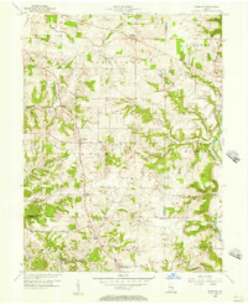
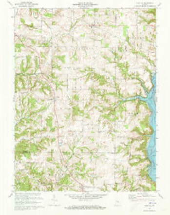
11 topographic sheets cover this place, the earliest surveyed in 1953 and the latest in 1986. It stands in Jackson Township. It lies in ZIP code area 47331. The Survey maps it on the Everton quadrangle. It stands 1,066 feet above sea level.
Topographic sheets covering this place
5 surveys from 11 printed sheetsMatched by testing this settlement's coordinate against the published boundary of every sheet in the United States Geological Survey's historical collection. Each opens the scanned sheet at the Survey.
- 1953 USGS Cincinnati quadrangle1:250000, 3 printings
- 1956 USGS Everton quadrangle1:24000
- 1957 USGS Cincinnati quadrangle1:250000
- 1972 USGS Everton quadrangle1:24000, 4 printings
- 1986 USGS New Castle quadrangle1:100000, 2 printings



In the county-history sources
5,391 words on this townshipHistory of Fayette County, Indiana: Containing a History of the Townships, Towns, Villages, Schools, Churches, Industries, Etc.; Portraits of Early Settlers and Prominent Men; Biographies, Etc., Etc. .., published 1885 names this settlement in its chapter on Jackson Township. These are the passages that mention it, exactly as the scans read.
In the fall of 1813 (October 5) several families from the same neighborhood in Pendleton District, S. C. , and all related, emigrated and settled on lands in the southeastern part of the township. There were Ebenezer Smith, George Stanley, Simon Grist, James Waters and son John Waters, all men of families. The Waterses had been to the vicinity in 1812 and then made their purchase, but returned and all, as just stated, made the journey together, which consumed about one month, coming by wagons. It is believed by the descendants of some of these families that on their arrival there were no residents south and east of Everton to what are now the Union and Franklin County lines. That section was then very heavily timbered, the forests abounding in much line poplar.
Passage source: History of Fayette County, Indiana: Containing a History of the Townships, Towns, Villages, Schools, Churches, Industries, Etc.; Portraits of Early Settlers and Prominent Men; Biographies, Etc., Etc. .., published 1885.
Hanson Steele and John Mcllwain, related, emigrated from Abbeyville District, S. C, in 1813, and either one or both stopped one season in the vicinity of Fairfield, Franklin County, where one crop was raised; then they settled on laud above designated.
Passage source: History of Fayette County, Indiana: Containing a History of the Townships, Towns, Villages, Schools, Churches, Industries, Etc.; Portraits of Early Settlers and Prominent Men; Biographies, Etc., Etc. .., published 1885.
Jesse Ward and family from Bracken County, Ky., settled in the vicinity of Eli's Creek about 1822 or 1823, and subsequently entered the land on Bear Creek heretofore referred to. He was the father of Gen. Durbin Ward, of Ohio, and Alfred Ward, a promising young lawyer who settled at Brookville and died many years ago; and also of Maj. Augustus Ward, who left Miami University and went into the Union Army before he was seventeen years old and rose to be Major at twenty. He afterward studied law at Columbian College, Washington, D. C, and after admission was appointed clerk in the office of Hon. William M. Everts, then Attorney-General of the United States. From there he was appointed Assistant United States Attorney at Cincinnati, and then elected to the Ohio Legislature from that city in 1869, and died a member of that body in 1871. Both parents passed the remainder of their lives in the township, and have long since been called to their reward.
Passage source: History of Fayette County, Indiana: Containing a History of the Townships, Towns, Villages, Schools, Churches, Industries, Etc.; Portraits of Early Settlers and Prominent Men; Biographies, Etc., Etc. .., published 1885.
Machine-read from a century-old scan, so expect the errors a machine makes: misspelled names, dropped words, stray characters.
Read the whole chapter on Jackson Township - it names this place 14 more 14 times.
Mines and quarries near this place
2 within 5 milesRegional context, not property-specific evidence. The federal mineral resources record lists 2 workings within 5 miles of Everton: 2 producers. All of them still produce. What was taken out: Sand and Gravel, Construction. Distance is straight-line from the map coordinates, so a quarry counted here may appear on a neighbouring settlement's page as well.
| Where | Site | Commodity | Status | Recorded |
|---|---|---|---|---|
| Connersville Pit | Sand and Gravel, Construction | Producer | ||
| Park Road Gravel Pit | Sand and Gravel, Construction | Producer |
Storms near this place
5 since 2000Regional context, not property-specific evidence. The National Weather Service names Everton in 5 storm reports between 2000 and 2025: 3 thunderstorm wind, 2 hail. No death or injury is recorded in these reports. Each account below is quoted exactly as the forecast office filed it, from the NOAA Storm Events Database, and each date opens the federal record of that event.
| When | Event | Place named | Harm | What the report says |
|---|---|---|---|---|
| April 2020 | Thunderstorm Wind | Everton | $3,000 | Several large trees were knocked down along Indiana Route 1, south of Connersville. |
| April 2025 | Thunderstorm Wind | Everton | $1,000 | A tree was downed near the intersection of Big Bear Road and State Route 1. |
| June 2000 | Thunderstorm Wind | Everton | $1,000 | Trees were blown down. |
| April 2019 | Hail | Everton | - | no account filed |
| May 2014 | Hail | Everton | - | no account filed |
Nearest settlements
The eight closest, with where each one stands in the county. Distances are straight-line, computed from the Geographic Names Information System coordinates.
| Map | Place | Distance | Sheets |
|---|---|---|---|
| Nulltown | 3.8 miles | 10 | |
| Alquina | 3.9 miles | 11 | |
| Alpine | 4.6 miles | 10 | |
| Connersville | 6.1 miles | 9 | |
| Columbia | 6.3 miles | 10 | |
| Lyonsville | 6.5 miles | 10 | |
| Springersville | 6.8 miles | 10 | |
| Tyner Crossing | 7.8 miles | 9 |
Elsewhere
Matched on this settlement's Geographic Names Information System number rather than its name, so it cannot be a different place of the same name in another state.
| Wikipedia article on Everton | An encyclopaedic summary. Its text is share-alike, so it is linked here rather than copied. |
| Wikidata item Q5417384 | The structured record the population and elevation above come from. Public domain (CC0). |
Provenance
This settlement is recorded in the Geographic Names Information System as feature 434271. The sheet list is computed by point-in-boundary test against the United States Geological Survey's historical topographic inventory. Both are works of the United States government and carry no copyright under 17 U.S.C. 105.
Mines and quarries. USGS Mineral Resources Data System (MRDS) https://mrdata.usgs.gov/mrds/ A work of the United States government, no copyright under 17 U.S.C. 105.
Storms. NOAA National Centers for Environmental Information, Storm Events Database https://www.ncei.noaa.gov/stormevents/ A work of the United States government, no copyright under 17 U.S.C. 105. Narratives are quoted verbatim from the National Weather Service report and are not edited or summarised.