 Block
Columbia, Indiana
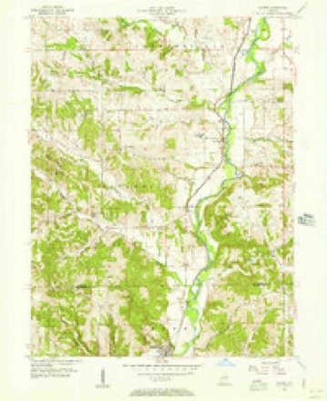
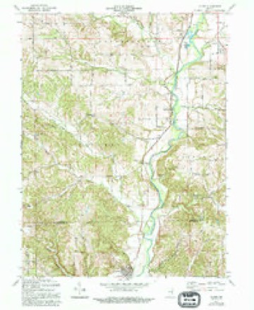
10 topographic sheets cover this place, the earliest surveyed in 1953 and the latest in 1986. It stands in Columbia Township. It lies in ZIP code area 47331. The Survey maps it on the Alpine quadrangle. It stands 991 feet above sea level.
Topographic sheets covering this place
5 surveys from 10 printed sheetsMatched by testing this settlement's coordinate against the published boundary of every sheet in the United States Geological Survey's historical collection. Each opens the scanned sheet at the Survey.
- 1953 USGS Cincinnati quadrangle1:250000, 3 printings
- 1956 USGS Alpine quadrangle1:24000
- 1957 USGS Cincinnati quadrangle1:250000
- 1971 USGS Alpine quadrangle1:24000, 3 printings
- 1986 USGS New Castle quadrangle1:100000, 2 printings



In the county-history sources
15,482 words on this townshipHistory of Fayette County, Indiana: Containing a History of the Townships, Towns, Villages, Schools, Churches, Industries, Etc.; Portraits of Early Settlers and Prominent Men; Biographies, Etc., Etc. .., published 1885 names this settlement in its chapter on Columbia Township. These are the passages that mention it, exactly as the scans read.
COLUMBIA is the central of the southern tier of townships of the county, and lies south of Connersville Township, west of the river, north of Franklin County, and east of the township of Orange. It was one of the original townships into which the county was divided in 1819, and at that time its boundaries were designated as follows: "Beginning at the southeast corner of Section 33 in Township 13, Range 13; thence west along the line dividing the counties of Franklin and Fayette to the western boundary of the county of Fayette; thence north along said count}- line live miles; thence on a direct line east to the northwest corner of Section 8, in Township 13, Range 12; thence east along the line dividing Sections 8 and 9 in Township 13, Range 13; thence south on the line dividing said Sections 8 and 9, to the southwest corner of Section 16, Township and Range last aforesaid; thence east to the line dividing the counties of Franklin and Fayette; thence south along the said line to the place of beginning."
Passage source: History of Fayette County, Indiana: Containing a History of the Townships, Towns, Villages, Schools, Churches, Industries, Etc.; Portraits of Early Settlers and Prominent Men; Biographies, Etc., Etc. .., published 1885.
The township then included, besides its present territory, all of Orange Township as it now is, exceptthe two northern tiers of sections, and all of Jackson as it now is, except the two eastern tiers of sections south of Jennings Township. This latter territory it lost on the formation of Jackson in 1820, and the former on the formation of Orange in 1822.
Passage source: History of Fayette County, Indiana: Containing a History of the Townships, Towns, Villages, Schools, Churches, Industries, Etc.; Portraits of Early Settlers and Prominent Men; Biographies, Etc., Etc. .., published 1885.
Bays, Charles Scott, the Gillams, Jonathan and David, and James Newhouse (from Virginia) settled in the township prior to 1814; Isaac, Enoch, Levi, Elijah and Jonathan Limptis, brothers, natives of Virginia, though they had settled in Kentucky early, going from thence to Butler County, Ohio, and to what is now Columbia Township in 1813.
Passage source: History of Fayette County, Indiana: Containing a History of the Townships, Towns, Villages, Schools, Churches, Industries, Etc.; Portraits of Early Settlers and Prominent Men; Biographies, Etc., Etc. .., published 1885.
Machine-read from a century-old scan, so expect the errors a machine makes: misspelled names, dropped words, stray characters.
Read the whole chapter on Columbia Township - it names this place 12 more 12 times.
Mines and quarries near this place
4 within 5 milesRegional context, not property-specific evidence. The federal mineral resources record lists 4 workings within 5 miles of Columbia: 4 producers. All of them still produce. What was taken out: Limestone, Dimension, Sand and Gravel, Construction. Distance is straight-line from the map coordinates, so a quarry counted here may appear on a neighbouring settlement's page as well.
| Where | Site | Commodity | Status | Recorded |
|---|---|---|---|---|
| Connersville Pit | Sand and Gravel, Construction | Producer | ||
| Booher Stone Quarry | Limestone, Dimension | Producer | ||
| Ogle Stone Quarry | Limestone, Dimension | Producer | ||
| Rabbit Hollow Quarry | Limestone, Dimension | Producer |
Storms near this place
2 since 2011Regional context, not property-specific evidence. The National Weather Service names Columbia in 2 storm reports between 2011 and 2022: 1 flood, 1 flash flood. No death or injury is recorded in these reports. Each account below is quoted exactly as the forecast office filed it, from the NOAA Storm Events Database, and each date opens the federal record of that event.
| When | Event | Place named | Harm | What the report says |
|---|---|---|---|---|
| December 2011 | Flood | Columbia | $1,000 | Several creeks across the county were reported out of their banks due to heavy rain. |
| May 2022 | Flash Flood | Columbia | - | South Snyder Road was impassable due to high water flowing across it. |
Nearest settlements
The eight closest, with where each one stands in the county. Distances are straight-line, computed from the Geographic Names Information System coordinates.
| Map | Place | Distance | Sheets |
|---|---|---|---|
| Alpine | 2.3 miles | 10 | |
| Nulltown | 2.6 miles | 10 | |
| Bunker Hill | 3.9 miles | 9 | |
| Orange | 4.9 miles | 9 | |
| Longwood Crossing | 5.6 miles | 9 | |
| Tyner Crossing | 5.6 miles | 9 | |
| Connersville | 5.7 miles | 9 | |
| Everton | 6.3 miles | 11 |
Elsewhere
Matched on this settlement's Geographic Names Information System number rather than its name, so it cannot be a different place of the same name in another state.
| Wikipedia article on Columbia | An encyclopaedic summary. Its text is share-alike, so it is linked here rather than copied. |
| Wikidata item Q5149570 | The structured record the population and elevation above come from. Public domain (CC0). |
Provenance
This settlement is recorded in the Geographic Names Information System as feature 432813. The sheet list is computed by point-in-boundary test against the United States Geological Survey's historical topographic inventory. Both are works of the United States government and carry no copyright under 17 U.S.C. 105.
Mines and quarries. USGS Mineral Resources Data System (MRDS) https://mrdata.usgs.gov/mrds/ A work of the United States government, no copyright under 17 U.S.C. 105.
Storms. NOAA National Centers for Environmental Information, Storm Events Database https://www.ncei.noaa.gov/stormevents/ A work of the United States government, no copyright under 17 U.S.C. 105. Narratives are quoted verbatim from the National Weather Service report and are not edited or summarised.