 Block
Orange, Indiana
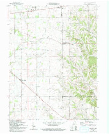
9 topographic sheets cover this place, the earliest surveyed in 1953 and the latest in 1986. It stands in Orange Township. It lies in ZIP code area 46133. The Survey maps it on the New Salem quadrangle. It stands 1,099 feet above sea level.
Topographic sheets covering this place
4 surveys from 9 printed sheetsMatched by testing this settlement's coordinate against the published boundary of every sheet in the United States Geological Survey's historical collection. Each opens the scanned sheet at the Survey.
- 1953 USGS Cincinnati quadrangle1:250000, 3 printings
- 1957 USGS Cincinnati quadrangle1:250000
- 1959 USGS New Salem quadrangle1:24000, 3 printings
- 1986 USGS New Castle quadrangle1:100000, 2 printings



In the county-history sources
6,000 words on this townshipHistory of Fayette County, Indiana: Containing a History of the Townships, Towns, Villages, Schools, Churches, Industries, Etc.; Portraits of Early Settlers and Prominent Men; Biographies, Etc., Etc. .., published 1885 names this settlement in its chapter on Orange Township. These are the passages that mention it, exactly as the scans read.
Among the first to settle in the township was the now venerable Wells Stevens, who, at this writing, is unconscious to the things of this world. Mr. Stevens is a North Carolinan, from which State his father, Robert, emigrated during the first decade of the century to the vicinity of the settlements of the Carolina colony on East Fork of Whitewater River. Robert here lived in the vicinity of Templeton's Creek until the close of the war of 1812, and during the war served several months along the frontier settlements. He then settled on Garrison's Creek in what is now Columbia Township.
Passage source: History of Fayette County, Indiana: Containing a History of the Townships, Towns, Villages, Schools, Churches, Industries, Etc.; Portraits of Early Settlers and Prominent Men; Biographies, Etc., Etc. .., published 1885.
Wells, possibly in 1819, but probably not before 1820, then just married, settled in the southwest corner of this township, and began the work of the early settler. He had built his cabin before the survey was comjjleted, and in it, it is said, he entertained more than once some one or more of the party engaged in making the survey. Later, Robert removed to that vicinity and there passed his life.
Passage source: History of Fayette County, Indiana: Containing a History of the Townships, Towns, Villages, Schools, Churches, Industries, Etc.; Portraits of Early Settlers and Prominent Men; Biographies, Etc., Etc. .., published 1885.
In 1826 Elias Matney, a Kentuckian, and his father-in-law, Alexander Ayers, settled on adjoining land on Sain's Creek, in the southeastern part of the township. They were from Preble County, Ohio, here. Ayers had emigrated thither from Pennsylvania.
Passage source: History of Fayette County, Indiana: Containing a History of the Townships, Towns, Villages, Schools, Churches, Industries, Etc.; Portraits of Early Settlers and Prominent Men; Biographies, Etc., Etc. .., published 1885.
Machine-read from a century-old scan, so expect the errors a machine makes: misspelled names, dropped words, stray characters.
Read the whole chapter on Orange Township - it names this place 9 more 9 times.
Storms near this place
5 since 2000Regional context, not property-specific evidence. The National Weather Service names Orange in 5 storm reports between 2000 and 2015: 4 thunderstorm wind, 1 hail. No death or injury is recorded in these reports. Each account below is quoted exactly as the forecast office filed it, from the NOAA Storm Events Database, and each date opens the federal record of that event.
| When | Event | Place named | Harm | What the report says |
|---|---|---|---|---|
| July 2001 | Thunderstorm Wind | Orange | $3,000 | Five trees were knocked down in Orange. |
| May 2014 | Thunderstorm Wind | Orange | $1,000 | One tree was downed at Columbia and Tower Roads due to thunderstorm winds. |
| June 2013 | Thunderstorm Wind | Orange | $1,000 | One tree was downed south of Glenwood due to thunderstorm winds. |
| December 2015 | Thunderstorm Wind | Orange | - | A large tree was knocked down across Sanes Rd. near W. Johnson School Rd. |
| August 2000 | Hail | Orange | - | no account filed |
Nearest settlements
The eight closest, with where each one stands in the county. Distances are straight-line, computed from the Geographic Names Information System coordinates.
| Map | Place | Distance | Sheets |
|---|---|---|---|
| Columbia | 4.9 miles | 10 | |
| Bunker Hill | 5.7 miles | 9 | |
| Longwood Crossing | 6.2 miles | 9 | |
| Alpine | 6.9 miles | 10 | |
| Nulltown | 7.5 miles | 10 | |
| Tyner Crossing | 8.1 miles | 9 | |
| Connersville | 9.3 miles | 9 | |
| Harrisburg | 9.5 miles | 9 |
Elsewhere
Matched on this settlement's Geographic Names Information System number rather than its name, so it cannot be a different place of the same name in another state.
| Wikipedia article on Orange | An encyclopaedic summary. Its text is share-alike, so it is linked here rather than copied. |
| Wikidata item Q7099470 | The structured record the population and elevation above come from. Public domain (CC0). |
Provenance
This settlement is recorded in the Geographic Names Information System as feature 440676. The sheet list is computed by point-in-boundary test against the United States Geological Survey's historical topographic inventory. Both are works of the United States government and carry no copyright under 17 U.S.C. 105.
Storms. NOAA National Centers for Environmental Information, Storm Events Database https://www.ncei.noaa.gov/stormevents/ A work of the United States government, no copyright under 17 U.S.C. 105. Narratives are quoted verbatim from the National Weather Service report and are not edited or summarised.