 Block
Beard, Indiana
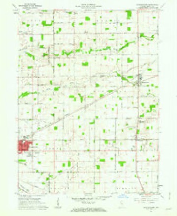
9 topographic sheets cover this place, the earliest surveyed in 1953 and the latest in 1984. It stands in Warren Township. It lies in ZIP code area 46041. The Survey maps it on the Michigantown quadrangle. It stands 850 feet above sea level.
Topographic sheets covering this place
5 surveys from 9 printed sheetsMatched by testing this settlement's coordinate against the published boundary of every sheet in the United States Geological Survey's historical collection. Each opens the scanned sheet at the Survey.
- 1953 USGS Danville quadrangle1:250000, 3 printings
- 1955 USGS Danville quadrangle1:250000
- 1956 USGS Danville quadrangle1:250000
- 1961 USGS Michigantown quadrangle1:24000, 2 printings
- 1984 USGS Lafayette quadrangle1:100000, 2 printings




In the county-history sources
9,888 words on this townshipCombination Atlas Map of Clinton County, Indiana, published 1878 names this settlement in its chapter on Warren Township. These are the passages that mention it, exactly as the scans read.
In 1833, came the following: Joseph and Andrew Robertson, on the land owned by the Widow Robertson and Dr. Young; James Morrison, on the farm belonging to his heirs; the Widow Frazier, on the John Catron farm; Beverly Williams, on the land owned by his son William; John Like, on the Jacob Storm farm; and William Nixon, on the land at present belonging to T. Heaton.
Passage source: Combination Atlas Map of Clinton County, Indiana, published 1878.
Among those who came in 1837, with some others who eame soon after and shared in the hardships of pioneer life, we name Josiah Bates, Pierson Ticen, Andrew Catron, Isaac Storms, Andrew Profit, Aaron Ford, David Beard, Charles Taylor, John, Samuel and David Cornable, Samuel Schultzs, and Charles Gum. The above constituted the basis of the early settlement. Some worthy names are doubtless omitted, having been forgotten by our informants.
Passage source: Combination Atlas Map of Clinton County, Indiana, published 1878.
The first school in the township was taught by Christian Beard, in a cabin which stood on the lot now owned by Dr. Gard, in the Winter of 1835-6. f In the Summer of 1836, a school house was built on the John Grey farm. The next was on the Zabina Babcock farm, and the next on the land belonging to Mr. Morrison.
Passage source: Combination Atlas Map of Clinton County, Indiana, published 1878.
Machine-read from a century-old scan, so expect the errors a machine makes: misspelled names, dropped words, stray characters.
Read the whole chapter on Warren Township - it names this place 3 more 3 times.
Nearest settlements
The eight closest, with where each one stands in the county. Distances are straight-line, computed from the Geographic Names Information System coordinates.
| Map | Place | Distance | Sheets |
|---|---|---|---|
| Geetingsville | 3.1 miles | 10 | |
| Ellis | 3.2 miles | 10 | |
| Kilmore | 3.4 miles | 10 | |
| Moran | 3.6 miles | 9 | |
| Middlefork | 4.2 miles | 10 | |
| Sedalia | 4.5 miles | 9 | |
| Michigantown | 4.5 miles | 9 | |
| Avery | 4.5 miles | 9 |
Elsewhere
Matched on this settlement's Geographic Names Information System number rather than its name, so it cannot be a different place of the same name in another state.
| Wikipedia article on Beard | An encyclopaedic summary. Its text is share-alike, so it is linked here rather than copied. |
| Wikidata item Q4876636 | The structured record the population and elevation above come from. Public domain (CC0). |
Provenance
This settlement is recorded in the Geographic Names Information System as feature 430647. The sheet list is computed by point-in-boundary test against the United States Geological Survey's historical topographic inventory. Both are works of the United States government and carry no copyright under 17 U.S.C. 105.