 Block
Geetingsville, Indiana
10 topographic sheets cover this place, the earliest surveyed in 1953 and the latest in 1984. It stands in Owen Township. It lies in ZIP code area 46041. The Survey maps it on the Burlington quadrangle. It stands 820 feet above sea level.
On record in Geetingsville
Buildings and businesses the archive holds for this place. Each opens its own page, with the source record it came from.
On the National Register 1 record
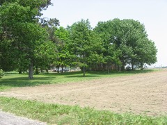 John Young Houselisted 1994
Topographic sheets covering this place
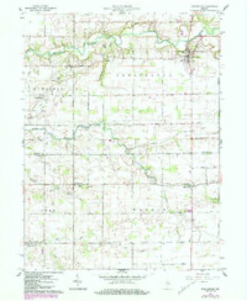
5 surveys from 10 printed sheetsMatched by testing this settlement's coordinate against the published boundary of every sheet in the United States Geological Survey's historical collection. Each opens the scanned sheet at the Survey.
- 1953 USGS Danville quadrangle1:250000, 3 printings
- 1955 USGS Danville quadrangle1:250000
- 1956 USGS Danville quadrangle1:250000
- 1961 USGS Burlington quadrangle1:24000, 3 printings
- 1984 USGS Lafayette quadrangle1:100000, 2 printings




In the county-history sources
7,163 words on this townshipHistory of Clinton County, Indiana. Together with Sketches of Its Cities, Villages and Towns, Educational, Religious, Civil, Military, and Political History, Portraits of Prominent Persons, and Biographies of Representative Citizens. Also a Condensed History of Indiana, Embodying Accounts of Prehistoric Races, Indian Wars, and a Brief Review of Its Civil and Political History, published 1886 names this settlement in its chapter on Owen Township. These are the passages that mention it, exactly as the scans read.
Joseph Calloway, deceased, was born in Ohio, September 12, 1822, a son of Winder and Mary Calloway, natives of Delaware. They came with their family to Clinton County, Indiana, in 1830, and settled in Ross Township, where they endured all the hardships and privations incident to life in a new country. Joseph Calloway was reared to manhood in Clinton County, and was a representative farmer of Owen Township. He made farming his principal avocation, although fourteen years of his life were ^pent in saw-milling and dealing in lumber. He was a soldier in the war of the Rebellion, enlisting March 17, 1865, being Second Lieutenant of the One Hundred and Fifty-fourth Indiana Infantry, He was discharged on the first day of July, 1865, when he returned to his home and followed farming until his death, September 22, 1866. He left a widow, Catharine Calloway, who still occupies the old homestead, and four children - Mary E., born July
Thomas Rapeb, a farmer of Owen Township, Clinton County, is a native of Indiana, born in Wayne County, on the homestead farm which his Grandfather Raper had entered in an early day. The grandfather was a native of England, coming to America when very young. He settled in Wayne County, remaining there till his death. The father of our subject, William Raper, was born and reared in Wayne County, but in the year of 1858 removed to Clinton County, and in 1882 to Kosciusko County, Indiana, wheie he died at the age of seventy-four years. The mother of our subject, Louisa Raper, was born in Kentucky, and died in Clinton County, Indiana, aged seventy-four years. Thomas Raper, the subject of this sketch, came to Clinton County, Indiana, in 1858, and bought forty acres of land in Owen Township, from Eli Weaver, paying for the same $18 per acre. Here he has lived a life of toil and industry for nearly thirty years, and has made many valuable improvements on his place till his land is now worth from $45 to $50 per acre. February 16, 1865, he enlisted in the late war in the One Hundred and Fiftieth Indiana Infantry, under command of Colonel Taylor. He was discharged in August of the same year without having met the enemy in battle, when he returned to his home in
Machine-read from a century-old scan, so expect the errors a machine makes: misspelled names, dropped words, stray characters.
Storms near this place
2 since 2006Regional context, not property-specific evidence. The National Weather Service names Geetingsville in 2 storm reports between 2006 and 2018: 1 hail, 1 flood. No death or injury is recorded in these reports. Each account below is quoted exactly as the forecast office filed it, from the NOAA Storm Events Database, and each date opens the federal record of that event.
| When | Event | Place named | Harm | What the report says |
|---|---|---|---|---|
| April 2006 | Hail | Geetingsville | $15,000 | A sheriff deputy's car was damaged. |
| February 2018 | Flood | Geetingsville | $500 | Dispatch reported County Road 800 North closed from County Road 100 East to County Road 200 East due to high water from heavy rainfall. |
Nearest settlements
The eight closest, with where each one stands in the county. Distances are straight-line, computed from the Geographic Names Information System coordinates.
Elsewhere
Matched on this settlement's Geographic Names Information System number rather than its name, so it cannot be a different place of the same name in another state.
| Wikipedia article on Geetingsville | An encyclopaedic summary. Its text is share-alike, so it is linked here rather than copied. |
| Wikidata item Q5529992 | The structured record the population and elevation above come from. Public domain (CC0). |
Provenance
This settlement is recorded in the Geographic Names Information System as feature 435475. The sheet list is computed by point-in-boundary test against the United States Geological Survey's historical topographic inventory. Both are works of the United States government and carry no copyright under 17 U.S.C. 105.
Storms. NOAA National Centers for Environmental Information, Storm Events Database https://www.ncei.noaa.gov/stormevents/ A work of the United States government, no copyright under 17 U.S.C. 105. Narratives are quoted verbatim from the National Weather Service report and are not edited or summarised.