 Block
Benton, Indiana
12 topographic sheets cover this place, the earliest surveyed in 1953 and the latest in 1985. It stands in Benton Township. It lies in ZIP code area 46526. The Survey maps it on the Goshen quadrangle. It stands 830 feet above sea level.
On record in Benton
Buildings and businesses the archive holds for this place. Each opens its own page, with the source record it came from.
On the National Register 1 record
- Log Cabin Inn Tourist Camplisted 2019
Topographic sheets covering this place
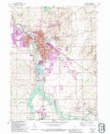
4 surveys from 12 printed sheetsMatched by testing this settlement's coordinate against the published boundary of every sheet in the United States Geological Survey's historical collection. Each opens the scanned sheet at the Survey.
- 1953 USGS Fort Wayne quadrangle1:250000, 4 printings
- 1956 USGS Fort Wayne quadrangle1:250000, 2 printings
- 1959 USGS Goshen quadrangle1:24000, 4 printings
- 1985 USGS Elkhart quadrangle1:100000, 2 printings


Mines and quarries near this place
2 within 5 milesRegional context, not property-specific evidence. The federal mineral resources record lists 2 workings within 5 miles of Benton: 2 producers. All of them still produce. What was taken out: Sand and Gravel, Construction. Distance is straight-line from the map coordinates, so a quarry counted here may appear on a neighbouring settlement's page as well.
| Where | Site | Commodity | Status | Recorded |
|---|---|---|---|---|
| Elkhart County Gravel, Inc. Pit | Sand and Gravel, Construction | Producer | ||
| Elkhart Gravel Pit | Sand and Gravel, Construction | Producer |
Storms near this place
18 since 2001Regional context, not property-specific evidence. The National Weather Service names Benton in 18 storm reports between 2001 and 2026: 13 thunderstorm wind, 2 hail, 2 tornado, 1 flash flood. No death or injury is recorded in these reports. Each account below is quoted exactly as the forecast office filed it, from the NOAA Storm Events Database, and each date opens the federal record of that event.
| When | Event | Place named | Harm | What the report says |
|---|---|---|---|---|
| March 2023 | Thunderstorm Wind | Benton | $50,000 | A trained spotter reported several power flashes and power outages in the area. |
| June 2010 | Tornado (EF1) | Benton | $50,000 | An off duty NWS employee witnessed a circulation touch down in an open field on West Lincoln Street, west of County Road 33 and move east southeast. The tornado's main structural impact occurred to a barn on the 15000 block of County Road 42. The owner of the barn witnessed the roof being picked up and carried into a nearby neighbor's yard (DI: SBO DOD: 6). The circulation then proceeded across the Timber Ridge Golf Course and began to turn more southeastward, causing extensive damage to over 200 trees on the course and then striking a large grove of 40 year old pine trees at a residence in the 12000 block of County Road 44. The final signs of the circulation were then found over an open field northwest of County Road 46 and State Route 13. Maximum winds are estimated at 100 mph. |
| July 2024 | Thunderstorm Wind | Benton | $35,000 | Photo on Twitter of a large barn with one wall collapsed and a partial roof collapse. Trusses are still standing on one-quarter of the roof. Barn door in the photo is open or missing. |
| March 2023 | Thunderstorm Wind | Benton | $30,000 | A two foot diameter tree was down. Powerlines down. Rail car tops were flipped over. |
| February 2008 | Flash Flood | Benton | $10,000 | An off duty NWS employee reported eight to twelve inches of fast flowing water over roadways just east of Benton, around County Road 44 and 33. |
| February 2026 | Thunderstorm Wind | Benton | - | Recorded at the Goshen Airport. |
| June 2020 | Thunderstorm Wind | Benton | - | Uprooted tree reported. |
| July 2019 | Thunderstorm Wind | Benton | - | A NWS survey of a concentrated area of damage confirmed a microburst occurred with winds estimated upwards of 70 mph. Several trees were snapped and large tree limbs blown down between CR 44 and 46. |
| September 2019 | Thunderstorm Wind | Benton | - | The Automated Weather Observation System at the Goshen airport recorded at 58 mph wind gust. |
| May 2019 | Hail | Benton | - | The public posted a picture on Facebook of quarter size hail. |
| May 2019 | Thunderstorm Wind | Benton | - | The public reported four to six inch diameter tree limbs were blown down. |
| November 2016 | Thunderstorm Wind | Benton | - | An off duty NWS employee reported large tree limbs were blown down. |
| November 2016 | Thunderstorm Wind | Benton | - | An off duty NWS employee reported estimated wind gusts to 60 mph. |
| August 2016 | Tornado (EF0) | Benton | - | A brief EF-0 tornado touched down just west of CR 133 south of US-6 in southeast Elkhart county. The tornado caused minor structural damage to two homes, snapped limbs of multiple trees, and flattened corn in a field before lifting roughly one minute and one tenth of a mile east northeast of where the tornado touched down. |
| March 2026 | Thunderstorm Wind | Benton | - | no account filed |
| June 2025 | Thunderstorm Wind | Benton | - | no account filed |
| July 2023 | Thunderstorm Wind | Benton | - | no account filed |
| May 2001 | Hail | Benton | - | no account filed |
Nearest settlements
The eight closest, with where each one stands in the county. Distances are straight-line, computed from the Geographic Names Information System coordinates.
| Map | Place | Distance | Sheets |
|---|---|---|---|
| Bainter Town | 3.0 miles | 12 | |
| New Paris | 3.6 miles | 12 | |
| Millersburg | 3.8 miles | 12 | |
| Waterford Mills | 4.4 miles | 12 | |
| Goshen | 6.4 miles | 12 | |
| Foraker | 8.7 miles | 12 | |
| Southwest | 9.9 miles | 12 | |
| Midway | 10.2 miles | 12 |
Elsewhere
Matched on this settlement's Geographic Names Information System number rather than its name, so it cannot be a different place of the same name in another state.
| Wikipedia article on Benton | An encyclopaedic summary. Its text is share-alike, so it is linked here rather than copied. |
| Wikidata item Q14688298 | The structured record the population and elevation above come from. Public domain (CC0). |
Provenance
This settlement is recorded in the Geographic Names Information System as feature 430828. The sheet list is computed by point-in-boundary test against the United States Geological Survey's historical topographic inventory. Both are works of the United States government and carry no copyright under 17 U.S.C. 105.
Mines and quarries. USGS Mineral Resources Data System (MRDS) https://mrdata.usgs.gov/mrds/ A work of the United States government, no copyright under 17 U.S.C. 105.
Storms. NOAA National Centers for Environmental Information, Storm Events Database https://www.ncei.noaa.gov/stormevents/ A work of the United States government, no copyright under 17 U.S.C. 105. Narratives are quoted verbatim from the National Weather Service report and are not edited or summarised.