 Block
Waterford Mills, Indiana
12 topographic sheets cover this place, the earliest surveyed in 1953 and the latest in 1985. It stands in Elkhart Township. It lies in ZIP code area 46526. The Survey maps it on the Goshen quadrangle. It stands 804 feet above sea level.
On record in Waterford Mills
Buildings and businesses the archive holds for this place. Each opens its own page, with the source record it came from.
On the National Register within a mile 2 records
The National Register names another town for these. They stand within one mile of this settlement's coordinate.
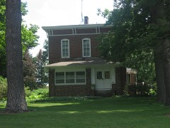 William N. Violett Houselisted 1984 · 0.2 miles away
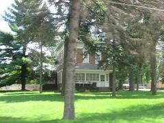 Violett-Martin House and Gardenslisted 2007 · 0.6 miles away
Topographic sheets covering this place
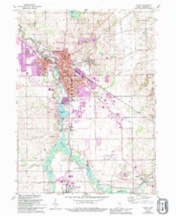
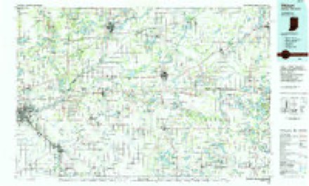
4 surveys from 12 printed sheetsMatched by testing this settlement's coordinate against the published boundary of every sheet in the United States Geological Survey's historical collection. Each opens the scanned sheet at the Survey.
- 1953 USGS Fort Wayne quadrangle1:250000, 4 printings
- 1956 USGS Fort Wayne quadrangle1:250000, 2 printings
- 1959 USGS Goshen quadrangle1:24000, 4 printings
- 1985 USGS Elkhart quadrangle1:100000, 2 printings


What happened here
An account from the chapter on Elkhart township. The inset identifies its exact source book and publication year.
Clarissa W. Ellis
the Jeffersonville Soldiers' Hospital, as a result of the disease contracted in that service she died July 24, 1865. The patriotic record of the family during the Civil war culminated in the gallant young Frank Baldwin, who was killed at the battle of Stone River. Only a short time previous to this engagement he had been promoted to lieutenant in recognition of his personal bravery on the field of battle.
In the county-history sources
67,768 words on this townshipHistory of Elkhart County, Indiana : Together with Sketches of Its Cities ... and Biographies of Representative Citizens : History of Indiana, Embracing Accounts of the Pre-historic Races .., published 1881; A Twentieth Century History and Biographical Record of Elkhart County, Indiana, published 1905 has no passage naming this settlement, which was common for smaller places. Its township is covered in full.
The chapter on Elkhart Township covers the township.
Read the chapter on Elkhart Township - 67,768 words.
Mines and quarries near this place
6 within 5 milesRegional context, not property-specific evidence. The federal mineral resources record lists 6 workings within 5 miles of Waterford Mills: 5 producers, 1 past producer. 5 still produce. What was taken out: Sand and Gravel, Construction, Stone. Distance is straight-line from the map coordinates, so a quarry counted here may appear on a neighbouring settlement's page as well.
| Where | Site | Commodity | Status | Recorded |
|---|---|---|---|---|
| Elkhart Co. Hwy. Dept. - Own Crews | Stone | Producer | ||
| Elkhart County Gravel, Inc. Pit | Sand and Gravel, Construction | Producer | ||
| Elkhart County Highway Department | Sand and Gravel, Construction | Producer | ||
| Elkhart Gravel Pit | Sand and Gravel, Construction | Producer | ||
| Fidler Inc. | Sand and Gravel, Construction | Producer | ||
| Indiana Highway Materials Pit | Sand and Gravel, Construction | Past Producer |
Storms near this place
10 since 1999Regional context, not property-specific evidence. The National Weather Service names Waterford Mills in 10 storm reports between 1999 and 2025: 6 thunderstorm wind, 2 hail, 1 flash flood, 1 flood. No death or injury is recorded in these reports. Each account below is quoted exactly as the forecast office filed it, from the NOAA Storm Events Database, and each date opens the federal record of that event.
| When | Event | Place named | Harm | What the report says |
|---|---|---|---|---|
| August 2021 | Thunderstorm Wind | Waterford Mills | $3,000 | Healthy tree snapped at the base and down on a fence. |
| June 2001 | Thunderstorm Wind | Waterford Mills | $1,500 | Tree down on car. |
| July 2025 | Flood | Waterford Mills | $1,000 | Video received on Facebook from the Menards parking lot depicting water about 6 to 8 inches deep. |
| March 2025 | Hail | Waterford Mills | $500 | Report from mPING of 0.75 inch hail. |
| September 2019 | Flash Flood | Waterford Mills | - | Three to nearly 5 inches of rain fell over a several hour period, causing numerous areas of basement flooding as well as several creeks and streams to overflow. Some road closures did occur for a few hour period during the height of the rainfall. Conditions subsided prior to sunrise. |
| August 2018 | Thunderstorm Wind | Waterford Mills | - | Local media reported a tree split from the strong winds and fell. |
| June 2014 | Thunderstorm Wind | Waterford Mills | - | A trained spotter reported a large tree fell onto a car. No details on the occupants were available. |
| July 2010 | Thunderstorm Wind | Waterford Mills | - | Broadcast media reported a portion of a roof being blown off of a house and power poles snapped on State Route 19 south of County Road 38. |
| June 2009 | Thunderstorm Wind | Waterford Mills | - | An off duty NWS employee reported numerous ten to eighteen inch tree limbs down 3 miles southwest of Goshen. |
| April 1999 | Hail | Waterford Mills | - | no account filed |
Nearest settlements
The eight closest, with where each one stands in the county. Distances are straight-line, computed from the Geographic Names Information System coordinates.
| Map | Place | Distance | Sheets |
|---|---|---|---|
| Bainter Town | 1.9 miles | 12 | |
| Goshen | 2.7 miles | 12 | |
| New Paris | 3.0 miles | 12 | |
| Benton | 4.4 miles | 12 | |
| Foraker | 5.3 miles | 12 | |
| Southwest | 6.0 miles | 12 | |
| Midway | 6.1 miles | 12 | |
| Millersburg | 7.3 miles | 12 |
Elsewhere
Matched on this settlement's Geographic Names Information System number rather than its name, so it cannot be a different place of the same name in another state.
| Wikipedia article on Waterford Mills | An encyclopaedic summary. Its text is share-alike, so it is linked here rather than copied. |
| Wikidata item Q7974034 | The structured record the population and elevation above come from. Public domain (CC0). |
Provenance
This settlement is recorded in the Geographic Names Information System as feature 445538. The sheet list is computed by point-in-boundary test against the United States Geological Survey's historical topographic inventory. Both are works of the United States government and carry no copyright under 17 U.S.C. 105.
Mines and quarries. USGS Mineral Resources Data System (MRDS) https://mrdata.usgs.gov/mrds/ A work of the United States government, no copyright under 17 U.S.C. 105.
Storms. NOAA National Centers for Environmental Information, Storm Events Database https://www.ncei.noaa.gov/stormevents/ A work of the United States government, no copyright under 17 U.S.C. 105. Narratives are quoted verbatim from the National Weather Service report and are not edited or summarised.