 Block
Southwest, Indiana
12 topographic sheets cover this place, the earliest surveyed in 1953 and the latest in 1985. It stands in Harrison Township. It lies in ZIP code area 46526. The Survey maps it on the Foraker quadrangle. It stands 856 feet above sea level.
On record in Southwest
Buildings and businesses the archive holds for this place. Each opens its own page, with the source record it came from.
On the National Register within a mile 1 record
The National Register names another town for these. They stand within one mile of this settlement's coordinate.
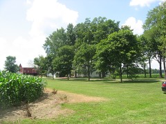 Joseph J. Rohrer Farmlisted 1990 · 0.8 miles away
Topographic sheets covering this place
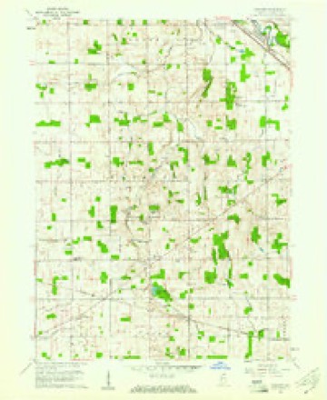
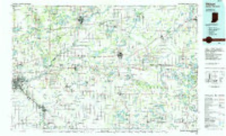
4 surveys from 12 printed sheetsMatched by testing this settlement's coordinate against the published boundary of every sheet in the United States Geological Survey's historical collection. Each opens the scanned sheet at the Survey.
- 1953 USGS Fort Wayne quadrangle1:250000, 4 printings
- 1956 USGS Fort Wayne quadrangle1:250000, 2 printings
- 1960 USGS Foraker quadrangle1:24000, 4 printings
- 1985 USGS Elkhart quadrangle1:100000, 2 printings


In the county-history sources
6,432 words on this townshipHistory of Elkhart County, Indiana : Together with Sketches of Its Cities ... and Biographies of Representative Citizens : History of Indiana, Embracing Accounts of the Pre-historic Races .., published 1881 names this settlement in its chapter on Harrison Township. These are the passages that mention it, exactly as the scans read.
Mr. S. had off at some distance from his " cabin home " a turkey pen or trap. The trap was constructed of poles, perhaps three feet by four feet in size, with a ditch dug along under the pen for the turkeys to pass in, he having previously scattered shelled corn around the pen and also in the ditch as a bait. They would devour the corn in the ditch to its terminus, tlien to get out would fiy upward, instead of returning via the entrance, and would soon find themselves entrapped. A turkey will always fly upward instead of downward to get out of a trap. On one occasion Mr. Stutsman went out to his turkey pen with his rifle, baited it with the corn as usual, and stepped back a few paces to wait for turkeys to come. He soon heard the rustle of leaves (it was autumn and the leaves had just fallen) at a distance, and on looking some rods apace saw an object resembling a red-headed gobbler moving along as if looking over a log. Mr. S. coolly raised his gun, intending when Mr. Turkev alighted on the log to dispatch him with a bullet; just then an Indian with a red handkerchief tied around his head, seeing that " big Injun be shot " leaped from behind the log and came running withall the (.987)
Passage source: History of Elkhart County, Indiana : Together with Sketches of Its Cities ... and Biographies of Representative Citizens : History of Indiana, Embracing Accounts of the Pre-historic Races .., published 1881.
Machine-read from a century-old scan, so expect the errors a machine makes: misspelled names, dropped words, stray characters.
Mines and quarries near this place
1 within 5 milesRegional context, not property-specific evidence. The federal mineral resources record lists 1 working within 5 miles of Southwest: 1 producer. All of them still produce. What was taken out: Sand and Gravel, Construction. Distance is straight-line from the map coordinates, so a quarry counted here may appear on a neighbouring settlement's page as well.
| Where | Site | Commodity | Status | Recorded |
|---|---|---|---|---|
| Christner Gravel Pit | Sand and Gravel, Construction | Producer |
Nearest settlements
The eight closest, with where each one stands in the county. Distances are straight-line, computed from the Geographic Names Information System coordinates.
| Map | Place | Distance | Sheets |
|---|---|---|---|
| Foraker | 1.8 miles | 12 | |
| Wakarusa | 4.1 miles | 11 | |
| Locke | 5.8 miles | 11 | |
| Waterford Mills | 6.0 miles | 12 | |
| Midway | 6.3 miles | 12 | |
| Goshen | 6.6 miles | 12 | |
| New Paris | 6.6 miles | 12 | |
| Bainter Town | 6.9 miles | 12 |
Elsewhere
Matched on this settlement's Geographic Names Information System number rather than its name, so it cannot be a different place of the same name in another state.
| Wikipedia article on Southwest | An encyclopaedic summary. Its text is share-alike, so it is linked here rather than copied. |
| Wikidata item Q7571191 | The structured record the population and elevation above come from. Public domain (CC0). |
Provenance
This settlement is recorded in the Geographic Names Information System as feature 443890. The sheet list is computed by point-in-boundary test against the United States Geological Survey's historical topographic inventory. Both are works of the United States government and carry no copyright under 17 U.S.C. 105.
Mines and quarries. USGS Mineral Resources Data System (MRDS) https://mrdata.usgs.gov/mrds/ A work of the United States government, no copyright under 17 U.S.C. 105.