 Block
New Palestine, Indiana
11 topographic sheets cover this place, the earliest surveyed in 1953 and the latest in 1986. It stands in Sugar Creek Township. It lies in ZIP code area 46163. It stands on Palestine Branch. The Survey maps it on the Acton quadrangle. 2,744 people lived here at the 2020 count. It stands 837 feet above sea level.
Population over time
2 figuresNew Palestine grew from 2,055 to 2,744 between 2010 and 2020. These are the recorded population figures Wikidata holds for this place, reached through the Geographic Names Information System number this page is keyed on rather than by name, so they belong to this place and not to another of the same name. Most are census counts, but not all are: an early figure may be a founding or settlement estimate, and an estimate published within five years of a census is left out. The change column is computed, and is left blank where more than 20 years separate a figure from the one before it, because a gap that long is not a change between two counts.
| Year | People | Change |
|---|---|---|
| 2010 | 2,055 | |
| 2020 | 2,744 | +689 (+34%) |
Topographic sheets covering this place
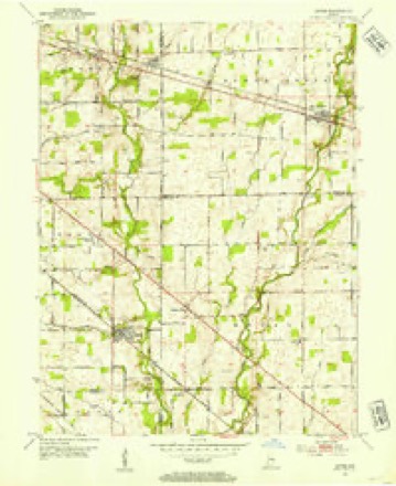
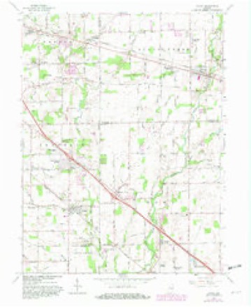
5 surveys from 11 printed sheetsMatched by testing this settlement's coordinate against the published boundary of every sheet in the United States Geological Survey's historical collection. Each opens the scanned sheet at the Survey.
- 1953 USGS Acton quadrangle1:24000
- 1953 USGS Cincinnati quadrangle1:250000, 3 printings
- 1957 USGS Cincinnati quadrangle1:250000
- 1962 USGS Acton quadrangle1:24000, 4 printings
- 1986 USGS New Castle quadrangle1:100000, 2 printings



In the county-history sources
46,576 words on this townshipHistory of Hancock County, Indiana, from Its Earliest Settlement by the "pale Face," in 1818, Down to 1882, published 1882 names this settlement in its chapter on Sugar Creek Township. These are the passages that mention it, exactly as the scans read.
Philadelphia, named in commemoration of the city of brotherly love, is located four miles west of Greenfield, on the National road. The P., C. and St. L. R. R. runs by it. It contains a two-story public school building, one sawmill, a flouring mill, post-office, express office, daily mail, druggist, grocer, merchants, mechanics, physicians, and other necessaries to a village of her dimensions. Philadelphia was laid out by the records fail to show whom, on the nth day of April, 1838, being about six months prior to the laying out of New Palestine. The original plat consists of one hundred and two lots and six out-lots. The first and only addition was made by Clark, on the second day of April, 1864, and consisted of nineteen lots, located south of the old plat. Among the first business men of this place were: Charles Atherton, Sen., general merchant and post-master; Allen McCane, Joseph Marshall, G. W. Willett, Samuel McConaha, J. B. Sting, J. B. Conover and O. S. Meek. First physicians. Dr. Hodson McCallister & Son, J. H. Hazen, W. H. Dye, G. T. Rennick and H. B. Tilson. We will not consume space in ijivinij a full list of the business throuirh her entire history, but will now come up to the present, and furnish for this date a
Passage source: History of Hancock County, Indiana, from Its Earliest Settlement by the "pale Face," in 1818, Down to 1882, published 1882.
New Palestine, was organized September 4, 1870, on the following platform : " We, the undersigned, members of the body of Christ, agree to congregate ourselves together for the worship of the true God, and the edifying of each other in love ; to be governed by the word of the Lord,
Passage source: History of Hancock County, Indiana, from Its Earliest Settlement by the "pale Face," in 1818, Down to 1882, published 1882.
The citizens of New Palestine, in harmony with the progressive spirit of the times and country, nearly two -decades since organized the musical talent of the place into a brass band, well furnished, equipped, and supplied with ii wagon, at a total cost for instruments, uniforms and wagon, of $1,150; in addition to which liberality, they for instruction and music, $400 ; for incidentals, perhaps $50, making a total expenditure to the boys and their friends of $1 ,6oo. The charter members, not included in the present membership, were Walter Waterson, James Arthur, Henry G. Mickle, Albert H. Dix, Charles Haynes, Thomas J. Elliott, and J. M. Freeman. The present members are : Smith T. JVic/ioh,'^ John H. Garvcr, George W. Nichols, William F. Anderson, John Westlake, Fred Freagel, William Gundrum, John Carson, Marshall Waterson and Harry Garvcr. This band is in good working order, and is equaled in the county in its efficiency and ability to charm and hold spell-bound its audiences by the Greenfield band only, whose leader has been their main instructor, and it is surpassed by none, notwithstanding the acknowledged ability and recognized efficiency of the other good bands of the countv. It has been our <:ood pleasure to hear this band discourse on different occasions to enrapt audiences such euphonious, harmonious music as seldom wings its way to the ear of mortal man ; and should they so direct their steps as to have the good fortune to enter the celestial city, they will doubtless be chosen to augment that innumerable company which surrounds the throne, with golden instruments and harps in their hands, ever singing, blowing, playing and rejoicing, as only angels can do.
Passage source: History of Hancock County, Indiana, from Its Earliest Settlement by the "pale Face," in 1818, Down to 1882, published 1882.
Machine-read from a century-old scan, so expect the errors a machine makes: misspelled names, dropped words, stray characters.
Read the whole chapter on Sugar Creek Township - it names this place 63 more 63 times.
Mines and quarries near this place
1 within 5 milesRegional context, not property-specific evidence. The federal mineral resources record lists 1 working within 5 miles of New Palestine: 1 producer. All of them still produce. What was taken out: Sand and Gravel, Construction. Distance is straight-line from the map coordinates, so a quarry counted here may appear on a neighbouring settlement's page as well.
| Where | Site | Commodity | Status | Recorded |
|---|---|---|---|---|
| Indianapolis Aggregates Division | Sand and Gravel, Construction | Producer |
Storms near this place
29 since 1997Regional context, not property-specific evidence. The National Weather Service names New Palestine in 29 storm reports between 1997 and 2023: 14 thunderstorm wind, 14 hail, 1 flood. No death or injury is recorded in these reports. Each account below is quoted exactly as the forecast office filed it, from the NOAA Storm Events Database, and each date opens the federal record of that event.
| When | Event | Place named | Harm | What the report says |
|---|---|---|---|---|
| June 2021 | Thunderstorm Wind | New Palestine | $15,000 | Trees downed across road by thunderstorm wind gust at this location. There were 8 other locations nearby with reports of a tree downed with numerous additional likely that went unreported. |
| July 2023 | Thunderstorm Wind | New Palestine | $10,000 | Thunderstorm winds damaged trees and blew shingles off of a roof. |
| May 2017 | Thunderstorm Wind | New Palestine | $7,000 | Trees and power lines were down across roads in and near this location due to damaging thunderstorm wind gusts. |
| May 2019 | Thunderstorm Wind | New Palestine | $3,000 | Power lines were reported down due to damaging thunderstorm wind gusts. |
| June 2008 | Thunderstorm Wind | New Palestine | $2,000 | Trees and power lines were knocked down due to damaging thunderstorm winds. |
| July 1998 | Thunderstorm Wind | New Palestine | $1,500 | Thunderstorm winds blew down several trees, one which landed on a pickup truck. |
| June 2021 | Thunderstorm Wind | New Palestine | $1,000 | Several large tree limbs downed by thunderstorm wind gusts and on road just off US Highway 52. |
| May 2002 | Thunderstorm Wind | New Palestine | $1,000 | A tree fell on a power pole, knocking down the pole. |
| July 2023 | Thunderstorm Wind | New Palestine | - | A 60 mph thunderstorm wind gust was estimated at this location with dime sized hail also ongoing. |
| June 2021 | Hail | New Palestine | - | Photograph of 3.4 inch hailstone with tape measure next to the stone. |
| February 2009 | Flood | New Palestine | - | An un-named creek near County Road 600 West and Stinemyer Road was partially blocked by debris, causing the water to flow over the road at a depth of 2 to 3 inches. |
| June 2008 | Thunderstorm Wind | New Palestine | - | Trees blown down over the road at 300 South and 3000 West due to damaging thunderstorm winds. Tree limbs were also blown down onto 400 South. |
| July 2005 | Thunderstorm Wind | New Palestine | - | A large tree was downed. |
| May 2004 | Thunderstorm Wind | New Palestine | - | 2 1/2 Foot diameter tree down. |
| July 2023 | Hail | New Palestine | - | no account filed |
| June 2021 | Hail | New Palestine | - | no account filed |
| June 2021 | Hail | New Palestine | - | no account filed |
| June 2021 | Hail | New Palestine | - | no account filed |
| May 2016 | Hail | New Palestine | - | no account filed |
| May 2016 | Hail | New Palestine | - | no account filed |
| May 2016 | Hail | New Palestine | - | no account filed |
| April 2012 | Hail | New Palestine | - | no account filed |
| April 2012 | Hail | New Palestine | - | no account filed |
| September 2012 | Hail | New Palestine | - | no account filed |
| March 2011 | Hail | New Palestine | - | no account filed |
| June 2008 | Hail | New Palestine | - | no account filed |
| September 2002 | Hail | New Palestine | - | no account filed |
| June 2000 | Thunderstorm Wind | New Palestine | - | no account filed |
| April 1997 | Thunderstorm Wind | New Palestine | - | no account filed |
Nearest settlements
The eight closest, with where each one stands in the county. Distances are straight-line, computed from the Geographic Names Information System coordinates.
| Map | Place | Distance | Sheets |
|---|---|---|---|
| Brookville Heights | 0.9 miles | 11 | |
| Carriage Estates | 1.1 miles | 11 | |
| Schildmeier Park | 2.6 miles | 11 | |
| Carrollton | 3.8 miles | 9 | |
| Reedville Station | 3.9 miles | 9 | |
| Gem | 4.0 miles | 12 | |
| Spring Lake | 4.2 miles | 12 | |
| Philadelphia | 4.7 miles | 12 |
Elsewhere
Matched on this settlement's Geographic Names Information System number rather than its name, so it cannot be a different place of the same name in another state.
| Wikipedia article on New Palestine | An encyclopaedic summary. Its text is share-alike, so it is linked here rather than copied. |
| Wikidata item Q770993 | The structured record the population and elevation above come from. Public domain (CC0). |
Provenance
This settlement is recorded in the Geographic Names Information System as feature 440091. The sheet list is computed by point-in-boundary test against the United States Geological Survey's historical topographic inventory. Both are works of the United States government and carry no copyright under 17 U.S.C. 105.
Mines and quarries. USGS Mineral Resources Data System (MRDS) https://mrdata.usgs.gov/mrds/ A work of the United States government, no copyright under 17 U.S.C. 105.
Storms. NOAA National Centers for Environmental Information, Storm Events Database https://www.ncei.noaa.gov/stormevents/ A work of the United States government, no copyright under 17 U.S.C. 105. Narratives are quoted verbatim from the National Weather Service report and are not edited or summarised.