 Block
Clarksville, Indiana
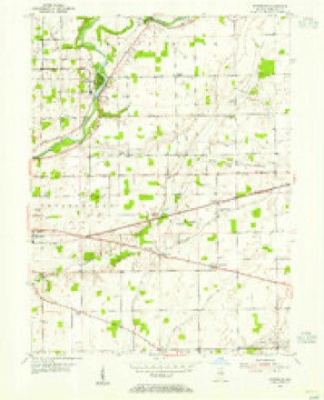
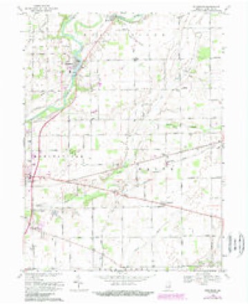
15 topographic sheets cover this place, the earliest surveyed in 1953 and the latest in 1986. It stands in Wayne Township. It lies in ZIP code area 46060. The Survey maps it on the Riverwood quadrangle. It stands 837 feet above sea level.
Topographic sheets covering this place
5 surveys from 15 printed sheetsMatched by testing this settlement's coordinate against the published boundary of every sheet in the United States Geological Survey's historical collection. Each opens the scanned sheet at the Survey.
- 1953 USGS Muncie quadrangle1:250000, 5 printings
- 1953 USGS Riverwood quadrangle1:24000, 2 printings
- 1956 USGS Muncie quadrangle1:250000
- 1969 USGS Riverwood quadrangle1:24000, 4 printings
- 1986 USGS Muncie quadrangle1:100000, 3 printings



In the county-history sources
8,256 words on this townshipHistory of Hamilton County, Indiana : with Illustrations and Biographical Sketches of Some of Its Prominent Men and Pioneers : to Which Are Appended Maps of Its Several Townships, published 1880 names this settlement in its chapter on Wayne Township. These are the passages that mention it, exactly as the scans read.
Philip P. Whitesell was born in Cincinnati on the 4th day of December, . 182H. His boyhood was passed in the schools until 18.'!1, when, iu consof|Ucnec of the cholera, the family moved to Prankliu County, Ind., where they remained until he wils fourteen years of age, when they removed to Marion County, and .settled near Indianapolis on n farm. The yonng boy remained at home assisting on the farm until he was seventeen yearsof age, when he entered a school at Madison, where he remained three years. He then commenced the study of medicine with Dr. II. B. \. Johnson, of Marion County, where ho remained three years. He then studied with Drs. Dullard & Mcara, of Indianapolis, and then for a few months wna engaged on the Indianapolis k Peru Kailroad.
Passage source: History of Hamilton County, Indiana : with Illustrations and Biographical Sketches of Some of Its Prominent Men and Pioneers : to Which Are Appended Maps of Its Several Townships, published 1880.
He next attended a course of medical lectures at the Central Medical College nt Indianapolis, and then, in the spring of IS.'ifl, he .settled at Clarksville, Hamilton County, and conimenccd the practice of his profession, and where he has ever since resided, except an interval of two years in Noblesville and while in service in the army.
Passage source: History of Hamilton County, Indiana : with Illustrations and Biographical Sketches of Some of Its Prominent Men and Pioneers : to Which Are Appended Maps of Its Several Townships, published 1880.
In December, 18.-):i, ho was united in marriage to Miss May K. Heiny, daughter of Henry and Eliziilieth Heiny. of Clarksville. The Doctor continued in the pr.acticc of medicine until 1861, when the long-impending crisis between the North and South broke out into actual rebellion against the Government and Union. The Doctor, who was an active and zealous supporter of the Ilepubliean parly, laid aside his profession and busincas and beeaine actively engaged in cnli.sting men and means for the defense of Iho Government. Ho enlisted Company E, of the Thirty-ninth Indiana Infantry, which he uniformed and clothed at his own expense, and then with it went into the field as Captain. Ho
Passage source: History of Hamilton County, Indiana : with Illustrations and Biographical Sketches of Some of Its Prominent Men and Pioneers : to Which Are Appended Maps of Its Several Townships, published 1880.
Machine-read from a century-old scan, so expect the errors a machine makes: misspelled names, dropped words, stray characters.
Read the whole chapter on Wayne Township - it names this place 2 more 2 times.
Fires near this place
1 since 2004Regional context, not property-specific evidence. The federal wildfire occurrence database lists 1 fire within 5 miles of Clarksville in 2004, burning under an acre in total. None started naturally. None was recorded as arson. Distance is straight-line from the map coordinates, so a fire counted here may appear on a neighbouring settlement's page as well.
| Reported cause | Fires |
|---|---|
| Missing data/not specified/undetermined | 1 |
The most recent of them, most recent first, with the day each was reported and the service that recorded it.
| Date | Cause | Size | Reported by | Name on the report |
|---|---|---|---|---|
| 8 April 2004 | Missing data/not specified/undetermined | under an acre | Indiana State Fire Marshal's Office | not named |
Settlements close enough to share some of these fires:
Mines and quarries near this place
4 within 5 milesRegional context, not property-specific evidence. The federal mineral resources record lists 4 workings within 5 miles of Clarksville: 2 producers, 1 occurrence, 1 past producer. 2 still produce. What was taken out: Stone, Crushed/Broken, Zinc, Sulfur. Distance is straight-line from the map coordinates, so a quarry counted here may appear on a neighbouring settlement's page as well.
| Where | Site | Commodity | Status | Recorded |
|---|---|---|---|---|
| Sphalerite Occurrence Z80 | Zinc, Sulfur | Occurrence | Sphalerite | |
| Lapel Mine & Mill | Stone, Crushed/Broken | Producer | ||
| Lapel Quarry | Stone, Crushed/Broken | Past Producer | ||
| Stony Creek Stone Company Ops | Stone, Crushed/Broken | Producer |
Storms near this place
17 since 2008Regional context, not property-specific evidence. The National Weather Service names Clarksville in 17 storm reports between 2008 and 2024: 6 hail, 5 thunderstorm wind, 3 flash flood, 2 lightning. No death or injury is recorded in these reports. Each account below is quoted exactly as the forecast office filed it, from the NOAA Storm Events Database, and each date opens the federal record of that event.
| When | Event | Place named | Harm | What the report says |
|---|---|---|---|---|
| May 2008 | Lightning | Clarksville | $300,000 | Lightning struck a home and caused a fire to begin on the rear corner of the home. The winds caught the home next door on fire. A third house had minor damage from the fire. |
| June 2010 | Lightning | Clarksville | $20,000 | Lightning struck a house just north of 136th Street on Marilyn Road. It scorched several places along the roof line, blew off siding and a gutter downspout while melting the aluminum, and came through a bedroom wall via a nail and blasted into an electrical wire which fried the outlet beneath it. A small fire was associated with this event. |
| March 2022 | Thunderstorm Wind | Clarksville | $18,000 | Thunderstorm winds blew many shingles off of roofs while bits of siding were ripped from houses. Also minor tree damage with about 0.5 inch branches snapped off. |
| March 2020 | Thunderstorm Wind | Clarksville | $10,000 | Concrete siding ripped from a couple of houses due to thunderstorm wind gusts. |
| May 2015 | Flash Flood | Clarksville | $6,000 | The westbound lane of Highway 38 was underwater about half a mile west of Highway 13. Several inches of flowing water is also going over some driveways. Heavy thunderstorm rainfall was the cause of the flooding. |
| July 2023 | Thunderstorm Wind | Clarksville | $5,000 | Thunderstorm winds downed a few large trees between Fishers and Fortville amid small hail. |
| June 2008 | Flash Flood | Clarksville | $5,000 | Water was covering the roadway at the intersection of 156th Street and Baptist Church Road due to heavy rainfall. |
| June 2015 | Flood | Clarksville | $3,000 | Six inches of standing water was over the road in Sagamore Golf Club in Noblesville due to heavy rainfall. |
| June 2008 | Flash Flood | Clarksville | $1,000 | One hundred sixty-sixth Street was closed between Boden and Olio Roads due to flood waters. |
| December 2021 | Thunderstorm Wind | Clarksville | - | Near the Ruoff Music Center. Reported on Twitter. |
| March 2020 | Thunderstorm Wind | Clarksville | - | Trained spotter measured a 69 mph thunderstorm wind gust. |
| May 2015 | Hail | Clarksville | - | Dime size hail reports were received via videos and pictures on Twitter from 7:39 PM to 7:44 PM. This occurred near Olio Road and 131st Street. |
| March 2024 | Hail | Clarksville | - | no account filed |
| March 2017 | Hail | Clarksville | - | no account filed |
| March 2017 | Hail | Clarksville | - | no account filed |
| April 2013 | Hail | Clarksville | - | no account filed |
| March 2012 | Hail | Clarksville | - | no account filed |
Nearest settlements
The eight closest, with where each one stands in the county. Distances are straight-line, computed from the Geographic Names Information System coordinates.
| Map | Place | Distance | Sheets |
|---|---|---|---|
| Durbin | 1.7 miles | 15 | |
| Olio | 4.2 miles | 12 | |
| Meadows Knoll | 4.5 miles | 15 | |
| Meadows Glen | 4.7 miles | 15 | |
| Ashwood | 5.0 miles | 12 | |
| Gray Eagle | 5.1 miles | 12 | |
| Sandstone Lakes | 5.1 miles | 12 | |
| Plantana | 5.1 miles | 12 |
Elsewhere
Matched on this settlement's Geographic Names Information System number rather than its name, so it cannot be a different place of the same name in another state.
| Wikipedia article on Clarksville | An encyclopaedic summary. Its text is share-alike, so it is linked here rather than copied. |
| Wikidata item Q5127674 | The structured record the population and elevation above come from. Public domain (CC0). |
Provenance
This settlement is recorded in the Geographic Names Information System as feature 432577. The sheet list is computed by point-in-boundary test against the United States Geological Survey's historical topographic inventory. Both are works of the United States government and carry no copyright under 17 U.S.C. 105.
Wildfire. Short, Karen C. 2022. Spatial wildfire occurrence data for the United States, 1992-2020 [FPA_FOD_20221014]. 6th Edition. Fort Collins, CO: Forest Service Research Data Archive. https://doi.org/10.2737/RDS-2013-0009.6 Collected with United States Government funding and usable without additional permissions or fees.
Mines and quarries. USGS Mineral Resources Data System (MRDS) https://mrdata.usgs.gov/mrds/ A work of the United States government, no copyright under 17 U.S.C. 105.
Storms. NOAA National Centers for Environmental Information, Storm Events Database https://www.ncei.noaa.gov/stormevents/ A work of the United States government, no copyright under 17 U.S.C. 105. Narratives are quoted verbatim from the National Weather Service report and are not edited or summarised.