 Block
Durbin, Indiana
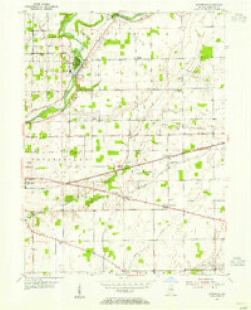
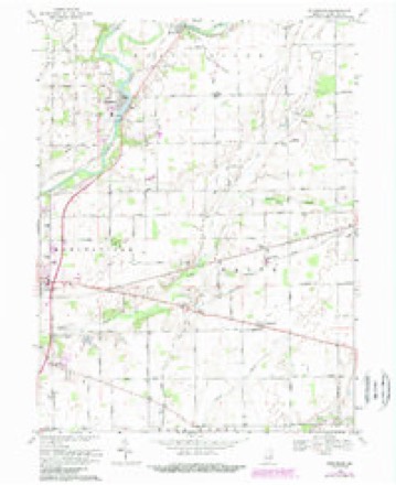
15 topographic sheets cover this place, the earliest surveyed in 1953 and the latest in 1986. It stands in Wayne Township. It lies in ZIP code area 46060. The Survey maps it on the Riverwood quadrangle.
Topographic sheets covering this place
5 surveys from 15 printed sheetsMatched by testing this settlement's coordinate against the published boundary of every sheet in the United States Geological Survey's historical collection. Each opens the scanned sheet at the Survey.
- 1953 USGS Muncie quadrangle1:250000, 5 printings
- 1953 USGS Riverwood quadrangle1:24000, 2 printings
- 1956 USGS Muncie quadrangle1:250000
- 1969 USGS Riverwood quadrangle1:24000, 4 printings
- 1986 USGS Muncie quadrangle1:100000, 3 printings



In the county-history sources
8,256 words on this townshipHistory of Hamilton County, Indiana : with Illustrations and Biographical Sketches of Some of Its Prominent Men and Pioneers : to Which Are Appended Maps of Its Several Townships, published 1880 names this settlement in its chapter on Wayne Township. These are the passages that mention it, exactly as the scans read.
His son Philip was born in Germany in 17Sli. He was reared and remained at home near l*itt.sburgh, Penn., until nineteen years of age, when he became a pilot on the Ohio liiver, from Pittsburgh to Cincinnati. lie afterward built and run the Phcbus, which was the second steamer run between Pittsburgh and Cincinnati. Ho was married to Sarah Cubbage, and afterward, in 1821, he .settled in the city of Cincinnati. He followed the river all his life, and died in LSHO, at tlic age of sixty-one years. His widow died in 185:i, at the age of seventy-two years. They were the parents of nine children, named Catharine, Sarah, William, Jacob, AVilson, Philip, Samuel. Charles and an infint (deceased) not named. All these arc liring at this time save the one last
Passage source: History of Hamilton County, Indiana : with Illustrations and Biographical Sketches of Some of Its Prominent Men and Pioneers : to Which Are Appended Maps of Its Several Townships, published 1880.
Philip P. Whitesell was born in Cincinnati on the 4th day of December, . 182H. His boyhood was passed in the schools until 18.'!1, when, iu consof|Ucnec of the cholera, the family moved to Prankliu County, Ind., where they remained until he wils fourteen years of age, when they removed to Marion County, and .settled near Indianapolis on n farm. The yonng boy remained at home assisting on the farm until he was seventeen yearsof age, when he entered a school at Madison, where he remained three years. He then commenced the study of medicine with Dr. II. B. \. Johnson, of Marion County, where ho remained three years. He then studied with Drs. Dullard & Mcara, of Indianapolis, and then for a few months wna engaged on the Indianapolis k Peru Kailroad.
Passage source: History of Hamilton County, Indiana : with Illustrations and Biographical Sketches of Some of Its Prominent Men and Pioneers : to Which Are Appended Maps of Its Several Townships, published 1880.
He next attended a course of medical lectures at the Central Medical College nt Indianapolis, and then, in the spring of IS.'ifl, he .settled at Clarksville, Hamilton County, and conimenccd the practice of his profession, and where he has ever since resided, except an interval of two years in Noblesville and while in service in the army.
Passage source: History of Hamilton County, Indiana : with Illustrations and Biographical Sketches of Some of Its Prominent Men and Pioneers : to Which Are Appended Maps of Its Several Townships, published 1880.
Machine-read from a century-old scan, so expect the errors a machine makes: misspelled names, dropped words, stray characters.
Mines and quarries near this place
5 within 5 milesRegional context, not property-specific evidence. The federal mineral resources record lists 5 workings within 5 miles of Durbin: 3 producers, 1 occurrence, 1 past producer. 3 still produce. What was taken out: Stone, Crushed/Broken, Zinc, Sulfur, Sand and Gravel, Construction. Distance is straight-line from the map coordinates, so a quarry counted here may appear on a neighbouring settlement's page as well.
| Where | Site | Commodity | Status | Recorded |
|---|---|---|---|---|
| Southard Pit | Sand and Gravel, Construction | Producer | ||
| Sphalerite Occurrence Z80 | Zinc, Sulfur | Occurrence | Sphalerite | |
| Lapel Mine & Mill | Stone, Crushed/Broken | Producer | ||
| Lapel Quarry | Stone, Crushed/Broken | Past Producer | ||
| Stony Creek Stone Company Ops | Stone, Crushed/Broken | Producer |
Storms near this place
4 since 2011Regional context, not property-specific evidence. The National Weather Service names Durbin in 4 storm reports between 2011 and 2025: 2 thunderstorm wind, 2 hail. No death or injury is recorded in these reports. Each account below is quoted exactly as the forecast office filed it, from the NOAA Storm Events Database, and each date opens the federal record of that event.
| When | Event | Place named | Harm | What the report says |
|---|---|---|---|---|
| April 2025 | Thunderstorm Wind | Durbin | $30,000 | Trees downed by thunderstorm wind gusts through Noblesville. |
| July 2011 | Thunderstorm Wind | Durbin | $5,000 | Trees were downed on 191st Street and Victor Chapel Road due to damaging thunderstorm wind gusts. |
| April 2012 | Hail | Durbin | - | One and a half inch hail fell near the Hamilton and Madison County lines. |
| July 2012 | Hail | Durbin | - | no account filed |
Nearest settlements
The eight closest, with where each one stands in the county. Distances are straight-line, computed from the Geographic Names Information System coordinates.
| Map | Place | Distance | Sheets |
|---|---|---|---|
| Clarksville | 1.7 miles | 15 | |
| Meadows Knoll | 3.8 miles | 15 | |
| Meadows Glen | 4.1 miles | 15 | |
| Riverwood | 4.3 miles | 15 | |
| Clare | 4.9 miles | 15 | |
| Strawtown | 5.0 miles | 15 | |
| Noblesville | 5.2 miles | 15 | |
| West Noblesville | 5.9 miles | 15 |
Provenance
This settlement is recorded in the Geographic Names Information System as feature 433806. The sheet list is computed by point-in-boundary test against the United States Geological Survey's historical topographic inventory. Both are works of the United States government and carry no copyright under 17 U.S.C. 105.
Mines and quarries. USGS Mineral Resources Data System (MRDS) https://mrdata.usgs.gov/mrds/ A work of the United States government, no copyright under 17 U.S.C. 105.
Storms. NOAA National Centers for Environmental Information, Storm Events Database https://www.ncei.noaa.gov/stormevents/ A work of the United States government, no copyright under 17 U.S.C. 105. Narratives are quoted verbatim from the National Weather Service report and are not edited or summarised.