 Block
Preble, Indiana
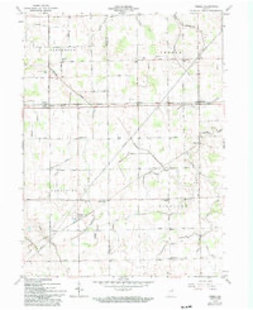
10 topographic sheets cover this place, the earliest surveyed in 1953 and the latest in 1986. It stands in Preble Township. It lies in ZIP code area 46733. The Survey maps it on the Preble quadrangle. It stands 814 feet above sea level.
Topographic sheets covering this place
4 surveys from 10 printed sheetsMatched by testing this settlement's coordinate against the published boundary of every sheet in the United States Geological Survey's historical collection. Each opens the scanned sheet at the Survey.
- 1953 USGS Muncie quadrangle1:250000, 5 printings
- 1956 USGS Muncie quadrangle1:250000
- 1962 USGS Preble quadrangle1:24000, 2 printings
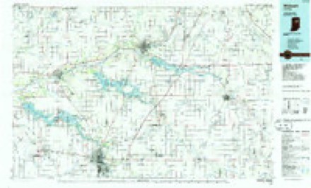
- 1986 USGS Wabash quadrangle1:100000, 2 printings


In the county-history sources
849 words on this townshipSnow's History of Adams County, Indiana, published 1907 names this settlement in its chapter on Preble Township. These are the passages that mention it, exactly as the scans read.
and is situated in the northwest corner of road ; Jacob Yager, Christian Micssing. Contlie county. It joins Welis and Allen coun- rad Renking, Louis Kcppert, Christ:an worth of fine church property. There is hardly a corner in the township from which a church spire cannot be seen. This township, as most others, used its school houses for church purposes at first until church to school became a matter of consideration. The first additional church was built to the east of the river from Freidheim, in what is known as the Dirkson neighborhood. This was located on the old Piqua road and called the Saint Form's Lutheran church. The first buildings were erected. The Wafel school church here was built about 1847 and conhouse was built about 1841 and was located tin"e(! in «« lir;til the Present elegant brick in the west part of section 26. The Fuhr- edifice was erected in 1877. The minister man school house was about two miles north of this in section 23 ; was built in 1843. These houses were both log structures. In 1852 the Dirkson school house, a frame, was built. The Fruchte school house was a frame, and was built in 1853. At the bein charge at this church is the Rev. II. C. Jaus. The next Lutheran church built in this township is known as the Saint Peter's Lutheran church, and is situated a short distance northwest of Preble station. This church was erected about 1878, has a large ginning the Lutheran people settled in the congregation and as all the others, a paronorthwest part of the township and started chial school. The minister in charge here is chial school and church buildings. The cen- Tt is known as the Zion Evangelical Luthertral and southern parts of the township had an church.
Passage source: Snow's History of Adams County, Indiana, published 1907.
formed organization, which built the Salem were log structures. The third building waschurch at the east side of section 28 in 1857. a frame and was constantly in use for over the present massive brick structure, is one of the best in the county. This church has a large congregation, with the Rev. C. B. Preuss as minister since 1893. This township has two villages, the towns of Preble and Magley, each of which are railroad stations in the southern part of the township.. The town of Magley was begun in 18S2 by 'Jacob Magley, who then started a small general country store and served as station agent for the first few years. This town has some nice residences, a telephone station and stock yards, and one of the largest general stores in any small town in the county. It also has a creamery that was built by Levi Sarin some ten or twelve years ago. The farmers in this section of the county ship a great many cans of milk to the Chicago market each week. Robert Case, the storekeeper, is at this time the postmaster and coa! merchant in addition to his extensive store interests. This town is located a mile from the Wells county line and two miles west of Preble .and has perhaps fifty residents. The town of Preble is located about four miles directly west of Decatur and is the oil town of the county. This town was laid out and the plat recorded on the 14th day of November, 18S4, by Daniel Hoffman and David Werling. Its original plat contained thirteen lots that are fifty by one hundred and fifty feet in size. Within the next three years David Werling laid out an addition to the town. A tile mill and a saw mil! were located here soon after the town was begun. This village now has a large hotel, a good country store, a barber shop, butcher shop and saloon. The Standard Oil Company has extensive business interests here that require the presence of a large force of men, who permanently reside in Preb'.e. The oil company's pumping station buildings are about ail brick. To the east and southeast is a town of great big boiler-iron tanks that resemble the tents of a show ground. This town has one brick residence, that of County Commissioner David Werling. The first steam circular saw milt operated in this township was located in section 27 and was owned by Frederick Peck and Lewis Fruchte. The estimated population of Preble township in 1907 is one thousand three hundred and eighty-five; number of voters, two hundred and seventy-seven ; the school enumeration, three hundred and ninety-seven. It is impossible to give a complete list of township trustees, but commonly the trustee or president of the board of trustees until 1S60 was the inspector of elections. Frederick Buuck. 1S46; Ernst Stopenhagcu. 1848; Jacob Yager, 1850; Frederick- Buuck, 1851; George Kieffer. 1854; Ernst Stopenhagen, 1855; A. Kieffer, 1856; Ernst Stopenhagen, 1857: A. Kieffer, 1S5S: Conrad Reir.king, 1859; John Rupright, 1S60; John Archbold, 1864; John Rupright, 1S65 ; Thomas Archbold, 1868; F. W. Gallemyer. 1S69: Dcdrich Buuck. 1878; F. W. Gallemyer, 1882; Lewis Fruchte, 18S6; Henry Dirkson, 1890; Lewis Fruchte, 1894; G. W. Rupright, 1900; Lewis Kline, 1904.
Passage source: Snow's History of Adams County, Indiana, published 1907.
Machine-read from a century-old scan, so expect the errors a machine makes: misspelled names, dropped words, stray characters.
Mines and quarries near this place
4 within 5 milesRegional context, not property-specific evidence. The federal mineral resources record lists 4 workings within 5 miles of Preble: 3 producers, 1 past producer. 3 still produce. What was taken out: Sand and Gravel, Construction, Stone, Clay. Distance is straight-line from the map coordinates, so a quarry counted here may appear on a neighbouring settlement's page as well.
| Where | Site | Commodity | Status | Recorded |
|---|---|---|---|---|
| Decatur City Engr. | Stone | Producer | ||
| Krick-Tyndall Pit | Clay | Past Producer | ||
| Adams County Sand & Gravel Pit | Sand and Gravel, Construction | Producer | ||
| Cly Gravel Company | Sand and Gravel, Construction | Producer |
Storms near this place
7 since 1998Regional context, not property-specific evidence. The National Weather Service names Preble in 7 storm reports between 1998 and 2015: 4 thunderstorm wind, 2 hail, 1 heavy rain. No death or injury is recorded in these reports. Each account below is quoted exactly as the forecast office filed it, from the NOAA Storm Events Database, and each date opens the federal record of that event.
| When | Event | Place named | Harm | What the report says |
|---|---|---|---|---|
| June 2015 | Heavy Rain | Preble | - | Six to eight inches of water covering the ground with one to two inches flowing over area roads near Highway 224 and 300W. |
| June 2014 | Thunderstorm Wind | Preble | - | A trained spotter measured a wind gust to 62 mph. |
| August 2012 | Thunderstorm Wind | Preble | - | A trained spotter reported large tree branches down. |
| May 2004 | Thunderstorm Wind | Preble | - | Law enforcement reported trees down in Preble. |
| April 1998 | Thunderstorm Wind | Preble | - | Limbs down and some power lines down from near Peterson and Preble to Decatur. |
| May 2011 | Hail | Preble | - | no account filed |
| August 2000 | Hail | Preble | - | no account filed |
Nearest settlements
The eight closest, with where each one stands in the county. Distances are straight-line, computed from the Geographic Names Information System coordinates.
| Map | Place | Distance | Sheets |
|---|---|---|---|
| Peterson | 1.3 miles | 10 | |
| Magley | 2.0 miles | 10 | |
| Elm Tree Crossroads | 4.3 miles | 13 | |
| Monmouth | 4.5 miles | 13 | |
| Decatur | 4.5 miles | 13 | |
| Honduras | 5.2 miles | 10 | |
| Williams | 6.3 miles | 12 | |
| Coppess Corner | 6.8 miles | 13 |
Elsewhere
Matched on this settlement's Geographic Names Information System number rather than its name, so it cannot be a different place of the same name in another state.
| Wikipedia article on Preble | An encyclopaedic summary. Its text is share-alike, so it is linked here rather than copied. |
| Wikidata item Q7239378 | The structured record the population and elevation above come from. Public domain (CC0). |
Provenance
This settlement is recorded in the Geographic Names Information System as feature 441572. The sheet list is computed by point-in-boundary test against the United States Geological Survey's historical topographic inventory. Both are works of the United States government and carry no copyright under 17 U.S.C. 105.
Mines and quarries. USGS Mineral Resources Data System (MRDS) https://mrdata.usgs.gov/mrds/ A work of the United States government, no copyright under 17 U.S.C. 105.
Storms. NOAA National Centers for Environmental Information, Storm Events Database https://www.ncei.noaa.gov/stormevents/ A work of the United States government, no copyright under 17 U.S.C. 105. Narratives are quoted verbatim from the National Weather Service report and are not edited or summarised.