 Block
Franklin, Indiana
23 topographic sheets cover this place, the earliest surveyed in 1942 and the latest in 1986. It stands in Franklin Township. It lies in ZIP code area 46131. It stands on Hurricane Creek. The Survey maps it on the Franklin quadrangle. 25,313 people lived here at the 2020 count. It stands 725 feet above sea level.
On record in Franklin
Buildings and businesses the archive holds for this place. Each opens its own page, with the source record it came from.
On the National Register 12 of 14 shown
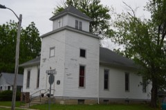 Bethel African Methodist Episcopal Churchlisted 2015
 Franklin College Library (Shirk Hall)listed 1975
 Franklin College-Old Mainlisted 1975
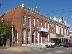 Franklin Commercial Historic Districtlisted 1989
 Franklin Senior High Schoollisted 2012
 Greenlawn Cemeterylisted 2013
 Heck-Hasler Houselisted 2000
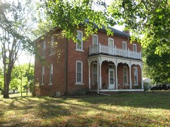 Herriott Houselisted 1982
 Hopewell Presbyterian Churchlisted 2000
 Johnson County Courthouse Squarelisted 1981
 Martin Place Historic Districtlisted 1987
 Masonic Templelisted 1991
Population over time
2 figuresFranklin grew from 23,712 to 25,313 between 2010 and 2020. These are the recorded population figures Wikidata holds for this place, reached through the Geographic Names Information System number this page is keyed on rather than by name, so they belong to this place and not to another of the same name. Most are census counts, but not all are: an early figure may be a founding or settlement estimate, and an estimate published within five years of a census is left out. The change column is computed, and is left blank where more than 20 years separate a figure from the one before it, because a gap that long is not a change between two counts.
| Year | People | Change |
|---|---|---|
| 2010 | 23,712 | |
| 2020 | 25,313 | +1,601 (+7%) |
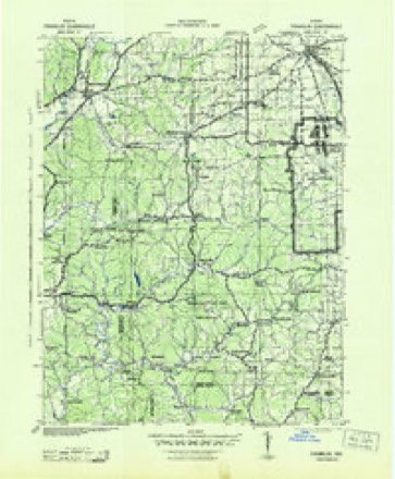
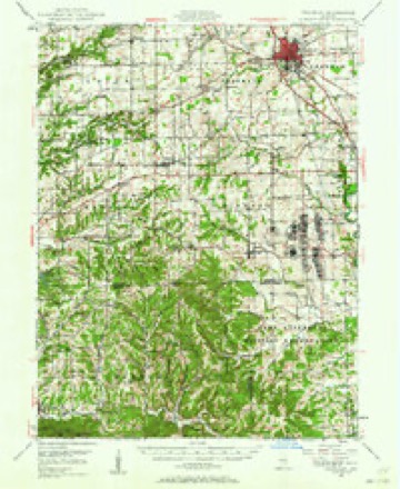
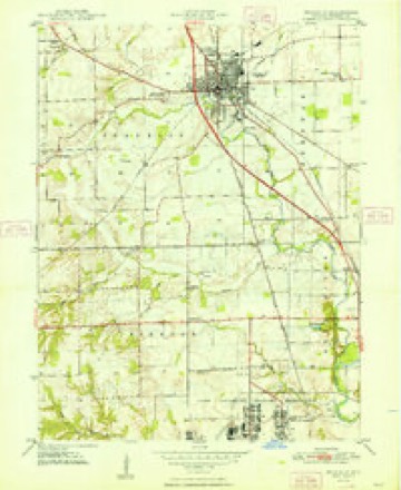
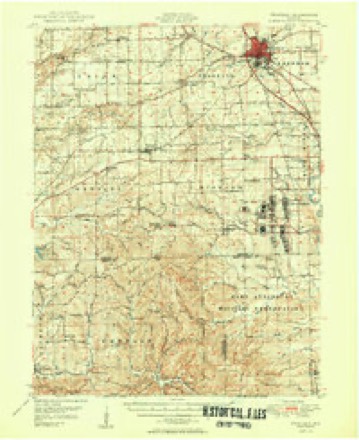
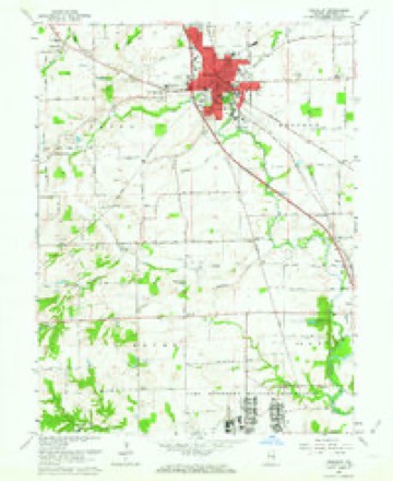
Topographic sheets covering this place
10 surveys from 23 printed sheetsMatched by testing this settlement's coordinate against the published boundary of every sheet in the United States Geological Survey's historical collection. Each opens the scanned sheet at the Survey.
- 1942 USGS Franklin quadrangle1:125000
- 1947 USGS Franklin quadrangle1:62500
- 1948 USGS Franklin quadrangle1:24000, 2 printings
- 1950 USGS Franklin quadrangle1:62500, 2 printings
- 1953 USGS Indianapolis quadrangle1:250000, 4 printings
- 1956 USGS Indianapolis quadrangle1:250000
- 1957 USGS Indianapolis quadrangle1:250000, 2 printings
- 1961 USGS Franklin quadrangle1:24000, 6 printings
- 1962 USGS Indianapolis quadrangle1:250000
- 1986 USGS Bloomington quadrangle1:100000, 3 printings





In the county-history sources
10,529 words on this townshipA Historical Sketch of Johnson County, Indiana, published 1881 names this settlement in its chapter on Franklin Township. These are the passages that mention it, exactly as the scans read.
In 1822, in the first half of the year, as is supposed, William Burkhart, from Green County, Ky., and Levi Moore, built the first cabins in Franklin Township. They came by the way of the Indian trail, and Burkhart built his cabin on the banks of the little creek, where Michael Canary afterward lived and died, while Moore went out as far as the Big Spring, and then turning to the east, located at the knoll, a few hundred yards west of Young's Creek, where John McCaslin's house stands. Moore afterward moved to the farm now owned by Aaron Legrange, and there built a mill, the third built in the township ; but he moved to a newer country within a few years, leaving an unsavory reputation behind him. Moore's Creek commemorates his name.
Passage source: A Historical Sketch of Johnson County, Indiana, published 1881.
In the spring of 1823, George King, Simon Covert and David W. McCaslin, accompanied by Isaac Voris, a young man, moved from Kentucky, and began clearings near the mouth of Camp Creek, or, as it afterward came to be known, Covert's Creek, after which, it took its present name of Hurricane. There was no road cut out beyond John Adams' place, now Amity, and the movers being joined by Robert Gilchrist, " bushed " the way out to their future home. On the afternoon of a day in March, they reached Camp Creek ; but finding the stream high, and not knowing the fords, they encamped for the night on the high ground, where stand the college buildings. All returned to Adams, save Covert and Voris, who, when night came, milked the cows, milking into and drinking out of the cow bells that had been brought for use in the range. The next morning, the pilgrims crossed over the turbulent stream, and at once began the work of building King's cabin on a knoll west of the present crossing of the Cincinnati & Martinsville Railroad and Jefferson street. ^ That being up, McCaslin's was built on the south side of Young's Creek, and Covert's on the east side of the Hurricane.
Passage source: A Historical Sketch of Johnson County, Indiana, published 1881.
During the following summer, Franklin was laid out, and made ready for settlers ; but it was not until the spring after that a house was built within the plat. At that time, a man named Kelly put up a house on the west side of the square, and kept a few articles in the grocery line for sale, chief among which seems to have been an odd sort of beer and cakes. He was for some
Passage source: A Historical Sketch of Johnson County, Indiana, published 1881.
Machine-read from a century-old scan, so expect the errors a machine makes: misspelled names, dropped words, stray characters.
Read the whole chapter on Franklin Township - it names this place 18 more 18 times.
Storms near this place
60 of 72 shownRegional context, not property-specific evidence. The National Weather Service names Franklin in 72 storm reports between 1995 and 2026: 33 thunderstorm wind, 20 hail, 8 flood, 6 lightning. The reports record 1 injury. Each account below is quoted exactly as the forecast office filed it, from the NOAA Storm Events Database, and each date opens the federal record of that event.
| When | Event | Place named | Harm | What the report says |
|---|---|---|---|---|
| August 2002 | Thunderstorm Wind | Franklin | 1 hurt, $20,000 | Part of a ceiling of a Wal-Mart department store collapsed. One person had minor injuries. |
| June 2001 | Lightning | Franklin | $425,000 | no account filed |
| April 2020 | Thunderstorm Wind | Franklin | $150,000 | Roof was blown off of building at 90 East Jefferson due to thunderstorm wind gusts. Partial collapse of home at 1001 N Home Ave. Damage to steeple and church at 100 E Madison. Emergency manager also reported significant tree damage across the county with no specific locations. |
| March 2025 | Thunderstorm Wind | Franklin | $40,000 | A roof on a skating rink was partially peeled up by thunderstorm winds. |
| July 2006 | Thunderstorm Wind | Franklin | $40,000 | Trees, power lines, and at least one stoplight were downed by thunderstorm winds. One tree fell into power lines. These lines started a fire which damaged a residence. |
| August 2000 | Lightning | Franklin | $40,000 | no account filed |
| May 2002 | Flash Flood | Franklin | $25,000 | no account filed |
| March 2026 | Thunderstorm Wind | Franklin | $20,000 | Grill thrown by thunderstorm winds from patio into yard. Fence was also broken. |
| July 2001 | Lightning | Franklin | $20,000 | no account filed |
| July 2008 | Thunderstorm Wind | Franklin | $13,000 | Thunderstorm winds knocked trees into roads, houses, and utility lines. Power lines fell into a tree along Maple Lane where they started sparking before slipping onto a fence. A power surge resulted, shorting out five power boxes outside of homes along the lane. All of the homes were filled with smoke before firefighters got the situation under control. Each box required a technician to make repairs, and the damage should run between $200 and $800 per home. Elsewhere, trees crashed onto a vehicle on Adams Street in Franklin. Fallen trees blocked Houghham Street in Franklin and North County Road 800 East outside of Franklin, where a utility pole caught on fire. |
| October 2013 | Thunderstorm Wind | Franklin | $10,000 | Trees were reported to be downed on a vehicle due to damaging thunderstorm wind gusts. |
| December 2013 | Flash Flood | Franklin | $10,000 | Multiple water rescues across the county with many roads being reported under water. |
| July 2006 | Lightning | Franklin | $10,000 | A small fire sparked by a lightning strike damaged a home's bathroom. |
| August 2002 | Lightning | Franklin | $5,000 | no account filed |
| May 2011 | Thunderstorm Wind | Franklin | $3,000 | Two foot diameter live trees and power lines were reported down due to damaging thunderstorm wind gusts near the intersection of North Main and Adams Streets. |
| July 2008 | Flash Flood | Franklin | $3,000 | Employees at Johnson County Memorial Hospital had to sandbag much of the first floor, including the emergency room waiting area, officials said; however, the ER was not affected. |
| July 2008 | Thunderstorm Wind | Franklin | $2,000 | Thunderstorm winds blew down trees, tree limbs, and utility lines. |
| July 2006 | Lightning | Franklin | $2,000 | A home's water heater caught fire due to a power surge caused by lightning. |
| April 2025 | Thunderstorm Wind | Franklin | $1,000 | Large tree limb downed by thunderstorm wind gusts onto a road. |
| August 2021 | Thunderstorm Wind | Franklin | $1,000 | Several large tree limbs snapped by thunderstorm wind gusts across the town of Franklin. |
| July 2017 | Flood | Franklin | $1,000 | North-bound and south-bound lanes of US Highway 31 were closed due to flooding at Blue Heron Park near Greenlawn Cemetery and Franklin Lakes subdivision due to heavy rainfall. Jefferson Street in downtown Franklin was also closed. |
| February 2014 | Thunderstorm Wind | Franklin | $1,000 | A railroad crossing gate arm was damaged by the wind on Commerce Road due to damaging thunderstorm wind gusts. |
| June 2010 | Thunderstorm Wind | Franklin | $1,000 | A tree was reported down in this location due to damaging thunderstorm wind gusts. |
| June 2010 | Thunderstorm Wind | Franklin | $1,000 | A two foot diameter tree was uprooted at State Route 144 and County Road 100 W due to damaging thunderstorm wind gusts. |
| June 2008 | Thunderstorm Wind | Franklin | $1,000 | A utility pole was blow down by damaging thunderstorm winds. |
| July 1997 | Thunderstorm Wind | Franklin | $1,000 | Thunderstorm winds blew down power lines northwest of Franklin. |
| March 2012 | Flood | Franklin | $750 | Water was reported over the road due to heavy thunderstorm rainfall on US Route 31 North at State Road 144. |
| July 2017 | Flood | Franklin | $500 | One to two inches of flowing water was over the road at the intersection of Hurricane Road and County Road 300 North due to heavy rainfall. Water was also covering the road in a couple spots north of that intersection. |
| September 2013 | Flood | Franklin | $500 | Minor street flooding was reported in downtown Franklin due to thunderstorm heavy rainfall. |
| October 2013 | Thunderstorm Wind | Franklin | $500 | Patio furniture was damaged at a residence in this location due to damaging thunderstorm wind gusts. |
| March 2012 | Flood | Franklin | $500 | Minor street flooding was reported along Jefferson Street due to thunderstorm heavy rainfall. |
| March 2012 | Flood | Franklin | $500 | Minor street flooding was reported at the intersection of State Route 44 and Highway 31 due to heavy rainfall. |
| June 2010 | Flood | Franklin | $500 | One foot of water was reported on downtown streets in Franklin, near Jefferson Street and State Route 31. |
| March 2012 | Thunderstorm Wind | Franklin | $100 | Small tree limbs were downed due to strong thunderstorm wind gusts. |
| April 2009 | Hail | Franklin | - | Nickel size hail reported by Amateur radio in Franklin. |
| June 2008 | Heavy Rain | Franklin | - | Measured rainfall of 7.29 inches was reported. |
| June 2008 | Heavy Rain | Franklin | - | Measured rainfall of 5.77 inches was reported. |
| July 2008 | Thunderstorm Wind | Franklin | - | A large tree was blow down onto Graham Road by thunderstorm winds. |
| April 2007 | Thunderstorm Wind | Franklin | - | A tree was reported down due to damaging thunderstorm winds. |
| July 2007 | Thunderstorm Wind | Franklin | - | A trained spotter reported a small tree down near State Road 44 and Main Street near the Courthouse. Power was out at US 31 and North Main Street. |
| May 2005 | Thunderstorm Wind | Franklin | - | Trees were blown down on State Road 144. |
| June 2005 | Thunderstorm Wind | Franklin | - | A tree was blown down. |
| June 2002 | Thunderstorm Wind | Franklin | - | Law enforcement report two trees down. |
| July 1999 | Thunderstorm Wind | Franklin | - | Law enforcement reported trees down. |
| July 1995 | Thunderstorm Wind | Franklin | - | Thunderstorm winds blew down an acre of corn. |
| March 2026 | Hail | Franklin | - | no account filed |
| March 2017 | Hail | Franklin | - | no account filed |
| March 2016 | Hail | Franklin | - | no account filed |
| April 2015 | Hail | Franklin | - | no account filed |
| April 2015 | Hail | Franklin | - | no account filed |
| April 2013 | Hail | Franklin | - | no account filed |
| April 2013 | Hail | Franklin | - | no account filed |
| April 2013 | Hail | Franklin | - | no account filed |
| April 2013 | Hail | Franklin | - | no account filed |
| April 2013 | Hail | Franklin | - | no account filed |
| March 2012 | Hail | Franklin | - | no account filed |
| June 2011 | Hail | Franklin | - | no account filed |
| May 2011 | Hail | Franklin | - | no account filed |
| March 2006 | Hail | Franklin | - | no account filed |
| April 2006 | Thunderstorm Wind | Franklin | - | no account filed |
Nearest settlements
The eight closest, with where each one stands in the county. Distances are straight-line, computed from the Geographic Names Information System coordinates.
| Map | Place | Distance | Sheets |
|---|---|---|---|
| Hopewell | 3.4 miles | 23 | |
| Mount Pleasant | 3.7 miles | 23 | |
| Urmeyville | 4.7 miles | 12 | |
| Amity | 4.7 miles | 23 | |
| Whiteland | 5.0 miles | 16 | |
| West Whiteland | 5.2 miles | 16 | |
| Needham | 5.6 miles | 12 | |
| New Whiteland | 5.8 miles | 16 |
Elsewhere
Matched on this settlement's Geographic Names Information System number rather than its name, so it cannot be a different place of the same name in another state.
| Wikipedia article on Franklin | An encyclopaedic summary. Its text is share-alike, so it is linked here rather than copied. |
| Wikidata item Q983769 | The structured record the population and elevation above come from. Public domain (CC0). |
Provenance
This settlement is recorded in the Geographic Names Information System as feature 434762. The sheet list is computed by point-in-boundary test against the United States Geological Survey's historical topographic inventory. Both are works of the United States government and carry no copyright under 17 U.S.C. 105.
Storms. NOAA National Centers for Environmental Information, Storm Events Database https://www.ncei.noaa.gov/stormevents/ A work of the United States government, no copyright under 17 U.S.C. 105. Narratives are quoted verbatim from the National Weather Service report and are not edited or summarised.