 Block
Whiteland, Indiana
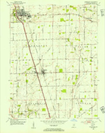
16 topographic sheets cover this place, the earliest surveyed in 1953 and the latest in 1992. It stands in Pleasant Township. It lies in ZIP code area 46184. The Survey maps it on the Greenwood quadrangle. 4,599 people lived here at the 2020 count. It stands 794 feet above sea level.
Population over time
2 figuresWhiteland grew from 4,169 to 4,599 between 2010 and 2020. These are the recorded population figures Wikidata holds for this place, reached through the Geographic Names Information System number this page is keyed on rather than by name, so they belong to this place and not to another of the same name. Most are census counts, but not all are: an early figure may be a founding or settlement estimate, and an estimate published within five years of a census is left out. The change column is computed, and is left blank where more than 20 years separate a figure from the one before it, because a gap that long is not a change between two counts.
| Year | People | Change |
|---|---|---|
| 2010 | 4,169 | |
| 2020 | 4,599 | +430 (+10%) |
Topographic sheets covering this place
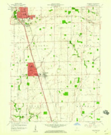
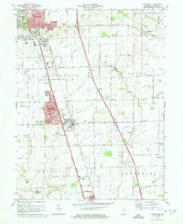
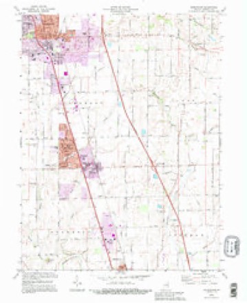
9 surveys from 16 printed sheetsMatched by testing this settlement's coordinate against the published boundary of every sheet in the United States Geological Survey's historical collection. Each opens the scanned sheet at the Survey.
- 1953 USGS Greenwood quadrangle1:24000
- 1953 USGS Indianapolis quadrangle1:250000, 4 printings
- 1956 USGS Indianapolis quadrangle1:250000
- 1957 USGS Indianapolis quadrangle1:250000, 2 printings
- 1959 USGS Greenwood quadrangle1:24000
- 1962 USGS Indianapolis quadrangle1:250000
- 1973 USGS Greenwood quadrangle1:24000, 3 printings
- 1986 USGS Indianapolis quadrangle1:100000, 2 printings
- 1992 USGS Greenwood quadrangle1:24000





In the county-history sources
22,145 words on this townshipA Historical Sketch of Johnson County, Indiana, published 1881 names this settlement in its chapter on Pleasant Township. These are the passages that mention it, exactly as the scans read.
As soon as settlers began coming in, Bell built a horse-mill, the first of the kind in the county. This was a very primitive affair, the tub in which the stone revolved being a section of a hollow sycamore, and the harness with which the horses were hitched to the levers being of rawhide. But Bell was an unworthy miller, and so managed the grists that came to his mill as to steal more of the corn and meal than he took by lawful toll. He wore the sleeves of his hunting shirt open and large, and he not only managed to pick up a few extra grains while tolling the grist, but, on the pretense of examining the meal as it came from the spout, he managed to catch in his open sleeves a good share of the meal, and then folding his arms about him he sauntered to his own chest or to his cabin and unloaded. Sometimes his victims would remonstrate with him, but his usual reply was, " Well, the little old man must live." On one occasion, it is said that the miller's sleeves being well gorged with meal, the horses took fright, ran away and knocked the mill stones from their frail scaffolding, and otherwise damaged the property. Bell himself received a blow from the flying debris that knocked him down and scattered the meal stored in his ample sleeves. Shame or conscience so worked upon him that he promised to do better in the future, but his promise was soon broken ; he never mended his ways. For many years after the settlement of the county, every man's stock ran in the range, and hogs soon became wild, and, when fattened on the mast, were hunted and shot by their owners the same as were the deer. Bell, it was believed, made a practice of killing other men's hogs, and once at a log-rolling, Permenter Mullenix, who had lost hogs, charged Bell with the theft. Apparently much shocked that such a charge should be made, he went to Indianapolis and employed Judge Wick, then practicing law, and Calvin Fletcher, to prosecute Mullenix for slander. The action was accordingly begun, but Mullenix made good his defense by proving the charge to be true, whereupon the grand jury indicted Bell, and he was tried, convicted and sent to the penitentiary, the first convict sent from the county.
Passage source: A Historical Sketch of Johnson County, Indiana, published 1881.
On the 4th day of May, 1829, Pleasant Township was created by striking off from White River all the territory east of the range line, making the west boundary the same as it now is ; but, up to 1838, Clark Township formed a part of Pleasant. Elections were ordered to be held at the house of Isaac Smock, and Isaiah Lewis was appointed inspector. The township took its name from its principal stream, Pleasant Run. Two explanations have been given, accounting for the name of the creek, one of which is, that when the country was first settled the stream was a gently flowing, pleasant running stream ; and the other that it was the reverse of this, and the name was given by way of irony.
Passage source: A Historical Sketch of Johnson County, Indiana, published 1881.
The first sermon preached in Pleasant Township was at the house of John C. Smock, in 1824, by the Rev. George Bush, who afterward became a professor in a theological school in New York, and wrote "Bush's Notes on the Gospels," and a life of Mohammed. A Presbyterian Church was organized in the Smock neighborhood, the first in the township, after which a meeting-house was built, which was used for a time as a schoolhouse.
Passage source: A Historical Sketch of Johnson County, Indiana, published 1881.
Machine-read from a century-old scan, so expect the errors a machine makes: misspelled names, dropped words, stray characters.
Read the whole chapter on Pleasant Township - it names this place 11 more 11 times.
Mines and quarries near this place
1 within 5 milesRegional context, not property-specific evidence. The federal mineral resources record lists 1 working within 5 miles of Whiteland: 1 unknown. None of them still produces. What was taken out: Sand and Gravel, Construction. Distance is straight-line from the map coordinates, so a quarry counted here may appear on a neighbouring settlement's page as well.
| Where | Site | Commodity | Status | Recorded |
|---|---|---|---|---|
| Kelsay & York Gravel Pit | Sand and Gravel, Construction | Unknown |
Storms near this place
36 since 1996Regional context, not property-specific evidence. The National Weather Service names Whiteland in 36 storm reports between 1996 and 2026: 14 hail, 13 thunderstorm wind, 4 lightning, 2 flood. No death or injury is recorded in these reports. Each account below is quoted exactly as the forecast office filed it, from the NOAA Storm Events Database, and each date opens the federal record of that event.
| When | Event | Place named | Harm | What the report says |
|---|---|---|---|---|
| March 2023 | Tornado (EF3) | New Whiteland | $6,670,000 | The rotating supercell's fifth and final tornado was a violent EF3 that immediately followed the Johnson County EF0. Following the storm's east-northeasterly track, a tornado redeveloped (2.8 miles after the end of the EF0) in an open field, 0.15 miles west of the intersection of South Sawmill Road and Park Forest South Drive. The tornado moved through mainly northern portions of the Park Forest neighborhood while strengthening from EF1 to EF2 intensity. The circulation continued towards US Highway 31, damaging a communications tower near Whiteland Sewer Department. After crossing US Highway 31, the tornado inflicted mainly EF2-intensity damage to southeastern portions of Whiteland, especially east of West Street and south of Main Street. Multiple homes sustained major roof damage, while a few homes had most exterior walls collapse, and one poorly constructed home had only one wall left standing.||Higher-end EF2 damage was observed as it crossed the railroad track and hit the neighborhood near Paris Lane and East Pearl Street. Numerous homes sustained roof damage. A poorly constructed and very poorly anchored home along East Pearl Street was completely destroyed down to its concrete slab. The tornado produced damage to a home along Whiteland Road before crossing an open field as it departed the Whiteland community. The vortex maintained intensity before hitting a few more homes along County Road 225 East (Graham Road). Many trees were uprooted or snapped with significant roof damage and a collapsed garage. A warehouse further east-northeast along Graham Road sustained EF3 damage from winds of 140 mph. Portions of the warehouse were completely gone and blown onto Interstate Route 65.||The circulation crossed Interstate 65 and weakened while continuing to the east-northeast. The tornado produced ground scoring through a field to the south of County Road 600 North, and then turned more northeasterly when approaching the intersection of 600 North and Hurricane Road. EF1 damage occurred on either side of Hurricane Road immediately south of its bridge over Hurricane Creek, where a large garage's walls were collapsed and minor tree damage occurred. Finally, the circulation strengthening to EF2 while turning back to more east-northeasterly, completely destroying two farm outbuildings one-third of a mile northeast of the Hurricane Road bridge. The tornado continued another 0.3 miles before ending on a slight rise of land, 0.3 miles west of County Road 500 East. |
| May 2000 | Lightning | New Whiteland | $500,000 | no account filed |
| February 2019 | Flash Flood | New Whiteland | $40,000 | The fire department reported water flowing over numerous roads in Johnson County with a swift water rescue completed near Greenwood due to flash flooding from heavy rainfall. |
| May 2009 | Lightning | Whiteland | $40,000 | Lightning struck the roof of a home, leaving a gaping hole during heavy rain. Firefighters were called about 7 PM EST. The lightning sparked an attic fire that took about 20 minutes to put out, according to the fire chief. The rest of the home had smoke and water damage. Time of event is approximate. Damage cost is grossly estimated. |
| March 2026 | Flood | New Whiteland | $25,000 | Standing water caused vehicles to become stranded on roads with at least one road closed by the high water. |
| July 2012 | Thunderstorm Wind | Whiteland | $25,000 | An estimated thunderstorm wind gust of 70 mph was observed in this location. Trees up to 2 feet in diameter were downed. A barn was destroyed. There was partial roof damage on another barn. |
| February 2019 | Flash Flood | New Whiteland | $20,000 | Several roads were closed all across the county due to flash flooding from heavy rainfall. |
| April 2015 | Thunderstorm Wind | New Whiteland | $15,000 | A grain silo was downed due to damaging thunderstorm wind gusts. |
| October 2010 | Thunderstorm Wind | Whiteland | $12,000 | A semi tractor-trailer was blown over at mile marker 94.5 on Interstate 65 due to damaging thunderstorm wind gusts. |
| June 2008 | Lightning | Whiteland | $10,000 | Lightning struck a house in Whiteland. |
| May 1996 | Thunderstorm Wind | Whiteland | $10,000 | no account filed |
| June 2025 | Thunderstorm Wind | New Whiteland | $5,000 | Tree and power line downed by thunderstorm wind gusts. |
| June 2006 | Lightning | New Whiteland | $5,000 | Lightning struck a transformer on Tracy Road, causing a power outage lasting 11 hours. |
| June 2011 | Flood | New Whiteland | $1,000 | Numerous roads were reported with water over the road and closed in Johnson County, especially near New Whiteland. |
| June 2010 | Thunderstorm Wind | Whiteland | $1,000 | A live, eight inch diameter tree was reported down a quarter mile south of Whiteland Road due to damaging thunderstorm wind gusts. |
| June 2017 | Thunderstorm Wind | New Whiteland | $750 | A home sustained minor shingle damage due to strong thunderstorm wind gusts. |
| May 2015 | Thunderstorm Wind | New Whiteland | $200 | A three inch diameter tree limb was snapped due to strong thunderstorm wind gusts. This was reported by BAM Chase. |
| March 2020 | Thunderstorm Wind | New Whiteland | - | Trained spotter estimated 65 mph thunderstorm wind gust. |
| June 2011 | Hail | New Whiteland | - | This hail was accompanied by a measured 45 mph thunderstorm wind gust. |
| April 2006 | Hail | Whiteland | - | No property damage estimates were available. |
| April 2006 | Hail | Whiteland | - | No property damage estimates were available. |
| June 2006 | Thunderstorm Wind | New Whiteland | - | Trees were downed. |
| July 2006 | Thunderstorm Wind | Whiteland | - | Several trees were downed. |
| May 2024 | Hail | New Whiteland | - | no account filed |
| June 2011 | Hail | New Whiteland | - | no account filed |
| May 2011 | Hail | New Whiteland | - | no account filed |
| May 2011 | Hail | New Whiteland | - | no account filed |
| May 2011 | Hail | New Whiteland | - | no account filed |
| May 2011 | Hail | New Whiteland | - | no account filed |
| April 2006 | Hail | New Whiteland | - | no account filed |
| July 2006 | Hail | New Whiteland | - | no account filed |
| April 2003 | Hail | New Whiteland | - | no account filed |
| May 2003 | Thunderstorm Wind | New Whiteland | - | no account filed |
| June 2001 | Thunderstorm Wind | Whiteland | - | no account filed |
| September 2001 | Hail | New Whiteland | - | no account filed |
| May 1996 | Hail | Whiteland | - | no account filed |
Nearest settlements
The eight closest, with where each one stands in the county. Distances are straight-line, computed from the Geographic Names Information System coordinates.
| Map | Place | Distance | Sheets |
|---|---|---|---|
| West Whiteland | 0.4 miles | 16 | |
| New Whiteland | 1.0 miles | 16 | |
| Tremont | 4.5 miles | 16 | |
| Hopewell | 4.5 miles | 23 | |
| Old Bargersville | 4.6 miles | 16 | |
| Greenwood | 4.6 miles | 16 | |
| Stones Crossing | 4.6 miles | 16 | |
| McCarty | 4.9 miles | 16 |
Elsewhere
Matched on this settlement's Geographic Names Information System number rather than its name, so it cannot be a different place of the same name in another state.
| Wikipedia article on Whiteland | An encyclopaedic summary. Its text is share-alike, so it is linked here rather than copied. |
| Wikidata item Q3296022 | The structured record the population and elevation above come from. Public domain (CC0). |
Provenance
This settlement is recorded in the Geographic Names Information System as feature 445970. The sheet list is computed by point-in-boundary test against the United States Geological Survey's historical topographic inventory. Both are works of the United States government and carry no copyright under 17 U.S.C. 105.
Mines and quarries. USGS Mineral Resources Data System (MRDS) https://mrdata.usgs.gov/mrds/ A work of the United States government, no copyright under 17 U.S.C. 105.
Storms. NOAA National Centers for Environmental Information, Storm Events Database https://www.ncei.noaa.gov/stormevents/ A work of the United States government, no copyright under 17 U.S.C. 105. Narratives are quoted verbatim from the National Weather Service report and are not edited or summarised.