 Block
Gessie, Indiana
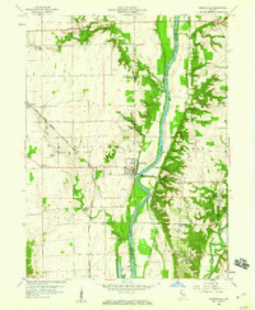
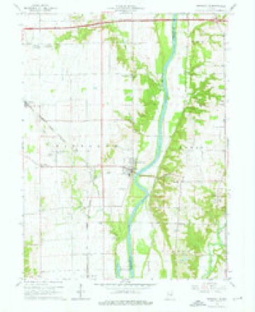
11 topographic sheets cover this place, the earliest surveyed in 1953 and the latest in 1987. It stands in Highland Township. It lies in ZIP code area 47974. The Survey maps it on the Perrysville quadrangle. It stands 617 feet above sea level.
Topographic sheets covering this place
7 surveys from 11 printed sheetsMatched by testing this settlement's coordinate against the published boundary of every sheet in the United States Geological Survey's historical collection. Each opens the scanned sheet at the Survey.
- 1953 USGS Danville quadrangle1:250000, 3 printings
- 1955 USGS Danville quadrangle1:250000
- 1956 USGS Danville quadrangle1:250000
- 1958 USGS Perrysville quadrangle1:24000
- 1964 USGS Perrysville quadrangle1:24000, 3 printings
- 1984 USGS Danville quadrangle1:100000
- 1987 USGS Danville quadrangle1:100000



In the county-history sources
9,160 words on this townshipBiographical and Historical Record of Vermillion County, Indiana : Containing Portraits of All the Presidents of the United States from Washington to Cleveland, with Accompanying Biographies of Each; a Condensed History of the State of Indiana; Portraits and Biographies of Some of the Prominent Men of the State; Engravings of Prominent Citizens in Vermillion County, with Personal Histories of Many of the Leading Families, and a Concise History of the County and Its Villages, published 1888 names this settlement in its chapter on Highland Township. These are the passages that mention it, exactly as the scans read.
Parke give due notice that they will make application to the next court to have commissioners appointed to assign and set ofl" the widow's dower in the real estate of said decedent. Dr. Waterman gives notice that the partnership heretofore existing between himself and Dr. Small is dissolved. Crawford & Jackson, proprietors of an oil mill, advertise that they will give the highest price for flax and hemp seed, or castor beans. George W. Palmer offers a one-horse wagon and harness for sale cheap for cash. J. W. Downing, J. P., gives notice that an irongray mare, taken up by James Rush, was appraised by William P. Dole and A. M. II. Robinson at §45 before him on the 24th day of November, 1838. William Bales, sherift', advertises the real estate of John Fosdick for sale at public auction, to satisfy a judgment in favor of Silas Kellough, William Dunning and Isaiah Dill. Joshua Skidmore, of Clinton, gives notice as follows: ""Whereas, my wife Mary has left my bed and board without just cause or provocation, I do hereby warn all persons, body politic or coi'porate and of whatsoever name or title, not to credit or harbor her on my account, as I am determined not to pay any debts of her contracting after this date, January 1, 1839." The names of Durham Hood and Margaret Craft appear as administrators of the estate of John Craft, late of Eugene. Roseberry & Jewett, dry goods merchants of Perrysville, occupy about one-third of a column in enumerating their large arrival of new goods. William J. Nichols and James H. Cory, of Eugene, inform the people where to get their saddles and cheap harness. Dr. T. S. Davidson tenders his professional services to the citizens of Perrysville and adjoining country. Hall & Gessie announce the reception of new goods in a two-inch card. Jones & Smith call attention in a four-inch card to their stock of fall and winter goods. Nathan Reed and J. H. McNiitt request that those indebted to them for professional services come forward and square up by cash or note immediately. Jacob Riley informs the readei's that he has found a silk handkerchief, supposed to be worth |1.2o, which theownercan have by paying for the advertisement. G. W. Palmer, J. P., gives notice that John Fultz has taken up two estray heifers, which were appraised at §6 each by Samuel Lacy and James Crawford, before him, December 15, 1838.
Vermillion Lodge, No. 113, K. of P., was organized December 31, 1884, by District Deputy Talley, of Coal Creek, assisted by members from various lodges. There were sixteen charter members, and the first officers were: Dr. James T. Henderson, Chancellor Commander; F. S. Smith, Vice-Chancellor;
The Cross-EoadsUnited Brethren Church, two miles west of Perrysville, was organized over forty years ago, and a large frame church built also in early day. The membership there numbers about seventy-five, of whom the leader is Mrs. Sarah Park, and stewards, Jacob Brown and Richard Spandau. Sundayschool throughout the year, with an average attendance of about eighty, superintended by John Park.
Machine-read from a century-old scan, so expect the errors a machine makes: misspelled names, dropped words, stray characters.
Read the whole chapter on Highland Township - it names this place 12 more 12 times.
Mines and quarries near this place
1 within 5 milesRegional context, not property-specific evidence. The federal mineral resources record lists 1 working within 5 miles of Gessie: 1 past producer. None of them still produces. What was taken out: Sand and Gravel, Construction. Distance is straight-line from the map coordinates, so a quarry counted here may appear on a neighbouring settlement's page as well.
| Where | Site | Commodity | Status | Recorded |
|---|---|---|---|---|
| Ramsey Pit | Sand and Gravel, Construction | Past Producer |
Storms near this place
6 since 2006Regional context, not property-specific evidence. The National Weather Service names Gessie in 6 storm reports between 2006 and 2020: 2 flood, 2 thunderstorm wind, 1 hail, 1 heavy rain. No death or injury is recorded in these reports. Each account below is quoted exactly as the forecast office filed it, from the NOAA Storm Events Database, and each date opens the federal record of that event.
| When | Event | Place named | Harm | What the report says |
|---|---|---|---|---|
| August 2020 | Thunderstorm Wind | Gessie | $2,000 | Gust front ahead of line of storms caused power outage. 30 to 40 mph winds continued for several minutes after initial gust of 60 mph. |
| July 2017 | Thunderstorm Wind | Gessie | $2,000 | Corn stalks were blown over in a pattern consistent with damaging straight-line winds. Tree limbs, approximately 12 inches in diameter, were downed and power was out. |
| July 2018 | Flood | Gessie | $1,000 | Minor to moderate street flooding occurred along Interstate 74 due to heavy rainfall. |
| June 2015 | Flood | Gessie | $500 | Dispatch reported many roads with high water across northern Vermillion County due to thunderstorm heavy rainfall. |
| July 2010 | Heavy Rain | Gessie | - | The observer measured 2.54 inches of rain that fell in approximately 45 minutes. |
| April 2006 | Hail | Gessie | - | no account filed |
Nearest settlements
The eight closest, with where each one stands in the county. Distances are straight-line, computed from the Geographic Names Information System coordinates.
| Map | Place | Distance | Sheets |
|---|---|---|---|
| Rileysburg | 2.0 miles | 19 | |
| Flat Iron | 2.1 miles | 11 | |
| Tree Spring | 3.7 miles | 11 | |
| Perrysville | 4.1 miles | 11 | |
| Eugene | 8.1 miles | 13 | |
| Cayuga | 9.5 miles | 13 | |
| Newport | 14.5 miles | 13 | |
| Quaker | 15.7 miles | 17 |
Elsewhere
Matched on this settlement's Geographic Names Information System number rather than its name, so it cannot be a different place of the same name in another state.
| Wikipedia article on Gessie | An encyclopaedic summary. Its text is share-alike, so it is linked here rather than copied. |
| Wikidata item Q5553645 | The structured record the population and elevation above come from. Public domain (CC0). |
Provenance
This settlement is recorded in the Geographic Names Information System as feature 435046. The sheet list is computed by point-in-boundary test against the United States Geological Survey's historical topographic inventory. Both are works of the United States government and carry no copyright under 17 U.S.C. 105.
Mines and quarries. USGS Mineral Resources Data System (MRDS) https://mrdata.usgs.gov/mrds/ A work of the United States government, no copyright under 17 U.S.C. 105.
Storms. NOAA National Centers for Environmental Information, Storm Events Database https://www.ncei.noaa.gov/stormevents/ A work of the United States government, no copyright under 17 U.S.C. 105. Narratives are quoted verbatim from the National Weather Service report and are not edited or summarised.