 Block
Perrysville, Indiana
11 topographic sheets cover this place, the earliest surveyed in 1953 and the latest in 1987. It stands in Highland Township. It lies in ZIP code area 47974. The Survey maps it on the Perrysville quadrangle. 456 people lived here at the 2020 count. It stands 538 feet above sea level.
Population over time
2 figuresPerrysville grew from 456 to 456 between 2010 and 2020. These are the recorded population figures Wikidata holds for this place, reached through the Geographic Names Information System number this page is keyed on rather than by name, so they belong to this place and not to another of the same name. Most are census counts, but not all are: an early figure may be a founding or settlement estimate, and an estimate published within five years of a census is left out. The change column is computed, and is left blank where more than 20 years separate a figure from the one before it, because a gap that long is not a change between two counts.
| Year | People | Change |
|---|---|---|
| 2010 | 456 | |
| 2020 | 456 | 0 (0%) |
Topographic sheets covering this place
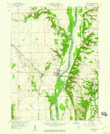
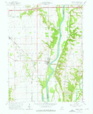
7 surveys from 11 printed sheetsMatched by testing this settlement's coordinate against the published boundary of every sheet in the United States Geological Survey's historical collection. Each opens the scanned sheet at the Survey.
- 1953 USGS Danville quadrangle1:250000, 3 printings
- 1955 USGS Danville quadrangle1:250000
- 1956 USGS Danville quadrangle1:250000
- 1958 USGS Perrysville quadrangle1:24000
- 1964 USGS Perrysville quadrangle1:24000, 3 printings
- 1984 USGS Danville quadrangle1:100000
- 1987 USGS Danville quadrangle1:100000



In the county-history sources
9,160 words on this townshipBiographical and Historical Record of Vermillion County, Indiana : Containing Portraits of All the Presidents of the United States from Washington to Cleveland, with Accompanying Biographies of Each; a Condensed History of the State of Indiana; Portraits and Biographies of Some of the Prominent Men of the State; Engravings of Prominent Citizens in Vermillion County, with Personal Histories of Many of the Leading Families, and a Concise History of the County and Its Villages, published 1888 names this settlement in its chapter on Highland Township. These are the passages that mention it, exactly as the scans read.
Among the early business men here perhaps J. F. Smith, T. II. Smith, J. N. Jones and Robert D. Moli'att have been the most conspicuous. The old warehouses and gristmill still used to some extent on the bank of the river, were built and run for many years by Smith & Jones, and are yet owned by the senior partner, J. F. Smith, Mr. Jones having died. The latter also built another grist-mill at the wharf, was burnt down. March 31, 1884, occurred perhaps the gi-eatest fire that ever visited Perrysville, which entirely consumed the three principal business houses, fine brick structures, two stories high besides basement, the property of the Smith Brothers. The origin of the fire was from the roof of an adjoining building. By this tire the Masonic hall, with its records and paraphernalia, was destroyed.
The Perrysville Woolen Mill was erected in the western part of town a ycai- or two after the war, by Riggs, Head & Co., who furnished the machinery mainly from Coving- ton, Indiana, where tliey had previously been running a similar factory. The Perrysville institution was run until 1881, with only partial success. During the latter year, after the mill had been standing idle a few montlis, Jj. O. Carpenter purchased the building and power, and converted it into a flonring-mill, of two run of buhrs and a capacity of about seventy or eighty barrels of flour per day of twenty-four hours.
Perrysville has been an incorporated town. The first municipal election was held January 15, 1881, when the following were elected trustees: First Ward, William Collins; Second Ward, Jolm R. McNeill; Third Ward, Samuel Shaner. W. M. Benefiel was elected Clerk; Rezin Metzger, Assessor; Lewis A. Morgan, Treasurer; and Peter S. Moudy, Marshal. Mr. Shaner was elected President. J. F. Smith was the next president of the board. Mr. Morgan resigned his ofiice as treasurer and Mr. Benefiel was appointed in his place, still retaining the clerkship. The third president was Lewis Morgan, when John T. Lowe was elected clerk and treasurer.
Machine-read from a century-old scan, so expect the errors a machine makes: misspelled names, dropped words, stray characters.
Read the whole chapter on Highland Township - it names this place 25 more 25 times.
Mines and quarries near this place
5 within 5 milesRegional context, not property-specific evidence. The federal mineral resources record lists 5 workings within 5 miles of Perrysville: 3 past producers, 2 producers. 2 still produce. What was taken out: Sand and Gravel, Construction. Distance is straight-line from the map coordinates, so a quarry counted here may appear on a neighbouring settlement's page as well.
| Where | Site | Commodity | Status | Recorded |
|---|---|---|---|---|
| Conrad Perry Gravel Pit | Sand and Gravel, Construction | Producer | ||
| Cronkite Pit | Sand and Gravel, Construction | Past Producer | ||
| Dickerson Pit | Sand and Gravel, Construction | Producer | ||
| Materials Service Pit | Sand and Gravel, Construction | Past Producer | ||
| Ramsey Pit | Sand and Gravel, Construction | Past Producer |
Storms near this place
10 since 2000Regional context, not property-specific evidence. The National Weather Service names Perrysville in 10 storm reports between 2000 and 2025: 9 thunderstorm wind, 1 flood. No death or injury is recorded in these reports. Each account below is quoted exactly as the forecast office filed it, from the NOAA Storm Events Database, and each date opens the federal record of that event.
| When | Event | Place named | Harm | What the report says |
|---|---|---|---|---|
| July 2004 | Thunderstorm Wind | Perrysville | $10,000 | no account filed |
| March 2025 | Thunderstorm Wind | Perrysville | $2,000 | Trees of unknown size downed by thunderstorm wind gusts. Utility lines were also blown down over State Road 63. |
| August 2019 | Thunderstorm Wind | Perrysville | $2,000 | Several small to medium size tree limbs were down and power was out in this location due to damaging thunderstorm wind gusts. |
| August 2009 | Thunderstorm Wind | Perrysville | $1,000 | A tree was reported downed due to thunderstorm wind gusts in this location. |
| July 2017 | Thunderstorm Wind | Perrysville | - | An estimated 60 mph thunderstorm wind gust was reported in this location. |
| February 2009 | Flood | Perrysville | - | Flooding occurred along the Wabash River in Vermillion County, including near Covington in Fountain County, due to heavy rain. |
| May 2005 | Thunderstorm Wind | Perrysville | - | A wind gust to 60 mph was reported. |
| August 2005 | Thunderstorm Wind | Perrysville | - | Trees and power poles were blown down. |
| September 2005 | Thunderstorm Wind | Perrysville | - | Trees were downed. |
| May 2000 | Thunderstorm Wind | Perrysville | - | no account filed |
Nearest settlements
The eight closest, with where each one stands in the county. Distances are straight-line, computed from the Geographic Names Information System coordinates.
| Map | Place | Distance | Sheets |
|---|---|---|---|
| Flat Iron | 3.0 miles | 11 | |
| Tree Spring | 3.1 miles | 11 | |
| Gessie | 4.1 miles | 11 | |
| Rileysburg | 6.1 miles | 19 | |
| Eugene | 6.2 miles | 13 | |
| Cayuga | 7.2 miles | 13 | |
| Newport | 11.6 miles | 13 | |
| Quaker | 14.4 miles | 17 |
Elsewhere
Matched on this settlement's Geographic Names Information System number rather than its name, so it cannot be a different place of the same name in another state.
| Wikipedia article on Perrysville | An encyclopaedic summary. Its text is share-alike, so it is linked here rather than copied. |
| Wikidata item Q1839101 | The structured record the population and elevation above come from. Public domain (CC0). |
Provenance
This settlement is recorded in the Geographic Names Information System as feature 441034. The sheet list is computed by point-in-boundary test against the United States Geological Survey's historical topographic inventory. Both are works of the United States government and carry no copyright under 17 U.S.C. 105.
Mines and quarries. USGS Mineral Resources Data System (MRDS) https://mrdata.usgs.gov/mrds/ A work of the United States government, no copyright under 17 U.S.C. 105.
Storms. NOAA National Centers for Environmental Information, Storm Events Database https://www.ncei.noaa.gov/stormevents/ A work of the United States government, no copyright under 17 U.S.C. 105. Narratives are quoted verbatim from the National Weather Service report and are not edited or summarised.