 Block
Newport, Indiana
13 topographic sheets cover this place, the earliest surveyed in 1953 and the latest in 1986. It stands in Vermillion Township. It lies in ZIP code area 47966. The Survey maps it on the Newport quadrangle. 416 people lived here at the 2020 count. It stands 528 feet above sea level.
On record in Newport
Buildings and businesses the archive holds for this place. Each opens its own page, with the source record it came from.
On the National Register 3 records
 Newport Covered Bridgelisted 1994
 Vermillion County Courthouselisted 2007
 Vermillion County Jail and Sheriff's Residencelisted 1999
Population over time
2 figuresNewport fell from 515 to 416 between 2010 and 2020. These are the recorded population figures Wikidata holds for this place, reached through the Geographic Names Information System number this page is keyed on rather than by name, so they belong to this place and not to another of the same name. Most are census counts, but not all are: an early figure may be a founding or settlement estimate, and an estimate published within five years of a census is left out. The change column is computed, and is left blank where more than 20 years separate a figure from the one before it, because a gap that long is not a change between two counts.
| Year | People | Change |
|---|---|---|
| 2010 | 515 | |
| 2020 | 416 | -99 (-19%) |
Topographic sheets covering this place
7 surveys from 13 printed sheetsMatched by testing this settlement's coordinate against the published boundary of every sheet in the United States Geological Survey's historical collection. Each opens the scanned sheet at the Survey.
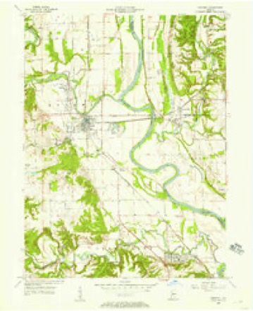
- 1953 USGS Indianapolis quadrangle1:250000, 4 printings
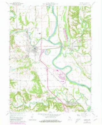
- 1955 USGS Newport quadrangle1:24000
- 1956 USGS Indianapolis quadrangle1:250000
- 1957 USGS Indianapolis quadrangle1:250000, 2 printings
- 1962 USGS Indianapolis quadrangle1:250000
- 1964 USGS Newport quadrangle1:24000, 2 printings
- 1986 USGS Paris quadrangle1:100000, 2 printings




In the county-history sources
8,680 words on this townshipBiographical and Historical Record of Vermillion County, Indiana : Containing Portraits of All the Presidents of the United States from Washington to Cleveland, with Accompanying Biographies of Each; a Condensed History of the State of Indiana; Portraits and Biographies of Some of the Prominent Men of the State; Engravings of Prominent Citizens in Vermillion County, with Personal Histories of Many of the Leading Families, and a Concise History of the County and Its Villages, published 1888 names this settlement in its chapter on Vermillion Township. These are the passages that mention it, exactly as the scans read.
Mr. Dillow came some time prior to 1810, from Virginia. Abel Sexton, still one of the most prominent citizens of Newport, was born in New York in 1820, and settled in tliis county in 1813. (See sketch.) Other prominent citizens of Vermillion Township, who either settled here or were born here in pioneer times, are Alvah Arrasmith, living; Tiionias G. Arrasmith, wagon-maker at Newport, now in Terre Haute; Samuel and G. W. Clark, living; David Fry, living; James Kaufman, who now lives in Dana; Leonard Sanders, deceased; his sons, Samuel, Daniel and William, are living; John Rice, who died in 1880, at the age of seventy years; his son, William Z., is sketched in the biographical department of this work: Daniel E. Jones, who became a wealthy citizen of Chicago and died there; Major John Gardner, IFenry Betson, etc.
The above are the initials of one of tlie most prominent citizens of Vermillion County; namely, Oliver P. Davis, and have also become the name of the 1,300 acre farm which he owns tliree to four miles below Newport, and of the railroad station at that point, when it is generally spelled Opedee.
One night some years ago, Mr. H. F. Jackson, residing about three and a half miles south of Newport, heard his dog making a terrible noise. About midnight he arose, went out, and discovering the smoke-house dour open, concluded it had been inadvertently left open by the family, closed it, and returned to bed, thinking all was safe. But by closing the smoke-house door he unawares locked up a thief within. Next morning Mr. Jackson reconnoitering around to see what he could discover, noticed a hole in the ground dug out under the wall of the smoke-house. The thief had to work his way through a large puddle of water in order to get out, thinking doubtless that he was lucky to get off as well as he did.
Machine-read from a century-old scan, so expect the errors a machine makes: misspelled names, dropped words, stray characters.
Read the whole chapter on Vermillion Township - it names this place 38 more 38 times.
Mines and quarries near this place
3 within 5 milesRegional context, not property-specific evidence. The federal mineral resources record lists 3 workings within 5 miles of Newport: 2 past producers, 1 producer. 1 still produces. What was taken out: Sand and Gravel, Construction, Clay. Distance is straight-line from the map coordinates, so a quarry counted here may appear on a neighbouring settlement's page as well.
| Where | Site | Commodity | Status | Recorded |
|---|---|---|---|---|
| Dana Clay Pit | Clay | Past Producer | ||
| Cayuga Sand and Gravel Pit | Sand and Gravel, Construction | Past Producer | ||
| Hawkins Gravel | Sand and Gravel, Construction | Producer |
Storms near this place
20 since 1996Regional context, not property-specific evidence. The National Weather Service names Newport in 20 storm reports between 1996 and 2022: 10 thunderstorm wind, 5 flood, 3 hail, 2 flash flood. No death or injury is recorded in these reports. Each account below is quoted exactly as the forecast office filed it, from the NOAA Storm Events Database, and each date opens the federal record of that event.
| When | Event | Place named | Harm | What the report says |
|---|---|---|---|---|
| May 2002 | Flash Flood | Newport | $50,000 | no account filed |
| October 1996 | Thunderstorm Wind | Newport | $25,000 | no account filed |
| August 2022 | Thunderstorm Wind | Newport | $10,000 | Trees downed by thunderstorm wind gusts at residence. A few larger branches downed on vehicles. |
| February 2008 | Flash Flood | Newport | $10,000 | Flash flooding occurred across northern portions of Vermillion County, especially by the Vermillion River. Sandbags were handed out and a campground was evacuated. |
| May 2008 | Thunderstorm Wind | Newport | $8,000 | A covered bridge sustained damage due to thunderstorm winds. |
| August 2013 | Thunderstorm Wind | Newport | $5,000 | Trees were down and blocking a road in this location due to damaging thunderstorm wind gusts. |
| June 1998 | Thunderstorm Wind | Newport | $1,500 | Trees and power lines blown down. |
| May 2009 | Flood | Newport | $1,000 | Extensive lowland flooding occurred along the Wabash River near Hillsdale, Indiana. The river crested 12.1 feet above flood stage on May 18th at a reading of 26.1 feet. Damage costs are grossly estimated. |
| January 2008 | Flood | Newport | $1,000 | Flooding occurred along the Wabash River in Vermillion County due to heavy rain and snow melt. Flooding began on December 22nd and continued into January. |
| June 2007 | Thunderstorm Wind | Newport | $1,000 | Power lines were reported down due to damaging thunderstorm winds. |
| April 2009 | Flood | Newport | - | Flooding of bottomlands occurred along the Wabash River near Hillsdale, Indiana. The river crested twice, both of which were in May. Again, flooding continued into May. |
| April 2009 | Flood | Newport | - | Fairly extensive flooding of lowland and some higher bottomlands occurred along the Wabash River near Hillsdale, Indiana. The river crested at 21 feet on April 10th, 7 feet above flood stage. The river remained above flood stage until April 26th. These readings were obtained at the Montezuma river gauge at nearby Montezuma, Indiana of Parke County. |
| May 2009 | Flood | Newport | - | Flooding of bottomlands occurred along the Wabash River near Hillsdale, Indiana. This was a continuation of flooding from April. The river crested twice, both of which were in May. The primary crest was at 19.73 feet on May 3rd and the secondary crest at 16.1 feet on May 9th. Flood stage is 14 feet at the Montezuma, Indiana river gauge. Crop damage is grossly estimated. |
| June 2008 | Thunderstorm Wind | Newport | - | Trees were knocked down due to damaging thunderstorm winds. |
| August 2005 | Thunderstorm Wind | Newport | - | A tree was downed. |
| May 2004 | Hail | Newport | - | no account filed |
| July 2003 | Thunderstorm Wind | Newport | - | no account filed |
| February 1999 | Thunderstorm Wind | Newport | - | no account filed |
| April 1998 | Hail | Newport | - | no account filed |
| January 1996 | Hail | Newport | - | no account filed |
Nearest settlements
The eight closest, with where each one stands in the county. Distances are straight-line, computed from the Geographic Names Information System coordinates.
Elsewhere
Matched on this settlement's Geographic Names Information System number rather than its name, so it cannot be a different place of the same name in another state.
| Wikipedia article on Newport | An encyclopaedic summary. Its text is share-alike, so it is linked here rather than copied. |
| Wikidata item Q1920795 | The structured record the population and elevation above come from. Public domain (CC0). |
Provenance
This settlement is recorded in the Geographic Names Information System as feature 440148. The sheet list is computed by point-in-boundary test against the United States Geological Survey's historical topographic inventory. Both are works of the United States government and carry no copyright under 17 U.S.C. 105.
Mines and quarries. USGS Mineral Resources Data System (MRDS) https://mrdata.usgs.gov/mrds/ A work of the United States government, no copyright under 17 U.S.C. 105.
Storms. NOAA National Centers for Environmental Information, Storm Events Database https://www.ncei.noaa.gov/stormevents/ A work of the United States government, no copyright under 17 U.S.C. 105. Narratives are quoted verbatim from the National Weather Service report and are not edited or summarised.