 Block
Cayuga, Indiana
13 topographic sheets cover this place, the earliest surveyed in 1953 and the latest in 1986. It stands in Eugene Township. It lies in ZIP code area 47928. It stands on Vermilion River. The Survey maps it on the Newport quadrangle. 952 people lived here at the 2020 count. It stands 505 feet above sea level.
Population over time
2 figuresCayuga fell from 1,162 to 952 between 2010 and 2020. These are the recorded population figures Wikidata holds for this place, reached through the Geographic Names Information System number this page is keyed on rather than by name, so they belong to this place and not to another of the same name. Most are census counts, but not all are: an early figure may be a founding or settlement estimate, and an estimate published within five years of a census is left out. The change column is computed, and is left blank where more than 20 years separate a figure from the one before it, because a gap that long is not a change between two counts.
| Year | People | Change |
|---|---|---|
| 2010 | 1,162 | |
| 2020 | 952 | -210 (-18%) |
Topographic sheets covering this place
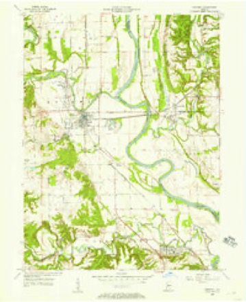
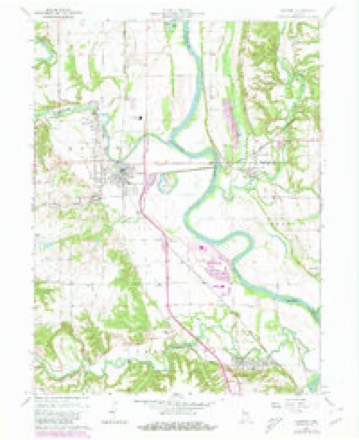
7 surveys from 13 printed sheetsMatched by testing this settlement's coordinate against the published boundary of every sheet in the United States Geological Survey's historical collection. Each opens the scanned sheet at the Survey.
- 1953 USGS Indianapolis quadrangle1:250000, 4 printings
- 1955 USGS Newport quadrangle1:24000
- 1956 USGS Indianapolis quadrangle1:250000
- 1957 USGS Indianapolis quadrangle1:250000, 2 printings
- 1962 USGS Indianapolis quadrangle1:250000
- 1964 USGS Newport quadrangle1:24000, 2 printings
- 1986 USGS Paris quadrangle1:100000, 2 printings




What happened here
An account from the chapter on Eugene township. The inset identifies its exact source book and publication year.
Eugene
As previously remarked, Eugene is another example of those niimerous towns that were killed by the railroad passing just at killing distance; but it is a beautiful place for a quiet residence. The present population is estimated at about 500. Two or three conspiciious features strike the stranger who visits the place.
In the county-history sources
3,068 words on this townshipBiographical and Historical Record of Vermillion County, Indiana : Containing Portraits of All the Presidents of the United States from Washington to Cleveland, with Accompanying Biographies of Each; a Condensed History of the State of Indiana; Portraits and Biographies of Some of the Prominent Men of the State; Engravings of Prominent Citizens in Vermillion County, with Personal Histories of Many of the Leading Families, and a Concise History of the County and Its Villages, published 1888 names this settlement in its chapter on Eugene Township. These are the passages that mention it, exactly as the scans read.
1819. - John Groenendyke came from near Ovid, Cayuga County, New York, first to Terre Haute in 1818, and the next year to this county, settling on the Big Vermillion where Eugene now stands. He was the father of James - who built the " Big Vermillion," the first large grist-mill in the county already referred to - and Samuel, and the grandfather of Hon. John Groenendyke and his cousin Samuel, and also the grandfather of the present Colletts. The name was originally Van Groenendycke, which the express agent at Eugene, Samuel, has abbreviated still further to Grondyke - a word of two syllables, the first syllable being pronounced groan. The first family of this line came to America from Holland with the Knickerbockers in 1617, settling in New Amsterdam (New York).
Machine-read from a century-old scan, so expect the errors a machine makes: misspelled names, dropped words, stray characters.
Mines and quarries near this place
8 within 5 milesRegional context, not property-specific evidence. The federal mineral resources record lists 8 workings within 5 miles of Cayuga: 5 past producers, 3 producers. 3 still produce. What was taken out: Sand and Gravel, Construction, Clay. Distance is straight-line from the map coordinates, so a quarry counted here may appear on a neighbouring settlement's page as well.
| Where | Site | Commodity | Status | Recorded |
|---|---|---|---|---|
| Cayuga Shale Pit | Clay | Producer | ||
| Cayuga Sand and Gravel Pit | Sand and Gravel, Construction | Past Producer | ||
| Conrad Perry Gravel Pit | Sand and Gravel, Construction | Producer | ||
| Cronkite Pit | Sand and Gravel, Construction | Past Producer | ||
| Dickerson Pit | Sand and Gravel, Construction | Producer | ||
| Materials Service Pit | Sand and Gravel, Construction | Past Producer | ||
| Silverwood Sand and Gravel Pit | Sand and Gravel, Construction | Past Producer | ||
| Summit Grove Pit | Sand and Gravel, Construction | Past Producer |
Storms near this place
19 since 1994Regional context, not property-specific evidence. The National Weather Service names Cayuga in 19 storm reports between 1994 and 2020: 12 thunderstorm wind, 4 hail, 2 flash flood, 1 tornado. No death or injury is recorded in these reports. Each account below is quoted exactly as the forecast office filed it, from the NOAA Storm Events Database, and each date opens the federal record of that event.
| When | Event | Place named | Harm | What the report says |
|---|---|---|---|---|
| May 2000 | Hail | Cayuga | $5,000,000 | no account filed |
| April 2011 | Tornado (EF1) | Cayuga | $30,000 | An EF-1 tornado touched down at 9:10PM EDT in central Vermillion County and traveled northeast through northwest Parke, southeast Fountain, and west-central Montgomery Counties. This tornado formed 2.72 miles southwest of Cayuga and tracked northeast for approximately 4 miles before exiting Vermillion County about 2.36 miles east, southeast of Cayuga at 9:16PM EDT. The tornado continued northeast into Parke County, around 1.51 miles west of Waterman, for another 8.6 miles before leaving the county 3.53 miles northeast of Sylvania at 9:22PM EDT. The tornado continued northeast into Fountain County, around 1.69 miles east, southeast of Kingman, for another 9.3 miles before pushing into Montgomery County at 9:32PM EDT, 2.75 miles northwest of Alamo, for another 9.23 miles and dissipating about 1.89 miles northwest of Crawfordsville at 9:40PM EDT. Multiple trees and power lines were reported down along the path, as well as siding and shingles ripped off homes. A shed was destroyed in Vermillion County and another structure sustained damage in Parke County. The tornado was rated an EF-1 along most of its path, except in Montgomery County where EF-0 damage was found. The maximum width along the path was 100 yards. |
| July 2020 | Thunderstorm Wind | Cayuga | $5,000 | Numerous trees and power lines downed due to thunderstorm wind gusts in a line stretching from the northwestern portions of the county to Newport. |
| July 1998 | Thunderstorm Wind | Cayuga | $2,000 | Thunderstorm winds blew down trees and power lines in Cayuga and neighboring Eugene. |
| June 1998 | Thunderstorm Wind | Cayuga | $1,000 | Thunderstorm winds blew down trees and power lines. |
| April 1997 | Thunderstorm Wind | Cayuga | $500 | no account filed |
| May 2019 | Hail | Cayuga | - | Report was received from 4.5 miles southwest of Cayuga on the Indiana state line via spotternetwork.org. |
| December 2008 | Thunderstorm Wind | Cayuga | - | A spotter reported thunderstorm winds gusts of 55 to 65 MPH between Cayuga and Perrysville, Indiana. |
| June 2006 | Thunderstorm Wind | Cayuga | - | Trees were downed. |
| May 2004 | Thunderstorm Wind | Cayuga | - | VEHICLE BLOWN OFF OF ROAD |
| April 1994 | Thunderstorm Wind | Cayuga | - | Several trees were blown down in Cayuga. Numerous other trees were blown down throughout the county. |
| January 2005 | Flash Flood | Cayuga | - | no account filed |
| June 2004 | Thunderstorm Wind | Cayuga | - | no account filed |
| May 2003 | Thunderstorm Wind | Cayuga | - | no account filed |
| August 2002 | Flash Flood | Cayuga | - | no account filed |
| June 2001 | Thunderstorm Wind | Cayuga | - | no account filed |
| October 2001 | Thunderstorm Wind | Cayuga | - | no account filed |
| May 2000 | Hail | Cayuga | - | no account filed |
| May 2000 | Hail | Cayuga | - | no account filed |
Nearest settlements
The eight closest, with where each one stands in the county. Distances are straight-line, computed from the Geographic Names Information System coordinates.
| Map | Place | Distance | Sheets |
|---|---|---|---|
| Eugene | 1.4 miles | 13 | |
| Newport | 5.2 miles | 13 | |
| Perrysville | 7.2 miles | 11 | |
| Quaker | 7.4 miles | 17 | |
| Flat Iron | 7.4 miles | 11 | |
| Gessie | 9.5 miles | 11 | |
| Dana | 9.9 miles | 16 | |
| Tree Spring | 10.3 miles | 11 |
Elsewhere
Matched on this settlement's Geographic Names Information System number rather than its name, so it cannot be a different place of the same name in another state.
| Wikipedia article on Cayuga | An encyclopaedic summary. Its text is share-alike, so it is linked here rather than copied. |
| Wikidata item Q2800179 | The structured record the population and elevation above come from. Public domain (CC0). |
Provenance
This settlement is recorded in the Geographic Names Information System as feature 432255. The sheet list is computed by point-in-boundary test against the United States Geological Survey's historical topographic inventory. Both are works of the United States government and carry no copyright under 17 U.S.C. 105.
Mines and quarries. USGS Mineral Resources Data System (MRDS) https://mrdata.usgs.gov/mrds/ A work of the United States government, no copyright under 17 U.S.C. 105.
Storms. NOAA National Centers for Environmental Information, Storm Events Database https://www.ncei.noaa.gov/stormevents/ A work of the United States government, no copyright under 17 U.S.C. 105. Narratives are quoted verbatim from the National Weather Service report and are not edited or summarised.