 Block
Graham, Indiana
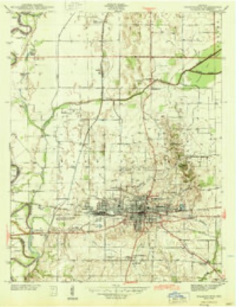
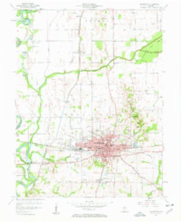
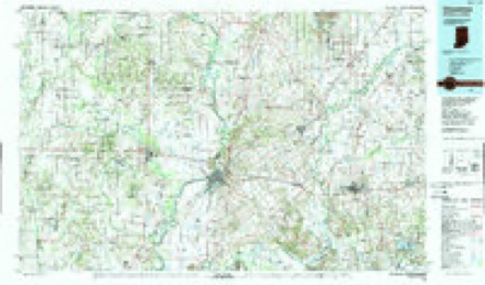
15 topographic sheets cover this place, the earliest surveyed in 1944 and the latest in 1986. It stands in Washington Township. It lies in ZIP code area 47501. The Survey maps it on the Washington quadrangle. It stands 449 feet above sea level.
Topographic sheets covering this place
6 surveys from 15 printed sheetsMatched by testing this settlement's coordinate against the published boundary of every sheet in the United States Geological Survey's historical collection. Each opens the scanned sheet at the Survey.
- 1944 USGS Washington quadrangle1:24000, 2 printings
- 1956 USGS Vincennes quadrangle1:250000, 4 printings
- 1957 USGS Vincennes quadrangle1:250000
- 1957 USGS Washington quadrangle1:24000, 4 printings
- 1958 USGS Vincennes quadrangle1:250000, 2 printings
- 1986 USGS Vincennes quadrangle1:100000, 2 printings



In the county-history sources
136,139 words on this townshipHistory of Knox and Daviess County, Indiana : from the Earliest Time to the Present; with Biographical Sketches, Reminiscences, Notes, Etc. ; Together with an Extended History of the Colonial Days of Vincennes, and Its Progress Down to the Formation of the State Government, published 1886 names this settlement in its chapter on Washington Township. These are the passages that mention it, exactly as the scans read.
One of the first settlers in the southern part of the township -was William Williams. He came from Virginia and settled in the township about 1800. He was with Gen. Harrison at Tippecanoe and received a slight wound. He owned a small farm and, like many pioneers, he made shoes for his own family. The sons of William Williams were Thomas, Joseph, Eben and Jesse; the former was born in 1805 and is still living. He has resided nearly all his life on the northwest quarter of Donation 30. The sons all settled in the same vicinity. Joseph, brother of William, also lived in the same neighborhood. John McCoy, who lived about one mile south of Thomas Williams, was killed at Tippecanoe, but his family remained in the same neighborhood for many years. William Welton settled the farm and cleared a part of the land in Donation 30, previous to 1800. John Welton, Sr., settled that portion of 31 where John Welton now resides. There were two other brothers, Ebenezer and William. George McClure settled on Donation 29, where he built a horse-mill and also a small still-house. Isaac Pureed came to the county from Virginia about 1790. Louisville was then unknown. He settled on Location 28. Noah Pureed also settled the adjoining donation ; William, elsewhere mentioned, settled near Bruceville, and Andrew settled where PurceU's Station now is, on the Evansville & Terre Haute Eailroad. In Donation 28 Pureed formerly had a small water-mill and still-house, also for a time a tanyard. George W. Pureed was murdered on December 26, 1862, by four men on the farm where Daniel Fox now lives. Samuel Emison was one of the pioneer settlers of Palmyra; he lived in the vicinity of Pureed; he was a farmer and was surveyor for a time. David and John McCord were also among the early settlers of Palmyra. John Hogue opened a farm a little east of the Pureed neighborhood. David McClure lived near Emison's. Samuel Langdon bought the lands in Donations 68 and 53 in 1807.
Passage source: History of Knox and Daviess County, Indiana : from the Earliest Time to the Present; with Biographical Sketches, Reminiscences, Notes, Etc. ; Together with an Extended History of the Colonial Days of Vincennes, and Its Progress Down to the Formation of the State Government, published 1886.
River. John Baptiste Frichette, a lot of twenty-five toises, one side to Hamilton and another to Vigo. Charles Lacoste, a piece of land two acres front by the usual depth, one side to Lacoste and another to Eiendo ; a lot twenty-eight toises square, and house thereon. The widow and children of Nicholas Cardinal, a lot twenty-six toises square, one side to Widow Tranbulle and another to Peter Queret; a lot in the village, twenty-five toises, one side to Bonneau and another to the domain ; a tract of . land two acres by forty, one side to Berthuit and the other to Godere. Peter Queret, a lot in the village, one side to his father and another to M. Vigo. The widow of Antoine Lefevre, a lot of eighteen toises, five feet by twenty-four toises, five feet, one side to Bonneau and another to Vaudrye ; a tract of two acres in front and the usual depth, in the Little Prairie, one side to Racine and the other to Crepeaux. Joseph Perredeau, a lot twenty-five toises, one side to Trudel and another to Bonneau. Joseph Perredeau, the younger, a lot of twenty-five toises, one side to Johnston and three sides to streets. Andrez Monplesir, two acres in front and usual depth, near the Cathilinette, one side to Lamotte, fronting on the river ; a lot twenty-five toises by three streets, and a barn thereon, granted by St. Marie ; also a lot twenty-five toises, one side to Bergen, and fronting two streets, formerly belonging to Brouillette. The children of Andrew Pelliere, two acres in front by the ordinary depth, by lands of Diri ; a lot twenty-five toises, one side to Astringus and another to J. B. Richard. The widow of Charles Lefevre, two acres in front by the usual depth, in the prairie of Cathilinette, bounding on lands of Dubras, called the Italian ; a lot in the village, bounded by M. Vigo and three streets. James Latrimouille, two acres in front by the usual depth, at the Nut Point, one side to Vaudrye and the other to Coder; a lot of twenty-five by twenty-four toises, one side to Dagnet and another to Drouet.
Passage source: History of Knox and Daviess County, Indiana : from the Earliest Time to the Present; with Biographical Sketches, Reminiscences, Notes, Etc. ; Together with an Extended History of the Colonial Days of Vincennes, and Its Progress Down to the Formation of the State Government, published 1886.
Machine-read from a century-old scan, so expect the errors a machine makes: misspelled names, dropped words, stray characters.
Read the whole chapter on Washington Township - it names this place 5 more 5 times.
Fires near this place
5 since 2005Regional context, not property-specific evidence. The federal wildfire occurrence database lists 5 fires within 5 miles of Graham between 2005 and 2007, burning about 19 acres in total. None started naturally. 1 was recorded as arson. Distance is straight-line from the map coordinates, so a fire counted here may appear on a neighbouring settlement's page as well.
| Reported cause | Fires |
|---|---|
| Recreation and ceremony | 1 |
| Arson/incendiarism | 1 |
| Missing data/not specified/undetermined | 1 |
| Debris and open burning | 1 |
| Equipment and vehicle use | 1 |
The most recent of them, most recent first, with the day each was reported and the service that recorded it.
| Date | Cause | Size | Reported by | Name on the report |
|---|---|---|---|---|
| 23 September 2007 | Missing data/not specified/undetermined | 10 acres | Indiana State Fire Marshal's Office | not named |
| 18 September 2007 | Equipment and vehicle use | 5.0 acres | Indiana State Fire Marshal's Office | not named |
| 9 March 2005 | Debris and open burning | 1.0 acres | Indiana State Fire Marshal's Office | not named |
| 4 March 2006 | Arson/incendiarism | 1.0 acres | Indiana State Fire Marshal's Office | not named |
| 21 November 2007 | Recreation and ceremony | 2.0 acres | Indiana State Fire Marshal's Office | not named |
Settlements close enough to share some of these fires:
Mines and quarries near this place
1 within 5 milesRegional context, not property-specific evidence. The federal mineral resources record lists 1 working within 5 miles of Graham: 1 producer. All of them still produce. What was taken out: Stone. Distance is straight-line from the map coordinates, so a quarry counted here may appear on a neighbouring settlement's page as well.
| Where | Site | Commodity | Status | Recorded |
|---|---|---|---|---|
| Daviess County Highway Dept. | Stone | Producer |
Storms near this place
5 since 2008Regional context, not property-specific evidence. The National Weather Service names Graham in 5 storm reports between 2008 and 2022: 2 flash flood, 2 thunderstorm wind, 1 tornado. No death or injury is recorded in these reports. Each account below is quoted exactly as the forecast office filed it, from the NOAA Storm Events Database, and each date opens the federal record of that event.
| When | Event | Place named | Harm | What the report says |
|---|---|---|---|---|
| January 2012 | Thunderstorm Wind | Graham | $50,000 | A house and turkey barns were destroyed in this location due to damaging thunderstorm wind gusts. Only one wall of the house was left standing. |
| September 2018 | Flash Flood | Graham | $10,000 | A car was trapped in water with the occupants rescued by the fire department due to heavy rainfall. No injuries were reported. |
| March 2011 | Flash Flood | Graham | $5,000 | A state conservation officer reported a levee break on the White River near County Roads 650 North and 375 West, about three miles west of Indiana 57. The break was reported to be about 25 feet wide and the cause is unknown. |
| July 2022 | Thunderstorm Wind | Graham | - | A 60 mph thunderstorm wind gust was estimated at this location. |
| May 2008 | Tornado (EF0) | Graham | - | A county sheriff witnessed a tornado in an open field. No damage occurred with the tornado. |
Nearest settlements
The eight closest, with where each one stands in the county. Distances are straight-line, computed from the Geographic Names Information System coordinates.
| Map | Place | Distance | Sheets |
|---|---|---|---|
| Lettsville | 1.2 miles | 15 | |
| Capehart | 1.7 miles | 15 | |
| Jordan | 2.3 miles | 15 | |
| Washington | 4.5 miles | 15 | |
| Cornettsville | 5.2 miles | 14 | |
| Maysville | 5.4 miles | 15 | |
| South Washington | 6.1 miles | 15 | |
| Plainville | 6.3 miles | 14 |
Elsewhere
Matched on this settlement's Geographic Names Information System number rather than its name, so it cannot be a different place of the same name in another state.
| Wikidata item Q5592601 | The structured record the population and elevation above come from. Public domain (CC0). |
Provenance
This settlement is recorded in the Geographic Names Information System as feature 435278. The sheet list is computed by point-in-boundary test against the United States Geological Survey's historical topographic inventory. Both are works of the United States government and carry no copyright under 17 U.S.C. 105.
Wildfire. Short, Karen C. 2022. Spatial wildfire occurrence data for the United States, 1992-2020 [FPA_FOD_20221014]. 6th Edition. Fort Collins, CO: Forest Service Research Data Archive. https://doi.org/10.2737/RDS-2013-0009.6 Collected with United States Government funding and usable without additional permissions or fees.
Mines and quarries. USGS Mineral Resources Data System (MRDS) https://mrdata.usgs.gov/mrds/ A work of the United States government, no copyright under 17 U.S.C. 105.
Storms. NOAA National Centers for Environmental Information, Storm Events Database https://www.ncei.noaa.gov/stormevents/ A work of the United States government, no copyright under 17 U.S.C. 105. Narratives are quoted verbatim from the National Weather Service report and are not edited or summarised.