 Block
Jordan, Indiana
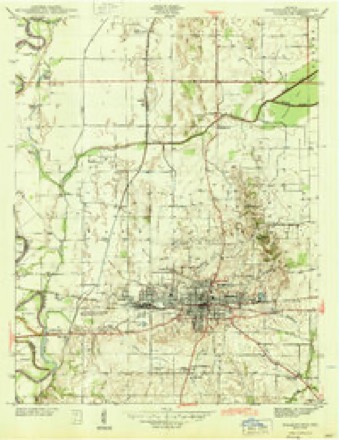
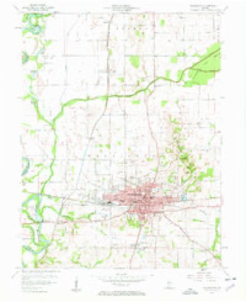
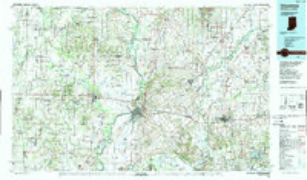
15 topographic sheets cover this place, the earliest surveyed in 1944 and the latest in 1986. It stands in Washington Township. It lies in ZIP code area 47501. The Survey maps it on the Washington quadrangle. It stands 449 feet above sea level.
Topographic sheets covering this place
6 surveys from 15 printed sheetsMatched by testing this settlement's coordinate against the published boundary of every sheet in the United States Geological Survey's historical collection. Each opens the scanned sheet at the Survey.
- 1944 USGS Washington quadrangle1:24000, 2 printings
- 1956 USGS Vincennes quadrangle1:250000, 4 printings
- 1957 USGS Vincennes quadrangle1:250000
- 1957 USGS Washington quadrangle1:24000, 4 printings
- 1958 USGS Vincennes quadrangle1:250000, 2 printings
- 1986 USGS Vincennes quadrangle1:100000, 2 printings



In the county-history sources
136,139 words on this townshipHistory of Knox and Daviess County, Indiana : from the Earliest Time to the Present; with Biographical Sketches, Reminiscences, Notes, Etc. ; Together with an Extended History of the Colonial Days of Vincennes, and Its Progress Down to the Formation of the State Government, published 1886 names this settlement in its chapter on Washington Township. These are the passages that mention it, exactly as the scans read.
Steen, son of John, kept a house of entertainment where Dunn now lives, and boarding a man sick of cholera was himself stricken by the dread disease, and died soon after. Mr. Robinson, sonin-law of Richard Steen, settled near where his son, Richard Robinson, now lives. James Jordan, who was prominent as a pioneer, settled, at a much later date, in the vicinity of Robinson. N. Burriss and James Burriss, who were from Kentucky, settled near Wheatland between 1816 and 1820. Simon Nicholson, from Pennsylvania, settled on the old State road, a short distance from town. James Young, D. W. Ballow, the Jackson family and Andrew Whitenack, all settled near the same neighborhood. The latter was for a time a justice of the peace. Merrill, another pioneer, lived east of the State road. He kept an "inn" for the public. He lived to be quite old. Andrew Berry lived east of Steen's, at what was known as Berryville. Here was the postoffice, and Berry was postmaster till Wheatland was laid out and the office moved to that place. Sim Harbin lived east of Wheatland; the railroad passes through the farm. Here he built a little horse-mill and a small still-house ; Jesse Harbin also lived near. A. Westfall was another old settler.
Passage source: History of Knox and Daviess County, Indiana : from the Earliest Time to the Present; with Biographical Sketches, Reminiscences, Notes, Etc. ; Together with an Extended History of the Colonial Days of Vincennes, and Its Progress Down to the Formation of the State Government, published 1886.
David Welton built an ox tread-mill on his farm in the southern part of the township. Robert McClure built a horse-mill, as did Noah Purcell a small water-mill. Col. Jordan also owned a water-mill at the head waters of the Deshee. Grists that were not ground at these mills were ground by hand-mills, beaten in a mortar or taken elsewhere. The only tanyard remembered was the one owned by Isaac Purcell. During the Indian troubles of 1812-14 every neighborhood had its forts or block-houses, sufficient for the accommodation of the settlers. The most convenient and commanding place was usually chosen. There were two such defenses in Palmyra, one at Isaac Purcell' s, the other at Martin Rose's, usually known as Rose's fort. These were built in 1812, but neither was ever attacked.
Passage source: History of Knox and Daviess County, Indiana : from the Earliest Time to the Present; with Biographical Sketches, Reminiscences, Notes, Etc. ; Together with an Extended History of the Colonial Days of Vincennes, and Its Progress Down to the Formation of the State Government, published 1886.
The works seen in Kuox County, consist of mounds of habitation, sepulchral and temple mounds, and number over 200, with probably as many more not yet explored. Mounds of habitation are found in the north and southwest parts of Vincennes, along the summit of the high river bluff south of Edwardsport, on the wagon road between the latter town and Sandborn, and on the top and sides of the Dicksburg hills. A group of fifty-two mounds on the Vaulting farm six miles southeast from Purcell, showed more attention to regularity than is elsewhere seen, being arranged somewhat in regular lines from north to south, and from east to west. Sepulchral mounds are rare. The only one certainly identified was situated centrally in the last mentioned group. Explored by Samuel Jordan, it was found to contain human skeletons, and round-bottomed pottery. Plumb-bobs, stone shuttles, spinerets and numerous fragments of pottery have been found on S. Catt's land (Surrey 22) adjoining. Other tumuli of this character will reward the future explorer. This region was well to the center of the Mound Builders Nation. Remote from the dangers incident to a more exposed situation and encircled by a bulwark of loving hearts - forts, walled exclosures, and citadels were unnecessary, and not erected as at exposed points on their frontier. Perhaps the seat of a royal priesthood, their efforts essayed to build a series of temples which constituted at once capital and holy city - the Heliopolis of the AVest. Three sacred mounds thrown upon, or against the sides of the second terrace or bluff east and southeast of Vincenues are the result; and in size, symmetry and grandeur of aspect, rival if not excel any prehistoric remains in the United States. All three are truncated cones or pyramidal, and without doubt erected designedly for sacred purposes ; the flat area on the summit was reserved for an oratory and altar, as in the Teocalli of Mexico. The Pyramid Mound (on the Miller farm, common Lot 83, Division B. ), one mile south of Vincennes, is placed on a slightly elevated terrace surrounded by a cluster of small mounds. It is oblong, with extreme diameter from east to west, at the base of 300 feet, 150 feet wide, and is 47 feet high. The level area on the summit, 15x50 feet, is crowded with intrusive burials of a later race. The Sugar Loaf Mound, on Mr. Fay's land, just east of the city line, is built against and upon the side of the bluff, but stands out in bold relief with sharply inclined sides. Diameter from east to west, 216 feet; from north to south, 180 feet, and towering aloft 140 feet above Vincennes Plain, it commands by 27 feet the high plateau to the east. Area on top 10x25 feet. The following section was developed by sinking a shaft centrally from the top:
Passage source: History of Knox and Daviess County, Indiana : from the Earliest Time to the Present; with Biographical Sketches, Reminiscences, Notes, Etc. ; Together with an Extended History of the Colonial Days of Vincennes, and Its Progress Down to the Formation of the State Government, published 1886.
Machine-read from a century-old scan, so expect the errors a machine makes: misspelled names, dropped words, stray characters.
Read the whole chapter on Washington Township - it names this place 2 more 2 times.
Fires near this place
7 since 2003Regional context, not property-specific evidence. The federal wildfire occurrence database lists 7 fires within 5 miles of Jordan between 2003 and 2007, burning about 21 acres in total. None started naturally. 1 was recorded as arson. Distance is straight-line from the map coordinates, so a fire counted here may appear on a neighbouring settlement's page as well.
| Reported cause | Fires |
|---|---|
| Missing data/not specified/undetermined | 2 |
| Debris and open burning | 2 |
| Recreation and ceremony | 1 |
| Arson/incendiarism | 1 |
| Equipment and vehicle use | 1 |
The most recent of them, most recent first, with the day each was reported and the service that recorded it.
| Date | Cause | Size | Reported by | Name on the report |
|---|---|---|---|---|
| 23 September 2007 | Missing data/not specified/undetermined | 10 acres | Indiana State Fire Marshal's Office | not named |
| 18 September 2007 | Equipment and vehicle use | 5.0 acres | Indiana State Fire Marshal's Office | not named |
| 9 March 2005 | Debris and open burning | 1.0 acres | Indiana State Fire Marshal's Office | not named |
| 4 March 2006 | Arson/incendiarism | 1.0 acres | Indiana State Fire Marshal's Office | not named |
| 28 February 2006 | Missing data/not specified/undetermined | 2.0 acres | Indiana State Fire Marshal's Office | not named |
| 21 November 2007 | Recreation and ceremony | 2.0 acres | Indiana State Fire Marshal's Office | not named |
| 25 October 2003 | Debris and open burning | under an acre | Indiana State Fire Marshal's Office | not named |
Settlements close enough to share some of these fires:
Mines and quarries near this place
1 within 5 milesRegional context, not property-specific evidence. The federal mineral resources record lists 1 working within 5 miles of Jordan: 1 producer. All of them still produce. What was taken out: Stone. Distance is straight-line from the map coordinates, so a quarry counted here may appear on a neighbouring settlement's page as well.
| Where | Site | Commodity | Status | Recorded |
|---|---|---|---|---|
| Daviess County Highway Dept. | Stone | Producer |
Storms near this place
1 since 2011Regional context, not property-specific evidence. The National Weather Service names Jordan in 1 storm report in 2011: 1 hail. No death or injury is recorded in these reports. Each account below is quoted exactly as the forecast office filed it, from the NOAA Storm Events Database, and each date opens the federal record of that event.
| When | Event | Place named | Harm | What the report says |
|---|---|---|---|---|
| April 2011 | Hail | Jordan | - | no account filed |
Nearest settlements
The eight closest, with where each one stands in the county. Distances are straight-line, computed from the Geographic Names Information System coordinates.
| Map | Place | Distance | Sheets |
|---|---|---|---|
| Graham | 2.3 miles | 15 | |
| Lettsville | 2.7 miles | 15 | |
| Washington | 2.7 miles | 15 | |
| Maysville | 3.0 miles | 15 | |
| Capehart | 4.0 miles | 15 | |
| South Washington | 4.0 miles | 15 | |
| Thomas | 5.4 miles | 14 | |
| Black Oak | 6.9 miles | 13 |
Elsewhere
Matched on this settlement's Geographic Names Information System number rather than its name, so it cannot be a different place of the same name in another state.
| Wikidata item Q14688515 | The structured record the population and elevation above come from. Public domain (CC0). |
Provenance
This settlement is recorded in the Geographic Names Information System as feature 437126. The sheet list is computed by point-in-boundary test against the United States Geological Survey's historical topographic inventory. Both are works of the United States government and carry no copyright under 17 U.S.C. 105.
Wildfire. Short, Karen C. 2022. Spatial wildfire occurrence data for the United States, 1992-2020 [FPA_FOD_20221014]. 6th Edition. Fort Collins, CO: Forest Service Research Data Archive. https://doi.org/10.2737/RDS-2013-0009.6 Collected with United States Government funding and usable without additional permissions or fees.
Mines and quarries. USGS Mineral Resources Data System (MRDS) https://mrdata.usgs.gov/mrds/ A work of the United States government, no copyright under 17 U.S.C. 105.
Storms. NOAA National Centers for Environmental Information, Storm Events Database https://www.ncei.noaa.gov/stormevents/ A work of the United States government, no copyright under 17 U.S.C. 105. Narratives are quoted verbatim from the National Weather Service report and are not edited or summarised.