 Block
Plainville, Indiana
14 topographic sheets cover this place, the earliest surveyed in 1943 and the latest in 1986. It stands in Steele Township. It lies in ZIP code area 47568. It stands on Hanna Creek. The Survey maps it on the Plainville quadrangle. 499 people lived here at the 2020 count. It stands 469 feet above sea level.
On record in Plainville
Buildings and businesses the archive holds for this place. Each opens its own page, with the source record it came from.
On the National Register 1 record
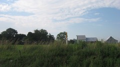 McCall Family Farmsteadlisted 2013
Population over time
2 figuresPlainville grew from 476 to 499 between 2010 and 2020. These are the recorded population figures Wikidata holds for this place, reached through the Geographic Names Information System number this page is keyed on rather than by name, so they belong to this place and not to another of the same name. Most are census counts, but not all are: an early figure may be a founding or settlement estimate, and an estimate published within five years of a census is left out. The change column is computed, and is left blank where more than 20 years separate a figure from the one before it, because a gap that long is not a change between two counts.
| Year | People | Change |
|---|---|---|
| 2010 | 476 | |
| 2020 | 499 | +23 (+5%) |
Topographic sheets covering this place
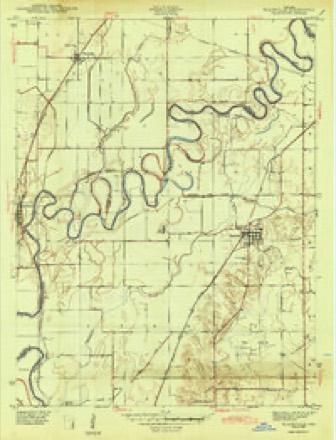
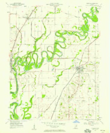
6 surveys from 14 printed sheetsMatched by testing this settlement's coordinate against the published boundary of every sheet in the United States Geological Survey's historical collection. Each opens the scanned sheet at the Survey.
- 1943 USGS Plainville quadrangle1:24000, 2 printings
- 1956 USGS Vincennes quadrangle1:250000, 4 printings
- 1957 USGS Plainville quadrangle1:24000, 3 printings
- 1957 USGS Vincennes quadrangle1:250000
- 1958 USGS Vincennes quadrangle1:250000, 2 printings
- 1986 USGS Vincennes quadrangle1:100000, 2 printings



In the county-history sources
2,804 words on this townshipHistory of Knox and Daviess County, Indiana : from the Earliest Time to the Present; with Biographical Sketches, Reminiscences, Notes, Etc. ; Together with an Extended History of the Colonial Days of Vincennes, and Its Progress Down to the Formation of the State Government, published 1886 names this settlement in its chapter on Steele Township. These are the passages that mention it, exactly as the scans read.
This township lies north of Washington Township and along the White River. Very few if any land entries were made here previous to 1820. The following were made in 1821: On June 18, Andrew Coutchman, the west half of the northeast quarter of Section 20, Township 4, Range 7; Abraham Case, the southwest quarter of the same section; and Alexander R. Hinds, the west half of the southeast quarter of the same section. On the next day Elias Beddle entered the west half of the southwest quarter of Section 29 ; and on the 20th of August Josiah Culbertson entered the west half of the northeast quarter of the same section. Since this time Steele Township has kept even pace with the rest of the county in improving on the early condition of things, and now, in common with Elmore, has a valuable line of railway, and has also a flourishing village and railway station by the name of Plainville, about ten miles north of Washington.
Passage source: History of Knox and Daviess County, Indiana : from the Earliest Time to the Present; with Biographical Sketches, Reminiscences, Notes, Etc. ; Together with an Extended History of the Colonial Days of Vincennes, and Its Progress Down to the Formation of the State Government, published 1886.
(Cloud) Millis. The father was a native of Orange County, IncL, born in 1816, and was a farmer in good cinmmstances. He moved to Kansas in 1868, where he now lives. The mother was born in North Carolina, and when about six years old came to Indiana, where she was raised. She was born in 1815 and died in Kansas in 1875. Of this parentage was born the subject of this sketch in Orange County, Ind., May 22, 1845. He passed his boyhood days on a farm, and when eighteen years old enlisted in the army in Company K, Fifty-third Indiana Infantry and served until the close of the war. By exposure and hardships incident to army life he contracted chronic rheumatism, which has led to disease of the heart and gives him great trouble. After returning home from the war he attended school at different academies for about three years and afterward taught two schools. He began attending school at the State University but took only a part of one year's course, when his health failed him. He then studied medicine for several years, and took a course of lectures in the Kentucky School of Medicine at Louisville. He practiced his profession in Lawrence County, Ind., until 1880, when he came to Plainville, Daviess County, and still continues his practice. He owns ninety-five acres of good land, which his son cultivates. After his return from the army he married Eliza A. Burton, who was born April 25, 1816. They were married in 1867 and became the parents of five children, one of whom died in infancy. Those living are Tillie, Burton J., Carrie N. and William E. Dr. Millis is a Kepublican in politics, and he and wife are members of the Missionary Baptist Church. He is a successful physician and one who is eVer ready to support worthy enterprises. His eldest daughter graduated in the common school course at the age of fifteen years, and taught her first school very successfully when sixteen years old.
Passage source: History of Knox and Daviess County, Indiana : from the Earliest Time to the Present; with Biographical Sketches, Reminiscences, Notes, Etc. ; Together with an Extended History of the Colonial Days of Vincennes, and Its Progress Down to the Formation of the State Government, published 1886.
Machine-read from a century-old scan, so expect the errors a machine makes: misspelled names, dropped words, stray characters.
Mines and quarries near this place
2 within 5 milesRegional context, not property-specific evidence. The federal mineral resources record lists 2 workings within 5 miles of Plainville: 1 past producer, 1 producer. 1 still produces. What was taken out: Sand and Gravel, Construction. Distance is straight-line from the map coordinates, so a quarry counted here may appear on a neighbouring settlement's page as well.
| Where | Site | Commodity | Status | Recorded |
|---|---|---|---|---|
| Jackson Gravel Pit | Sand and Gravel, Construction | Past Producer | ||
| Mize Dredge | Sand and Gravel, Construction | Producer |
Storms near this place
34 since 1994Regional context, not property-specific evidence. The National Weather Service names Plainville in 34 storm reports between 1994 and 2026: 17 flood, 9 thunderstorm wind, 6 hail, 1 flash flood. No death or injury is recorded in these reports. Each account below is quoted exactly as the forecast office filed it, from the NOAA Storm Events Database, and each date opens the federal record of that event.
| When | Event | Place named | Harm | What the report says |
|---|---|---|---|---|
| June 2008 | Flood | Plainville | $20,000,000 | Flooding occurred along the White River in Daviess County, including near Edwardsport, due to heavy rain and a breach in a levee. A levee just downstream of Elnora blew out and sandbags were scattered more than a half mile downstream. |
| March 2006 | Flood | Plainville | $100,000 | no account filed |
| February 2008 | Flood | Plainville | $20,000 | Flooding occurred along the White River in Daviess County due to heavy rain and snow melt. |
| July 2004 | Thunderstorm Wind | Plainville | $20,000 | A garage roof was removed, and a chimney and home roof were damaged. |
| March 2008 | Flood | Plainville | $15,000 | Flooding occurred along the White River in western Daviess County due to heavy rain. Flooding continued until April 8th at 1630. |
| March 2008 | Flood | Plainville | $15,000 | Flooding occurred along the White River in western Daviess County due to heavy rain and snow melt. |
| August 2007 | Thunderstorm Wind | Plainville | $15,000 | A tree fell on a house in Plainville and caused roof and gutter damage. Another tree fell on a garage damaging two sides of the building. This damage was due to damaging thunderstorm winds. |
| January 2008 | Flood | Plainville | $10,000 | Flooding occurred along the White River in Daviess County due to heavy rain and snow melt. |
| July 2008 | Flood | Plainville | $10,000 | Excessive rainfall along the White River caused flooding in Daviess county. |
| May 2008 | Flood | Plainville | $5,000 | Flooding occurred along the White River in western Daviess County due to heavy rain. |
| April 1994 | Thunderstorm Wind | Plainville | $5,000 | Trees were blown down along highway 57 from Plainville to Elnora in northern Daviess County. |
| June 1998 | Tornado (F0) | Plainville | $5,000 | no account filed |
| June 2016 | Thunderstorm Wind | Plainville | $1,500 | A tree and some limbs were downed in this location due to damaging thunderstorm wind gusts. |
| September 2006 | Thunderstorm Wind | Plainville | $1,000 | Power lines were downed. |
| May 2002 | Thunderstorm Wind | Plainville | $1,000 | Trees downed |
| May 1996 | Thunderstorm Wind | Plainville | $500 | no account filed |
| February 2009 | Flood | Plainville | - | Flooding occurred along the White River in Daviess County, including near Edwardsport in Knox County, due to heavy rain. It affected most bottomlands and some county roads. |
| April 2009 | Flood | Plainville | - | Flooding occurred along the White River west of Plainville of Daviess County, along the river across from Edwardsport in neighboring Knox County. Flooding continued into May, with the river cresting then. |
| April 2009 | Flood | Plainville | - | Flooding occurred along the White River west of Plainville of Daviess County, along the river across from Edwardsport in neighboring Knox County. The river crested 5.7 feet above flood stage at the Edwardsport river gauge on April 11th at a reading of 20.7 feet. A river level of 20 feet typically occurs about once a year and affects agricultural land and a few roads or so...state, county, and local. |
| January 2009 | Flood | Plainville | - | Rainfall and warm temperatures that occurred on and off during the second half of December led to flooding of low lying agricultural land on the White River during late December and very early January, affecting Knox County at and near the Edwardsport river gage. This flood event is a continuation from December. |
| May 2009 | Flood | Plainville | - | Flooding of bottomlands occurred along the White River west of Plainville of Daviess County, along the river across from Edwardsport in neighboring Knox County. Flooding continued from April. The river crested at 19 feet on May 5th. Flood stage is 15 feet. Crop damage estimate is grossly estimated. |
| May 2009 | Flood | Plainville | - | The beginnings of a flood occurred a few miles east of Plainville, Indiana along the White River. The river crested 0.6 feet above flood stage on May 10th at a reading of 15.6 feet. Flooding of this magnitude typically means the river has expanded into low agricultural fields and Daviess County Road 375 WN is flooded. |
| May 2009 | Flood | Plainville | - | Extensive flooding of bottomlands occurred along the White River approximately 5 miles west of Plainville, Indiana, in the vicinity of Edwardsport, Indiana of neighboring Knox County. The river crested 7.6 feet above flood stage on May 18th at a reading of 22.6 feet. Flooding of this magnitude typically affects local/county/state roads, agricultural land, and surrounds river cabins. Damage costs are grossly estimated. |
| April 2008 | Flood | Plainville | - | Flooding occurred along the White River in western Daviess County due to heavy rain. This flooding is a continuation from March flooding that began on March 18th at 2200. March flood damage estimates are around fifteen thousand dollars. |
| December 2008 | Flood | Plainville | - | Rainfall and warm temperatures that occurred on and off during the second half of December lead to flooding of low lying agricultural land on the White River during late December and very early January, affecting Daviess County at and near the Edwardsport river gage. This flood event continued into January. |
| June 2007 | Hail | Plainville | - | Law enforcement reported quarter size hail at the intersection of SR 57 and CR 800 N. |
| March 2026 | Hail | Plainville | - | no account filed |
| September 2006 | Hail | Plainville | - | no account filed |
| April 2003 | Hail | Plainville | - | no account filed |
| July 2002 | Thunderstorm Wind | Plainville | - | no account filed |
| June 2001 | Hail | Plainville | - | no account filed |
| May 1996 | Hail | Plainville | - | no account filed |
| May 1996 | Thunderstorm Wind | Plainville | - | no account filed |
| April 1996 | Flash Flood | Plainville | - | no account filed |
Nearest settlements
The eight closest, with where each one stands in the county. Distances are straight-line, computed from the Geographic Names Information System coordinates.
| Map | Place | Distance | Sheets |
|---|---|---|---|
| Cornettsville | 4.1 miles | 14 | |
| Capehart | 4.7 miles | 15 | |
| Epsom | 4.9 miles | 14 | |
| Elnora | 6.1 miles | 14 | |
| Lettsville | 6.2 miles | 15 | |
| Graham | 6.3 miles | 15 | |
| Jordan | 8.6 miles | 15 | |
| Odon | 8.9 miles | 13 |
Elsewhere
Matched on this settlement's Geographic Names Information System number rather than its name, so it cannot be a different place of the same name in another state.
| Wikipedia article on Plainville | An encyclopaedic summary. Its text is share-alike, so it is linked here rather than copied. |
| Wikidata item Q2261106 | The structured record the population and elevation above come from. Public domain (CC0). |
Provenance
This settlement is recorded in the Geographic Names Information System as feature 441224. The sheet list is computed by point-in-boundary test against the United States Geological Survey's historical topographic inventory. Both are works of the United States government and carry no copyright under 17 U.S.C. 105.
Mines and quarries. USGS Mineral Resources Data System (MRDS) https://mrdata.usgs.gov/mrds/ A work of the United States government, no copyright under 17 U.S.C. 105.
Storms. NOAA National Centers for Environmental Information, Storm Events Database https://www.ncei.noaa.gov/stormevents/ A work of the United States government, no copyright under 17 U.S.C. 105. Narratives are quoted verbatim from the National Weather Service report and are not edited or summarised.