 Block
Grant City, Indiana
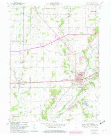
9 topographic sheets cover this place, the earliest surveyed in 1953 and the latest in 1986. It stands in Wayne Township. It lies in ZIP code area 47384. It stands on Bench Run. The Survey maps it on the Knightstown quadrangle. It stands 1,014 feet above sea level.
Topographic sheets covering this place
4 surveys from 9 printed sheetsMatched by testing this settlement's coordinate against the published boundary of every sheet in the United States Geological Survey's historical collection. Each opens the scanned sheet at the Survey.
- 1953 USGS Cincinnati quadrangle1:250000, 3 printings
- 1957 USGS Cincinnati quadrangle1:250000
- 1960 USGS Knightstown quadrangle1:24000, 3 printings
- 1986 USGS New Castle quadrangle1:100000, 2 printings



In the county-history sources
22,216 words on this townshipHistory of Henry County, Indiana : Together with Sketches of Its Cities, Villages, and Towns ... Also a Condensed History of Indiana, Embracing Accounts of Pre-historic Races, Aborigines, Winnebago and Black Hawk Wars, and a Brief Review of Its Civil and Political History., published 1884 names this settlement in its chapter on Wayne Township. These are the passages that mention it, exactly as the scans read.
This old village is pleasantly situated on the east bank of Blue River, opposite Knightstown. It was laid out by Judge John Anderson about the time the National road was located and named in honor of Governor Kay. It is a pretty, well-built rural village, containing two stores, a postoffice, two churches and a good school building, where an excellent school in three grades is maintained.
Passage source: History of Henry County, Indiana : Together with Sketches of Its Cities, Villages, and Towns ... Also a Condensed History of Indiana, Embracing Accounts of Pre-historic Races, Aborigines, Winnebago and Black Hawk Wars, and a Brief Review of Its Civil and Political History., published 1884.
One of the most destructive fires ever known in Knightstown occurred Monday, Feb. 24, 1868. The Probasco Block, a large and valuable building, was then destroyed, and several neighboring buildings damaged. The loss was about $30,000, half of which was on the building. Mr. Tenny and Mr. Probasco, merchants, Mr. Thayer, furniture dealer, Mr. Albright, artist, and the I. O. O. F. Lodge were all heavy losers.
Passage source: History of Henry County, Indiana : Together with Sketches of Its Cities, Villages, and Towns ... Also a Condensed History of Indiana, Embracing Accounts of Pre-historic Races, Aborigines, Winnebago and Black Hawk Wars, and a Brief Review of Its Civil and Political History., published 1884.
J. G. Pamsay is a native of Virginia, born March 12, 1828, a son of H. B. and Jane Bamsay, natives of Pennsylvania, and greatgrandson of Thomas Bamsay, who came to America from Ireland in an early day, and entered a claim of 900 acres of land. Oct. 12, 1829, his father came to Indiana and settled in Wayne County, where he died in 1870, aged seventy-two years, his wife following him in twenty-nine days. J. C. Bamsay received a good education, and then began farming, at which he has been very successful, now running 240 acres of fine land. He was married June 10, 1863, to
Passage source: History of Henry County, Indiana : Together with Sketches of Its Cities, Villages, and Towns ... Also a Condensed History of Indiana, Embracing Accounts of Pre-historic Races, Aborigines, Winnebago and Black Hawk Wars, and a Brief Review of Its Civil and Political History., published 1884.
Machine-read from a century-old scan, so expect the errors a machine makes: misspelled names, dropped words, stray characters.
Mines and quarries near this place
3 within 5 milesRegional context, not property-specific evidence. The federal mineral resources record lists 3 workings within 5 miles of Grant City: 3 past producers. None of them still produces. What was taken out: Sand and Gravel, Construction. Distance is straight-line from the map coordinates, so a quarry counted here may appear on a neighbouring settlement's page as well.
| Where | Site | Commodity | Status | Recorded |
|---|---|---|---|---|
| Fred Goodier Gravel Pit | Sand and Gravel, Construction | Past Producer | ||
| James L. Craig Pit | Sand and Gravel, Construction | Past Producer | ||
| Omar V. Davis Pit | Sand and Gravel, Construction | Past Producer |
Nearest settlements
The eight closest, with where each one stands in the county. Distances are straight-line, computed from the Geographic Names Information System coordinates.
| Map | Place | Distance | Sheets |
|---|---|---|---|
| Maple Valley | 2.4 miles | 9 | |
| Kennard | 2.9 miles | 8 | |
| Knox | 3.0 miles | 9 | |
| Woodville | 3.4 miles | 8 | |
| Stone Quarry Mills | 3.5 miles | 10 | |
| Greensboro | 4.1 miles | 11 | |
| Knightstown | 5.0 miles | 9 | |
| Raysville | 5.1 miles | 9 |
Elsewhere
Matched on this settlement's Geographic Names Information System number rather than its name, so it cannot be a different place of the same name in another state.
| Wikipedia article on Grant City | An encyclopaedic summary. Its text is share-alike, so it is linked here rather than copied. |
| Wikidata item Q5596139 | The structured record the population and elevation above come from. Public domain (CC0). |
Provenance
This settlement is recorded in the Geographic Names Information System as feature 435319. The sheet list is computed by point-in-boundary test against the United States Geological Survey's historical topographic inventory. Both are works of the United States government and carry no copyright under 17 U.S.C. 105.
Mines and quarries. USGS Mineral Resources Data System (MRDS) https://mrdata.usgs.gov/mrds/ A work of the United States government, no copyright under 17 U.S.C. 105.