 Block
West Liberty, Indiana
13 topographic sheets cover this place, the earliest surveyed in 1953 and the latest in 1986. It stands in Union Township. It lies in ZIP code area 46936. It stands on Grassy Fork. The Survey maps it on the Greentown quadrangle.
Topographic sheets covering this place
4 surveys from 13 printed sheetsMatched by testing this settlement's coordinate against the published boundary of every sheet in the United States Geological Survey's historical collection. Each opens the scanned sheet at the Survey.
- 1953 USGS Muncie quadrangle1:250000, 5 printings
- 1956 USGS Muncie quadrangle1:250000
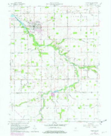
- 1960 USGS Greentown quadrangle1:24000, 4 printings
- 1986 USGS Muncie quadrangle1:100000, 3 printings



In the county-history sources
18,486 words on this townshipCounties of Howard and Tipton, Indiana. Historical and Biographical.., published 1883 names this settlement in its chapter on Union Township. These are the passages that mention it, exactly as the scans read.
Joseph Brown, the oldest inhabitant of the township living at the present time, was a resident of Grant County previous to his settlement here. He first saw this part of the country in 1843, while on a hunt for cattle belonging to his employer, Mr. Tyler, and, liking the appearance of the land, determined to locate here. He selected a spot for his cabin about one-half mile northeast of Jerome on Lily Creek, and soon had a habitation ready for occupancy. His family was soon transferred to their new home, and since that period Mr. Brown has been prominently identified with the growth and development of the township. At the present time, he is operating a mill very successfully at the village of Jerome. Moorman located near West Liberty, and was soon afterward joined by Elliott Mason, who settled in the same vicinity. They both came here from Grant County^ and for many years were residents of Union. John Farrington settled on the south bank of Wild Cat, one mile southeast of Jerome, where he took a claim. He traded this claim two years later to Ephraim Bates, who lived north of the creek, on the old Bailey place. He was a man of considerable energy and rare business qualifications, and became the possessor of a fine tract of real estate, which, at the present time, is in possession of his descendants.
Passage source: Counties of Howard and Tipton, Indiana. Historical and Biographical.., published 1883.
Among other early settlers who came in about the same time, or perhaps a little later, were Elias Brown, brother of Joseph Brown, who located on Lily Creek, one mile north of Jerome, where he entered land in 1847, and Jefferson Horine, who settled about midway between West Liberty and Jerome, on the East Fork of Wild Cat, where his son, Samuel Horine, lives. Horine was a native of Kentucky, and proved a valuable acquisition to the community where he settled. He was the first physi- cian in the township, and early achieved quite a reputation for the successful manner in which he treated the chills and ague, so common in pioneer times.
Passage source: Counties of Howard and Tipton, Indiana. Historical and Biographical.., published 1883.
In the year 1875, William Jessup moved a steam flouring mill from Kokomo to the village of West Liberty, which proved a valuable acquisition to that part of the country, Jessup sold it before its completion to - Carr, who operated it a short time, when it was purchased by William McConnell. It passed through several hands and was finally bought by Mr. Covalt, the present owner, who has remodeled it and added new and improved machinery. A saw has been attached and certain days of each week are devoted to the lumber business.
Passage source: Counties of Howard and Tipton, Indiana. Historical and Biographical.., published 1883.
Machine-read from a century-old scan, so expect the errors a machine makes: misspelled names, dropped words, stray characters.
Read the whole chapter on Union Township - it names this place 6 more 6 times.
Mines and quarries near this place
1 within 5 milesRegional context, not property-specific evidence. The federal mineral resources record lists 1 working within 5 miles of West Liberty: 1 producer. All of them still produce. What was taken out: Sand and Gravel, Construction. Distance is straight-line from the map coordinates, so a quarry counted here may appear on a neighbouring settlement's page as well.
| Where | Site | Commodity | Status | Recorded |
|---|---|---|---|---|
| Windfall Sand and Gravel Pit | Sand and Gravel, Construction | Producer |
Storms near this place
1 since 1999Regional context, not property-specific evidence. The National Weather Service names West Liberty in 1 storm report in 1999: 1 hail. No death or injury is recorded in these reports. Each account below is quoted exactly as the forecast office filed it, from the NOAA Storm Events Database, and each date opens the federal record of that event.
| When | Event | Place named | Harm | What the report says |
|---|---|---|---|---|
| May 1999 | Hail | West Liberty | - | no account filed |
Nearest settlements
The eight closest, with where each one stands in the county. Distances are straight-line, computed from the Geographic Names Information System coordinates.
Elsewhere
Matched on this settlement's Geographic Names Information System number rather than its name, so it cannot be a different place of the same name in another state.
| Wikipedia article on West Liberty | An encyclopaedic summary. Its text is share-alike, so it is linked here rather than copied. |
| Wikidata item Q20709394 | The structured record the population and elevation above come from. Public domain (CC0). |
Provenance
This settlement is recorded in the Geographic Names Information System as feature 445783. The sheet list is computed by point-in-boundary test against the United States Geological Survey's historical topographic inventory. Both are works of the United States government and carry no copyright under 17 U.S.C. 105.
Mines and quarries. USGS Mineral Resources Data System (MRDS) https://mrdata.usgs.gov/mrds/ A work of the United States government, no copyright under 17 U.S.C. 105.
Storms. NOAA National Centers for Environmental Information, Storm Events Database https://www.ncei.noaa.gov/stormevents/ A work of the United States government, no copyright under 17 U.S.C. 105. Narratives are quoted verbatim from the National Weather Service report and are not edited or summarised.