 Block
Jerome, Indiana
13 topographic sheets cover this place, the earliest surveyed in 1953 and the latest in 1986. It stands in Union Township. It lies in ZIP code area 46936. It stands on Rome Run. The Survey maps it on the Greentown quadrangle. It stands 860 feet above sea level.
Topographic sheets covering this place
4 surveys from 13 printed sheetsMatched by testing this settlement's coordinate against the published boundary of every sheet in the United States Geological Survey's historical collection. Each opens the scanned sheet at the Survey.
- 1953 USGS Muncie quadrangle1:250000, 5 printings
- 1956 USGS Muncie quadrangle1:250000
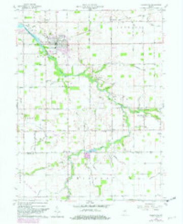
- 1960 USGS Greentown quadrangle1:24000, 4 printings
- 1986 USGS Muncie quadrangle1:100000, 3 printings



In the county-history sources
18,486 words on this townshipCounties of Howard and Tipton, Indiana. Historical and Biographical.., published 1883 names this settlement in its chapter on Union Township. These are the passages that mention it, exactly as the scans read.
Union Township occupies the southeast corner of Howard County and comprises thirty-one and a half square miles of territory bordering on Grant County on the east, and Tipton County on the south. Liberty and Jackson Townships on the north, and Taylor Township on the west. It was originally included in the territory of Green Township, and was set off as a distinct division at the March term , 1853, of the Board of County Commissioners. Topographically, the surface may be described as principally of even face in the northeastern, southeastern and southwestern portions, with occasional undulations of somewhat irregular character in the central part, while adjacent to the streams the land is more uneven, though in no place is it too broken for farming purposes. The township is well watered and drained by several streams, which flow throuu^h the country in various directions, the chief of which is Big Wild Cat. This water course passes through the central part of the township in a northwesterly direction, and aiibrds tlie principal drainage of the eastern part of the county. It has three divisions, known as the Grassy, Middle and South Forks, which unite, as a single stream, near the central part of the township in Section 18. Lily Creek rises near the northwestern part of the township, flows through an irregular channel in an easterly direction, and empties into Wild Cat in Section 10, near the village of Jerome, Kokomo Creek, the second stream of importance in the county, flows through the western part of Union. It enters the township from the west, about one-half mile from the southern boundary, takes a northeasterly course through Sections 80, 20 and 19, and leaves from Section 18. A small stream known as Prairie Creek rises near the south-central part of the township in Section 27, from whence it flows a northwesterly course through Sections 22 and 15, crossing the northern boundary in Section 16.
Passage source: Counties of Howard and Tipton, Indiana. Historical and Biographical.., published 1883.
The first settler who located in Union Township as it is at present designated, was David Bailey, the exact date of whose arrival was not ascertained, though it is supposed to have been prior to the year 1842. He located near the forks of Wild Cat, about two miles southeast of Jerome, where he erected a small cabin and cleared a patch of ground, though he did not remain there very long. There was a large family of the Baileys, several of whom settled near Greentown, in Liberty Townships where they took and disposed of a great many claims, accumulating thereby considerable money, which enabled them to enter land when it came into market. In the year 1843, Jesse Lancaster came to the township and settled a short distance north of the present site of Jerome, on land at present owned and occupied by Isaac Reed. At that time, the land was still in possession of the Indians, from whom Lancaster obtained permission to settle and make improvements. When the land came into market, he laid claim to 160 acres, but not having sufficient means to pay the Government price, he sold the claim, which was an eligible site, to Clem Murphy, for money enough to enter the adjoining quarter. Lancaster came here from Wells County, and seems to have been a man of some prominence in the little pioneer community. He was quite a mechanical genius, being a millwright by occupation, and found abundant opportunities for exercising his skill in making chairs, tables, plows and other articles for the early settlers. He improved a good farm and set out the first orchard in the township, many trees of which are still standing. In 1858, he sold this farm to John Shaughan and moved to Wayne County.
Passage source: Counties of Howard and Tipton, Indiana. Historical and Biographical.., published 1883.
A son-in-law of Lancaster, Charles Baldwin, came about the same time and selected a site for his home a short distance west of Jerome, near a large spring, where he erected a rude pole shanty. This structure, which cannot be dignified by the term house, was constructed in a few hours, while the wind was blowing a still' breeze and the snow Avas flying thick in tlie air. The large cracks were stuff'ed with moss, which, with sheets hung around the interior, served to keep out the cold winter winds. A fire on the ground near the central 'part of the domicile, there being no floor, answered for heating and cooking purposes, while smoke was allowed to make its escape as best it could through a small opening in the brush and hay roof. The following spring, a more comfortable and convenient cabin was built, but the members of the family never forgot their experience in the rail-pen during the cold winter of 1843-44. Baldwin was a native of England, a man of more than ordinary intellectual culture, and, as a teacher, was for several years identified with the early schools of Union. He afterward became the possessor of a good farm, lying about one mile east of Jerome, where Albert Farrington now lives. He sold this place and moved into Jackson Township a number of years ago.
Passage source: Counties of Howard and Tipton, Indiana. Historical and Biographical.., published 1883.
Machine-read from a century-old scan, so expect the errors a machine makes: misspelled names, dropped words, stray characters.
Read the whole chapter on Union Township - it names this place 29 more 29 times.
Mines and quarries near this place
1 within 5 milesRegional context, not property-specific evidence. The federal mineral resources record lists 1 working within 5 miles of Jerome: 1 producer. All of them still produce. What was taken out: Sand and Gravel, Construction. Distance is straight-line from the map coordinates, so a quarry counted here may appear on a neighbouring settlement's page as well.
| Where | Site | Commodity | Status | Recorded |
|---|---|---|---|---|
| Windfall Sand and Gravel Pit | Sand and Gravel, Construction | Producer |
Storms near this place
2 since 2020Regional context, not property-specific evidence. The National Weather Service names Jerome in 2 storm reports between 2020 and 2024: 1 thunderstorm wind, 1 hail. No death or injury is recorded in these reports. Each account below is quoted exactly as the forecast office filed it, from the NOAA Storm Events Database, and each date opens the federal record of that event.
| When | Event | Place named | Harm | What the report says |
|---|---|---|---|---|
| March 2024 | Hail | Jerome | $50,000 | no account filed |
| June 2020 | Thunderstorm Wind | Jerome | $1,000 | Healthy 10 inch diameter tree downed due to thunderstorm wind gusts and was blocking the road. |
Nearest settlements
The eight closest, with where each one stands in the county. Distances are straight-line, computed from the Geographic Names Information System coordinates.
Elsewhere
Matched on this settlement's Geographic Names Information System number rather than its name, so it cannot be a different place of the same name in another state.
| Wikipedia article on Jerome | An encyclopaedic summary. Its text is share-alike, so it is linked here rather than copied. |
| Wikidata item Q6182520 | The structured record the population and elevation above come from. Public domain (CC0). |
Provenance
This settlement is recorded in the Geographic Names Information System as feature 436996. The sheet list is computed by point-in-boundary test against the United States Geological Survey's historical topographic inventory. Both are works of the United States government and carry no copyright under 17 U.S.C. 105.
Mines and quarries. USGS Mineral Resources Data System (MRDS) https://mrdata.usgs.gov/mrds/ A work of the United States government, no copyright under 17 U.S.C. 105.
Storms. NOAA National Centers for Environmental Information, Storm Events Database https://www.ncei.noaa.gov/stormevents/ A work of the United States government, no copyright under 17 U.S.C. 105. Narratives are quoted verbatim from the National Weather Service report and are not edited or summarised.