 Block
Griffin, Indiana
21 topographic sheets cover this place, the earliest surveyed in 1903 and the latest in 1986. It stands in Bethel Township. It lies in ZIP code area 47616. The Survey maps it on the New Harmony quadrangle. 143 people lived here at the 2020 count. It stands 387 feet above sea level.
Population over time
2 figuresGriffin fell from 172 to 143 between 2010 and 2020. These are the recorded population figures Wikidata holds for this place, reached through the Geographic Names Information System number this page is keyed on rather than by name, so they belong to this place and not to another of the same name. Most are census counts, but not all are: an early figure may be a founding or settlement estimate, and an estimate published within five years of a census is left out. The change column is computed, and is left blank where more than 20 years separate a figure from the one before it, because a gap that long is not a change between two counts.
| Year | People | Change |
|---|---|---|
| 2010 | 172 | |
| 2020 | 143 | -29 (-17%) |
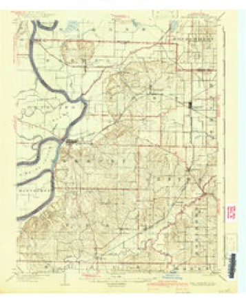
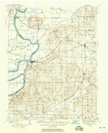
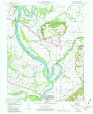
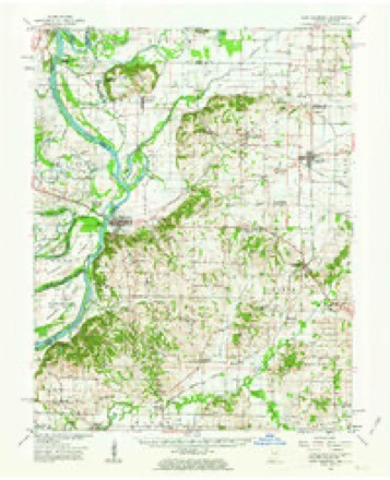
Topographic sheets covering this place
9 surveys from 21 printed sheetsMatched by testing this settlement's coordinate against the published boundary of every sheet in the United States Geological Survey's historical collection. Each opens the scanned sheet at the Survey.
- 1903 USGS New Harmony quadrangle1:62500, 3 printings
- 1903 USGS Patoka quadrangle1:125000, 2 printings
- 1938 USGS New Harmony quadrangle1:62500
- 1956 USGS Vincennes quadrangle1:250000, 4 printings
- 1957 USGS Vincennes quadrangle1:250000
- 1958 USGS Vincennes quadrangle1:250000, 2 printings
- 1959 USGS New Harmony quadrangle1:24000, 4 printings
- 1959 USGS New Harmony quadrangle1:62500, 2 printings
- 1986 USGS Princeton quadrangle1:100000, 2 printings





In the county-history sources
3,149 words on this townshipHistory of Posey County, Indiana : from the Earliest Times to the Present, with Biographical Sketches, Reminiscences, Notes, Etc. : Together with an Extended History of the Northwest, the Indiana Territory, and the State of Indiana, published 1886 names this settlement in its chapter on Bethel Township. These are the passages that mention it, exactly as the scans read.
was organized August 14, 1821, and was named after P. C. Bethel, the first white man settling in the township. It is in the extreme northwest of the county, lying contiguous to Gibson County, Eiobb Township and the Wabash Eiver. The present area is near 13,760 acres, about two-thirds being in cultivation. The surface is level with the single exception of about 2,000 acres of table-land which is situated in the extreme north of the township. The level land is very rich, and is principally of a black sandy loam. Wheat, corn, oats, rye, barley and many other crops grow in great abundance on the black sandy soil, while that adjoining the Wabash and Black Rivers, being subject to overflows, is cultivated for corn only. The soil of the tableland is not as black and rich as the lower lands adjoining, still it produces remarkably well. These high lands, usually called "the hills," rise from 100 to 200 feet above the level lands, the highest plateaus affording a fine view of the surrounding towns and country. The principal portion of the land in cultivation is valued at from $30 to $50 per acre, while a few swampy tracts can be bought at a low rate. The original forests that covered the ground contained much valuable timber, but the bulk of it was of the inferior grades. Sweet gum grew in immense quantities, the trees being very large and tall, much of it still remaining on the low lands near the streams. The largest burr oaks in the county, and perhaps in the State, are to be found on the bottom lands of Gen. Hovey. Many of these trees will measure from four to five feet in diameter, while occasionally one is found that will reach over eight feet. The General recently sold one of these mammoth trees on the stump for $51. On the table-land much black walnut, yellow poplar, oak and ash originally grew, but the greater went to market or was destroyed by the first settlers. Considerable oak, ash, poplar, sugar-tree and inferior grades still abound.
Passage source: History of Posey County, Indiana : from the Earliest Times to the Present, with Biographical Sketches, Reminiscences, Notes, Etc. : Together with an Extended History of the Northwest, the Indiana Territory, and the State of Indiana, published 1886.
Machine-read from a century-old scan, so expect the errors a machine makes: misspelled names, dropped words, stray characters.
Read the whole chapter on Bethel Township - it names this place 1 more 1 time.
Fires near this place
1 since 2004Regional context, not property-specific evidence. The federal wildfire occurrence database lists 1 fire within 5 miles of Griffin in 2004, burning about 1 acre in total. None started naturally. None was recorded as arson. Distance is straight-line from the map coordinates, so a fire counted here may appear on a neighbouring settlement's page as well.
| Reported cause | Fires |
|---|---|
| Debris and open burning | 1 |
The most recent of them, most recent first, with the day each was reported and the service that recorded it.
| Date | Cause | Size | Reported by | Name on the report |
|---|---|---|---|---|
| 29 February 2004 | Debris and open burning | 1.0 acres | Indiana State Fire Marshal's Office | not named |
Settlements close enough to share some of these fires:
Mines and quarries near this place
4 within 5 milesRegional context, not property-specific evidence. The federal mineral resources record lists 4 workings within 5 miles of Griffin: 2 producers, 1 past producer, 1 plant. 3 still produce. What was taken out: Sand and Gravel, Construction. Distance is straight-line from the map coordinates, so a quarry counted here may appear on a neighbouring settlement's page as well.
| Where | Site | Commodity | Status | Recorded |
|---|---|---|---|---|
| Aulvin Sand & Gravel | Sand and Gravel, Construction | Producer | ||
| Compton Pit & Dredge | Sand and Gravel, Construction | Producer | ||
| Diamond Dredge and Mill | Sand and Gravel, Construction | Past Producer | ||
| Eastwood Dredge and Mill | Sand and Gravel, Construction | Plant |
Storms near this place
11 since 1998Regional context, not property-specific evidence. The National Weather Service names Griffin in 11 storm reports between 1998 and 2020: 4 flood, 3 thunderstorm wind, 2 tornado, 1 funnel cloud. The reports record 1 injury. Each account below is quoted exactly as the forecast office filed it, from the NOAA Storm Events Database, and each date opens the federal record of that event.
| When | Event | Place named | Harm | What the report says |
|---|---|---|---|---|
| April 2011 | Thunderstorm Wind | Griffin | 1 hurt, $750,000 | A machine shed was unroofed at exit 12 along Interstate 64. A tractor-trailer rig was blown off Interstate 64. The driver was slightly injured. At least a half dozen grain bins were destroyed, and at least a half dozen house roofs sustained moderate to major damage. Dozens of houses received minor roof damage. Several farms in the Griffin area sustained damage. Trees, barns, and sheds were blown down. Three mobile homes were destroyed in the Wadesville area. A few farm buildings were destroyed in the New Harmony area. |
| February 2017 | Tornado (EF2) | Griffin | $500,000 | This long-track tornado continued from White County, Illinois across the Wabash River into Posey County. The tornado was rated EF-2 throughout its path in Posey County. The tornado was about 220 yards wide when it crossed the Wabash River to Indiana Highway 69. Several small barns were destroyed, and most trees were snapped along the path. Power poles were snapped, and roads were blocked by debris. The Posey County portion of the path was almost entirely through agricultural land, resulting in damage to very few residences. The tornado crossed Interstate 64 west of Poseyville, leaving a path of flattened trees across the interstate. Just before the tornado crossed into Gibson County, an old house was shifted off its foundation. The tornado again strengthened to EF-3 intensity after crossing into Gibson County. |
| June 2018 | Thunderstorm Wind | Griffin | $275,000 | A microburst produced a long swath of damaging winds across far northern Posey County. The swath was as much as two miles wide in places. Several corn fields were blown down, with the stalks broken in some areas. Hundreds of trees were broken or uprooted, and several power lines were down. Widespread tree damage occurred along Interstate 64 near the Black River rest area. Some small sheds and signs were damaged. The 25-mile long microburst continued across southern Gibson County, where it became more intense and damaging. |
| March 2008 | Flood | Griffin | $250,000 | A number of structures throughout the county were damaged by flooding. A subdivision off Indiana Highway 62 was flooded. Flooding of Big Creek raised water to the eaves of structures of an historic village off Indiana 69. The village is an attraction that consists of recreated historic buildings. Numerous roads were closed. Five motorists were rescued from flooded roads. Schools were closed. The county declared a State of Emergency. |
| June 2009 | Thunderstorm Wind | Griffin | $30,000 | A couple of homes were damaged by falling trees, along with a couple of pickup trucks. |
| April 2018 | Flood | Griffin | $20,000 | Moderate flooding continued on the Wabash River from late March. At the New Harmony river gage, the river crested at 20.68 feet on April 11th. Flood stage there is 15 feet. Flooding of farmland was extensive, and farmers were forced to delay the planting of crops. Corn is normally planted by mid May. Floodwaters encroached on parts of northern New Harmony, requiring sandbagging in town. Harmonie State Park was partially inundated and closed. Some stripper oil wells were flooded along the river from New Harmony south. The river was three miles wide at Interstate 64. Considerable flooding of bottomland agricultural land occurred. Some rural county roads were impacted. |
| January 2016 | Flood | Griffin | $10,000 | Moderate flooding of the Wabash River continued into January. At the New Harmony river gage, the river crested at 20.69 feet on the 7th. Flood stage there is 15 feet. There was considerable flooding of low-lying woods and fields near the river. A few secondary roads were flooded. Parts of northern New Harmony began to flood, and sandbagging became necessary in town. Harmonie State Park was closed. |
| October 2020 | Flood | Griffin | - | Numerous roads were flooded across Posey County. Two water rescues were conducted, both on roads that frequently flood. |
| May 2006 | Tornado (F0) | Griffin | - | Numerous small tree limbs were blown down in this weak tornado. The path, which was through sparsely populated open farmland, was not continuous. The parent supercell thunderstorm produced other weak tornadoes, including one in White County, Illinois just prior to this one. |
| May 1998 | Funnel Cloud | Griffin | - | A funnel cloud was reported just north of Griffin off Interstate 64. There was an unconfirmed report that it briefly touched down in open fields. |
| March 2019 | Hail | Griffin | - | no account filed |
Nearest settlements
The eight closest, with where each one stands in the county. Distances are straight-line, computed from the Geographic Names Information System coordinates.
| Map | Place | Distance | Sheets |
|---|---|---|---|
| New Baltimore | 1.9 miles | 21 | |
| Barrett | 2.4 miles | 21 | |
| Stewartsville | 4.5 miles | 21 | |
| New Harmony | 5.2 miles | 21 | |
| Rapture | 5.3 miles | 21 | |
| Poseyville | 7.4 miles | 21 | |
| Wadesville | 9.8 miles | 19 | |
| Cynthiana | 10.9 miles | 17 |
Elsewhere
Matched on this settlement's Geographic Names Information System number rather than its name, so it cannot be a different place of the same name in another state.
| Wikipedia article on Griffin | An encyclopaedic summary. Its text is share-alike, so it is linked here rather than copied. |
| Wikidata item Q2096172 | The structured record the population and elevation above come from. Public domain (CC0). |
Provenance
This settlement is recorded in the Geographic Names Information System as feature 435495. The sheet list is computed by point-in-boundary test against the United States Geological Survey's historical topographic inventory. Both are works of the United States government and carry no copyright under 17 U.S.C. 105.
Wildfire. Short, Karen C. 2022. Spatial wildfire occurrence data for the United States, 1992-2020 [FPA_FOD_20221014]. 6th Edition. Fort Collins, CO: Forest Service Research Data Archive. https://doi.org/10.2737/RDS-2013-0009.6 Collected with United States Government funding and usable without additional permissions or fees.
Mines and quarries. USGS Mineral Resources Data System (MRDS) https://mrdata.usgs.gov/mrds/ A work of the United States government, no copyright under 17 U.S.C. 105.
Storms. NOAA National Centers for Environmental Information, Storm Events Database https://www.ncei.noaa.gov/stormevents/ A work of the United States government, no copyright under 17 U.S.C. 105. Narratives are quoted verbatim from the National Weather Service report and are not edited or summarised.