 Block
Stewartsville, Indiana
21 topographic sheets cover this place, the earliest surveyed in 1903 and the latest in 1986. It stands in Robb Township. It lies in ZIP code area 47633. The Survey maps it on the Poseyville quadrangle. It stands 479 feet above sea level.
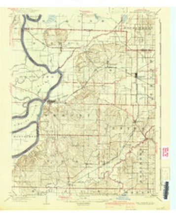
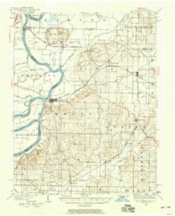
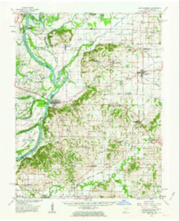
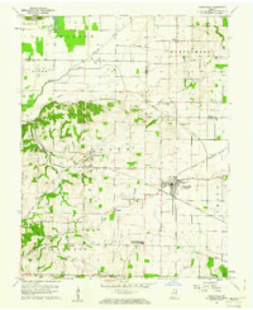
Topographic sheets covering this place
9 surveys from 21 printed sheetsMatched by testing this settlement's coordinate against the published boundary of every sheet in the United States Geological Survey's historical collection. Each opens the scanned sheet at the Survey.
- 1903 USGS New Harmony quadrangle1:62500, 3 printings
- 1903 USGS Patoka quadrangle1:125000, 2 printings
- 1938 USGS New Harmony quadrangle1:62500
- 1956 USGS Vincennes quadrangle1:250000, 4 printings
- 1957 USGS Vincennes quadrangle1:250000
- 1958 USGS Vincennes quadrangle1:250000, 2 printings
- 1959 USGS New Harmony quadrangle1:62500, 2 printings
- 1959 USGS Poseyville quadrangle1:24000, 4 printings
- 1986 USGS Princeton quadrangle1:100000, 2 printings





In the county-history sources
14,233 words on this townshipHistory of Posey County, Indiana : from the Earliest Times to the Present, with Biographical Sketches, Reminiscences, Notes, Etc. : Together with an Extended History of the Northwest, the Indiana Territory, and the State of Indiana, published 1886 names this settlement in its chapter on Robb Township. These are the passages that mention it, exactly as the scans read.
JOHN CHEISTIE was born in Virginia, June 21, 1834, son of Henry and Ellen (St. Clair) Christie. The parents were natives of Virginia, born in 1806 and 1811, respectively. The father was a stone-mason, and came to Posey County, Ind., in 1850, where he followed the life of a farmer. His death occurred June 6, 1879. The mother is yet living. Our subject received a limited education, owing to the poor facilities of that day, and when nineteen years old began working for himself. June 13, 1859, he took for his companion through life Rosetta Kirby, born September 13, 1842, in Tennessee. They have this family: Jessie E., Minnie E. (deceased), Mary E. (deceased), Martha A., Nellie G. and Bstella F. Mr. Christie enlisted in Company D., Ninety -first Regular Indiana Infantry, August 20, 1862, and was an active and faithful soldier for three years. In June, 1865, he returned home, and in the fall of the same year, purchased forty-seven acres of land in Robb Township, and began farming. December 8, 1880, he lost his wife, and since that time his daughter Jessie has been his housekeeper. He aftetWard increased his farm to 107 acres, but meeting with an accident which crippled him in 1884, he abandoned farming, and has since lived in Poseyville. He is a Republican in politics and cast his first vote for Fremont.
Passage source: History of Posey County, Indiana : from the Earliest Times to the Present, with Biographical Sketches, Reminiscences, Notes, Etc. : Together with an Extended History of the Northwest, the Indiana Territory, and the State of Indiana, published 1886.
LEANDEK DEFUE was born in Posey County, Ind., February 15, 1831, son of Eoswell and Bedy (Eoberts) Defur. The father was of French descent, born in 1803, in South Carolina, and came to Indiana in his youth. He was married in 1821, and resided in Posey County until his death in 1858. Our subject's grandfather took an active part in the battle of Tippecanoe. At that time the country was full of hostile Indians, and many atrocious crimes were committed. Some interesting stories related by Mr. Defur will be found in another part of this work. The mother was born in South Carolina October 20,. 1804. She is at present living with our subject, and is quite bright and active for so old a lady. Leander was educated in the district schools, and in 1854 took a trip to the Pacific coast, going via the Gulf of Mexico, Isthmus of Panama, and up the Pacific coast to the Golden Gate. He became a miner, and only a few days after his arrival found a piece of quartz rock which contained over $60 worth of gold. He remained there four years and then returned to "Hoosierdom" with upward of $1,000, which he had earned. He located on the old place, where he has ever since lived, owning 101 acres of land. In 1874 the house caught fire and was consumed. Since that time he has rebuilt, and is doing well as a farmer. He is a Democrat in politics, and is a member of the Eegular Baptist Church.
Passage source: History of Posey County, Indiana : from the Earliest Times to the Present, with Biographical Sketches, Reminiscences, Notes, Etc. : Together with an Extended History of the Northwest, the Indiana Territory, and the State of Indiana, published 1886.
WILLIAM A. DEAKE, miller, is a native of Kentucky, born August 23, 1854, son of Eev. James and Sarah Jane (Gish) Drake. The parents were natives of Keiitucky, born in 1815 and 1821, respectively. The father was a farmer and miller by occupation, and also became minister of the gospel while in his native State, and preached for upward of forty years. He came to Posey County, Ind., where he remained until 1880, when he moved to Kentiicky and remained until his death in 1883. The mother's death occurred in 1872. Our subject was educated in the common schools, and aided his parents on the farm until nearly twenty-one years old. In 1879 he entered into partnership with his brother, John, in the saw-mill business. In 1884 they became partners of James Hall in grist-milling, and are doing a paying business. In politics Mr. Drake is a Eepublican. In 1884 he was married to Miss Mattie A. Sandefur, daughter of J. T. and Julia B. Sandefur. She was born April 28, 1866, and has borne her husband one child, George Humphrey. She is a member of the Methodist Episcopal Church.
Passage source: History of Posey County, Indiana : from the Earliest Times to the Present, with Biographical Sketches, Reminiscences, Notes, Etc. : Together with an Extended History of the Northwest, the Indiana Territory, and the State of Indiana, published 1886.
Machine-read from a century-old scan, so expect the errors a machine makes: misspelled names, dropped words, stray characters.
Read the whole chapter on Robb Township - it names this place 13 more 13 times.
Fires near this place
1 since 2004Regional context, not property-specific evidence. The federal wildfire occurrence database lists 1 fire within 5 miles of Stewartsville in 2004, burning about 1 acre in total. None started naturally. None was recorded as arson. Distance is straight-line from the map coordinates, so a fire counted here may appear on a neighbouring settlement's page as well.
| Reported cause | Fires |
|---|---|
| Debris and open burning | 1 |
The most recent of them, most recent first, with the day each was reported and the service that recorded it.
| Date | Cause | Size | Reported by | Name on the report |
|---|---|---|---|---|
| 29 February 2004 | Debris and open burning | 1.0 acres | Indiana State Fire Marshal's Office | not named |
Settlements close enough to share some of these fires:
Mines and quarries near this place
1 within 5 milesRegional context, not property-specific evidence. The federal mineral resources record lists 1 working within 5 miles of Stewartsville: 1 producer. All of them still produce. What was taken out: Sand and Gravel, Construction. Distance is straight-line from the map coordinates, so a quarry counted here may appear on a neighbouring settlement's page as well.
| Where | Site | Commodity | Status | Recorded |
|---|---|---|---|---|
| Compton Pit & Dredge | Sand and Gravel, Construction | Producer |
Storms near this place
9 since 2004Regional context, not property-specific evidence. The National Weather Service names Stewartsville in 9 storm reports between 2004 and 2012: 6 hail, 2 thunderstorm wind, 1 tornado. The reports record 2 deaths. Each account below is quoted exactly as the forecast office filed it, from the NOAA Storm Events Database, and each date opens the federal record of that event.
| When | Event | Place named | Harm | What the report says |
|---|---|---|---|---|
| January 2008 | Tornado (EF2) | Stewartsville | 2 killed, $200,000 | A mobile home was destroyed. Two occupants of the mobile home were killed. Numerous trees were uprooted. One barn was destroyed, along with some small sheds. Four barns, three houses, and one church were damaged. The damage was mostly to roofs. Peak winds were estimated near 120 mph. The average path width was estimated to be 80 yards. The tornado continued into extreme southern Gibson County. |
| July 2004 | Thunderstorm Wind | Stewartsville | $30,000 | Wind gusts were estimated to at least 70 MPH by a spotter and an emergency manager. Numerous trees were blown down in Griffin and Stewartsville, some of which landed on houses, cars, and roadways. |
| October 2010 | Thunderstorm Wind | Stewartsville | - | Trained spotters estimated wind gusts from 60 to 65 mph near Interstate 64 in the Stewartsville and Poseyville areas. |
| January 2008 | Hail | Stewartsville | - | The hail was covering the ground. |
| March 2012 | Hail | Stewartsville | - | no account filed |
| February 2011 | Hail | Stewartsville | - | no account filed |
| April 2011 | Hail | Stewartsville | - | no account filed |
| February 2011 | Hail | Stewartsville | - | no account filed |
| September 2008 | Hail | Stewartsville | - | no account filed |
Nearest settlements
The eight closest, with where each one stands in the county. Distances are straight-line, computed from the Geographic Names Information System coordinates.
| Map | Place | Distance | Sheets |
|---|---|---|---|
| Barrett | 2.2 miles | 21 | |
| Rapture | 2.3 miles | 21 | |
| Poseyville | 2.8 miles | 21 | |
| New Baltimore | 4.5 miles | 21 | |
| Griffin | 4.5 miles | 21 | |
| Wadesville | 6.2 miles | 19 | |
| Cynthiana | 6.5 miles | 17 | |
| New Harmony | 6.6 miles | 21 |
Elsewhere
Matched on this settlement's Geographic Names Information System number rather than its name, so it cannot be a different place of the same name in another state.
| Wikipedia article on Stewartsville | An encyclopaedic summary. Its text is share-alike, so it is linked here rather than copied. |
| Wikidata item Q22059207 | The structured record the population and elevation above come from. Public domain (CC0). |
Provenance
This settlement is recorded in the Geographic Names Information System as feature 444158. The sheet list is computed by point-in-boundary test against the United States Geological Survey's historical topographic inventory. Both are works of the United States government and carry no copyright under 17 U.S.C. 105.
Wildfire. Short, Karen C. 2022. Spatial wildfire occurrence data for the United States, 1992-2020 [FPA_FOD_20221014]. 6th Edition. Fort Collins, CO: Forest Service Research Data Archive. https://doi.org/10.2737/RDS-2013-0009.6 Collected with United States Government funding and usable without additional permissions or fees.
Mines and quarries. USGS Mineral Resources Data System (MRDS) https://mrdata.usgs.gov/mrds/ A work of the United States government, no copyright under 17 U.S.C. 105.
Storms. NOAA National Centers for Environmental Information, Storm Events Database https://www.ncei.noaa.gov/stormevents/ A work of the United States government, no copyright under 17 U.S.C. 105. Narratives are quoted verbatim from the National Weather Service report and are not edited or summarised.