 Block
Bentonville, Indiana
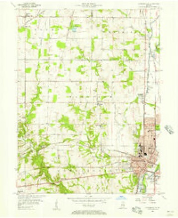
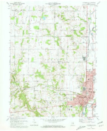
9 topographic sheets cover this place, the earliest surveyed in 1953 and the latest in 1986. It stands in Posey Township. It lies in ZIP code area 47357. The Survey maps it on the Connersville quadrangle. It stands 1,060 feet above sea level.
On record in Bentonville
Buildings and businesses the archive holds for this place. Each opens its own page, with the source record it came from.
On the National Register 1 record
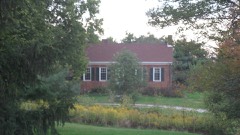 William Lowry Houselisted 1982
Topographic sheets covering this place
5 surveys from 9 printed sheetsMatched by testing this settlement's coordinate against the published boundary of every sheet in the United States Geological Survey's historical collection. Each opens the scanned sheet at the Survey.
- 1953 USGS Cincinnati quadrangle1:250000, 3 printings
- 1956 USGS Connersville quadrangle1:24000
- 1957 USGS Cincinnati quadrangle1:250000
- 1972 USGS Connersville quadrangle1:24000, 2 printings
- 1986 USGS New Castle quadrangle1:100000, 2 printings



In the county-history sources
4,982 words on this townshipHistory of Fayette County, Indiana: Containing a History of the Townships, Towns, Villages, Schools, Churches, Industries, Etc.; Portraits of Early Settlers and Prominent Men; Biographies, Etc., Etc. .., published 1885 names this settlement in its chapter on Posey Township. These are the passages that mention it, exactly as the scans read.
The Mungers, among the first to enter and settle upon land in the " New Purchase, " were from Rutland County, Vt. Edmund K. , with family, settled about one and a half miles southeast of the present site of Bentonville in the fall of 1821. He was the son of Brig.-Gen. Edward Munger, of Vermont, who in the early history of Ohio went to Belpre, and there raised and disciplined an army, with headquarters near Dayton. The Mungers settled for a time in that locality, where now, in Montgomery and Greene Counties (Ohio), a number of their descendants reside. Edward and Lazarus, now residents of this township' are sons of Edmund K.
Passage source: History of Fayette County, Indiana: Containing a History of the Townships, Towns, Villages, Schools, Churches, Industries, Etc.; Portraits of Early Settlers and Prominent Men; Biographies, Etc., Etc. .., published 1885.
George Van Buskirk, Sr., and family, from Kentucky, settled in the vicinity of Cambridge City in 1815, and in 1831 a son, George, Jr., settled in the vicinity of where he now resides just west of Bentonville, where he has played well his part in converting the wilderness of that day into the beautiful farms of the present.
Passage source: History of Fayette County, Indiana: Containing a History of the Townships, Towns, Villages, Schools, Churches, Industries, Etc.; Portraits of Early Settlers and Prominent Men; Biographies, Etc., Etc. .., published 1885.
Among other pioneers of that part of the township lying in the " New Purchase" were the Galbreaths, Isaac and David, who emigrated from Kentucky in 1820, and in that year settled Jehu Vickroy, from North Carolina.
Passage source: History of Fayette County, Indiana: Containing a History of the Townships, Towns, Villages, Schools, Churches, Industries, Etc.; Portraits of Early Settlers and Prominent Men; Biographies, Etc., Etc. .., published 1885.
Machine-read from a century-old scan, so expect the errors a machine makes: misspelled names, dropped words, stray characters.
Read the whole chapter on Posey Township - it names this place 15 more 15 times.
Storms near this place
10 since 1999Regional context, not property-specific evidence. The National Weather Service names Bentonville in 10 storm reports between 1999 and 2025: 5 thunderstorm wind, 3 tornado, 1 hail, 1 flood. No death or injury is recorded in these reports. Each account below is quoted exactly as the forecast office filed it, from the NOAA Storm Events Database, and each date opens the federal record of that event.
| When | Event | Place named | Harm | What the report says |
|---|---|---|---|---|
| June 2019 | Tornado (EF0) | Bentonville | $50,000 | The tornado briefly touched down damaging an older church building on North County Road 550 West. The roof collapsed within the building as the north wall was blown out. There was a large amount of splatter on the east facing wall. A piece of metal was located in a tree around forty yards to the west of the church. Debris from the church was lifted and scattered northward across the cemetery and up to 200 yards into a nearby field. |
| May 2024 | Tornado (EF0) | Bentonville | $25,000 | The tornado began along North County Road 350 West, about 3 miles northeast of Bentonville, where tree damage was observed. Additional tree damage occurred to the east of Paul Road on the Fayette and Wayne County border. The tornado moved into Wayne County at 1910EST and continued northeast before ending about 1 mile north of Milton at 1913EST. |
| March 2025 | Thunderstorm Wind | Bentonville | $15,000 | A barn was heavily damaged when a section of its roof panels was blown off and one of its exterior walls was collapsed. |
| February 2023 | Thunderstorm Wind | Bentonville | $10,000 | A few trees and powerlines were downed. |
| May 1999 | Tornado (F0) | Bentonville | $10,000 | A tornado touched down in a rural area toppling several trees. Numerous other trees were down across the county due to thunderstorm winds. |
| July 2016 | Thunderstorm Wind | Bentonville | $5,000 | Numerous trees were downed across the northern part of Fayette County. |
| April 2025 | Flood | Bentonville | $3,000 | Several roads were closed in Bentonville due to high water. One home had to be evacuated due to rising waters. |
| August 2021 | Thunderstorm Wind | Bentonville | $3,000 | A few trees were downed along West County Road 600 N. |
| February 2014 | Thunderstorm Wind | Bentonville | $1,000 | A large limb was downed due to thunderstorm winds. |
| March 2011 | Hail | Bentonville | - | no account filed |
Nearest settlements
The eight closest, with where each one stands in the county. Distances are straight-line, computed from the Geographic Names Information System coordinates.
| Map | Place | Distance | Sheets |
|---|---|---|---|
| Harrisburg | 4.1 miles | 9 | |
| Huber | 5.0 miles | 9 | |
| Waterloo | 5.6 miles | 10 | |
| Tyner Crossing | 6.3 miles | 9 | |
| Longwood Crossing | 6.4 miles | 9 | |
| Connersville | 7.7 miles | 9 | |
| Bunker Hill | 7.8 miles | 9 | |
| Springersville | 9.6 miles | 10 |
Elsewhere
Matched on this settlement's Geographic Names Information System number rather than its name, so it cannot be a different place of the same name in another state.
| Wikipedia article on Bentonville | An encyclopaedic summary. Its text is share-alike, so it is linked here rather than copied. |
| Wikidata item Q4890647 | The structured record the population and elevation above come from. Public domain (CC0). |
Provenance
This settlement is recorded in the Geographic Names Information System as feature 430830. The sheet list is computed by point-in-boundary test against the United States Geological Survey's historical topographic inventory. Both are works of the United States government and carry no copyright under 17 U.S.C. 105.
Storms. NOAA National Centers for Environmental Information, Storm Events Database https://www.ncei.noaa.gov/stormevents/ A work of the United States government, no copyright under 17 U.S.C. 105. Narratives are quoted verbatim from the National Weather Service report and are not edited or summarised.