 Block
Waterloo, Indiana
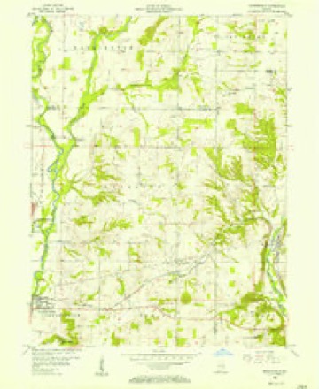
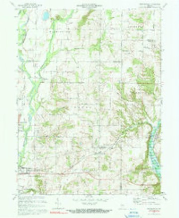
10 topographic sheets cover this place, the earliest surveyed in 1953 and the latest in 1986. It stands in Waterloo Township. It lies in ZIP code area 47331. The Survey maps it on the Brownsville quadrangle. It stands 869 feet above sea level.
Topographic sheets covering this place
5 surveys from 10 printed sheetsMatched by testing this settlement's coordinate against the published boundary of every sheet in the United States Geological Survey's historical collection. Each opens the scanned sheet at the Survey.
- 1953 USGS Cincinnati quadrangle1:250000, 3 printings
- 1956 USGS Brownsville quadrangle1:24000
- 1957 USGS Cincinnati quadrangle1:250000
- 1972 USGS Brownsville quadrangle1:24000, 3 printings
- 1986 USGS New Castle quadrangle1:100000, 2 printings



In the county-history sources
7,163 words on this townshipHistory of Fayette County, Indiana: Containing a History of the Townships, Towns, Villages, Schools, Churches, Industries, Etc.; Portraits of Early Settlers and Prominent Men; Biographies, Etc., Etc. .., published 1885 names this settlement in its chapter on Waterloo Township. These are the passages that mention it, exactly as the scans read.
All of the territory of the township as it now is which lies east of a line parallel to the eastern boundary of Jennings Township was taken from Brownsville Township, and the rest from Harrison. In position it is the northeastern township of the county, Wayne County lying north of it, Qnion east, Jennings and Cohuersville Townships south, and the West Fork of Whitewater River west. It is a small subdivison having an area of a little more than sixteen square miles. The face of the country is rolling. Its principal streams are West Fork and Nolan's Fork; both are on its western border. Simpson's and Williams Creeks - small streams^drain portions of the land. The extreme southeastern portion of the township is crossed by the C. H. & I. R. R., and within its confines are situated the hamlet of Waterloo and the major part of the hamlet- of Springerville.
Passage source: History of Fayette County, Indiana: Containing a History of the Townships, Towns, Villages, Schools, Churches, Industries, Etc.; Portraits of Early Settlers and Prominent Men; Biographies, Etc., Etc. .., published 1885.
Section 33 sold in 1813, Jonathan Higgins purchasing the northeast quarter September 6, 1813; James Parker the southeast quarter on the same date. Jonathan Coleman purchased the northwest quarter December 6, 1813, and December 22, 1813, Nathan Roysdon the southwest quarter.
Passage source: History of Fayette County, Indiana: Containing a History of the Townships, Towns, Villages, Schools, Churches, Industries, Etc.; Portraits of Early Settlers and Prominent Men; Biographies, Etc., Etc. .., published 1885.
Matthias Dawson, whose name is connected with several of the original entries given above, was a native of Virginia, and when a small boy while engaged in plowing or otherwise tending corn was quietly captured by two Indians, and himself and the horse borne away. He remained in captivity with the Indians for many years, and in their journeys had been to this region of country when it was yet the red man's home and formed part of his possessions. The chief, or the one of authority under whose care and charge Mr. Dawson had been reared, it is said, promised him the land he subsequently had to purchase of the Government (in the vicinity of Waterloo). Mr. Dawson, after the battle of Fort Wayne, was released, and then settled on his possessions, which he improved, living here for a number of years, when he removed to St. Joseph County, this State, and there closed his life.
Passage source: History of Fayette County, Indiana: Containing a History of the Townships, Towns, Villages, Schools, Churches, Industries, Etc.; Portraits of Early Settlers and Prominent Men; Biographies, Etc., Etc. .., published 1885.
Machine-read from a century-old scan, so expect the errors a machine makes: misspelled names, dropped words, stray characters.
Read the whole chapter on Waterloo Township - it names this place 19 more 19 times.
Mines and quarries near this place
1 within 5 milesRegional context, not property-specific evidence. The federal mineral resources record lists 1 working within 5 miles of Waterloo: 1 producer. All of them still produce. What was taken out: Stone. Distance is straight-line from the map coordinates, so a quarry counted here may appear on a neighbouring settlement's page as well.
| Where | Site | Commodity | Status | Recorded |
|---|---|---|---|---|
| Fayette Co. Hwy. Dept. - Own Crews | Stone | Producer |
Storms near this place
3 since 2008Regional context, not property-specific evidence. The National Weather Service names Waterloo in 3 storm reports between 2008 and 2022: 2 flash flood, 1 hail. No death or injury is recorded in these reports. Each account below is quoted exactly as the forecast office filed it, from the NOAA Storm Events Database, and each date opens the federal record of that event.
| When | Event | Place named | Harm | What the report says |
|---|---|---|---|---|
| April 2018 | Flash Flood | Waterloo | $30,000 | County Road 440 North was washed out near Waterloo. |
| June 2022 | Flash Flood | Waterloo | $10,000 | A culvert was washed out. |
| June 2008 | Hail | Waterloo | $1,000 | no account filed |
Nearest settlements
The eight closest, with where each one stands in the county. Distances are straight-line, computed from the Geographic Names Information System coordinates.
| Map | Place | Distance | Sheets |
|---|---|---|---|
| Huber | 2.3 miles | 9 | |
| Springersville | 4.1 miles | 10 | |
| Harrisburg | 4.2 miles | 9 | |
| Lyonsville | 4.4 miles | 10 | |
| Connersville | 4.8 miles | 9 | |
| Tyner Crossing | 5.2 miles | 9 | |
| Bentonville | 5.6 miles | 9 | |
| Alquina | 6.8 miles | 11 |
Elsewhere
Matched on this settlement's Geographic Names Information System number rather than its name, so it cannot be a different place of the same name in another state.
| Wikipedia article on Waterloo | An encyclopaedic summary. Its text is share-alike, so it is linked here rather than copied. |
| Wikidata item Q7974181 | The structured record the population and elevation above come from. Public domain (CC0). |
Provenance
This settlement is recorded in the Geographic Names Information System as feature 445541. The sheet list is computed by point-in-boundary test against the United States Geological Survey's historical topographic inventory. Both are works of the United States government and carry no copyright under 17 U.S.C. 105.
Mines and quarries. USGS Mineral Resources Data System (MRDS) https://mrdata.usgs.gov/mrds/ A work of the United States government, no copyright under 17 U.S.C. 105.
Storms. NOAA National Centers for Environmental Information, Storm Events Database https://www.ncei.noaa.gov/stormevents/ A work of the United States government, no copyright under 17 U.S.C. 105. Narratives are quoted verbatim from the National Weather Service report and are not edited or summarised.