 Block
Haubstadt, Indiana
17 topographic sheets cover this place, the earliest surveyed in 1901 and the latest in 1986. It stands in Johnson Township. It lies in ZIP code area 47639. The Survey maps it on the Haubstadt quadrangle. 1,638 people lived here at the 2020 count. It stands 472 feet above sea level.
On record in Haubstadt
Buildings and businesses the archive holds for this place. Each opens its own page, with the source record it came from.
On the National Register 1 record
 Haubstadt State Banklisted 1984
Population over time
2 figuresHaubstadt grew from 1,577 to 1,638 between 2010 and 2020. These are the recorded population figures Wikidata holds for this place, reached through the Geographic Names Information System number this page is keyed on rather than by name, so they belong to this place and not to another of the same name. Most are census counts, but not all are: an early figure may be a founding or settlement estimate, and an estimate published within five years of a census is left out. The change column is computed, and is left blank where more than 20 years separate a figure from the one before it, because a gap that long is not a change between two counts.
| Year | People | Change |
|---|---|---|
| 2010 | 1,577 | |
| 2020 | 1,638 | +61 (+4%) |
Topographic sheets covering this place
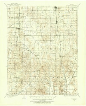
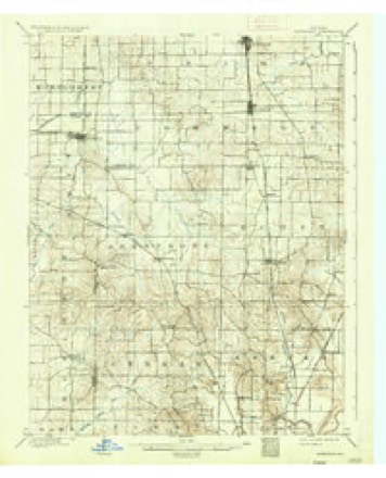
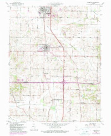
8 surveys from 17 printed sheetsMatched by testing this settlement's coordinate against the published boundary of every sheet in the United States Geological Survey's historical collection. Each opens the scanned sheet at the Survey.
- 1901 USGS Haubstadt quadrangle1:62500
- 1903 USGS Haubstadt quadrangle1:62500, 2 printings
- 1903 USGS Patoka quadrangle1:125000, 2 printings
- 1956 USGS Vincennes quadrangle1:250000, 4 printings
- 1957 USGS Vincennes quadrangle1:250000
- 1958 USGS Vincennes quadrangle1:250000, 2 printings
- 1961 USGS Haubstadt quadrangle1:24000, 3 printings
- 1986 USGS Princeton quadrangle1:100000, 2 printings





In the county-history sources
9,092 words on this townshipHistory of Gibson County Indiana, published 1884 names this settlement in its chapter on Johnson Township. These are the passages that mention it, exactly as the scans read.
According to the census for the year 1880 the population of this township, including the villages of Fort Branch and Haubstadt, contained 3,211. The population is composed of representatives of several nationalities, among which are English, Germans, Scotch, Irish and a few colored persons. The township is largely peopled by Germans in the central portion. the thrifty and enterprising citizens, and as careful farmers they have contributed very largely to the reputation which Johnson bears as being one of the best agricultural districts in the county.
Passage source: History of Gibson County Indiana, published 1884.
This road has by furnishing easy and accessible markets, contributed largely to the development of the material resources of this séction as well as to the building up of the thriving towns of Fort Branch and Haubstadt. St. James, also a station on the line of The village of Warrenton is located on Section 16, and is
Passage source: History of Gibson County Indiana, published 1884.
It is conceded by the old residents that the pioneer of this township was John Hamer and his family, consisting of himself, wife, two sons, and two daughters. They located in the timber in the year 1804, on Section 30, Township 3, Range 11, where they made a little clearing and built a small pole cabin. They were from the mountain districts of Tennessee. He made a precarious living for his family, principally by hunting, family subsisted. He became tired of the locality and in 1806 returned with his family to his old home in Tennessee. and family, who located on Section 20, Township 3, in the fall of 1806. He left numerous descendants who are still residents of the county, some of whom reside in Johnson, though most of them are citizens of Montgomery Township. nent citizens of the southern part of the county during the early days.
Passage source: History of Gibson County Indiana, published 1884.
Machine-read from a century-old scan, so expect the errors a machine makes: misspelled names, dropped words, stray characters.
Read the whole chapter on Johnson Township - it names this place 22 more 22 times.
Storms near this place
18 since 1998Regional context, not property-specific evidence. The National Weather Service names Haubstadt in 18 storm reports between 1998 and 2025: 7 hail, 6 thunderstorm wind, 3 flash flood, 2 tornado. No death or injury is recorded in these reports. Each account below is quoted exactly as the forecast office filed it, from the NOAA Storm Events Database, and each date opens the federal record of that event.
| When | Event | Place named | Harm | What the report says |
|---|---|---|---|---|
| March 2012 | Hail | Haubstadt | $3,000,000 | A severe hail event, with hail near baseball size, occurred in southern Gibson county causing extensive damage to homes, businesses, vehicles and other structures. Some of the largest hail was reported just south of Fort Branch. Ninety six homes were damaged with many having major shingle damage, siding damage, and windows broken out. One insurance company alone reported 500 vehicles damaged, with many of those being totaled by the large hail. |
| March 2025 | Tornado (EF2) | Haubstadt | $2,000,000 | An EF-2 tornado began just northeast of the Tri State Speedway near Haubstadt. Damage to outbuildings and power poles occurred, along with many trees that were uprooted as it moved northeast crossing Highway 168 and did substantial damage to farm buildings and silos on County Road 550. It eventually crossed Interstate 69 and did roof damage to a church and canopy damage to a Gas Station to the southwest of Oakland City. Several trees were uprooted through town and one mobile home was severely damaged. The tornado continued northeast across the Patoka River National Wildlife Refuge and through Pike County. The tornado continued into Daviess county Indiana and had a total length of just shy of 58 miles. The estimated peak wind was 117 mph. |
| May 2009 | Tornado (EF2) | Haubstadt | $300,000 | Maximum winds were estimated near 120 mph at the beginning of the damage path. The most significant damage occurred on a farm on the north side of the Haubstadt Raceway. A 50-foot grain bin was moved off its foundation and destroyed, several large machinery buildings sustained partial losses of roofs and walls, and a race car frame on blocks was moved about 100 feet. Damage intensity decreased eastward along the path. Elsewhere along the path, a barn lost its roof, and several homes received roof damage. |
| December 2013 | Flash Flood | Haubstadt | $30,000 | County Road 800S was closed south of Fort Branch. A water rescue was conducted on County Road 750S near Fort Branch, where a mini-van was stranded in floodwater. Another water rescue was conducted on State Route 64 east of Oakland City, near the Pike County line. Three persons were standing on the roof of a car that was submerged in floodwater. Route 64 was closed near the county line. Near Oakland City, a truck was washed off the road on County Road 950E at 350S. West of Princeton, State Route 64 was closed near State Route 65 due to a levee breach. Other roads around the county were covered by water at various locations. A trained spotter in Fort Branch measured 6.80 inches of rain. |
| April 2016 | Thunderstorm Wind | Haubstadt | $3,000 | A tree was across the road at the intersection of U.S. Highway 41 and State Route 68. A grain bin was destroyed. |
| June 1998 | Thunderstorm Wind | Haubstadt | $3,000 | Power poles were down. |
| October 2025 | Thunderstorm Wind | Haubstadt | $2,000 | A large tree was blown down into power lines in Haubstadt. |
| June 2015 | Thunderstorm Wind | Haubstadt | $2,000 | Construction signs were blown down at the intersection of U.S. Highway 41 and Indiana Highway 68. |
| June 2019 | Thunderstorm Wind | Haubstadt | $1,000 | A snapped power line was reported near the intersection of U.S. Highway 41 and Highway 68. |
| September 2018 | Flash Flood | Haubstadt | - | Numerous roads were flooded. State Route 64 was flooded. Several county roads were closed. A 24-hour rainfall amount of 6.30 inches was reported in Fort Branch. |
| March 2012 | Hail | Haubstadt | - | Half dollar size hail was reported at Haubstadt. |
| May 2022 | Hail | Haubstadt | - | no account filed |
| May 2020 | Hail | Haubstadt | - | no account filed |
| March 2017 | Hail | Haubstadt | - | no account filed |
| March 2005 | Thunderstorm Wind | Haubstadt | - | no account filed |
| April 2005 | Hail | Haubstadt | - | no account filed |
| May 2004 | Flash Flood | Haubstadt | - | no account filed |
| May 2004 | Hail | Haubstadt | - | no account filed |
Nearest settlements
The eight closest, with where each one stands in the county. Distances are straight-line, computed from the Geographic Names Information System coordinates.
| Map | Place | Distance | Sheets |
|---|---|---|---|
| Saint James | 2.0 miles | 17 | |
| Warrenton | 3.1 miles | 17 | |
| Fort Branch | 3.2 miles | 24 | |
| Durham | 3.8 miles | 24 | |
| McGary | 5.0 miles | 23 | |
| Fort Gibson (historical) | 6.1 miles | 24 | |
| King | 6.8 miles | 24 | |
| Mounts | 7.2 miles | 17 |
Elsewhere
Matched on this settlement's Geographic Names Information System number rather than its name, so it cannot be a different place of the same name in another state.
| Wikipedia article on Haubstadt | An encyclopaedic summary. Its text is share-alike, so it is linked here rather than copied. |
| Wikidata item Q2782575 | The structured record the population and elevation above come from. Public domain (CC0). |
Provenance
This settlement is recorded in the Geographic Names Information System as feature 435880. The sheet list is computed by point-in-boundary test against the United States Geological Survey's historical topographic inventory. Both are works of the United States government and carry no copyright under 17 U.S.C. 105.
Storms. NOAA National Centers for Environmental Information, Storm Events Database https://www.ncei.noaa.gov/stormevents/ A work of the United States government, no copyright under 17 U.S.C. 105. Narratives are quoted verbatim from the National Weather Service report and are not edited or summarised.