 Block
Thomas, Indiana
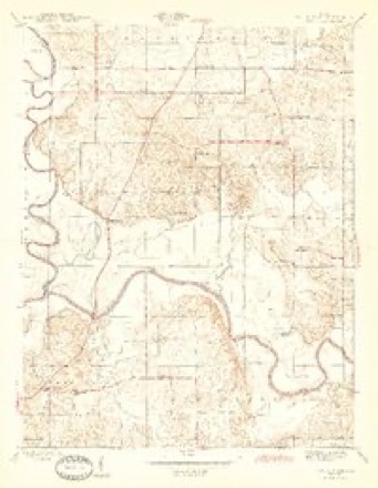
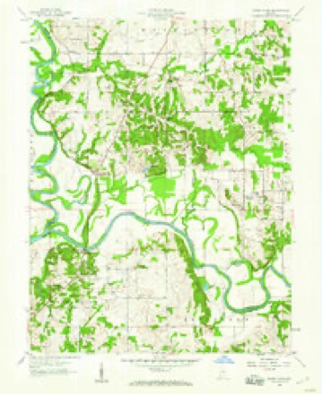
14 topographic sheets cover this place, the earliest surveyed in 1945 and the latest in 1986. It stands in Washington Township. It lies in ZIP code area 47501. It stands on Veale Creek. The Survey maps it on the Sandy Hook quadrangle.
Topographic sheets covering this place
6 surveys from 14 printed sheetsMatched by testing this settlement's coordinate against the published boundary of every sheet in the United States Geological Survey's historical collection. Each opens the scanned sheet at the Survey.
- 1945 USGS Sandy Hook quadrangle1:24000, 2 printings
- 1956 USGS Vincennes quadrangle1:250000, 4 printings
- 1957 USGS Vincennes quadrangle1:250000
- 1958 USGS Sandy Hook quadrangle1:24000, 3 printings
- 1958 USGS Vincennes quadrangle1:250000, 2 printings
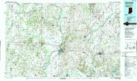
- 1986 USGS Vincennes quadrangle1:100000, 2 printings



In the county-history sources
136,139 words on this townshipHistory of Knox and Daviess County, Indiana : from the Earliest Time to the Present; with Biographical Sketches, Reminiscences, Notes, Etc. ; Together with an Extended History of the Colonial Days of Vincennes, and Its Progress Down to the Formation of the State Government, published 1886 names this settlement in its chapter on Washington Township. These are the passages that mention it, exactly as the scans read.
Thomas Baird moved from Pennsylvania to Kentucky, and from Kentucky he moved to Indiana in 1801, and settled near Vincennes; in 1806 he moved on his farm near Bruceville, where he remained till his death. Joseph Baird, who is still living near Bruceville, is a son of the above. He was born in the county in 1803, and now has a silver medal given by the old settlers' reunion as the oldest native born of the county. From 1863 to 1872 he was engaged in merchandising in Bruceville. The remainder of his time has been spent on the farm. Bazil Parker came from Kentucky in 1818, and settled in the "Barrens;" later he lived near Bruceville. James Threlkeld (Tuccahoe) lived near Baird, where he remained till his death. Samuel Johnson came from Kentucky in 1826, and John Young from the Carolinas; they both lived on donations. Thomas Emison came from Kentucky about 1802 or 1803, and settled on Marie Creek. On that stream he built the first grist-mill and saw-mill in the community, at a much later date steam was added. Marks of the old mill are still visible, yet three-quarters of a century have rolled by since its first erection. James Kyle settled farther south in the township. It is probable he was from Ohio. He came while Indiana was yet a Territory. Samuel Thompson was from Kentucky. He bought the donation on which he lived from Gen. Harrison in 1804; for the 400 acres he was to pay §1, 000. The land was to be paid for in brick ; the deed was made and the land transferred to Thompson before a single brick was made, such was Harrison's confidence in Thompson. The bricks were made by Thompson on the farm where Mr. A. B. McKee now lives, and were used in build- ing the Harrison residence in Vincennes. John McKee came from Kentucky and settled near Emison's mill about 1807 or 1808. He was a farmer, a potter and associate judge for a time. John, Peter and David Hollingsworth were from South Carolina; they settled near McKee on Congress land. They had small stillhouses. Samuel Hollingsworth owned negroes, and on Indiana becoming a State he left his land and went South with his slaves. Nicholas Harper and "Washington Sartor lived near the Hollingsworths; the former was from Kentucky, the latter from South Carolina. He was also owner of a small still. Each came about 1810. Richard Posey settled a very short distance from Bruceville about 1805. He was a Methodist preacher and school teacher. He was the grandfather of Hon. F. B. Posey, of Petersburg. John Bolthus lived near lower part of the township. He came from Kentucky about 1807 or 1808. Daniel McClure came with the Thompsons from Kentucky not far from 1800. He was for a time justice of the peace and associate judge. A fort was built on his farm in 1812. Charles McClure was a member of the "Light Horse Company" in the war of 1812. Robert Elliott, from South Carolina, settled in Knox about 1802. He was a Baptist preacher and owner of a still-house - not an uncommon thing in those days.
Passage source: History of Knox and Daviess County, Indiana : from the Earliest Time to the Present; with Biographical Sketches, Reminiscences, Notes, Etc. ; Together with an Extended History of the Colonial Days of Vincennes, and Its Progress Down to the Formation of the State Government, published 1886.
Virginia. He brought with him his slaves, and among them was Dinah, a slave woman, who was the mother of Bob and Anthony. These were held as slaves by Luke Decker, son of Luke Decker, after the passage of the ordinance of 1787 and after Indiana became a State. In 1817 Bob and Anthony sued Luke Decker in the Orange County Court for their freedom, and after a period of five years in different courts they at last gained their freedom. John Decker, before mentioned, lived near White Biver, below Deckertown. He owned a body of land on which he lived. Isaac Decker, son-in-law of Kirkendall, was a relative of John and Luke Decker. He sometimes ran flat-boats to New Orleans, and, as was the custom of the time, he would have to walk home. Henry Crow was born in Gibson County in 1812, but has lived almost in sight of the township all the time. He has lived in Section 18 for the last forty years. John came to the township from Virginia, not far from 1800, where he remained until his death. Jacob Anthis was another old settler who opened a a farm on White Biver. Bobert Worth, or Warth, settled about three miles below Deckertown, on the edge of the hills, where he opened a small farm. He lived by cultivating his small tract of land and by hunting. He left two sons, who remained on or near the same spot till their deaths. Jacob Jacobus came from New England and settled on a donation. He opened up a good farm, and was a man of worth. He was the father of Bobert Jacobus, township trustee of Decker Township. David Jennings was another pioneer settler on White Biver. He also was from New England. Thomas Dick was another early settler. He was the owner of Donations 6 and 7. It was for him that the town of Dicksburg was named. David Crack, who settled about one mile and a half from Henry Crow's residence, was from Virginia. He left two sons and three daughters, who remained in the neighborhood until death. Other pioneers were Conrad Crum, John Bamsey, Aquilla Bamsey, Marshal Browning, Jeremiah McNeeley and Thomas Washburn.
Passage source: History of Knox and Daviess County, Indiana : from the Earliest Time to the Present; with Biographical Sketches, Reminiscences, Notes, Etc. ; Together with an Extended History of the Colonial Days of Vincennes, and Its Progress Down to the Formation of the State Government, published 1886.
The first settlers in the northern part of the township lived mainly in the vicinity of Black Creek. One of the first in that section was Thomas Anderson, the father of Presley Anderson. He settled there in about 1820. He moved there in a two-horse wagon and settled on a land warrant of 160 acres of land. Anderson was a soldier at Tippecanoe. Samuel Scamp was from the East; he settled on Black Creek in 1819. He was a farmer, but occasionally took a flat-boat to New Orleans. John Johnson settled about one and a half miles southwest of Sandborn after the war of 1812, in which he was a soldier. Robinson Anderson was from Kentucky; he settled east of the railroad about two miles from Sandborn. Phillip Slaughter and Fred Slaughter were from Kentucky, but came at a later date. The last named built a water-mill on Black Creek about 1835. Mrs. Smith (granny) lived as a squatter on the river at Owl Prairie. She had a son, Jacob, who dressed as an Indian and did little but hunt. "Granny " Smith was supposed to possess the mysterious power of witchcraft, and woe unto the one that should come within her enchanted circle, the silver bullet being the only remedy, which was once tried by Phillip Slaughter. John McMurray and John McCombs also settled near Black Creek. Others were George Williamson, brother-in-law of Blan Ballard, the great Indian fighter. James Anderson, the great-grandfather of Presley Anderson and a Eevolutionary soldier, and Moses Slinkard, who was a son-in-law of Scamp. Slinkard lived between Black Creek and White Eiver, where he built a horse-mill between 1820 and 1830. William Keith settled on Section 30 about 1820. Hopkins lived near the present site of Edwardsport. Other settlers in the same vicinity were Comstock, Goodman, Azbell and Hulen. Near the southern part of the township were Bicknell and Buntin and later were the Medleys.
Passage source: History of Knox and Daviess County, Indiana : from the Earliest Time to the Present; with Biographical Sketches, Reminiscences, Notes, Etc. ; Together with an Extended History of the Colonial Days of Vincennes, and Its Progress Down to the Formation of the State Government, published 1886.
Machine-read from a century-old scan, so expect the errors a machine makes: misspelled names, dropped words, stray characters.
Read the whole chapter on Washington Township - it names this place 76 more 76 times.
Fires near this place
4 since 2003Regional context, not property-specific evidence. The federal wildfire occurrence database lists 4 fires within 5 miles of Thomas between 2003 and 2006, burning about 8 acres in total. None started naturally. None was recorded as arson. Distance is straight-line from the map coordinates, so a fire counted here may appear on a neighbouring settlement's page as well.
| Reported cause | Fires |
|---|---|
| Debris and open burning | 2 |
| Equipment and vehicle use | 1 |
| Missing data/not specified/undetermined | 1 |
The most recent of them, most recent first, with the day each was reported and the service that recorded it.
| Date | Cause | Size | Reported by | Name on the report |
|---|---|---|---|---|
| 13 April 2006 | Equipment and vehicle use | 3.0 acres | Indiana State Fire Marshal's Office | not named |
| 19 March 2005 | Debris and open burning | 3.0 acres | Indiana State Fire Marshal's Office | not named |
| 28 February 2006 | Missing data/not specified/undetermined | 2.0 acres | Indiana State Fire Marshal's Office | not named |
| 25 October 2003 | Debris and open burning | under an acre | Indiana State Fire Marshal's Office | not named |
Settlements close enough to share some of these fires:
Mines and quarries near this place
1 within 5 milesRegional context, not property-specific evidence. The federal mineral resources record lists 1 working within 5 miles of Thomas: 1 producer. All of them still produce. What was taken out: Stone. Distance is straight-line from the map coordinates, so a quarry counted here may appear on a neighbouring settlement's page as well.
| Where | Site | Commodity | Status | Recorded |
|---|---|---|---|---|
| Daviess County Highway Dept. | Stone | Producer |
Storms near this place
2 since 2009Regional context, not property-specific evidence. The National Weather Service names Thomas in 2 storm reports between 2009 and 2025: 1 flood, 1 flash flood. No death or injury is recorded in these reports. Each account below is quoted exactly as the forecast office filed it, from the NOAA Storm Events Database, and each date opens the federal record of that event.
| When | Event | Place named | Harm | What the report says |
|---|---|---|---|---|
| April 2025 | Flash Flood | Thomas | $250,000 | Numerous roads closed due to flash flooding. US 231 had water flowing over it. River flooding later in the week would inundate dozens of structures. |
| May 2009 | Flood | Thomas | $1,000 | Extensive flooding occurred along the White River near Sandy Hook, Indiana of Daviess County, or Petersburg of Pike County. The river crested 7.8 feet above flood stage on May 19th at a reading of 23.8 feet at the Petersburg, Indiana river gauge. Flooding of this magnitude typically affects local/county/state roads, agricultural land, rural residental areas, and surrounds river cabins. Damage costs are grossly estimated. |
Nearest settlements
The eight closest, with where each one stands in the county. Distances are straight-line, computed from the Geographic Names Information System coordinates.
| Map | Place | Distance | Sheets |
|---|---|---|---|
| Maysville | 2.4 miles | 15 | |
| Sandy Hook | 3.2 miles | 14 | |
| South Washington | 3.2 miles | 15 | |
| Washington | 4.5 miles | 15 | |
| Jordan | 5.4 miles | 15 | |
| Cumback | 5.8 miles | 14 | |
| Graham | 7.7 miles | 15 | |
| Lettsville | 7.9 miles | 15 |
Elsewhere
Matched on this settlement's Geographic Names Information System number rather than its name, so it cannot be a different place of the same name in another state.
| Wikidata item Q18394214 | The structured record the population and elevation above come from. Public domain (CC0). |
Provenance
This settlement is recorded in the Geographic Names Information System as feature 444685. The sheet list is computed by point-in-boundary test against the United States Geological Survey's historical topographic inventory. Both are works of the United States government and carry no copyright under 17 U.S.C. 105.
Wildfire. Short, Karen C. 2022. Spatial wildfire occurrence data for the United States, 1992-2020 [FPA_FOD_20221014]. 6th Edition. Fort Collins, CO: Forest Service Research Data Archive. https://doi.org/10.2737/RDS-2013-0009.6 Collected with United States Government funding and usable without additional permissions or fees.
Mines and quarries. USGS Mineral Resources Data System (MRDS) https://mrdata.usgs.gov/mrds/ A work of the United States government, no copyright under 17 U.S.C. 105.
Storms. NOAA National Centers for Environmental Information, Storm Events Database https://www.ncei.noaa.gov/stormevents/ A work of the United States government, no copyright under 17 U.S.C. 105. Narratives are quoted verbatim from the National Weather Service report and are not edited or summarised.