 Block
Lincoln, Indiana
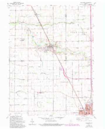
10 topographic sheets cover this place, the earliest surveyed in 1953 and the latest in 1985. It stands in Jackson Township. It lies in ZIP code area 46994. The Survey maps it on the Galveston quadrangle. It stands 781 feet above sea level.
Topographic sheets covering this place
5 surveys from 10 printed sheetsMatched by testing this settlement's coordinate against the published boundary of every sheet in the United States Geological Survey's historical collection. Each opens the scanned sheet at the Survey.
- 1953 USGS Danville quadrangle1:250000, 3 printings
- 1955 USGS Danville quadrangle1:250000
- 1956 USGS Danville quadrangle1:250000
- 1959 USGS Galveston quadrangle1:24000, 3 printings
- 1985 USGS Logansport quadrangle1:100000, 2 printings



In the county-history sources
1,143 words on this townshipHistory of Cass County, Indiana, published 1878 names this settlement in its chapter on Jackson Township. These are the passages that mention it, exactly as the scans read.
is situated in the north-central part, and was laid out by Theodore Lincoln, about the year 1855. It contains at present the following business houses: Howard Shanks, general merchant; Bell & Sou, saw¬ mill ; William Tracy, cooper shop ; J. H. Doyle, miller; Dr. Lester, physician and surgeon; Albert Rhea, blacksmith; on church - Methodist; one school house and a post office, H. Shanks, Postmaster. The town is a station on the line of the P., C. & St. L. Railroad.
Passage source: History of Cass County, Indiana, published 1878.
Machine-read from a century-old scan, so expect the errors a machine makes: misspelled names, dropped words, stray characters.
Mines and quarries near this place
1 within 5 milesRegional context, not property-specific evidence. The federal mineral resources record lists 1 working within 5 miles of Lincoln: 1 past producer. None of them still produces. What was taken out: Sand and Gravel, Construction. Distance is straight-line from the map coordinates, so a quarry counted here may appear on a neighbouring settlement's page as well.
| Where | Site | Commodity | Status | Recorded |
|---|---|---|---|---|
| Orr Gravel | Sand and Gravel, Construction | Past Producer |
Storms near this place
4 since 2010Regional context, not property-specific evidence. The National Weather Service names Lincoln in 4 storm reports between 2010 and 2025: 2 thunderstorm wind, 1 tornado, 1 funnel cloud. The reports record 1 injury. Each account below is quoted exactly as the forecast office filed it, from the NOAA Storm Events Database, and each date opens the federal record of that event.
| When | Event | Place named | Harm | What the report says |
|---|---|---|---|---|
| June 2010 | Tornado (EF2) | Lincoln | 1 hurt, $125,000 | After a brief break, the supercell produced one more circulation which touched down just west of the Cass/Miami county line along South County Road 1000 East. Several yards in the area had trees uprooted and limbs down (DI: TH, DOD: 4). A few residences were impacted by the trees, causing mainly roof or window damage. The circulation then went into a dense grove of trees with the circulation briefly weakening before coming back out near the Grissom Air Reserve Base. A 200 foot section of security fence on the southwest corner of the base was blown down into the adjacent roadway and portions of the nearby field before crossing into Miami County. An Automated Weather Observation System recorded a 114 mph wind gust as the circulation passed through. |
| May 2025 | Thunderstorm Wind | Lincoln | $10,000 | Large tree and power line down on the 6000 block of CR E 90 S. |
| May 2022 | Thunderstorm Wind | Lincoln | - | Local media related a wind gust of 62 mph from a private weather station. |
| June 2021 | Funnel Cloud | Lincoln | - | Received a video of a rotating wall cloud and possible funnel cloud. |
Nearest settlements
The eight closest, with where each one stands in the county. Distances are straight-line, computed from the Geographic Names Information System coordinates.
| Map | Place | Distance | Sheets |
|---|---|---|---|
| Galveston | 2.7 miles | 10 | |
| Walton | 3.6 miles | 12 | |
| Onward | 5.5 miles | 12 | |
| Deacon | 5.8 miles | 11 | |
| Poundstone Corner | 6.7 miles | 11 | |
| Young America | 7.9 miles | 9 | |
| Anoka | 8.3 miles | 11 | |
| Lewisburg | 9.1 miles | 12 |
Elsewhere
Matched on this settlement's Geographic Names Information System number rather than its name, so it cannot be a different place of the same name in another state.
| Wikipedia article on Lincoln | An encyclopaedic summary. Its text is share-alike, so it is linked here rather than copied. |
| Wikidata item Q6550383 | The structured record the population and elevation above come from. Public domain (CC0). |
Provenance
This settlement is recorded in the Geographic Names Information System as feature 437904. The sheet list is computed by point-in-boundary test against the United States Geological Survey's historical topographic inventory. Both are works of the United States government and carry no copyright under 17 U.S.C. 105.
Mines and quarries. USGS Mineral Resources Data System (MRDS) https://mrdata.usgs.gov/mrds/ A work of the United States government, no copyright under 17 U.S.C. 105.
Storms. NOAA National Centers for Environmental Information, Storm Events Database https://www.ncei.noaa.gov/stormevents/ A work of the United States government, no copyright under 17 U.S.C. 105. Narratives are quoted verbatim from the National Weather Service report and are not edited or summarised.