 Block
Martinsburg, Indiana
14 topographic sheets cover this place, the earliest surveyed in 1950 and the latest in 1994. It stands in Jackson Township. It lies in ZIP code area 47165. The Survey maps it on the Palmyra quadrangle. It stands 820 feet above sea level.
Topographic sheets covering this place
7 surveys from 14 printed sheetsMatched by testing this settlement's coordinate against the published boundary of every sheet in the United States Geological Survey's historical collection. Each opens the scanned sheet at the Survey.
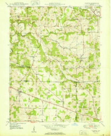
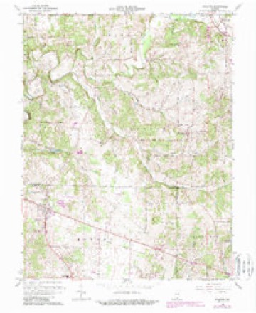
- 1950 USGS Palmyra quadrangle1:24000, 2 printings
- 1956 USGS Vincennes quadrangle1:250000, 4 printings
- 1957 USGS Vincennes quadrangle1:250000
- 1958 USGS Vincennes quadrangle1:250000, 2 printings
- 1966 USGS Palmyra quadrangle1:24000, 3 printings
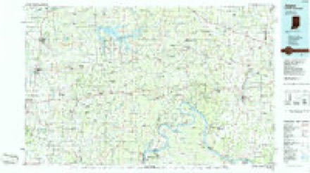
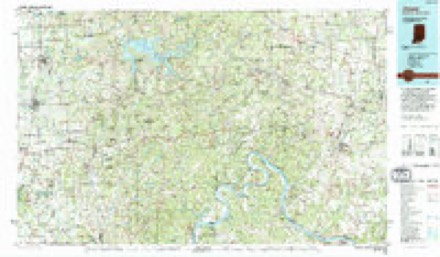
- 1986 USGS Jasper quadrangle1:100000
- 1994 USGS Jasper quadrangle1:100000



In the county-history sources
3,181 words on this townshipCentennial History of Washington County, Indiana : Its People, Industies and Institutions : with Biographical Sketches of Representative Citizens and Genealogical Records of Many of the Old Families, published 1916 names this settlement in its chapter on Jackson Township. These are the passages that mention it, exactly as the scans read.
There are a number of caves in the township, the Redfleld cave in the western jiart of the township, in section 7, being the largest. It has never been explored very far, owing to the immense volume of water that constantly flows from it. A cave on the farm of WilHam Marshall, two miles south of Martinsburg, connects Washington and Floyd counties by tunnel. It can be traversed its' entire length, which is about a quarter of a mile. There are other small caves in the township, and owing to the fact that there are numerous sink holes scattered everywhere, this township may awaken some time to find itself situated over one of the wonders of the world.
Passage source: Centennial History of Washington County, Indiana : Its People, Industies and Institutions : with Biographical Sketches of Representative Citizens and Genealogical Records of Many of the Old Families, published 1916.
In 1807 Henry Wyman, a hardy German, came with his family from North Carolina and settled in section 4, of what is now Jackson township. It was an ideal place for a settler, being near Blue river, at the mouth of Dutch creek. The land was rich, and fish and game abundant. No Indian savages were there to molest him ; and so, being pleased with his new-found home, Henry Wym.an lived and prospered. In the year following, 1808, Leonard Karnes, also a North Carolinian, came and settled in section 2, near the present town of Martinsburg. In the same year F.phraim Goss settled in section i; Charles and Samuel Busey in section 10; John Green in section 12, and Aaron Wilcox in section 14. Daniel Bush came about 1810 and settled in section 2. In 1814 John, Lewis, and James Martin, all brothers, came from Kentucky and settled in what is now the vicinitv of Martinsburg. Steven Elrod came about the same time and settled near Henry Wyman, in section 4.
Passage source: Centennial History of Washington County, Indiana : Its People, Industies and Institutions : with Biographical Sketches of Representative Citizens and Genealogical Records of Many of the Old Families, published 1916.
Probably the first church organization in the township was that of the United Brethren, though the exact date cannot be learned. It was prior to 1820, however, and Rev. John Hiestand, who came from Ohio and was a nei)hevv of Bishop Hiestand, one of the earliest bishops of this denomination, was the moving spirit in the organization. Meetings were held in the residences or barns of the few members until 1854, when a large brick structure was erected just outside the town of Martinsburg. The membership increased until it is now about sixty. In 1887 the brick building was torn down, and the present large frame structure erected on its site. This chiH-ch is in a sound condition and has a powerful influence for good in the community, having a membership at present of sixty-two.
Passage source: Centennial History of Washington County, Indiana : Its People, Industies and Institutions : with Biographical Sketches of Representative Citizens and Genealogical Records of Many of the Old Families, published 1916.
Machine-read from a century-old scan, so expect the errors a machine makes: misspelled names, dropped words, stray characters.
Read the whole chapter on Jackson Township - it names this place 11 more 11 times.
Mines and quarries near this place
2 within 5 milesRegional context, not property-specific evidence. The federal mineral resources record lists 2 workings within 5 miles of Martinsburg: 2 past producers. None of them still produces. What was taken out: Silica. Distance is straight-line from the map coordinates, so a quarry counted here may appear on a neighbouring settlement's page as well.
| Where | Site | Commodity | Status | Recorded |
|---|---|---|---|---|
| Jorris Sand Pit | Silica | Past Producer | ||
| Miller Sand Pit | Silica | Past Producer |
Storms near this place
13 since 2002Regional context, not property-specific evidence. The National Weather Service names Martinsburg in 13 storm reports between 2002 and 2026: 8 thunderstorm wind, 3 hail, 2 heavy rain. No death or injury is recorded in these reports. Each account below is quoted exactly as the forecast office filed it, from the NOAA Storm Events Database, and each date opens the federal record of that event.
| When | Event | Place named | Harm | What the report says |
|---|---|---|---|---|
| March 2017 | Thunderstorm Wind | Martinsburg | $25,000 | The public reported that severe thunderstorm winds damaged a barn. |
| April 2006 | Thunderstorm Wind | Martinsburg | $2,000 | Shingles were blown off a roof. A storm spotter estimate 70 MPH winds. |
| April 2020 | Thunderstorm Wind | Martinsburg | $1,000 | There was damage to a barn and a tree blown down on South Bush Road. The report was relayed by a former NWS employee. |
| April 2026 | Thunderstorm Wind | Martinsburg | - | There were multiple trees down near Dutch Creek Road. |
| December 2025 | Thunderstorm Wind | Martinsburg | - | A tree fell on Martinsburg Road. |
| March 2024 | Thunderstorm Wind | Martinsburg | - | A tree blew down on State Road 335 near Lovell Road. |
| June 2016 | Thunderstorm Wind | Martinsburg | - | A trained spotter estimated winds around 50 knots. |
| April 2014 | Heavy Rain | Martinsburg | - | A spotter measured just over 4 inches of rain within a 40 hour period. |
| June 2010 | Thunderstorm Wind | Martinsburg | - | A trained spotter reported estimated wind gusts of 60 mph. |
| July 2009 | Heavy Rain | Martinsburg | - | A spotter measured 3.59 inches of rain over 3.5 hours. |
| March 2012 | Hail | Martinsburg | - | no account filed |
| June 2006 | Hail | Martinsburg | - | no account filed |
| June 2002 | Hail | Martinsburg | - | no account filed |
Nearest settlements
The eight closest, with where each one stands in the county. Distances are straight-line, computed from the Geographic Names Information System coordinates.
| Map | Place | Distance | Sheets |
|---|---|---|---|
| Old Pekin | 3.9 miles | 14 | |
| New Pekin | 4.2 miles | 15 | |
| Shorts Corner | 5.5 miles | 14 | |
| Daisy Hill | 6.3 miles | 9 | |
| Blue River | 7.5 miles | 9 | |
| Organ Springs | 7.7 miles | 14 | |
| Farabee | 7.8 miles | 15 | |
| Fredericksburg | 8.7 miles | 14 |
Elsewhere
Matched on this settlement's Geographic Names Information System number rather than its name, so it cannot be a different place of the same name in another state.
| Wikipedia article on Martinsburg | An encyclopaedic summary. Its text is share-alike, so it is linked here rather than copied. |
| Wikidata item Q6777215 | The structured record the population and elevation above come from. Public domain (CC0). |
Provenance
This settlement is recorded in the Geographic Names Information System as feature 438682. The sheet list is computed by point-in-boundary test against the United States Geological Survey's historical topographic inventory. Both are works of the United States government and carry no copyright under 17 U.S.C. 105.
Mines and quarries. USGS Mineral Resources Data System (MRDS) https://mrdata.usgs.gov/mrds/ A work of the United States government, no copyright under 17 U.S.C. 105.
Storms. NOAA National Centers for Environmental Information, Storm Events Database https://www.ncei.noaa.gov/stormevents/ A work of the United States government, no copyright under 17 U.S.C. 105. Narratives are quoted verbatim from the National Weather Service report and are not edited or summarised.