 Block
Old Pekin, Indiana
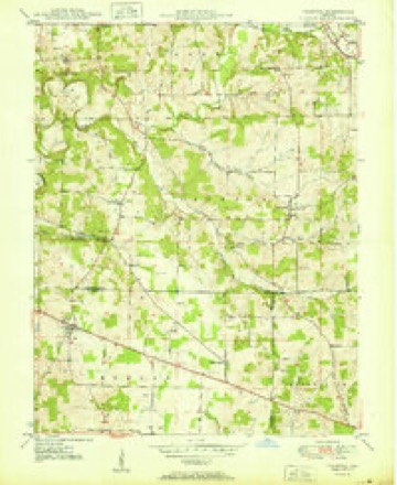
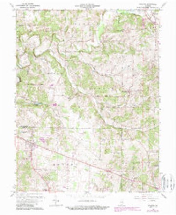
14 topographic sheets cover this place, the earliest surveyed in 1950 and the latest in 1994. It stands in Polk Township. It lies in ZIP code area 47165. The Survey maps it on the Palmyra quadrangle. It stands 735 feet above sea level.
Topographic sheets covering this place
7 surveys from 14 printed sheetsMatched by testing this settlement's coordinate against the published boundary of every sheet in the United States Geological Survey's historical collection. Each opens the scanned sheet at the Survey.
- 1950 USGS Palmyra quadrangle1:24000, 2 printings
- 1956 USGS Vincennes quadrangle1:250000, 4 printings
- 1957 USGS Vincennes quadrangle1:250000
- 1958 USGS Vincennes quadrangle1:250000, 2 printings
- 1966 USGS Palmyra quadrangle1:24000, 3 printings
- 1986 USGS Jasper quadrangle1:100000
- 1994 USGS Jasper quadrangle1:100000



In the county-history sources
1,709 words on this townshipCentennial History of Washington County, Indiana : Its People, Industies and Institutions : with Biographical Sketches of Representative Citizens and Genealogical Records of Many of the Old Families, published 1916 names this settlement in its chapter on Polk Township. These are the passages that mention it, exactly as the scans read.
Pekin was laid out in what is now Pulk township, near the Mutton fork of Blue river, in section 30, November 15, 1831, by Christian Bixler. It was not surveyed until October, 1837, when John I. Morrison laid off one hundred and sixty-seven lots. It was a stopping point for stages where passengers were halted for meals and where horses were exchanged. Among the first merchants weie Gabriel Peavler. D. W. Bierly and J. F. Persise. The latter kept the first ta\ern which he operated until the railroad was finished tn Salem, when he moved to Salem. George M. Johnson kept a store in Old Pekin for quite a while in later years. In an early day large ([uantities of liquor were sold here, two saloons were operated and did a thriving business. When the railroad was built the station was established north of the river on account of its being level land, there being considerable grade in the track at the old town, which gradually went down and by act of the county commissioners in 1854 the town was declared vacant.
Passage source: Centennial History of Washington County, Indiana : Its People, Industies and Institutions : with Biographical Sketches of Representative Citizens and Genealogical Records of Many of the Old Families, published 1916.
Machine-read from a century-old scan, so expect the errors a machine makes: misspelled names, dropped words, stray characters.
Read the whole chapter on Polk Township - it names this place 1 more 1 time.
Mines and quarries near this place
1 within 5 milesRegional context, not property-specific evidence. The federal mineral resources record lists 1 working within 5 miles of Old Pekin: 1 past producer. None of them still produces. What was taken out: Silica. Distance is straight-line from the map coordinates, so a quarry counted here may appear on a neighbouring settlement's page as well.
| Where | Site | Commodity | Status | Recorded |
|---|---|---|---|---|
| Miller Sand Pit | Silica | Past Producer |
Nearest settlements
The eight closest, with where each one stands in the county. Distances are straight-line, computed from the Geographic Names Information System coordinates.
| Map | Place | Distance | Sheets |
|---|---|---|---|
| New Pekin | 0.9 miles | 15 | |
| Daisy Hill | 3.4 miles | 9 | |
| Martinsburg | 3.9 miles | 14 | |
| Blue River | 4.1 miles | 9 | |
| Farabee | 4.2 miles | 15 | |
| Shorts Corner | 5.1 miles | 14 | |
| South Boston | 6.0 miles | 9 | |
| Harristown | 7.0 miles | 15 |
Elsewhere
Matched on this settlement's Geographic Names Information System number rather than its name, so it cannot be a different place of the same name in another state.
| Wikipedia article on Old Pekin | An encyclopaedic summary. Its text is share-alike, so it is linked here rather than copied. |
| Wikidata item Q7084708 | The structured record the population and elevation above come from. Public domain (CC0). |
Provenance
This settlement is recorded in the Geographic Names Information System as feature 449044. The sheet list is computed by point-in-boundary test against the United States Geological Survey's historical topographic inventory. Both are works of the United States government and carry no copyright under 17 U.S.C. 105.
Mines and quarries. USGS Mineral Resources Data System (MRDS) https://mrdata.usgs.gov/mrds/ A work of the United States government, no copyright under 17 U.S.C. 105.