 Block
Maxinkuckee, Indiana
11 topographic sheets cover this place, the earliest surveyed in 1953 and the latest in 1984. It stands in Union Township. It lies in ZIP code area 46511. The Survey maps it on the Culver quadrangle. It stands 791 feet above sea level.
On record in Maxinkuckee
Buildings and businesses the archive holds for this place. Each opens its own page, with the source record it came from.
On the National Register within a mile 2 records
The National Register names another town for these. They stand within one mile of this settlement's coordinate.
 East Shore Historic Districtlisted 1998 · 0.6 miles away
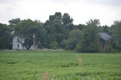 Norris Farm-Maxinkuckee Orchardlisted 2016 · 0.9 miles away
Topographic sheets covering this place
4 surveys from 11 printed sheetsMatched by testing this settlement's coordinate against the published boundary of every sheet in the United States Geological Survey's historical collection. Each opens the scanned sheet at the Survey.
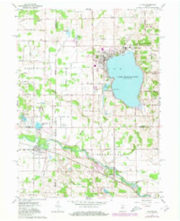
- 1953 USGS Chicago quadrangle1:250000, 5 printings
- 1957 USGS Chicago quadrangle1:250000
- 1962 USGS Culver quadrangle1:24000, 3 printings
- 1984 USGS Knox quadrangle1:100000, 2 printings


In the county-history sources
6,589 words on this townshipHistory of Indiana : Containing a History of Indiana and Biographical Sketches of Governors and Other Leading Men. Also a Statement of the Growth and Prosperity of Marshall County, Together with a Personal and Family Histry of Many of Its Citizens, published 1890 names this settlement in its chapter on Union Township. These are the passages that mention it, exactly as the scans read.
Capt. Edward Morris was born in Union township, Marshall county, Ind., March 7, 1847. His early education embraced the branches taught in the common schools and he early engaged in agricultural pursuits on the farm where he was raised and upon which he still resides. As a tiller of the soil he was quite successful for a number of years. He still owns his place, but of recent years has given his attention largely to constructing row boats and sailing yachts for use upon the lake, upon which he also runs a beautiful steamer, being both captain and proprietor. He was one of the first men to advertise the attraction of Lake Maxinkuckee to the world and has done more than any other man toward making it the most popular summer resort in Indiana. Capt. Morris is a public spirited citizen in all that term implies, and is one of the leading men of Union township. He is a charter member of lodge 231, K. of P., at Marmont, and in his politifcal belief adheres strictly to the republican party.
Passage source: History of Indiana : Containing a History of Indiana and Biographical Sketches of Governors and Other Leading Men. Also a Statement of the Growth and Prosperity of Marshall County, Together with a Personal and Family Histry of Many of Its Citizens, published 1890.
Celestion E. Thornburg, an intelligent young farmer of Union township, son of Harvey and Mary Jane (Rogers) Thornburg, was born in Van Wert county, Ohio, on the 14th day of July, 1863. When ten months of age his parents moved to Marshall county, Ind. He worked on his father's farm in the summer, and attended school in winter, and at the age of eighteen began to teach in the district school. His profession of teaching he continued with flattering success for a number of years. As a teacher, he soon earned the name of a capable, painstaking instructor. In 1886 he located upon a farm, in Union township, since which time his attention has mainly been given to agricultural pursuits. In 1890, he was a candidate for trustee, on the democratic ticket, and was defeated for said office through sectional strife by but one vote. He is also engaged in selling agricultural implements. In 1886, he was united in marriage to Miss Laura B. Grossman, daughter of David L. Grossman, a union blessed with the birth of two children, Harvey D. Thornburg and Gladis Thornburg. Mr. Thornburg is a member of the I. O. O. F., belonging to the Maxinkuckee lodge, No. t^-jT)' ^^'^ Plymouth encampment. No. 113.
Passage source: History of Indiana : Containing a History of Indiana and Biographical Sketches of Governors and Other Leading Men. Also a Statement of the Growth and Prosperity of Marshall County, Together with a Personal and Family Histry of Many of Its Citizens, published 1890.
L. T. Vanschoiack, for whom this sketch is prepared, is a native of Fleming county, Ky., born on the waters of Mill Creek, December 18, 181 2, the son of Reuben and Frances (Allen) Van- schoiack, both natives of the same state. His paternal grandfather, John S. Vanschoiack, was a native of Pennsylvania, and an early settler of Maryland, from which state he emigrated many years ago, to Kentucky, settling in Mason county. He was a soldier in the revolutionary war, and died in Kentucky many years ago. The subject's maternal grandfather was Robert Allen, amemberof oneof the prominent families of Kentucky, and at one tune a very wealthy planter and slave holder. After their marriage, Reuben and Frances X'anschoiack lived for some time in Kentucky, and the father afterward started to California, but died upon the plains before reaching his destination. His widow died in her native state, in 1850. Their family consisted of six children, three of whom are still living, viz.: Louisa, wife of William Grover; L. T., and Elizabeth, wife of James Campbell. The early life of our subject was marked by no event of particular interest, until the year 1833, when he left the familiar haunts of his childhood, and removed to the state of Indiana. He located in Wayne county, and in 1845 removed to the state of Illinois. After a residence of five years in that state he returned to Wayne county, Ind., and was there engaged in agricultural pursuits until 1S63. He came to Marshall county in that year, and purchased the farm upon which he now resides. In his early life he enjoyed but few educational advantages, yet he possessed a keen desire for knowledge, and availed himself of every opportunity for gratifying that desire. By a diligent course of study he prepared himself for the vocation of teaching, and taught school during the winter seasons. He was always provident, and made it a rule to save a portion of his income, however small it might be. Thus, as years rolled on, he found his fortune growing very surely, if very slowly, and as it increased he wisely invested his means in land, establishing his prosperity upon a sure foundation. Throughout his life he has made it a practice to operate within the bounds of legitimate business, and to avoid all speculations or enterprises of uncertain nature. His farm, which is situated on the banks of the beautiful Maxinkuckee lake, is one of the finest in Union township, and all its various departments bear evidence of cultivation by a skilled hand. It has been the aim of its owner to conduct his farm in such a manner as to merit the title, " a good farmer," and this ambition has stimulated him to the exclusion of all desire for notoriety through the channels of public office, though having filled the offices of justice and township trustee. He is a plain farmer, yet to those who know him he is an honorable man, upright in all his dealings with the world, and liberal in the support of public enterprises and religious and educational institutions. In his political faith he affiliates with the democratic party, and in religion is a member of the Christian church of Maxinkuckee, in which he holds the office of elder. March 27, 1838, he was married in Wayne county, Ind., to Miss Esther Bulla, to which union twelve children were born, eight now living, viz.: Francis A., Isaac A., Lavina E., Louisa J., William J., Elizabeth R., Elsa B., and Edward P.
Passage source: History of Indiana : Containing a History of Indiana and Biographical Sketches of Governors and Other Leading Men. Also a Statement of the Growth and Prosperity of Marshall County, Together with a Personal and Family Histry of Many of Its Citizens, published 1890.
Machine-read from a century-old scan, so expect the errors a machine makes: misspelled names, dropped words, stray characters.
Read the whole chapter on Union Township - it names this place 2 more 2 times.
Mines and quarries near this place
3 within 5 milesRegional context, not property-specific evidence. The federal mineral resources record lists 3 workings within 5 miles of Maxinkuckee: 2 past producers, 1 producer. 1 still produces. What was taken out: Limestone, General, Sand and Gravel, Construction. Distance is straight-line from the map coordinates, so a quarry counted here may appear on a neighbouring settlement's page as well.
| Where | Site | Commodity | Status | Recorded |
|---|---|---|---|---|
| Burr Oak Sand & Gravel Company | Sand and Gravel, Construction | Producer | ||
| Allen Weaver Marl Pit | Limestone, General | Past Producer | ||
| Eddy Lake Marl Pit | Limestone, General | Past Producer |
Storms near this place
1 since 2008Regional context, not property-specific evidence. The National Weather Service names Maxinkuckee in 1 storm report in 2008: 1 hail. No death or injury is recorded in these reports. Each account below is quoted exactly as the forecast office filed it, from the NOAA Storm Events Database, and each date opens the federal record of that event.
| When | Event | Place named | Harm | What the report says |
|---|---|---|---|---|
| June 2008 | Hail | Maxinkuckee | - | The supercell that produced a swath of hail across Pulaski County rapidly began to weaken and dropped hail the size of nickels into the Culver area before it rapidly dissipated. |
Nearest settlements
The eight closest, with where each one stands in the county. Distances are straight-line, computed from the Geographic Names Information System coordinates.
Elsewhere
Matched on this settlement's Geographic Names Information System number rather than its name, so it cannot be a different place of the same name in another state.
| Wikipedia article on Maxinkuckee | An encyclopaedic summary. Its text is share-alike, so it is linked here rather than copied. |
| Wikidata item Q6796004 | The structured record the population and elevation above come from. Public domain (CC0). |
Provenance
This settlement is recorded in the Geographic Names Information System as feature 438747. The sheet list is computed by point-in-boundary test against the United States Geological Survey's historical topographic inventory. Both are works of the United States government and carry no copyright under 17 U.S.C. 105.
Mines and quarries. USGS Mineral Resources Data System (MRDS) https://mrdata.usgs.gov/mrds/ A work of the United States government, no copyright under 17 U.S.C. 105.
Storms. NOAA National Centers for Environmental Information, Storm Events Database https://www.ncei.noaa.gov/stormevents/ A work of the United States government, no copyright under 17 U.S.C. 105. Narratives are quoted verbatim from the National Weather Service report and are not edited or summarised.