 Block
Williams, Indiana
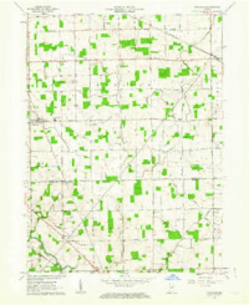
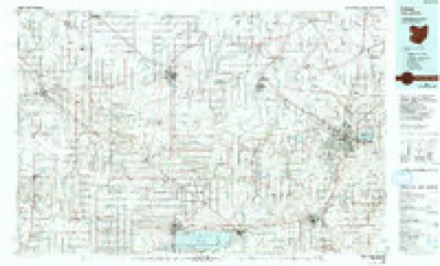
12 topographic sheets cover this place, the earliest surveyed in 1953 and the latest in 1986. It stands in Root Township. It lies in ZIP code area 46733. The Survey maps it on the Hoagland quadrangle.
Topographic sheets covering this place
4 surveys from 12 printed sheetsMatched by testing this settlement's coordinate against the published boundary of every sheet in the United States Geological Survey's historical collection. Each opens the scanned sheet at the Survey.
- 1953 USGS Muncie quadrangle1:250000, 5 printings
- 1956 USGS Muncie quadrangle1:250000
- 1961 USGS Hoagland quadrangle1:24000, 3 printings
- 1986 USGS Lima quadrangle1:100000, 3 printings


In the county-history sources
1,423 words on this townshipSnow's History of Adams County, Indiana, published 1907 names this settlement in its chapter on Root Township. These are the passages that mention it, exactly as the scans read.
Another early church building was erected north of Monmouth in section 17 in 1S65 and is a' frame. This was built by the English Lutherans and named Concord church. Many year? before this building was erected the Gorsline school house was used by this congregation for church purposes. In 1S54 there was a frame church built in Monmouth on inlot No. 17 by the Baptist church organization. Doubtless this was one of the first, if not the first, frame church building erected in the county. In 1870 the United Brethren built a frame church in the northern part of Monmouth near the graveyard. In 1868 the Methodist congregation converted one of the Ziba Dorwin tavern buildings into a church, but this has long since been abandoned. The German Lutheran people in the northern part of the township as early as 1841 built a log church building in section II. This was used for both church and school purposes. In 1851 a large frame church took its place and was used by this congregation until 1879, at which time the only brick church in the township was built. This building is a fine structure, about forty-five by ' seventy-five feet in size, and is known as the Saint Peter's Lutheran church. It is frequently called the "Fuelling church," as it is in the Fuelling neighborhood. This property consists of a church building, school house, parsonage and teacher's dwelling, and a conservative estimate would place the value of this property at about seventeen thousand dollars. Root township has two more towns within its borders. The town of Williams is situated on the north line of the county, nine miles west of the Ohio state line, on the Grand Rapids & Indiana Railroad. It was laid out and the plat recorded on the 7th day of June, 1S72. Its originators were David Crabbs and Benjamin Rice. This town has two streets. Main, which runs east and west, and Adams, a north and south street. It has fifty-four lots and was one of the timber towns that sprang into existence when the heavy forests were being removed and the railroads loaded with lumber for market. The timber interests, as heading factories and saw mills, were removed and the- town ceased to grow or improve. At present there is a postoffice, a general store, a saloon and creamer}'. This town has some good houses, among which is a good district school building.
Passage source: Snow's History of Adams County, Indiana, published 1907.
Machine-read from a century-old scan, so expect the errors a machine makes: misspelled names, dropped words, stray characters.
Mines and quarries near this place
3 within 5 milesRegional context, not property-specific evidence. The federal mineral resources record lists 3 workings within 5 miles of Williams: 3 producers. All of them still produce. What was taken out: Sand and Gravel, Construction, Sand and Gravel, Construction, Stone, Crushed/Broken. Distance is straight-line from the map coordinates, so a quarry counted here may appear on a neighbouring settlement's page as well.
| Where | Site | Commodity | Status | Recorded |
|---|---|---|---|---|
| Stone Street Quarry | Sand and Gravel, Construction, Stone, Crushed/Broken | Producer | ||
| Adams County Sand & Gravel Pit | Sand and Gravel, Construction | Producer | ||
| Cly Gravel Company | Sand and Gravel, Construction | Producer |
Storms near this place
1 since 1998Regional context, not property-specific evidence. The National Weather Service names Williams in 1 storm report in 1998: 1 thunderstorm wind. No death or injury is recorded in these reports. Each account below is quoted exactly as the forecast office filed it, from the NOAA Storm Events Database, and each date opens the federal record of that event.
| When | Event | Place named | Harm | What the report says |
|---|---|---|---|---|
| December 1998 | Thunderstorm Wind | Williams | $10,000 | SEVERAL POWER POLES WERE SNAPPED. |
Nearest settlements
The eight closest, with where each one stands in the county. Distances are straight-line, computed from the Geographic Names Information System coordinates.
Provenance
This settlement is recorded in the Geographic Names Information System as feature 446056. The sheet list is computed by point-in-boundary test against the United States Geological Survey's historical topographic inventory. Both are works of the United States government and carry no copyright under 17 U.S.C. 105.
Mines and quarries. USGS Mineral Resources Data System (MRDS) https://mrdata.usgs.gov/mrds/ A work of the United States government, no copyright under 17 U.S.C. 105.
Storms. NOAA National Centers for Environmental Information, Storm Events Database https://www.ncei.noaa.gov/stormevents/ A work of the United States government, no copyright under 17 U.S.C. 105. Narratives are quoted verbatim from the National Weather Service report and are not edited or summarised.