 Block
Royerton, Indiana
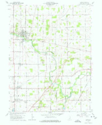
12 topographic sheets cover this place, the earliest surveyed in 1953 and the latest in 1986. It stands in Hamilton Township. It lies in ZIP code area 47303. The Survey maps it on the Eaton quadrangle. It stands 925 feet above sea level.
Topographic sheets covering this place
4 surveys from 12 printed sheetsMatched by testing this settlement's coordinate against the published boundary of every sheet in the United States Geological Survey's historical collection. Each opens the scanned sheet at the Survey.
- 1953 USGS Muncie quadrangle1:250000, 5 printings
- 1956 USGS Muncie quadrangle1:250000
- 1960 USGS Eaton quadrangle1:24000, 3 printings
- 1986 USGS Muncie quadrangle1:100000, 3 printings



In the county-history sources
6,890 words on this townshipA Portrait and Biographical Record of Delaware County, Indiana :, published 1894 names this settlement in its chapter on Hamilton Township. These are the passages that mention it, exactly as the scans read.
George Jonsonbough was born in Wayne county, Ohio, January 25, 1829. When sixteen years of age he began to learn the trade of carpenter and builder, in which he soon acquired great proficiency, and at which he worked for some time in his native state and in Indiana. In 1867 he removed to Royerton, purchased the first lot that was sold in that town, and erected a dwelling thereon, and for some time operated quite successfully a saw mill, which was extensively patronized by the citizens of Royerton and vicinity. He was a man of sterling integrity and was highly respected in the community where he resided. His death occurred on the 24th day of April, 1888, and Union cemetery of Delaware county is his final resting place. Mr. Jonsonbough was married on the 22d day of August, 1857, to Louisa Gline, daughter of Abraham and Massey Cline, natives of Ireland and Virginia respectively. Mrs. Jonsonbough was one of a family of nine children, as follows: Jane, Elizabeth, Jemima, Amanda, Mahlon L. , Eli B , Mary E., Sarah J. and Louisa. The mother of the above children died September 14, 1855, and Mr. Cline afterward married Hannah Hatfield, to which union three children were born: Marth A., Emmery and Flora. The father and mother of these children died August 30, 1 866, and October 30, 1892, respectively. To the marriage of Mr. and Mrs. Jonsonbough were born seven children: Sarah A., April 7, 1859, wife of Eli Studebaker; Elmer E., January 9, 1862; Ira A., January 7, 1865; Henry K., June 20, 1870; Leotis, March 31, 1875; James and Maggie, deceased.
Passage source: A Portrait and Biographical Record of Delaware County, Indiana :, published 1894.
Robert W. Stradling was but five years old when his father died, and with the exception of three years spent with his grandfather in Muncie, passed his life upon the farm. He was married February 16, 1877, to Mary E. Weir, daughter of Even and Louisa (Williamson) Weir, the father, a native of Pennsylvania, of Irish descent, and the mother of Ohio, where s-he was born of German parentage. After marriage Mr. Stradling located about three miles from the village of Royerton on a farm of eightyfive acres, and in 1879 removed to his present place, about one quarter of a mile of Royer- I ton, where he owns a valuable farm of 180 I acres, upon which there is some of the best I improvements in the township. Mr. Stradling is one of the progressive men of Delaware county, a representative farmer, and a man whom his neighbors and friends all unite in praising. Politically he is a republican, and while not a member of any church, gives cheerfully to aid all religious movements, and is a liberal friend of everything that has a tendency to advance the moral well being of the community. Like his father. Mr. Stradling posess- I es excellent business qualifications, and by I careful management and wise foresight has i succeeded in accumulating a goodly portion of this world's goods. Mrs. Stradling is a member of the United Brethren church, and has been a very valuable helpmeet to her husband during
Passage source: A Portrait and Biographical Record of Delaware County, Indiana :, published 1894.
Machine-read from a century-old scan, so expect the errors a machine makes: misspelled names, dropped words, stray characters.
Mines and quarries near this place
7 within 5 milesRegional context, not property-specific evidence. The federal mineral resources record lists 7 workings within 5 miles of Royerton: 5 producers, 2 past producers. 5 still produce. What was taken out: Sand and Gravel, Construction, Stone, Stone, Crushed/Broken. Distance is straight-line from the map coordinates, so a quarry counted here may appear on a neighbouring settlement's page as well.
| Where | Site | Commodity | Status | Recorded |
|---|---|---|---|---|
| Delaware County Highway Dept. | Stone | Producer | ||
| Eaton Quarry | Stone, Crushed/Broken | Past Producer | ||
| Irving Bros. Stone & Gravel Pit | Sand and Gravel, Construction | Producer | ||
| J and K Gravel Pit | Sand and Gravel, Construction | Past Producer | ||
| Muncie Pit and Mill | Sand and Gravel, Construction | Producer | ||
| Shick Sand & Gravel Pit | Sand and Gravel, Construction | Producer | ||
| Shirey Road Gravel Pit | Sand and Gravel, Construction | Producer |
Storms near this place
4 since 2012Regional context, not property-specific evidence. The National Weather Service names Royerton in 4 storm reports between 2012 and 2025: 2 thunderstorm wind, 1 flash flood, 1 hail. No death or injury is recorded in these reports. Each account below is quoted exactly as the forecast office filed it, from the NOAA Storm Events Database, and each date opens the federal record of that event.
| When | Event | Place named | Harm | What the report says |
|---|---|---|---|---|
| June 2025 | Thunderstorm Wind | Royerton | $10,000 | Thunderstorm wind gusts downed power lines and tree branches around 3 to 3.5 inches in diameter along with various other debris. |
| June 2012 | Thunderstorm Wind | Royerton | $10,000 | Trees, tree limbs, and power lines were downed near the intersection of State Highways 28 and 3. |
| July 2019 | Flash Flood | Royerton | $2,000 | Williamson Road between 500 North and State Road 28 is closed due to high water across the road from heavy thunderstorm rainfall. It was reported to be a few feet deep. |
| March 2024 | Hail | Royerton | - | no account filed |
Nearest settlements
The eight closest, with where each one stands in the county. Distances are straight-line, computed from the Geographic Names Information System coordinates.
Elsewhere
Matched on this settlement's Geographic Names Information System number rather than its name, so it cannot be a different place of the same name in another state.
| Wikipedia article on Royerton | An encyclopaedic summary. Its text is share-alike, so it is linked here rather than copied. |
| Wikidata item Q7375225 | The structured record the population and elevation above come from. Public domain (CC0). |
Provenance
This settlement is recorded in the Geographic Names Information System as feature 442377. The sheet list is computed by point-in-boundary test against the United States Geological Survey's historical topographic inventory. Both are works of the United States government and carry no copyright under 17 U.S.C. 105.
Mines and quarries. USGS Mineral Resources Data System (MRDS) https://mrdata.usgs.gov/mrds/ A work of the United States government, no copyright under 17 U.S.C. 105.
Storms. NOAA National Centers for Environmental Information, Storm Events Database https://www.ncei.noaa.gov/stormevents/ A work of the United States government, no copyright under 17 U.S.C. 105. Narratives are quoted verbatim from the National Weather Service report and are not edited or summarised.