 Block
Granville, Indiana
12 topographic sheets cover this place, the earliest surveyed in 1953 and the latest in 1986. It stands in Niles Township. It lies in ZIP code area 47338. The Survey maps it on the Eaton quadrangle. It stands 896 feet above sea level.
Topographic sheets covering this place
4 surveys from 12 printed sheetsMatched by testing this settlement's coordinate against the published boundary of every sheet in the United States Geological Survey's historical collection. Each opens the scanned sheet at the Survey.
- 1953 USGS Muncie quadrangle1:250000, 5 printings
- 1956 USGS Muncie quadrangle1:250000
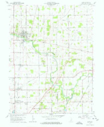
- 1960 USGS Eaton quadrangle1:24000, 3 printings
- 1986 USGS Muncie quadrangle1:100000, 3 printings



In the county-history sources
19,808 words on this townshipHistory of Delaware County, Indiana : with Illustrations and Biographical Sketches of Some of Its Prominent Men and Pioneers, published 1881 names this settlement in its chapter on Niles Township. These are the passages that mention it, exactly as the scans read.
Half-Way Creek is a small stream in the eastern part of the township, its entire length being scarcely more than four miles. Flowing south, it discharges into the Mississinewa at a point near the southern extremity of the village of Albany, in Delaware Township.
Passage source: History of Delaware County, Indiana : with Illustrations and Biographical Sketches of Some of Its Prominent Men and Pioneers, published 1881.
As to who was the first permanent settler in this township there is no positive evidence. It is stated that, as early as the year 1828, a man by the name of Hessenflow came and erected a cabin on the east bank of the Mississinewa, near Granville. He is the first settler of whom there is any account, and it is not improbable that he was one of the class who held their claims by the right of pre-emption, for his name does not appear in any of the early records as a purchaser of land. Some one perhaps entered the land upon which he located and dispossessed him. |
Passage source: History of Delaware County, Indiana : with Illustrations and Biographical Sketches of Some of Its Prominent Men and Pioneers, published 1881.
The real tide of immigration did nor set in until about the year 1833, although there were some who settled in the township prior to that time. Among these were Peter Thomas, Samuel Kyle, William Battreall and Samuel Gregory, who, with their families, settled near Granville in 1830 and 1831. | township. An accurate list of settlers who purchased land from 1831 until 1839 is furnished by the tract-book and the names are here reproduced. The various sections of the township were purchased by the
Passage source: History of Delaware County, Indiana : with Illustrations and Biographical Sketches of Some of Its Prominent Men and Pioneers, published 1881.
Machine-read from a century-old scan, so expect the errors a machine makes: misspelled names, dropped words, stray characters.
Read the whole chapter on Niles Township - it names this place 12 more 12 times.
Mines and quarries near this place
4 within 5 milesRegional context, not property-specific evidence. The federal mineral resources record lists 4 workings within 5 miles of Granville: 2 producers, 2 past producers. 2 still produce. What was taken out: Sand and Gravel, Construction, Stone, Crushed/Broken. Distance is straight-line from the map coordinates, so a quarry counted here may appear on a neighbouring settlement's page as well.
| Where | Site | Commodity | Status | Recorded |
|---|---|---|---|---|
| Eaton Quarry | Stone, Crushed/Broken | Past Producer | ||
| Irving Bros. Stone & Gravel Pit | Sand and Gravel, Construction | Producer | ||
| J and K Limestone Quarry | Stone, Crushed/Broken | Past Producer | ||
| Knotts Sand and Gravel Pit | Sand and Gravel, Construction | Producer |
Storms near this place
1 since 2020Regional context, not property-specific evidence. The National Weather Service names Granville in 1 storm report in 2020: 1 thunderstorm wind. No death or injury is recorded in these reports. Each account below is quoted exactly as the forecast office filed it, from the NOAA Storm Events Database, and each date opens the federal record of that event.
| When | Event | Place named | Harm | What the report says |
|---|---|---|---|---|
| July 2020 | Thunderstorm Wind | Granville | $1,000 | Tree limbs down to thunderstorm wind gusts along Black Cemetery Road between County Road 800N and State Road 67. |
Nearest settlements
The eight closest, with where each one stands in the county. Distances are straight-line, computed from the Geographic Names Information System coordinates.
Elsewhere
Matched on this settlement's Geographic Names Information System number rather than its name, so it cannot be a different place of the same name in another state.
| Wikipedia article on Granville | An encyclopaedic summary. Its text is share-alike, so it is linked here rather than copied. |
| Wikidata item Q5596849 | The structured record the population and elevation above come from. Public domain (CC0). |
Provenance
This settlement is recorded in the Geographic Names Information System as feature 435332. The sheet list is computed by point-in-boundary test against the United States Geological Survey's historical topographic inventory. Both are works of the United States government and carry no copyright under 17 U.S.C. 105.
Mines and quarries. USGS Mineral Resources Data System (MRDS) https://mrdata.usgs.gov/mrds/ A work of the United States government, no copyright under 17 U.S.C. 105.
Storms. NOAA National Centers for Environmental Information, Storm Events Database https://www.ncei.noaa.gov/stormevents/ A work of the United States government, no copyright under 17 U.S.C. 105. Narratives are quoted verbatim from the National Weather Service report and are not edited or summarised.