 Block
Saturn, Indiana
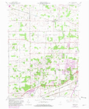
10 topographic sheets cover this place, the earliest surveyed in 1953 and the latest in 1994. It stands in Jefferson Township. It lies in ZIP code area 46725. The Survey maps it on the Arcola quadrangle.
Topographic sheets covering this place
5 surveys from 10 printed sheetsMatched by testing this settlement's coordinate against the published boundary of every sheet in the United States Geological Survey's historical collection. Each opens the scanned sheet at the Survey.
- 1953 USGS Fort Wayne quadrangle1:250000, 4 printings
- 1956 USGS Fort Wayne quadrangle1:250000, 2 printings
- 1961 USGS Arcola quadrangle1:24000, 2 printings
- 1984 USGS Fort Wayne quadrangle1:100000
- 1994 USGS Fort Wayne quadrangle1:100000




What happened here
An account from the chapter on Jefferson township. The inset identifies its exact source book and publication year.
The Barkdall Murder
One of the events that attracted the attention of the people of Whitley county a generation ago was the Barkdall murder, that occurred in Jefferson township in 1871. Henry Barkdall, Sr., was born in Wurtemberg, Germany, October 15, 1805; was married there and in the year 1839. he emigrated to America. He first settled in Stark county, Ohio, three miles east of Canal Fulton, where he remained about ten years as a renter on a small farm.
In the county-history sources
21,244 words on this townshipHistory of Whitley County, Indiana, published 1907 names this settlement in its chapter on Jefferson Township. These are the passages that mention it, exactly as the scans read.
Mr. Jeffries served as postmaster at Saturn for about three years and was followed by James T. Bayless, Eli Hatfield and James Broxon. Mr. Broxon held the office from 1867 until April 20, 1895. when he resigned and Marcus N. Aker was appointed and held the office until rural free delivery was established and the office was abolished November 15, 1900.
Passage source: History of Whitley County, Indiana, published 1907.
In the year 1866. this old house was abandoned for school purposes and the same year a neat frame schoolhouse was erected on "the southeast corner of section 26. one mile south of the Saturn postoffice and one mile east and one and one-half miles north of the old log schoolhouse. William Mc- Laughlin taught the first term of school in the new building and it is said that he named the house the "Fenian Schoolhouse," on account of its being located in an Irish settlement and man)- of the patrons took a deep interest in the "Fenian" movement at that time.
Passage source: History of Whitley County, Indiana, published 1907.
The Christians, or Disciples, desiring to be known only as Churches of Christ, have two prosperous organizations in Jefferson township with good buildings. The first preaching by ministers of this church in the township was by G. B. Mullis, of Logansport, Indiana, on the first Sunday in June, twenty-two members was instituted at the "Red Schoolhouse," in the Broxon neighborhood by William Dowling. The first officers were, elders, Samuel Braden and Tames Broxon ; deacons, William Jeffries and Daniel Swisher. In 1874, the church building in the eastern part of the township was built at a cost of one thousand five hundred dollars. It has since been repaired and is known as the "Saturn Christian Church." Since its organization there have been at least two hundred and thirty members enrolled and at present there is an enrollment of sixty members. Of those who have ministered to the congregation the following is a partial list : George W. Chapman. James Hadsel, William Dowling, Z. W. Shepherd, B. W. Hendryx. Aaron Walker, Charles B. Austin. T. H. McCormack, T. M. Barnau, P. Hasty, O. A. Newton, J. W. Hunt. H. M. Lambert, William Dunkleberger, Daniel Dunkleberger, J. H. Lacv, S. C. Hummel. J. M. Pyle. John W. Hayes, John H. Clark and A. M. Gillespie.
Passage source: History of Whitley County, Indiana, published 1907.
Machine-read from a century-old scan, so expect the errors a machine makes: misspelled names, dropped words, stray characters.
Mines and quarries near this place
2 within 5 milesRegional context, not property-specific evidence. The federal mineral resources record lists 2 workings within 5 miles of Saturn: 2 producers. All of them still produce. What was taken out: Sand and Gravel, Construction. Distance is straight-line from the map coordinates, so a quarry counted here may appear on a neighbouring settlement's page as well.
| Where | Site | Commodity | Status | Recorded |
|---|---|---|---|---|
| Roanoke Pit | Sand and Gravel, Construction | Producer | ||
| Roanoke Pit and Mill | Sand and Gravel, Construction | Producer |
Nearest settlements
The eight closest, with where each one stands in the county. Distances are straight-line, computed from the Geographic Names Information System coordinates.
| Map | Place | Distance | Sheets |
|---|---|---|---|
| Dunfee | 3.7 miles | 10 | |
| Laud | 5.2 miles | 11 | |
| Raber | 5.4 miles | 11 | |
| Coesse | 6.8 miles | 11 | |
| Briggs | 7.0 miles | 11 | |
| Coesse Corners | 7.6 miles | 11 | |
| Peabody | 7.9 miles | 11 | |
| Washington Center | 8.2 miles | 10 |
Provenance
This settlement is recorded in the Geographic Names Information System as feature 446649. The sheet list is computed by point-in-boundary test against the United States Geological Survey's historical topographic inventory. Both are works of the United States government and carry no copyright under 17 U.S.C. 105.
Mines and quarries. USGS Mineral Resources Data System (MRDS) https://mrdata.usgs.gov/mrds/ A work of the United States government, no copyright under 17 U.S.C. 105.