 Block
Hobbs, Indiana
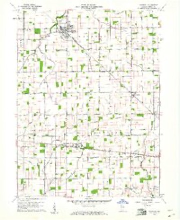
11 topographic sheets cover this place, the earliest surveyed in 1953 and the latest in 1986. It stands in Madison Township. It lies in ZIP code area 46072. The Survey maps it on the Windfall quadrangle. It stands 869 feet above sea level.
Topographic sheets covering this place
4 surveys from 11 printed sheetsMatched by testing this settlement's coordinate against the published boundary of every sheet in the United States Geological Survey's historical collection. Each opens the scanned sheet at the Survey.
- 1953 USGS Muncie quadrangle1:250000, 5 printings
- 1956 USGS Muncie quadrangle1:250000
- 1960 USGS Windfall quadrangle1:24000, 2 printings
- 1986 USGS Muncie quadrangle1:100000, 3 printings



In the county-history sources
2,603 words on this townshipHistory of Tipton County Indiana, published 1914 names this settlement in its chapter on Madison Township. These are the passages that mention it, exactly as the scans read.
The southern division of Madison township was opened up for settle¬ ment about 1830, being at that time included in Hamilton county, while the northern sections formed a part of the Indian reserve and were not placed on the market for a number of years afterward. This necessarily meant that the southern lands were settled first, and indeed in the year 1836 there were not many people living there: James Shaw, Henry Eytchison, Pleasant Allman, and Henry Hobbs. Shaw came from Rush county, and located two miles south of the village of New Lancaster. Eytchison came from North Carolina, and took a claim in section 17. He later moved to Madison county. Allman located in the southeast corner of the township, and was the first there. He came from Marion county. Hobbs was a Virginian, and a man of first quality. He was once a candidate for probate judge. Absalom Hobbs, brother, came a year later and entered a tract of land in section 27. He ran for the office of sheriff in 1846, but was so unfortunate as to belong to the weaker party.
Passage source: History of Tipton County Indiana, published 1914.
In 1837 a Virginian bv the name of Henry Hildebrand came to the township and bought land in the southern part. He afterward practiced medicine. About the same time settlements were made by Reuben Farlow, near the eastern boundary, and William Orr. a nephew, and by Absalom and Henry Hobbs in the southwest corner. Philip Letzinger came, in 1838, and was joined the same year by Mitchell and William Goings and Joseph A.
Passage source: History of Tipton County Indiana, published 1914.
Agriculture in the township is a highly developed art. In describing the condition, one might duplicate the words used in the review of the other townships. Time-saving equipment has been invented, and scientific methods of cultivation have been discovered, and of all of these the ag¬ riculturist has taken advantage. The broad, well-kept fields, the palatial farm residences, the orderly buildings are a source of great delight to the visi¬ tor. There are many beautiful spots in this township, among them Carr's Grove, near the town of Hobbs, which is used for picnics from Elwood, Tipton and other places.
Passage source: History of Tipton County Indiana, published 1914.
Machine-read from a century-old scan, so expect the errors a machine makes: misspelled names, dropped words, stray characters.
Read the whole chapter on Madison Township - it names this place 2 more 2 times.
Mines and quarries near this place
2 within 5 milesRegional context, not property-specific evidence. The federal mineral resources record lists 2 workings within 5 miles of Hobbs: 2 producers. All of them still produce. What was taken out: Stone, Stone, Crushed/Broken. Distance is straight-line from the map coordinates, so a quarry counted here may appear on a neighbouring settlement's page as well.
| Where | Site | Commodity | Status | Recorded |
|---|---|---|---|---|
| Muncie Plant | Stone, Crushed/Broken | Producer | ||
| Tipton Co. Hwy. Dept. | Stone | Producer |
Storms near this place
6 since 2000Regional context, not property-specific evidence. The National Weather Service names Hobbs in 6 storm reports between 2000 and 2017: 4 thunderstorm wind, 2 hail. No death or injury is recorded in these reports. Each account below is quoted exactly as the forecast office filed it, from the NOAA Storm Events Database, and each date opens the federal record of that event.
| When | Event | Place named | Harm | What the report says |
|---|---|---|---|---|
| April 2011 | Thunderstorm Wind | Hobbs | $5,000 | A roof was damaged in this location due to damaging thunderstorm wind gusts. |
| May 2013 | Thunderstorm Wind | Hobbs | $1,000 | A tree was reported down at the intersection of County Roads 100 North and 200 East due to damaging thunderstorm wind gusts. Winds were estimated at 65 mph. |
| April 2017 | Thunderstorm Wind | Hobbs | - | An estimated 60 mph thunderstorm wind gust was observed in this location. |
| November 2013 | Thunderstorm Wind | Hobbs | - | An estimated 60 mph thunderstorm wind gust was observed near the intersection of State Routes 213 and 28. |
| May 2000 | Hail | Hobbs | - | no account filed |
| May 2000 | Hail | Hobbs | - | no account filed |
Nearest settlements
The eight closest, with where each one stands in the county. Distances are straight-line, computed from the Geographic Names Information System coordinates.
| Map | Place | Distance | Sheets |
|---|---|---|---|
| Curtisville | 3.5 miles | 11 | |
| New Lancaster | 4.1 miles | 11 | |
| West Elwood | 4.6 miles | 11 | |
| Tipton | 5.0 miles | 9 | |
| Windfall | 5.5 miles | 11 | |
| Jacksons | 6.8 miles | 9 | |
| Nevada | 8.3 miles | 10 | |
| Sharpsville | 10.0 miles | 10 |
Elsewhere
Matched on this settlement's Geographic Names Information System number rather than its name, so it cannot be a different place of the same name in another state.
| Wikipedia article on Hobbs | An encyclopaedic summary. Its text is share-alike, so it is linked here rather than copied. |
| Wikidata item Q14688428 | The structured record the population and elevation above come from. Public domain (CC0). |
Provenance
This settlement is recorded in the Geographic Names Information System as feature 436258. The sheet list is computed by point-in-boundary test against the United States Geological Survey's historical topographic inventory. Both are works of the United States government and carry no copyright under 17 U.S.C. 105.
Mines and quarries. USGS Mineral Resources Data System (MRDS) https://mrdata.usgs.gov/mrds/ A work of the United States government, no copyright under 17 U.S.C. 105.
Storms. NOAA National Centers for Environmental Information, Storm Events Database https://www.ncei.noaa.gov/stormevents/ A work of the United States government, no copyright under 17 U.S.C. 105. Narratives are quoted verbatim from the National Weather Service report and are not edited or summarised.