 Block
Herndon, Kansas
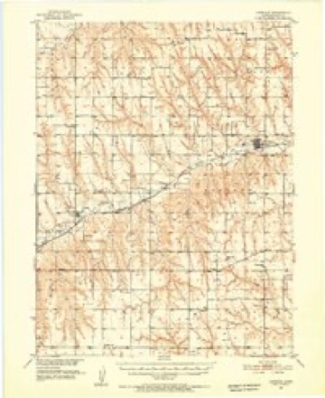
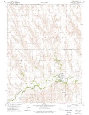
8 topographic sheets cover this place, the earliest surveyed in 1951 and the latest in 1985. It stands in Herl Township. It lies in ZIP code area 67739. The Survey maps it on the Herndon quadrangle. 119 people lived here at the 2020 count. It stands 2,671 feet above sea level.
Population over time
2 figuresHerndon fell from 129 to 119 between 2010 and 2020. These are the recorded population figures Wikidata holds for this place, reached through the Geographic Names Information System number this page is keyed on rather than by name, so they belong to this place and not to another of the same name. Most are census counts, but not all are: an early figure may be a founding or settlement estimate, and an estimate published within five years of a census is left out. The change column is computed, and is left blank where more than 20 years separate a figure from the one before it, because a gap that long is not a change between two counts.
| Year | People | Change |
|---|---|---|
| 2010 | 129 | |
| 2020 | 119 | -10 (-8%) |
Topographic sheets covering this place
6 surveys from 8 printed sheetsMatched by testing this settlement's coordinate against the published boundary of every sheet in the United States Geological Survey's historical collection. Each opens the scanned sheet at the Survey.
- 1951 USGS Herndon quadrangle1:62500
- 1954 USGS Goodland quadrangle1:250000
- 1956 USGS Goodland quadrangle1:250000
- 1957 USGS Goodland quadrangle1:250000, 2 printings
- 1978 USGS Herndon quadrangle1:24000
- 1985 USGS Oberlin quadrangle1:100000, 2 printings



Storms near this place
60 of 108 shownRegional context, not property-specific evidence. The National Weather Service names Herndon in 108 storm reports between 1995 and 2025: 62 hail, 29 thunderstorm wind, 9 flash flood, 7 tornado. No death or injury is recorded in these reports. Each account below is quoted exactly as the forecast office filed it, from the NOAA Storm Events Database, and each date opens the federal record of that event.
| When | Event | Place named | Harm | What the report says |
|---|---|---|---|---|
| April 2007 | Flash Flood | Herndon | $150,000 | Torrential rainfall brought 5-6 inches of precipitation in several hours throughout the eastern half of Rawlins county, resulting in culverts and roads washed out and bridge damage in several locations. Railroad tracks just south of Herndon on Hwy 117 suffered damage, and Ash and Beaver Creeks were reported out of their banks near Herndon. |
| July 2011 | Thunderstorm Wind | Herndon | $50,000 | Strong winds blew the roof off a building and lofted it over a grain bin. Grain bins also suffered roof damage. |
| May 2023 | Flash Flood | Herndon | $20,000 | At 8:35, dispatch reported multiple roads under water in Herndon. Over the following hours, conditions worsened dramatically. The town of Herndon became completely cutoff and surrounded by flood waters. These flash flood waters also put a levee upstream of the town to become at risk of failing, which would have flooded the town. Thankfully, the levee held and was able to be reinforced in the afternoon hours. North of Ludell, at least one country road culvert was completely washed out, making the road impassable. |
| June 2002 | Tornado (F0) | Herndon | $7,500 | Slow moving, weak tornado produced intermittent damage as it traveled north across mostly open fields before moving near the town of Herndon. Several irrigation circles were damaged and numerous trees were down and stripped of bark. |
| May 2023 | Flood | Herndon | $5,000 | In the afternoon of the 26th, the waters had stopped rising, but the town of Herndon was cutoff by all land routes until the late morning of the 27th, when all but one road became traversable. Multiple county roads were also submerged for days later, however on the 30th, flooding conditions subsided and no more roads were reported underwater, although there were many that had been washed out and destoryed. |
| August 1996 | Tornado (F1) | Herndon | $5,000 | no account filed |
| May 2018 | Flash Flood | Herndon | $2,500 | One of the buidings in Herdon has water flowing into it. The water is four inches deep in the building. |
| June 2002 | Thunderstorm Wind | Herndon | $1,500 | Several power poles down. |
| May 2025 | Thunderstorm Wind | Herndon | - | A 34 inch diameter tree trunk was uprooted, along with some 4 and 10 inch diameter limbs. |
| May 2024 | Hail | Herndon | - | West side of Herndon reports up to hail golf ball sized hail. |
| July 2024 | Hail | Herndon | - | Multiple reports of dime to quarter sized hail fell for a duration of ten minutes in Herndon. |
| April 2023 | Hail | Herndon | - | Hail up to pennies in size reported at location. Time is radar estimated. |
| July 2023 | Thunderstorm Wind | Herndon | - | Trained spotter estimated 60 MPH wind gusts on Highway 117 as the gust front moved through. The winds extended north to the state line, and also occurred west toward Atwood. |
| July 2022 | Thunderstorm Wind | Herndon | - | Report received of an estimated 60 mph thunderstorm wind gust at location. Near-zero visibility also reported at location due to blowing dust with the wind gust. |
| July 2022 | Hail | Herndon | - | Dime to penny sized hail observed. |
| June 2022 | Hail | Herndon | - | Multiple reports of hail in the town of Herndon varying in size from a quarter to golf balls. |
| May 2021 | Tornado (EFU) | Herndon | - | Tornado reported by trained spotter in far northeast Rawlins County. Radar used to pinpoint locations since NWS damage survey in area didn't find a distinct track. |
| May 2021 | Hail | Herndon | - | The hailstone measured 2.25 inches in diameter. |
| May 2021 | Tornado (EF1) | Herndon | - | A tornado hit a farmstead northwest of Herndon. At the farmstead, damage consisted of numerous snapped and uprooted trees, several farm structures damaged including torn off metal roofing, broken windows, and even a few metal support beams bent in. Several grain silos were damaged or removed from their foundation. Windows were broken in vehicles. A house suffered damage to shingles, a few broken windows, and a tree falling onto it. The tornado then proceeded north on County Road 27, snapping power lines and damaging a refurbished farmstead schoolhouse. As the tornado moved north, it also damaged some oil storage tanks, spreading the oil to the northeast in a field as it turned. The tornado crossed the field, and a damage path was observed on County Road 29. From there, there was no observable damage so it was determined the tornado ended at this location. |
| July 2020 | Hail | Herndon | - | Estimated time of report from radar. |
| August 2020 | Thunderstorm Wind | Herndon | - | A member of the public reported an estimated 60 mph wind gust associated with the outflow boundary of a thunderstorm cluster moving east across northwest Kansas. |
| June 2020 | Hail | Herndon | - | Quarter size hail reported at location. |
| June 2020 | Thunderstorm Wind | Herndon | - | Fire official reported ongoing 60 mph wind gusts causing blowing dirt and near zero visibility. |
| May 2019 | Hail | Herndon | - | Hail measured from pea to quarter sized. |
| May 2018 | Hail | Herndon | - | The hail ranged from pea to baseball size, with the hail covering the ground. The combination of heavy rain and hail was creating near zero visibility. |
| April 2016 | Thunderstorm Wind | Herndon | - | Measured at a mesonet site 7 WNW of Herndon. |
| June 2016 | Thunderstorm Wind | Herndon | - | The spotter also reported 1.11 inches of rain and small hail. |
| May 2016 | Thunderstorm Wind | Herndon | - | Eight inch diameter tree limbs blown down in Herndon. |
| August 2016 | Flash Flood | Herndon | - | Six inches of water was reported over roads directly west of Herndon. Enough hail covered the ground to make the landscape appear like snow had fallen. The floodwaters caused ditches to be filled with hail. |
| August 2016 | Hail | Herndon | - | The wind driven hail broke windows in the building. |
| November 2015 | Hail | Herndon | - | The ground is covered with pea to nickel size hail. |
| August 2013 | Flash Flood | Herndon | - | Intense rainfall of 2.5 inches in one hour resulted in some roads near Herndon being covered by a foot of water. |
| June 2012 | Thunderstorm Wind | Herndon | - | Estimated 50 TO 60 MPH wind gusts. |
| June 2012 | Hail | Herndon | - | Estimated location of the report. |
| July 2011 | Thunderstorm Wind | Herndon | - | Law enforcement reported peak wind gusts of 60 mph. |
| May 2010 | Hail | Herndon | - | Reported by the local fire department. |
| July 2010 | Thunderstorm Wind | Herndon | - | Spotter located 1/2 mile north and a 1/2 mile west of Herndon estimated peak wind gusts of 60 mph. |
| July 2010 | Thunderstorm Wind | Herndon | - | Fire department spotters estimated peak winds at 60 mph. |
| July 2010 | Hail | Herndon | - | Also 2.30 inches of rain measured in 45 minutes. |
| July 2010 | Flash Flood | Herndon | - | Water reported running over highway 117. |
| May 2010 | Hail | Herndon | - | Two reports of quarter sized hail were received from Herndon. |
| May 2010 | Thunderstorm Wind | Herndon | - | Fire fighters reported wind gusts estimated to 65 mph with areas of tree limb damage in Herndon. |
| May 2007 | Thunderstorm Wind | Herndon | - | Cottonwood tree downed. |
| June 2005 | Flash Flood | Herndon | - | County roads under water between Herndon and Ludell. |
| May 2005 | Thunderstorm Wind | Herndon | - | 5-inch diameter live tree branches snapped. |
| July 2004 | Thunderstorm Wind | Herndon | - | Two to three inch diameter branches down. |
| June 2004 | Thunderstorm Wind | Herndon | - | Eight-inch branch down. Several 4-inch branches down. |
| July 2003 | Thunderstorm Wind | Herndon | - | 1 to 2 inch diameter tree limbs broken off. |
| June 2002 | Tornado (F0) | Herndon | - | Brief touchdown over open field. No known damage. |
| July 2002 | Thunderstorm Wind | Herndon | - | Numerous 4-inch diameter tree limbs down. |
| April 2001 | Thunderstorm Wind | Herndon | - | Fallen trees and several damaged roofs were common from the strong winds. |
| August 1999 | Thunderstorm Wind | Herndon | - | Two inch tree limbs broken by strong winds. |
| September 2025 | Hail | Herndon | - | no account filed |
| July 2024 | Hail | Herndon | - | no account filed |
| April 2022 | Hail | Herndon | - | no account filed |
| May 2021 | Hail | Herndon | - | no account filed |
| May 2021 | Hail | Herndon | - | no account filed |
| May 2021 | Hail | Herndon | - | no account filed |
| May 2021 | Hail | Herndon | - | no account filed |
| June 2020 | Thunderstorm Wind | Herndon | - | no account filed |
Nearest settlements
The eight closest, with where each one stands in the county. Distances are straight-line, computed from the Geographic Names Information System coordinates.
Elsewhere
Matched on this settlement's Geographic Names Information System number rather than its name, so it cannot be a different place of the same name in another state.
| Wikipedia article on Herndon | An encyclopaedic summary. Its text is share-alike, so it is linked here rather than copied. |
| Wikidata item Q1981988 | The structured record the population and elevation above come from. Public domain (CC0). |
Provenance
This settlement is recorded in the Geographic Names Information System as feature 470915. The sheet list is computed by point-in-boundary test against the United States Geological Survey's historical topographic inventory. Both are works of the United States government and carry no copyright under 17 U.S.C. 105.
Storms. NOAA National Centers for Environmental Information, Storm Events Database https://www.ncei.noaa.gov/stormevents/ A work of the United States government, no copyright under 17 U.S.C. 105. Narratives are quoted verbatim from the National Weather Service report and are not edited or summarised.