Block
From the record
134 National Register listings published here, 3 of them National Historic Landmarks.
Sources: the county history on the Internet Archive · the National Register database, National Park Service
90 topographic sheets cover 26 settlements here, and 134 properties are on the National Register of Historic Places.
134 National Register listings published here, 3 of them National Historic Landmarks.
Sources: the county history on the Internet Archive · the National Register database, National Park Service
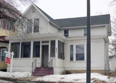
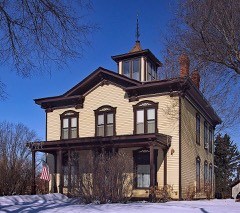
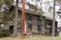
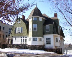
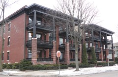
Every property in this county listed on the National Register of Historic Places, with the year it was listed and the federal nomination document.
Every wildfire the federal occurrence database records inside this county: 17 of them, burning about 142 acres. None started naturally and 5 were recorded as arson. Each settlement page carries the fires within five miles of it.
| Reported cause | Fires |
|---|---|
| Missing data/not specified/undetermined | 6 |
| Arson/incendiarism | 5 |
| Equipment and vehicle use | 3 |
| Railroad operations and maintenance | 1 |
| Debris and open burning | 1 |
| Smoking | 1 |
The five largest, by the area the report gives. Three of them were set deliberately.
| Date | Cause | Size | Reported by | Name on the report |
|---|---|---|---|---|
| 23 April 2008 | Debris and open burning | 26 acres | Minnesota Department of Natural Resources | OAK CREST |
| 2 April 2015 | Missing data/not specified/undetermined | 25 acres | Minnesota Valley National Wildlife Refuge | IRONDALE FIRE |
| 6 April 2000 | Arson/incendiarism | 25 acres | Minnesota Department of Natural Resources | not named |
| 23 April 1994 | Arson/incendiarism | 20 acres | Minnesota Department of Natural Resources | not named |
| 7 May 2009 | Equipment and vehicle use | 12 acres | Minnesota Department of Natural Resources | RED ARROW |
| 4 March 2000 | Arson/incendiarism | 9.0 acres | Minnesota Department of Natural Resources | not named |
| 2 April 2015 | Missing data/not specified/undetermined | 7.4 acres | Minnesota Department of Natural Resources | not named |
| 21 April 2005 | Missing data/not specified/undetermined | 7.0 acres | Minnesota Department of Natural Resources | not named |
Every settlement page carries the fires within five miles of it - see the settlement index below.
The NOAA Storm Events Database holds 443 reports for this county, causing 3 deaths, 181 injuries and about $264,404,500 in recorded property damage. Each settlement page carries the reports that name it.
| Kind of event | Reports |
|---|---|
| Hail | 230 |
| Thunderstorm Wind | 172 |
| Flash Flood | 19 |
| Heavy Rain | 9 |
| Tornado | 8 |
| Lightning | 3 |
| Flood | 2 |
The most serious of them, by death, then injury, then recorded damage. The accounts are quoted exactly as the forecast office filed them.
| When | Event | Place named | Harm | What the report says |
|---|---|---|---|---|
| June 1981 | Tornado (F3) | not stated | 1 killed, 60 hurt, $25,000,000 | no account filed |
| September 2007 | Flash Flood | St Paul | 1 killed, $200,000 | Nearly two inches of rain in one hour caused Battle Creek in South Maplewood to rise. Several boys were playing in and along the creek, and a thirteen year old boy was swept below a nearby dam. Some of the heavy rain was funneled into a neighborhood near Hancock and Third, where six houses were flooded. A retaining wall was blown out in the Swede Hollow neighborhood. |
| August 1998 | Lightning | White Bear Lake | 1 killed | One man died because of lightning strike while under a tree. |
| May 1965 | Tornado (F4) | not stated | 108 hurt, $25,000,000 | no account filed |
| April 1984 | Thunderstorm Wind | not stated | 6 hurt | no account filed |
| June 2017 | Thunderstorm Wind | (Stp)St Paul Downtown Airport Holman Field | 2 hurt | The wind gust was reported by the STP ASOS. In addition, two people were trapped when a damaged tree fell on them in St. Paul. The two adults had been standing near the tree after the storm passed through, when the tree collapsed and trapped them. |
| September 2005 | Thunderstorm Wind | Countywide | 1 hurt, $25,000,000 | A severe storm moved out of Anoka County and across northern Ramsey County, from Moundsview and New Brighton to White Bear Lake and North St Paul, knocking down tens of thousands of trees in those cities, as well as in Little Canada, Arden Hills, Maplewood, Vadnais Heights, Roseville, and St. Anthony. An NWS damage survey indicated damage from both the inflow and the rear flank downdraft as the mesocyclone moved through New Brighton. The St. Paul ASOS (Holman Field) measured 62 mph at 1837 CST. Several cities declared a state of emergency. Numerous roads were blocked. One child was injured in New Brighton from a tree limb crashing down. One person died in Moundsview while clearing their property.Many trees toppled onto houses, and one home in New Brighton was rendered uninhabitable. Two houses in Shoreview were damaged to the point of needing to be rebuilt. The roof of a mobile home in Moundsview was blown off. At one point, 90% of New Brighton was without power. The property damage report of $25 Million dollars covers all wind and hail reports from this storm in Ramsey County for 9-21-05. |
| August 2007 | Thunderstorm Wind | Falcon Hgts | 1 hurt | A long and wide swath of damaging wind extended from just west of the Minnesota State Fair grounds in Falcon Heights to the northeastern corner of the city of St Paul. Approximately 4000 trees were felled. Affected neighborhoods were St. Anthony, Como and Phalen. The worst damage was in the Como Park area, where many trees fell on houses, vehicles, sheds and garages. One tree crashed into a house and destroyed it. One man was injured when a window blew in on him. At the State Fair, part of the grandstand roof was torn off, and roofs were also torn off some exhibition buildings. Dozens of vendor booths were blown around, with many severely damaged. The damage was oriented from west to east. At one point shortly after the storm, XCEL Energy reported over 250,000 outages across the Minneapolis-St. Paul region. |
| July 1997 | Flash Flood | St Paul | 1 hurt | no account filed |
| May 1991 | Thunderstorm Wind | not stated | 1 hurt | no account filed |
| August 1988 | Thunderstorm Wind | not stated | 1 hurt | no account filed |
| May 1998 | Tornado (F1) | Roseville | $150,000,000 | Tornado touched down in Roseville, and travelled straight north through Shoreview, North Oaks, Lino Lakes, eventually lifting off in Blaine in Anoka County. 7 houses destroyed, 102 severely damaged. Damaged estimate for entire county including widespread wind driven hail. |
| April 1984 | Tornado (F3) | not stated | $25,000,000 | no account filed |
| September 2010 | Hail | St Paul | $5,000,000 | Several reports of large hail, up to the size of half dollars, occurred from the Highland Park area of St. Paul, northeast across the north side of the city. |
| March 2010 | Flood | St Paul | $2,400,000 | Several communities along the Mississippi River from Mendota Bridge to Hastings had flooding problems related to the flood crest on the Mississippi River in Ramsey County. Monetary costs were based on FEMA, State, and Local assistance which includes the following categories; debris removal, emergency protective measures, road systems and bridges, buildings, utilities and parks. |
| May 2001 | Hail | St Paul | $2,000,000 | Observed at the Univeristy of Minnesota St. Paul campus. Damage estimate pertains to all the hail reports from Ramsey County. Numerous vehicles and buildings damaged. |
| June 2014 | Flood | (Stp)St Paul Downtown Airport Holman Field | $1,900,000 | Several sources in Ramsey County compiled a summary of flood related damages and locations for the flood of June 2014.||Due to the flood waters affecting downtown St. Paul, and covering Harriet Island, the Taste of Minnesota and the 4th of July Fireworks were moved to a different location. In addition, the St. Paul Airport deployed a flood wall, which closed two of their shorter runways.||High water on the Mississippi River had forced the Minnesota Centennial Showboat to postpone a week of shows. |
| August 2022 | Tornado (EF0) | (Stp)St Paul Downtown Airport Holman Field | $750,000 | A tornado touched down just southeast of the intersection of I-94 and Highways 10/61 and moved north-northeast. It tracked just east of Harding High School, crossing White Bear Avenue near Case Avenue, and continuing beyond Larpenteur Avenue, then dissipated near Goodrich Park in Maplewood. The tornado uprooted or broke dozens of trees, with some falling on sheds, houses, and a few vehicles. |
| July 2015 | Tornado (EF0) | Shoreview | $500,000 | A storm survey indicated that an EF-0 tornado touch downed in the northwest portion of North Oaks, near Charley Lake, and moved east-northeast to the southern side of Deep Lake, where the greatest number of trees were toppled and snapped. Some of the trees fell on houses, vehicles and other structures. The tornado had a path length of 1.9 miles with maximum winds of 80 mph. |
| July 2011 | Flash Flood | White Bear Lake | $500,000 | Several main highways, and secondary roads had significant flooding, with up to four feet of standing water in northern Ramsey County. |
| May 2004 | Thunderstorm Wind | St Paul | $330,000 | A wind gust of 72 MPH was recorded by an automated sensor at Holman Field at 6:00 PM CDT. Numerous trees and power lines were downed from St. Anthony Park to the State Fairgrounds to the State Capitol including the southern portion of Como Park and the Midway area. A handful of buildings and signs at the fairgrounds were damaged. Four homes, a large porch, a fence, and a car near Como Park were significantly damaged by felled trees. In downtown about 60 windows were broken on buildings and skyways and a large billboard was downed onto power lines. Two of four clock faces were damaged on top of Landmark Center. The high winds also caused two barges to break loose on the Mississippi River and bump into the Robert Street Bridge. |
| May 2022 | Thunderstorm Wind | Falcon Hgts | $250,000 | Numerous trees were blown down from Falcon Heights to Roseville. Some of the trees were over 100 years old and several areas had power outages due to the falling debris. |
| June 1979 | Tornado (F1) | not stated | $250,000 | no account filed |
| August 2024 | Thunderstorm Wind | Roseville | $100,000 | Time estimated from radar. Delayed report of trees fell on two houses in the neighborhood and one had major damage. Two roads were blocked by fallen trees. |
| November 2012 | Thunderstorm Wind | St Paul | $50,000 | This is a continuation in Ramsey County of the wind damage that hit Mendota Heights and West St. Paul in Dakota County. It tracked northeast across south central St Paul, from Smith and Annapolis to St Paul Holman Field, but damage was more sporadic than when it hit Dakota County. Most of the damage was due to trees landing on cars, houses and sheds. |
| June 2012 | Thunderstorm Wind | St Paul | $50,000 | Numerous large trees and tree limbs were blown down in a large swath from near the Highland Park area, northeast toward Randolph Avenue. In addition, some of the trees landed on vehicles and caused damage. |
| August 2022 | Thunderstorm Wind | Little Canada | $30,000 | Several trees were blown down in the Little Canada area. One landed on a mobile home. |
| July 2016 | Thunderstorm Wind | Lauderdale | $25,000 | Scattered trees were uprooted or blown over, with some landing on vehicles. This was mostly in the Como, Midway and Highland Park areas of St Paul. |
| July 2010 | Thunderstorm Wind | Mounds View | $25,000 | Numerous large tree limbs were blown down from Mounds View, to New Brighton, Shoreview, Arden Hills and Vadnais Heights, Minnesota, including three large trees that fell on a home in Arden Hills and damaged it. A trained spotter measured a wind gust of 70 mph in Vadnais Heights. |
| May 2011 | Tornado (EF0) | Mounds View | $20,000 | An EF-0 tornado continued in Ramsey County, near Spring Lake, then north-northeast as it crossed back into Anoka County, near Highway 10, south of the Blaine-Anoka County Airport. Most of the damage was confined to sporadic trees blown down along the path. |
| July 2009 | Hail | North St Paul | $15,000 | Several locally trained spotters and local officials reported nickel to golf ball size hail stones from Maplewood, near Highway 36 and English Street, southeast across North St Paul. Minor hail damage was noted near the intersection of Century Avenue and Holloway Avenue, along the Ramsey-Washington county line. The hail storm continued into Washington County. |
| July 2010 | Thunderstorm Wind | North St Paul | $5,000 | Several trees were uprooted in North St. Paul, Minnesota. |
| June 2005 | Flash Flood | Countywide | $2,000 | County Road C was impassable due to flooding near the intersection of 35E in Little Canada. An underpass on Highway 36 in Maplewood was also flooded. A spotter near the intersection of Interstate 94 and McKnight Road in Maplewood recorded 0.80 inches of rain in 15 minutes. A spotter in St. Paul recorded 1.25 inches of rain in 30 minutes. |
| August 2022 | Thunderstorm Wind | Vadnais Hgts | $1,500 | Several trees and large tree branches were blown down in the Vadnais Heights area. |
| August 2022 | Thunderstorm Wind | (Stp)St Paul Downtown Airport Holman Field | $500 | Some trees were blown down in the Daytons Bluff area of St. Paul. |
| September 2021 | Thunderstorm Wind | (Stp)St Paul Downtown Airport Holman Field | $500 | A few tree branches were blown down. |
| July 2025 | Thunderstorm Wind | White Bear Lake | - | Two trees down on the north side of White Bear Lake. |
| July 2025 | Thunderstorm Wind | Mounds View | - | Large tree down approximately 18 inches in diameter, near 85th Ave and Spring Lake Road in Mounds View. |
| July 2025 | Heavy Rain | Falcon Hgts | - | A thunderstorm produced very heavy rainfall in 30 minutes nearing 4 p/hour rainfall rates. An area of standing water on Hwy 36 between Snelling Ave and Fairview Ave N caused a few cars to stall. Approximately one mile south, a CoCoRaHS observer recorded 2.11 of storm total rainfall. |
| June 2025 | Thunderstorm Wind | St Paul | - | Report of multiple large branches downed near Maryland and Jackson. |
| September 2025 | Hail | (Stp)St Paul Downtown Airport Holman Field | - | Report of half-inch to Ping Pong Ball sized hail for two minutes. |
| June 2025 | Flash Flood | (Stp)St Paul Downtown Airport Holman Field | - | Car stranded in water on exit ramp of Highway 61. |
| June 2025 | Flash Flood | Falcon Hgts | - | Water covered roadways near the intersection of I35W and MN 280.The DOT blocked off lanes as needed. Heavy rain caused a jack-knifed semi to block travel on I-35W at Industrial Blvd. |
| August 2024 | Thunderstorm Wind | Roseville | - | Delayed report of large tree split in half, time estimated from radar. |
| August 2024 | Thunderstorm Wind | St Paul | - | Wind gust measured via mesonet station. |
| August 2024 | Thunderstorm Wind | North St Paul | - | Delayed report of multiple downed tree branches up to 8 inches in diameter, time estimated from radar. |
| August 2024 | Thunderstorm Wind | St Paul | - | Time estimated from radar. Delayed report of numerous large trees down and blocking roads in the Como Park area. |
| August 2024 | Thunderstorm Wind | St Paul | - | Several trees and large branches were downed at the Minnesota state fairgrounds. |
| August 2024 | Thunderstorm Wind | St Paul | - | Report of large tree down. |
| August 2024 | Thunderstorm Wind | (Stp)St Paul Downtown Airport Holman Field | - | A large branch with a 3 foot diameter was blown down at Harriet Island. |
| July 2024 | Flash Flood | St Paul | - | A MNDOT traffic camera showed the intersection of I-35E and Shepard Rd flooded, with one car stranded in the flood water due to heavy rainfall. Other cars were using the freeway entrance ramp to get around the flooded roadway since the regular traffic lanes were all under water. |
| July 2024 | Thunderstorm Wind | St Paul | - | Large tree snapped near the St. Paul Cathedral. |
| July 2023 | Thunderstorm Wind | White Bear Lake | - | Multiple trees and branches down on the southern side of White Bear Lake. Time estimated from radar. |
| August 2023 | Thunderstorm Wind | (Stp)St Paul Downtown Airport Holman Field | - | A 68 mph wind gust was measured by the ASOS station at the KSTP St. Paul airport. |
| May 2022 | Thunderstorm Wind | Roseville | - | A severe wind gust was measured by a trained spotter. |
| August 2022 | Thunderstorm Wind | Falcon Hgts | - | A measured 61 mph wind gust occurred atop the stage at the Minnesota State Fair Grandstand. |
| May 2022 | Hail | (Stp)St Paul Downtown Airport Holman Field | - | There was a social media picture of golf ball size hail. |
| August 2022 | Thunderstorm Wind | White Bear Lake | - | A boat was damaged on a boat lift. A few large trees were snapped off above the ground. |
| July 2020 | Flash Flood | (Stp)St Paul Downtown Airport Holman Field | - | There were several reports of roads flooded due to rainfall amounts of 1 to 3 inches in a very short period of time. These heavy rainfall rates, combined with the urban area (mostly runoff from the streets), led to several flooded roads and a couple closures. Specifically, White Bear Avenue, Lakewood, and Maryland Streets were flooded at one point with stalled vehicles. |
| September 2019 | Thunderstorm Wind | White Bear Lake | - | Several reports of multiple trees blown down in the White Bear Lake area. |
The Survey's mineral resources record lists 1 working inside this county. It still produces. Each settlement page carries the workings within five miles of it.
| Commodity | Workings |
|---|---|
| Sand and Gravel, Construction | 1 |
The least common of them first, because a county's hundredth gravel pit says nothing its first ten did not.
| Where | Site | Commodity | Status | Recorded |
|---|---|---|---|---|
| Arsenal Sand and Gravel Pit | Sand and Gravel, Construction | Producer |
History of Ramsey County and the City of St. Paul, Including the Explorers and Pioneers of Minnesota devotes a chapter to each township: its boundaries and streams, who settled it and when, the mills, the schools and the churches. All 3 are reproduced here in full. Each row shows the township's own shape and where it lies in the county, drawn from the Census Bureau's boundary. Which settlements belong to which township is computed from that same boundary, not taken from the book.
| Shape and position in the county | Township | Settlements in it | Length | Sections |
|---|---|---|---|---|
| Mounds View City | Mounds View | 5,625 words | 2 | |
| St. Paul City | Highwood, Saint Paul | 13,839 words | 6 | |
| White Bear Township | Bald Eagle, Bellaire, White Bear Beach | 9,601 words | 5 |
Named settlements recorded in the Geographic Names Information System, each with the topographic sheets covering it. Villages, hamlets and abandoned places alike. Each is shown with the nearest named watercourse or landform and the survey quadrangle it falls on.
White Bear township · 55110 · Near Manitou Island · White Bear Lake East quadrangle
21 sheets, 1948 to 1985
St. Paul city · 55119 · On Battle Creek · Saint Paul East quadrangle
28 sheets, 1896 to 1985
White Bear Lake city · 55110 · White Bear Lake West quadrangle
22 sheets, 1902 to 1991
White Bear Lake city · 55110 · Near Manitou Island · White Bear Lake West quadrangle
22 sheets, 1902 to 1991
North St. Paul city · 55109 · White Bear Lake East quadrangle
21 sheets, 1948 to 1985
St. Paul city · 55101 · Near Raspberry Island · Saint Paul East quadrangle
28 sheets, 1896 to 1985
Vadnais Heights city · 55127 · White Bear Lake West quadrangle
22 sheets, 1902 to 1991
White Bear township · 55110 · Near Manitou Island · White Bear Lake East quadrangle
21 sheets, 1948 to 1985
White Bear Lake city · 55110 · Near Manitou Island · White Bear Lake West quadrangle
22 sheets, 1902 to 1991