 Block
Easton, Minnesota
7 topographic sheets cover this place, the earliest surveyed in 1954 and the latest in 1985. It stands in Easton City. It lies in ZIP code area 56025. The Survey maps it on the Easton quadrangle. 177 people lived here at the 2020 count. It stands 1,060 feet above sea level.
Population over time
2 figuresEaston fell from 199 to 177 between 2010 and 2020. These are the recorded population figures Wikidata holds for this place, reached through the Geographic Names Information System number this page is keyed on rather than by name, so they belong to this place and not to another of the same name. Most are census counts, but not all are: an early figure may be a founding or settlement estimate, and an estimate published within five years of a census is left out. The change column is computed, and is left blank where more than 20 years separate a figure from the one before it, because a gap that long is not a change between two counts.
| Year | People | Change |
|---|---|---|
| 2010 | 199 | |
| 2020 | 177 | -22 (-11%) |
Topographic sheets covering this place
5 surveys from 7 printed sheetsMatched by testing this settlement's coordinate against the published boundary of every sheet in the United States Geological Survey's historical collection. Each opens the scanned sheet at the Survey.
- 1954 USGS Mason City quadrangle1:250000, 2 printings
- 1957 USGS Mason City quadrangle1:250000
- 1958 USGS Mason City quadrangle1:250000
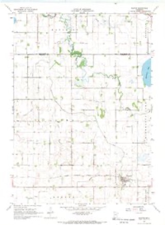
- 1967 USGS Easton quadrangle1:24000
- 1985 USGS Albert Lea quadrangle1:100000, 2 printings




In the county-history sources
2,466 words on this townshipThe History of Faribault County, Minnesota : from Its First Settlement to the Close of the Year 1879 : the Story of the Pioneers, published 1896 names this settlement in its chapter on Easton City. These are the passages that mention it, exactly as the scans read.
About the middle of September the town-site of "Easton" was surveyed and building commenced. This new village - the sixth in the county according to age, was located upon section thirty-six (36), in the town of Lura, on the line of the Southern Minnesota railroad. The early history of this village, will be given further along in this work.
Passage source: The History of Faribault County, Minnesota : from Its First Settlement to the Close of the Year 1879 : the Story of the Pioneers, published 1896.
The Chicago, Milwaukee & St. Paul Railway (formerly the Southern Minnesota) passes through the town of Lura, in the soutliern tier of sections. On the line of this road, on the northeast quarter of the southwest quarter of section thirty-six, is situated the village of Easton, the capital of the town of Lura. The village site was surveyed and staked out in September, 1873, but the plat was not filed for record in the ofiice of the register of deeds of the county until March 14, 1874. The original proprietors of the village were J. C. Easton and Conrad Ruf. At the close of 1873 there were already twelve buildings on the town site. The village was named in honor of Mr. Easton, but it was for some time known as "Lura Station." The name Easton is not an unfamiliar one. There is a fine city of that name in Pennsylvania, which contains a population of about fifteen thousand people. It is to be hoped that at some day, probably in the very distant future, our village of that name may rival that of Pennsylvania, in numbers, wealth and enter- prise. It may not be inappropriate to mention here the fact, that there are, in the United States, sixteen post-offices of the name of Easton.
Passage source: The History of Faribault County, Minnesota : from Its First Settlement to the Close of the Year 1879 : the Story of the Pioneers, published 1896.
Jason C. Easton, after whom the village was named, was for many years the most extensive banker and land owner in this State, and one of its wealthiest citizens. He was born in Lewis county, state of New York, on the twelfth day of May, 1823. He was prepared for college at Lowville Academy, N. Y., and entered Yale in 1847, but owing to failing health, he left during the first year. He subsequently became the editor and publisher of a newspaper, at Lowville, N. Y., for some four years In 1851 he was married to Miss Sarah J. Johnson, of Lewis county, N. Y. They have had one child. Mr. Easton came to Minnesota in 1856, and located at Chatfield, Filmore county, where he has since resided. He engaged, very extensively, for some time, in the grain commission business, and was for some years a director in the Southern Minne.sota Railroad Company. His principal business, however, has been banking and dealing in real estate. He has many farms, and has engaged largely in stock raising, and has some of the best sheep, hogs and cattle in the State. Mr. Easton is, undoubtedly, one of the ablest, most reliable and most successful financiers of the Northwest. The village was incorporated by act of the legislature, approved March 9th, 1874.
Passage source: The History of Faribault County, Minnesota : from Its First Settlement to the Close of the Year 1879 : the Story of the Pioneers, published 1896.
Machine-read from a century-old scan, so expect the errors a machine makes: misspelled names, dropped words, stray characters.
Read the whole chapter on Easton City - it names this place 1 more 1 time.
Fires near this place
1 since 2015Regional context, not property-specific evidence. The federal wildfire occurrence database lists 1 fire within 5 miles of Easton in 2015, burning about 1 acre in total. None started naturally. None was recorded as arson. Distance is straight-line from the map coordinates, so a fire counted here may appear on a neighbouring settlement's page as well.
| Reported cause | Fires |
|---|---|
| Missing data/not specified/undetermined | 1 |
The most recent of them, most recent first, with the day each was reported and the service that recorded it.
| Date | Cause | Size | Reported by | Name on the report |
|---|---|---|---|---|
| 22 April 2015 | Missing data/not specified/undetermined | 1.0 acres | Windom Wetland Management District | MINNESOTA LAKE |
Settlements close enough to share some of these fires:
Mines and quarries near this place
1 within 5 milesRegional context, not property-specific evidence. The federal mineral resources record lists 1 working within 5 miles of Easton: 1 producer. All of them still produce. What was taken out: Sand and Gravel, Construction. Distance is straight-line from the map coordinates, so a quarry counted here may appear on a neighbouring settlement's page as well.
| Where | Site | Commodity | Status | Recorded |
|---|---|---|---|---|
| Sheedy Pit & Mill | Sand and Gravel, Construction | Producer |
Storms near this place
15 since 1995Regional context, not property-specific evidence. The National Weather Service names Easton in 15 storm reports between 1995 and 2025: 6 hail, 4 thunderstorm wind, 3 tornado, 2 heavy rain. No death or injury is recorded in these reports. Each account below is quoted exactly as the forecast office filed it, from the NOAA Storm Events Database, and each date opens the federal record of that event.
| When | Event | Place named | Harm | What the report says |
|---|---|---|---|---|
| September 2018 | Thunderstorm Wind | Easton | $250,000 | A NWS storm survey concluded that a severe downburst caused significant structural damage in the town of Easton. A local church steeple was toppled, plus a few dozen trees were uprooted. Damage was consistent with winds up to 80-85 mph. |
| June 2009 | Tornado (EF0) | Easton | $1,000 | A tree was downed and a garage door damaged from a brief tornado at a farmstead. Rear flank downdraft winds also caused tree damage about 150 yards north-northwest of the tornado. |
| June 2014 | Thunderstorm Wind | Easton | - | A large shed roof was blown off. |
| June 2010 | Tornado (EF0) | Easton | - | Several trees were broken, the roof was partially removed from a large shed, a grain bin was damaged, outbuildings sustained minor damage, and a narrow path was observed in an adjacent corn field. |
| July 2010 | Heavy Rain | Easton | - | An observer measured 3.00 inches of rainfall in three hours. |
| June 2009 | Heavy Rain | Easton | - | Several reports of minor basement flooding occurred around Minnesota Lake the evening of June 21st where locally three to five inches fell. Some minor field flooding was also reported in the area. |
| June 2009 | Thunderstorm Wind | Easton | - | Large branches were broken from several trees due to rear flank downdraft winds. The damage occurred about 150 yards to the north-northwest of a brief tornado. |
| August 2005 | Thunderstorm Wind | Easton | - | Large branches were downed. |
| June 2004 | Tornado (F0) | Easton | - | A tornado touched down near the intersection of 200th Street and 430th Avenue about 4 miles west northwest of Easton. The tornado was estimated to be about 50 yards wide and F0 strength . It traveled east along on the ground for 5 miles until it reached near the intersection of 487th Avenue and 210th Street, about 2 miles north of Easton. Along its rural path, crops and trees were damaged and a shed was downed. |
| June 2001 | Hail | Easton | - | Several home windows broken. |
| August 1995 | Hail | Easton | - | Severe crop damage. |
| April 2025 | Hail | Easton | - | no account filed |
| May 2001 | Hail | Easton | - | no account filed |
| July 2000 | Hail | Easton | - | no account filed |
| July 1995 | Hail | Easton | - | no account filed |
Nearest settlements
The eight closest, with where each one stands in the county. Distances are straight-line, computed from the Geographic Names Information System coordinates.
| Map | Place | Distance | Sheets |
|---|---|---|---|
| Delavan | 6.3 miles | 6 | |
| Minnesota Lake | 6.4 miles | 8 | |
| Brush Creek | 8.8 miles | 8 | |
| Wells | 9.2 miles | 8 | |
| Dell | 9.8 miles | 8 | |
| Baroda | 12.4 miles | 8 | |
| Marna | 12.4 miles | 6 | |
| Frost | 12.5 miles | 8 |
Elsewhere
Matched on this settlement's Geographic Names Information System number rather than its name, so it cannot be a different place of the same name in another state.
| Wikipedia article on Easton | An encyclopaedic summary. Its text is share-alike, so it is linked here rather than copied. |
| Wikidata item Q2231404 | The structured record the population and elevation above come from. Public domain (CC0). |
Provenance
This settlement is recorded in the Geographic Names Information System as feature 643128. The sheet list is computed by point-in-boundary test against the United States Geological Survey's historical topographic inventory. Both are works of the United States government and carry no copyright under 17 U.S.C. 105.
Wildfire. Short, Karen C. 2022. Spatial wildfire occurrence data for the United States, 1992-2020 [FPA_FOD_20221014]. 6th Edition. Fort Collins, CO: Forest Service Research Data Archive. https://doi.org/10.2737/RDS-2013-0009.6 Collected with United States Government funding and usable without additional permissions or fees.
Mines and quarries. USGS Mineral Resources Data System (MRDS) https://mrdata.usgs.gov/mrds/ A work of the United States government, no copyright under 17 U.S.C. 105.
Storms. NOAA National Centers for Environmental Information, Storm Events Database https://www.ncei.noaa.gov/stormevents/ A work of the United States government, no copyright under 17 U.S.C. 105. Narratives are quoted verbatim from the National Weather Service report and are not edited or summarised.