 Block
Wells, Minnesota
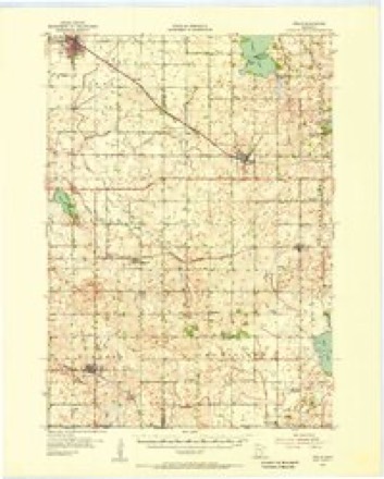
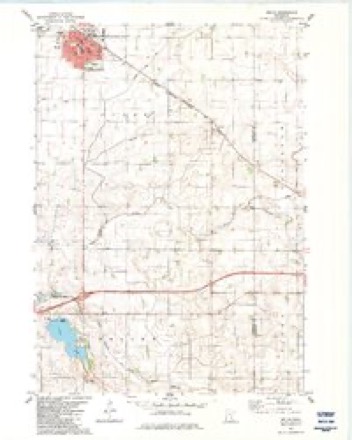
8 topographic sheets cover this place, the earliest surveyed in 1954 and the latest in 1985. It stands in Clark Township. It lies in ZIP code area 56097. The Survey maps it on the Wells quadrangle. 2,410 people lived here at the 2020 count. It stands 1,158 feet above sea level.
On record in Wells
Buildings and businesses the archive holds for this place. Each opens its own page, with the source record it came from.
On the National Register 3 records
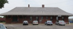 Milwaukee Chicago St. Paul and Pacific Depot and Lunchroomlisted 1980
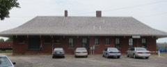 District No. 40 Schoollisted 1980
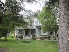 Muret N. Leland Houselisted 1980
Population over time
2 figuresWells grew from 2,343 to 2,410 between 2010 and 2020. These are the recorded population figures Wikidata holds for this place, reached through the Geographic Names Information System number this page is keyed on rather than by name, so they belong to this place and not to another of the same name. Most are census counts, but not all are: an early figure may be a founding or settlement estimate, and an estimate published within five years of a census is left out. The change column is computed, and is left blank where more than 20 years separate a figure from the one before it, because a gap that long is not a change between two counts.
| Year | People | Change |
|---|---|---|
| 2010 | 2,343 | |
| 2020 | 2,410 | +67 (+3%) |
Topographic sheets covering this place
6 surveys from 8 printed sheetsMatched by testing this settlement's coordinate against the published boundary of every sheet in the United States Geological Survey's historical collection. Each opens the scanned sheet at the Survey.
- 1954 USGS Mason City quadrangle1:250000, 2 printings
- 1955 USGS Wells quadrangle1:62500
- 1957 USGS Mason City quadrangle1:250000
- 1958 USGS Mason City quadrangle1:250000
- 1982 USGS Wells quadrangle1:24000
- 1985 USGS Albert Lea quadrangle1:100000, 2 printings




What happened here
An account from the chapter on Clark township. The inset identifies its exact source book and publication year.
In Early Days
"Three soldiers were frozen to death in a blizzard which swept over this part of the country during the winter of 1864, and their bodies were not found until spring. When found one was identified as the body of Mr. Daramas, of Minnesota Lake, and the others as the remains of two comrades named Price, who accompanied him to his home In this county on a furlough.
In the county-history sources
3,827 words on this townshipThe History of Faribault County, Minnesota : from Its First Settlement to the Close of the Year 1879 : the Story of the Pioneers, published 1896 names this settlement in its chapter on Clark Township. These are the passages that mention it, exactly as the scans read.
The soil is black, deep, rich and productive, growing the most nutritious grasses, and is better adapted, perhaps, to grazing, than grain raising, though the amount of grain raised here averages about the same as that in many other towns, according to the acreage cultivated. Should the improbable event ever occur, that the lands in other parts of this county should become arid or worn out. it may reasonably be expected that most of the lands in Clark township will still be productive. Good water is easily obtained by digging or boring, and there are in this town many artesian, or flowing wells, especially in the village of Wells. These flowing wells, or fountains, are obtained in any part of the town, and are very valuable. The water is verj* good. These wells are usually' two inches in diameter, and from 100 to 160 feet in depth. There are some indications from these flowing wells and some of their discharges and other considerations, that the locality embracing a part of this town and perhaps Dunbar, and other adjoining territory, has a subter-
Passage source: The History of Faribault County, Minnesota : from Its First Settlement to the Close of the Year 1879 : the Story of the Pioneers, published 1896.
This town was named Cobb by the special commissioners in 1858, they supposing that the Cobb river ran through the town. This was a mistake however. On September 7th, 1869, the name of the town was changed by the county commissioners to Thompson, but it appearing that there was another town in the state of this name, the commissioners on the twenty-fourth day of March, 1870, gave it the name of Clark. It was named Clark, and previously Thompson, in honor of Clark W. Thompson, the original proprietor of the village site of Wells, and the largest land owner of the town and county.
Passage source: The History of Faribault County, Minnesota : from Its First Settlement to the Close of the Year 1879 : the Story of the Pioneers, published 1896.
For many years there has been a very fine graded school at Wells, in this town, and there are now in the township four substantial school houses. The interest manifested in education, has always been very commendable.
Passage source: The History of Faribault County, Minnesota : from Its First Settlement to the Close of the Year 1879 : the Story of the Pioneers, published 1896.
Machine-read from a century-old scan, so expect the errors a machine makes: misspelled names, dropped words, stray characters.
Read the whole chapter on Clark Township - it names this place 14 more 14 times.
Storms near this place
31 since 1996Regional context, not property-specific evidence. The National Weather Service names Wells in 31 storm reports between 1996 and 2024: 12 thunderstorm wind, 6 hail, 5 flash flood, 3 funnel cloud. No death or injury is recorded in these reports. Each account below is quoted exactly as the forecast office filed it, from the NOAA Storm Events Database, and each date opens the federal record of that event.
| When | Event | Place named | Harm | What the report says |
|---|---|---|---|---|
| May 1996 | Thunderstorm Wind | Wells | $1,500,000 | no account filed |
| June 2013 | Hail | Wells | $100,000 | Baseball size hail caused damage to area roofs in Wells, Minnesota. |
| June 2013 | Hail | Wells | $25,000 | There was damage to roof shingles and siding of houses, with the hail depth of a few inches. |
| June 2013 | Thunderstorm Wind | Wells | $25,000 | A trained spotter, along with video coverage of the storm, had sustained severe winds lasting for 10 minutes or more. In addition to numerous trees blown down or uprooted, a barn north of Wells was destroyed. |
| June 2001 | Thunderstorm Wind | Wells | $20,000 | Barn shifted off foundation. Several trees felled. |
| June 2013 | Hail | Wells | $15,000 | There was damage to trees and broken windshields north of Wells, Minnesota. |
| August 2024 | Tornado (EF0) | Wells | - | The tornado mostly moved across fields, but it did hit one house. A storm chaser took video of the tornado. Satellite imagery showed a path through the crops, enabling a determination of the beginning and end points. |
| August 2024 | Thunderstorm Wind | Wells | - | Several trees and very large branches were taken down in the southeast side of Wells due to a downburst not far from a tornado. |
| August 2024 | Flash Flood | Wells | - | Flooded roadways in the southwest part of Wells due to heavy rain. |
| June 2024 | Heavy Rain | Wells | - | A total of 3 to 5 inches of rain fell from multiple rounds of thunderstorms. CoCoRaHS observers measured 4.62 inches near Minnesota Lake. |
| July 2019 | Thunderstorm Wind | Wells | - | In the city of Wells, several large branches, and a tree were blown down in the city park. |
| September 2016 | Heavy Rain | Wells | - | A local trained weather observer measured 5.15 inches of rainfall near Wells between Wednesday afternoon, September 21st, to the early morning of Thursday, September 22nd. |
| September 2015 | Flash Flood | Wells | - | Several streets were flooded in the town of Wells. |
| June 2014 | Heavy Rain | Wells | - | A measured 12 hour rainfall total of 2.57 inches near Wells. |
| June 2014 | Thunderstorm Wind | Wells | - | Several large tree branches and trees were blown down in Wells. |
| June 2013 | Flash Flood | Wells | - | Several resources including trained spotters, emergency managers and the local media indicated that significant flooding occurred in northeast Faribault County. County Road 109 between Alden (Freeborn County) and Wells (Faribault County) had several areas at which one lane was closed due to water over the roadway. In addition, several farms, fields and flood prone areas had standing water for several hours after 2 to 3 inches of rain fell in a short period of time. |
| June 2013 | Thunderstorm Wind | Wells | - | Scattered trees were blown down near Wells. |
| September 2012 | Thunderstorm Wind | Wells | - | A few trees were blown down in Wells, Minnesota. Power outages also occurred. |
| June 2010 | Tornado (EF0) | Wells | - | Numerous trees were broken, mostly in a cemetery on the west edge of Wells. |
| June 2010 | Thunderstorm Wind | Wells | - | A strong rear flank downdraft accompanied the Wells tornado. The winds knocked down numerous trees, mostly in the south side of the city of Wells. |
| June 2009 | Funnel Cloud | Wells | - | Caught on video by storm chaser. Fire department members stated it reached 3/4 of the way to the ground. |
| July 2008 | Thunderstorm Wind | Wells | - | Numerous corn fields flattened throughout town. |
| August 2007 | Flash Flood | Wells | - | A few streets under two feet of water. Half Moon Park was flooded. The cooperative observer in Wells measured 6.20 inches rain as of 0830 CST August 19. |
| September 2006 | Funnel Cloud | Wells | - | Multiple reports. |
| August 2004 | Hail | Wells | - | A cornfield was laid over along Highway 22 at 140th St. The time was estimated. |
| August 2004 | Flash Flood | Wells | - | Roads and low lying areas in and outside of Wells were under water. |
| July 2003 | Thunderstorm Wind | Wells | - | Tree down on house. |
| June 1998 | Funnel Cloud | Wells | - | Funnel clouds also sighted south of Easton. |
| June 1998 | Thunderstorm Wind | Wells | - | Large tree limbs blown down. Estimated windspeed. |
| June 2013 | Hail | Wells | - | no account filed |
| July 2003 | Hail | Wells | - | no account filed |
Nearest settlements
The eight closest, with where each one stands in the county. Distances are straight-line, computed from the Geographic Names Information System coordinates.
| Map | Place | Distance | Sheets |
|---|---|---|---|
| Baroda | 3.3 miles | 8 | |
| Minnesota Lake | 8.6 miles | 8 | |
| Easton | 9.2 miles | 7 | |
| Brush Creek | 9.4 miles | 8 | |
| Walters | 10.1 miles | 8 | |
| Dell | 13.0 miles | 8 | |
| Bricelyn | 13.4 miles | 8 | |
| Kiester | 14.5 miles | 8 |
Elsewhere
Matched on this settlement's Geographic Names Information System number rather than its name, so it cannot be a different place of the same name in another state.
| Wikipedia article on Wells | An encyclopaedic summary. Its text is share-alike, so it is linked here rather than copied. |
| Wikidata item Q2227553 | The structured record the population and elevation above come from. Public domain (CC0). |
Provenance
This settlement is recorded in the Geographic Names Information System as feature 653904. The sheet list is computed by point-in-boundary test against the United States Geological Survey's historical topographic inventory. Both are works of the United States government and carry no copyright under 17 U.S.C. 105.
Storms. NOAA National Centers for Environmental Information, Storm Events Database https://www.ncei.noaa.gov/stormevents/ A work of the United States government, no copyright under 17 U.S.C. 105. Narratives are quoted verbatim from the National Weather Service report and are not edited or summarised.