 Block
Brush Creek, Minnesota
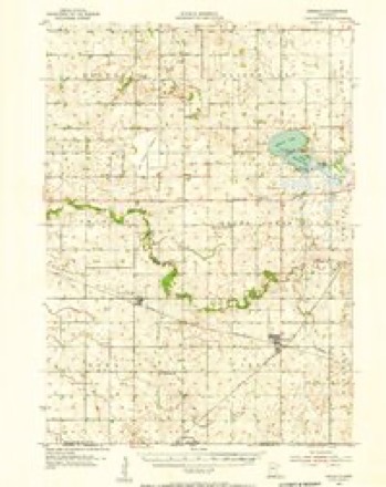
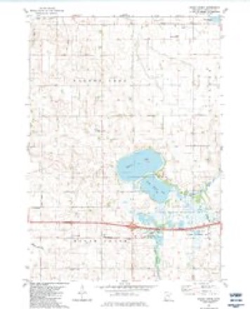
8 topographic sheets cover this place, the earliest surveyed in 1954 and the latest in 1985. It stands in Brush Creek Township. It lies in ZIP code area 56014. The Survey maps it on the Brush Creek quadrangle.
Topographic sheets covering this place
6 surveys from 8 printed sheetsMatched by testing this settlement's coordinate against the published boundary of every sheet in the United States Geological Survey's historical collection. Each opens the scanned sheet at the Survey.
- 1954 USGS Mason City quadrangle1:250000, 2 printings
- 1955 USGS Bricelyn quadrangle1:62500
- 1957 USGS Mason City quadrangle1:250000
- 1958 USGS Mason City quadrangle1:250000
- 1982 USGS Brush Creek quadrangle1:24000
- 1985 USGS Albert Lea quadrangle1:100000, 2 printings




In the county-history sources
964 words on this townshipThe History of Faribault County, Minnesota : from Its First Settlement to the Close of the Year 1879 : the Story of the Pioneers, published 1896 names this settlement in its chapter on Brush Creek Township. These are the passages that mention it, exactly as the scans read.
Nearly half of Walnut lake, one of the most beautiful sheets of water in the county, is in this town, near the northeast corner. There are. also, two other small lakes in the town, known as Swan Lake and Goose Lake. The east branch of the Blue Earth river runs from the northeast corner, in a southerly and southwesterly direction through the town, and a small stream, known as Brush Creek, enters the town about a mile from the southeast corner and empties into the Blue Earth river.
Passage source: The History of Faribault County, Minnesota : from Its First Settlement to the Close of the Year 1879 : the Story of the Pioneers, published 1896.
The town was named Brush Creek by the special commissioners in 1858, after the small stream of that name in the town, and the stream received this name because of the thick growth of small trees, thickets and brush along its banks. The name is not a common one, yet there are some six or eight post-offices and villages in the United States, bearing the name of Brush Creek.
Passage source: The History of Faribault County, Minnesota : from Its First Settlement to the Close of the Year 1879 : the Story of the Pioneers, published 1896.
It appears from the county records, that on the sixth of March, 1860, the county commissioners consolidated into one town district, the two town districts of Brush Creek and Foster, and Seely and Kiester, for town purposes. The town of Foster was detached from Brush Creek township by the county commissioners, September Gth 1664. In separating these towns, the strange circumstance hap pened, that Brush Creek, the principal town, became disorganized as all the officers of the town district resided at the time, in Foster the attached, or ancillary town, and the commissioners, therefore ordered an election for town officers to be held at the house of Lu cius S. Raymond, on the twenty-fifth day of October, 1864.
Passage source: The History of Faribault County, Minnesota : from Its First Settlement to the Close of the Year 1879 : the Story of the Pioneers, published 1896.
Machine-read from a century-old scan, so expect the errors a machine makes: misspelled names, dropped words, stray characters.
Storms near this place
5 since 1998Regional context, not property-specific evidence. The National Weather Service names Brush Creek in 5 storm reports between 1998 and 2025: 3 hail, 2 thunderstorm wind. No death or injury is recorded in these reports. Each account below is quoted exactly as the forecast office filed it, from the NOAA Storm Events Database, and each date opens the federal record of that event.
| When | Event | Place named | Harm | What the report says |
|---|---|---|---|---|
| April 2025 | Thunderstorm Wind | Brush Creek | - | Thunderstorm winds forced power poles to lean and pull towards the ground. A farm outbuilding sustained some roof damage. |
| October 2006 | Hail | Brush Creek | - | Hail damaged crops reported by Faribault County Farm Service Agency Director Kevin Beckman. An estimated one thousand acres of soybean fields throughout the county were impacted by hail, according to Mr. Beckman. As reported by the Faribault County Register newspaper. |
| June 1998 | Thunderstorm Wind | Brush Creek | - | Trees down around Walnut Lake. Estimated windspeed. |
| April 2025 | Hail | Brush Creek | - | no account filed |
| May 2005 | Hail | Brush Creek | - | no account filed |
Nearest settlements
The eight closest, with where each one stands in the county. Distances are straight-line, computed from the Geographic Names Information System coordinates.
Provenance
This settlement is recorded in the Geographic Names Information System as feature 640558. The sheet list is computed by point-in-boundary test against the United States Geological Survey's historical topographic inventory. Both are works of the United States government and carry no copyright under 17 U.S.C. 105.
Storms. NOAA National Centers for Environmental Information, Storm Events Database https://www.ncei.noaa.gov/stormevents/ A work of the United States government, no copyright under 17 U.S.C. 105. Narratives are quoted verbatim from the National Weather Service report and are not edited or summarised.