 Block
Caledonia, Minnesota
10 topographic sheets cover this place, the earliest surveyed in 1956 and the latest in 1990. It stands in Caledonia City. It lies in ZIP code area 55921. The Survey maps it on the Caledonia quadrangle. 2,847 people lived here at the 2020 count. It stands 1,181 feet above sea level.
Research this city
On record in Caledonia
Buildings and businesses the archive holds for this place. Each opens its own page, with the source record it came from.
On the National Register 5 records
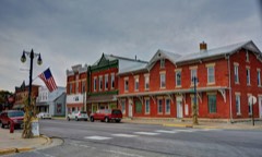 Caledonia Commercial Historic Districtlisted 1994
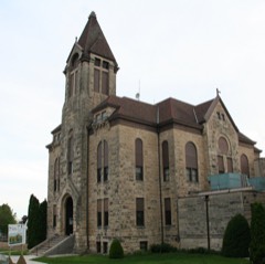 Houston County Courthouse and Jaillisted 1983
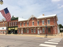 Spafford Williams Hotellisted 1982
- Schech Milllisted 1978
- David R. and Ellsworth A. Sprague Houseslisted 1982
Population over time
2 figuresCaledonia fell from 2,868 to 2,847 between 2010 and 2020. These are the recorded population figures Wikidata holds for this place, reached through the Geographic Names Information System number this page is keyed on rather than by name, so they belong to this place and not to another of the same name. Most are census counts, but not all are: an early figure may be a founding or settlement estimate, and an estimate published within five years of a census is left out. The change column is computed, and is left blank where more than 20 years separate a figure from the one before it, because a gap that long is not a change between two counts.
| Year | People | Change |
|---|---|---|
| 2010 | 2,868 | |
| 2020 | 2,847 | -21 (-1%) |
Topographic sheets covering this place
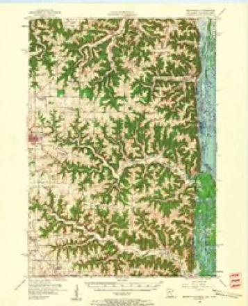
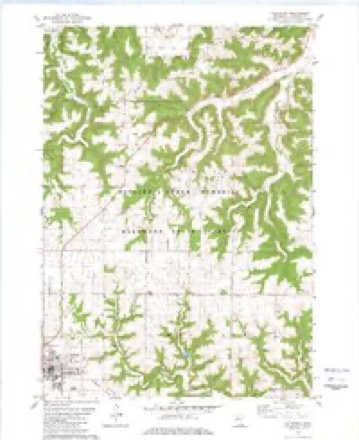
8 surveys from 10 printed sheetsMatched by testing this settlement's coordinate against the published boundary of every sheet in the United States Geological Survey's historical collection. Each opens the scanned sheet at the Survey.
- 1956 USGS Brownsville quadrangle1:62500, 2 printings
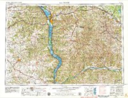
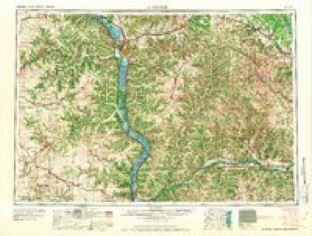
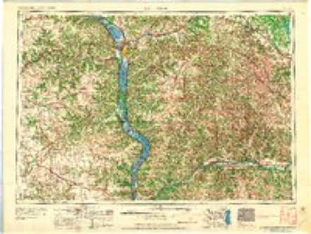
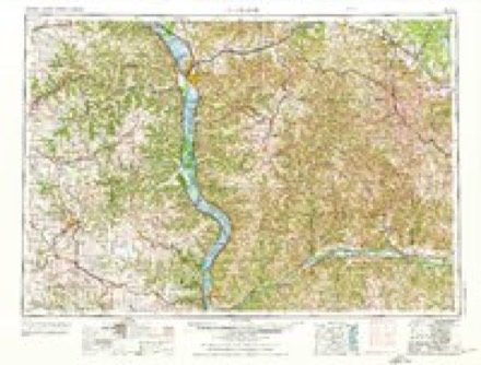
- 1958 USGS La Crosse quadrangle1:250000, 2 printings
- 1961 USGS La Crosse quadrangle1:250000
- 1965 USGS La Crosse quadrangle1:250000
- 1976 USGS La Crosse quadrangle1:250000
- 1980 USGS Caledonia quadrangle1:24000
- 1984 USGS La Crosse quadrangle1:100000
- 1990 USGS La Crosse quadrangle1:100000
In the county-history sources
9,241 words on this townshipThe Advantages and Resources of Houston County, Minnesota, published 1858 names this settlement in its chapter on Caledonia Township. These are the passages that mention it, exactly as the scans read.
About two hundred lots have already been sold and tlie proprietor still retains a hundred more for sale on reasonable terms. Several buildings are Jiow in process of erection, among which might be mentioned a parsonage for the M. E. church, an Mr. McPliail agrees to donate for church purposes two eligible lots to any denomination who will build upon them. Though Caledoaia, by reason of htr situation off from the Root and Mississippi Rivers, may not be so well accommodated as regards facilities for transportation, yet her position is an important one to tin's county, as being the town most central for the business operations of the whole people, and must too become an important inland grain market upon which our towns of shipping more cji- less rely for supplies from the country ai'ound it. This trade rich as it will become from the iticivasing productivenegs of tii« farming lands aioujid tliis town would be ample in itself \<> sustain a flouiisliing village, and when added to this the busing sk whicli naturally accumulates at a county scat, tlie advantages of such a place are largely increased.
Passage source: The Advantages and Resources of Houston County, Minnesota, published 1858.
The nndorsi^'nod will give their attention to the buying and sellino- of lands, tbe selection and location of town sites on the line of the Southern Minnesota Railroad, the loaning of money for capitalists, and to such other business as appertains to a Q'cneral laud agency.
Passage source: The Advantages and Resources of Houston County, Minnesota, published 1858.
N. B. Persons having money to loan at moderate rates of interest, (say from 20 to 25 per cent, per annum,) on unquestionable real estate security will do well to give uf? a call. If desired, wo will furnish a full description of all land oliered as security, and its present market value. THOMPSON, "WYKOFF «fe CO,
Passage source: The Advantages and Resources of Houston County, Minnesota, published 1858.
Machine-read from a century-old scan, so expect the errors a machine makes: misspelled names, dropped words, stray characters.
Read the whole chapter on Caledonia Township - it names this place 25 more 25 times.
Fires near this place
38 since 1992Regional context, not property-specific evidence. The federal wildfire occurrence database lists 38 fires within 5 miles of Caledonia between 1992 and 2017, burning about 191 acres in total. 1 started naturally. None was recorded as arson. Distance is straight-line from the map coordinates, so a fire counted here may appear on a neighbouring settlement's page as well.
| Reported cause | Fires |
|---|---|
| Debris and open burning | 20 |
| Missing data/not specified/undetermined | 8 |
| Equipment and vehicle use | 8 |
| Natural | 1 |
| Recreation and ceremony | 1 |
The most recent of them, most recent first, with the day each was reported and the service that recorded it.
| Date | Cause | Size | Reported by | Name on the report |
|---|---|---|---|---|
| 17 September 2003 | Missing data/not specified/undetermined | under an acre | Minnesota Department of Natural Resources | not named |
| 17 July 2001 | Natural | under an acre | Minnesota Department of Natural Resources | not named |
| 4 June 1995 | Debris and open burning | under an acre | Minnesota Department of Natural Resources | not named |
| 3 June 2014 | Equipment and vehicle use | under an acre | Minnesota Department of Natural Resources | not named |
| 17 June 1995 | Debris and open burning | under an acre | Minnesota Department of Natural Resources | not named |
| 30 May 1996 | Debris and open burning | under an acre | Minnesota Department of Natural Resources | not named |
| 15 May 2002 | Debris and open burning | under an acre | Minnesota Department of Natural Resources | not named |
| 15 May 1995 | Debris and open burning | 2.0 acres | Minnesota Department of Natural Resources | not named |
Settlements close enough to share some of these fires:
Mines and quarries near this place
3 within 5 milesRegional context, not property-specific evidence. The federal mineral resources record lists 3 workings within 5 miles of Caledonia: 3 producers. All of them still produce. What was taken out: Stone, Crushed/Broken. Distance is straight-line from the map coordinates, so a quarry counted here may appear on a neighbouring settlement's page as well.
| Where | Site | Commodity | Status | Recorded |
|---|---|---|---|---|
| Gengler Quarry & Mill | Stone, Crushed/Broken | Producer | ||
| Holty-Badger Quarry - Badger | Stone, Crushed/Broken | Producer | ||
| Holty-Badger Quarry- Holty | Stone, Crushed/Broken | Producer |
Storms near this place
32 since 1994Regional context, not property-specific evidence. The National Weather Service names Caledonia in 32 storm reports between 1994 and 2022: 16 thunderstorm wind, 9 hail, 2 flash flood, 2 heavy rain. No death or injury is recorded in these reports. Each account below is quoted exactly as the forecast office filed it, from the NOAA Storm Events Database, and each date opens the federal record of that event.
| When | Event | Place named | Harm | What the report says |
|---|---|---|---|---|
| August 2018 | Heavy Rain | Caledonia | $189,000 | Rainfall totaled 4.80 inches during this time frame. |
| June 2022 | Thunderstorm Wind | Caledonia | $100,000 | A localized downburst blew down trees, power lines, a barn and some farm outbuildings just northwest of Caledonia. |
| September 2012 | Thunderstorm Wind | Caledonia | $95,000 | An eighty foot tall tree fell on a garage and four vehicles near the intersection of First and Main Streets in Caledonia. |
| August 1997 | Tornado (F0) | Caledonia | $80,000 | no account filed |
| August 2018 | Flash Flood | Caledonia | $70,000 | Runoff from heavy rains caused street flooding to occur in Caledonia. |
| June 1998 | Thunderstorm Wind | Caledonia | $40,000 | no account filed |
| June 1998 | Thunderstorm Wind | Caledonia | $35,000 | no account filed |
| March 2017 | Thunderstorm Wind | Caledonia | $34,000 | Barns were damaged in the Caledonia area from strong storm winds. |
| June 1999 | Hail | Caledonia | $15,000 | no account filed |
| August 1997 | Thunderstorm Wind | Caledonia | $15,000 | no account filed |
| August 2000 | Hail | Caledonia | $12,000 | no account filed |
| May 2007 | Thunderstorm Wind | Caledonia | $10,000 | Roof damaged at elementary school. |
| June 1998 | Hail | Caledonia | $10,000 | no account filed |
| May 2012 | Thunderstorm Wind | Caledonia | $5,000 | Trees were blown down onto parts of State Highway 76 between Houston and Caledonia. |
| July 2012 | Lightning | Caledonia | $5,000 | Lightning struck the Houston County Courthouse and knocked out phone services, destroyed a control module for one of the ventilation units and a copy machine. |
| August 2000 | Hail | Caledonia | $5,000 | no account filed |
| June 1997 | Thunderstorm Wind | Caledonia | $5,000 | no account filed |
| June 1998 | Thunderstorm Wind | Caledonia | $4,000 | no account filed |
| September 2005 | Thunderstorm Wind | Caledonia | $1,500 | no account filed |
| May 2007 | Thunderstorm Wind | Caledonia | $1,000 | Siding ripped off and overhang damaged on mobile home. |
| August 2007 | Flash Flood | Caledonia | $1,000 | Law enforcement officials reported water over the roadway near Green Acres and across other sections of the county. |
| June 2000 | Thunderstorm Wind | Caledonia | $250 | no account filed |
| August 2017 | Funnel Cloud | Caledonia | - | A funnel cloud was sighted northeast of Caledonia. |
| September 2016 | Heavy Rain | Caledonia | - | The COOP observer in Caledonia measured 4.41 inches of rain. |
| July 2013 | Hail | Caledonia | - | Up to half dollar sized hail fell in Caledonia. |
| July 1994 | Thunderstorm Wind | Caledonia | - | Several trees and power lines were blown down by strong thunderstorm winds. |
| May 2011 | Hail | Caledonia | - | no account filed |
| April 2010 | Hail | Caledonia | - | no account filed |
| April 2002 | Hail | Caledonia | - | no account filed |
| May 1998 | Thunderstorm Wind | Caledonia | - | no account filed |
| June 1997 | Hail | Caledonia | - | no account filed |
| June 1996 | Thunderstorm Wind | Caledonia | - | no account filed |
Nearest settlements
The eight closest, with where each one stands in the county. Distances are straight-line, computed from the Geographic Names Information System coordinates.
| Map | Place | Distance | Sheets |
|---|---|---|---|
| Highland Park Estates | 0.0 miles | 10 | |
| Pine Estates | 0.0 miles | 10 | |
| Schechs Mill | 5.0 miles | 9 | |
| Willington Grove | 5.8 miles | 9 | |
| Sheldon | 5.9 miles | 9 | |
| Wilmington | 6.5 miles | 9 | |
| Freeburg | 7.2 miles | 10 | |
| Black Hammer | 8.8 miles | 8 |
Elsewhere
Matched on this settlement's Geographic Names Information System number rather than its name, so it cannot be a different place of the same name in another state.
| Wikipedia article on Caledonia | An encyclopaedic summary. Its text is share-alike, so it is linked here rather than copied. |
| Wikidata item Q1926675 | The structured record the population and elevation above come from. Public domain (CC0). |
Provenance
This settlement is recorded in the Geographic Names Information System as feature 640732. The sheet list is computed by point-in-boundary test against the United States Geological Survey's historical topographic inventory. Both are works of the United States government and carry no copyright under 17 U.S.C. 105.
Wildfire. Short, Karen C. 2022. Spatial wildfire occurrence data for the United States, 1992-2020 [FPA_FOD_20221014]. 6th Edition. Fort Collins, CO: Forest Service Research Data Archive. https://doi.org/10.2737/RDS-2013-0009.6 Collected with United States Government funding and usable without additional permissions or fees.
Mines and quarries. USGS Mineral Resources Data System (MRDS) https://mrdata.usgs.gov/mrds/ A work of the United States government, no copyright under 17 U.S.C. 105.
Storms. NOAA National Centers for Environmental Information, Storm Events Database https://www.ncei.noaa.gov/stormevents/ A work of the United States government, no copyright under 17 U.S.C. 105. Narratives are quoted verbatim from the National Weather Service report and are not edited or summarised.