 Block
Merton, Minnesota
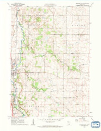
9 topographic sheets cover this place, the earliest surveyed in 1953 and the latest in 1985. It stands in Merton Township. It lies in ZIP code area 55060. The Survey maps it on the Medford East quadrangle.
Topographic sheets covering this place
6 surveys from 9 printed sheetsMatched by testing this settlement's coordinate against the published boundary of every sheet in the United States Geological Survey's historical collection. Each opens the scanned sheet at the Survey.
- 1953 USGS Saint Paul quadrangle1:250000, 3 printings
- 1953 USGS St. Paul quadrangle1:250000
- 1959 USGS Saint Paul quadrangle1:250000
- 1959 USGS St. Paul quadrangle1:250000
- 1962 USGS Medford East quadrangle1:24000
- 1985 USGS Faribault quadrangle1:100000, 2 printings




In the county-history sources
1,147 words on this townshipGeographical and Statistical History of Steele County from Its Earliest Settlement to the Present Time. Embracing Leading Incidents of Pioneer Life, Names of Early Settlers ... &c, published 1868 names this settlement in its chapter on Merton Township. These are the passages that mention it, exactly as the scans read.
The town of Merton was first settled in the year 1856 by Messrs. C. W. Curtis and L. E. Thompson, in the western part of the town. About the same time Mr. Magoon and' a family of the name of Naylor, arrived and locatisd in the south-east part of the town, where they still reside. Two young men by the name of Taylor and a Mr. Kendall made claims in the north part of the town.
Passage source: Geographical and Statistical History of Steele County from Its Earliest Settlement to the Present Time. Embracing Leading Incidents of Pioneer Life, Names of Early Settlers ... &c, published 1868.
The town of Merton is in the north-east corner of Steele county, comprises thirty-six full sections of land, of an average quality, and is devoted especially to agricultural pursuits. There are at the present time no stores, hotels, blacksmith shops, or carpenter shops, and thus far the peo- pie have kept "wliisky shops out of their midst, and arie coilsequently contented and happy, and growing rich upon the produce of their farms.
Passage source: Geographical and Statistical History of Steele County from Its Earliest Settlement to the Present Time. Embracing Leading Incidents of Pioneer Life, Names of Early Settlers ... &c, published 1868.
Machine-read from a century-old scan, so expect the errors a machine makes: misspelled names, dropped words, stray characters.
Storms near this place
9 since 1995Regional context, not property-specific evidence. The National Weather Service names Merton in 9 storm reports between 1995 and 2023: 5 hail, 2 flash flood, 1 tornado, 1 thunderstorm wind. No death or injury is recorded in these reports. Each account below is quoted exactly as the forecast office filed it, from the NOAA Storm Events Database, and each date opens the federal record of that event.
| When | Event | Place named | Harm | What the report says |
|---|---|---|---|---|
| August 2020 | Hail | Merton | - | A photograph of the hail was posted to a Skywarn group social media page. |
| June 2016 | Thunderstorm Wind | Merton | - | Large branches were downed. |
| September 2010 | Flash Flood | Merton | - | Periods of heavy rainfall developed toward midnight, and continued through most of the early morning hours. Rainfall rates increased to over 1.5 inches per hour which caused flash flooding. By 5 am, several county roads were covered by water, including Highway 14 near Meridan and Highway 218 between Highway 14 and Blooming Prairie. The county emergency manager reported street flooding in Owatonna, with intersections closed. Homes were also evacuated along Maple Creek, and sandbagging occurred along the Straight River south of town. |
| June 2010 | Flash Flood | Merton | - | Multiple areas of flooding occurred across Steele County, especially local streets in the town of Owatonna, Minnesota. |
| June 2005 | Hail | Merton | - | Dime sized hail was reported in Merton Township at the intersection of 69th Street and County Road 61. |
| August 1999 | Tornado (F0) | Merton | - | Touchdown in open field. Tornado continued into Dodge County of southeast Minnesota. |
| July 2023 | Hail | Merton | - | no account filed |
| June 1996 | Hail | Merton | - | no account filed |
| September 1995 | Hail | Merton | - | no account filed |
Nearest settlements
The eight closest, with where each one stands in the county. Distances are straight-line, computed from the Geographic Names Information System coordinates.
Provenance
This settlement is recorded in the Geographic Names Information System as feature 654826. The sheet list is computed by point-in-boundary test against the United States Geological Survey's historical topographic inventory. Both are works of the United States government and carry no copyright under 17 U.S.C. 105.
Storms. NOAA National Centers for Environmental Information, Storm Events Database https://www.ncei.noaa.gov/stormevents/ A work of the United States government, no copyright under 17 U.S.C. 105. Narratives are quoted verbatim from the National Weather Service report and are not edited or summarised.