 Block
Medford, Minnesota
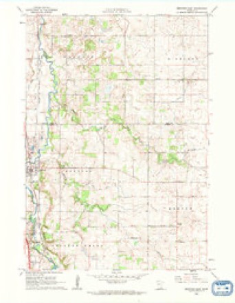
9 topographic sheets cover this place, the earliest surveyed in 1953 and the latest in 1985. It stands in Medford City. It lies in ZIP code area 55049. It stands on Medford Creek. The Survey maps it on the Medford East quadrangle. 1,315 people lived here at the 2020 count. It stands 1,099 feet above sea level.
On record in Medford
Buildings and businesses the archive holds for this place. Each opens its own page, with the source record it came from.
On the National Register 1 record
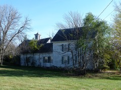 Daniel S. Piper Houselisted 1975
Population over time
2 figuresMedford grew from 1,239 to 1,315 between 2010 and 2020. These are the recorded population figures Wikidata holds for this place, reached through the Geographic Names Information System number this page is keyed on rather than by name, so they belong to this place and not to another of the same name. Most are census counts, but not all are: an early figure may be a founding or settlement estimate, and an estimate published within five years of a census is left out. The change column is computed, and is left blank where more than 20 years separate a figure from the one before it, because a gap that long is not a change between two counts.
| Year | People | Change |
|---|---|---|
| 2010 | 1,239 | |
| 2020 | 1,315 | +76 (+6%) |
Topographic sheets covering this place
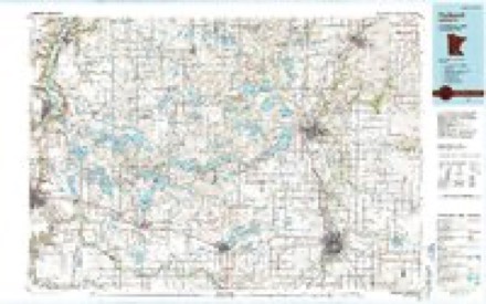
6 surveys from 9 printed sheetsMatched by testing this settlement's coordinate against the published boundary of every sheet in the United States Geological Survey's historical collection. Each opens the scanned sheet at the Survey.
- 1953 USGS Saint Paul quadrangle1:250000, 3 printings
- 1953 USGS St. Paul quadrangle1:250000
- 1959 USGS Saint Paul quadrangle1:250000
- 1959 USGS St. Paul quadrangle1:250000
- 1962 USGS Medford East quadrangle1:24000
- 1985 USGS Faribault quadrangle1:100000, 2 printings




In the county-history sources
2,588 words on this townshipGeographical and Statistical History of Steele County from Its Earliest Settlement to the Present Time. Embracing Leading Incidents of Pioneer Life, Names of Early Settlers ... &c, published 1868 names this settlement in its chapter on Medford City. These are the passages that mention it, exactly as the scans read.
The town of Medford is only three miles in extent from north to south and six from east to west, embracing only eighteen sections of land instead of thirty- six, about three fourths of which is covered with timber. Nearly all on the east side of the Straight river is covered witk a good growth of fine timber suitable for lumber or rails. The soil of the timber land is of a black sandy loam, very deep, with a clay subsoil, adapted to all kinds of cereals or vegetables. On the west side of the river the soil is of a lighter loam and produces the best quality of wheat, though not always of the largest yield. The town is well watered by the Straight river running through it from south to north, as well as several smail streams that flow into it. - There is one fine water power on the river as yet unimproved, and a steam saw mill in successful operation, owned by the Abbott Brothers.
Passage source: Geographical and Statistical History of Steele County from Its Earliest Settlement to the Present Time. Embracing Leading Incidents of Pioneer Life, Names of Early Settlers ... &c, published 1868.
The first claims were made in the summer of 1853, by Smith and Orlando Johnson, A. L. "Wright, L. M. Howard Chauncey Lull, '?7ho staked ofi" their claims, and in September Mr. Howard turned over the first prairie sod in what is now Steele County. The Messrs. Johnson commenced breaking on their claims that fall, but did not build their houses or remove their families to this place till the following spring. Messrs Wright and Lull built a log house in which they spent the winter, which was probably the first abode for civilization within the limits of the county. In the winter or .early spring of 1854 John Sanborn brought his family with him and located in the southern part of the town, Mrs. Sanborn being the first white woman to find a home in that vicinity. Mrs, Wm. K. Colling was the next white woman to take up her residence in the infant colony, which she did in the following spring. Soon after her arrival she gave birth to a son which was the first birth of a white child in either town or county. The first marriage that was solemnized in Medford was that of A. L. Wright and Miss Pheboe Ann Hays, Rev. 0. A. Thomas sealing the contract with the authority and sanction of the church. Mr. "William Woolford w^s the first to embark on the voyage '
Passage source: Geographical and Statistical History of Steele County from Its Earliest Settlement to the Present Time. Embracing Leading Incidents of Pioneer Life, Names of Early Settlers ... &c, published 1868.
In the spring of 1856 Miss Flora Sawyer, now Mrs. Isaac Sanborn, opened a select school in one room of her father's house, which was the first public efibrt at teaching the youth of that town how to climb the hill of science. - Religious services were held as early as 1854, Mr. Wm. Colling, a man of real practical piety, though not an ordained minister, frequently gathered his neighbors together and explained the scriptures, exhorting his audienee to live sober and useful lives. At a meeting of the settlers to consult upon a name wherewith to christen the town Mr. Colling said that he had a son who was born on board the ship Medford, and was named Medford in honor of the ship and proposed that the town should be named Medford in honor of the boy, which proposition was unanimously adopted.
Passage source: Geographical and Statistical History of Steele County from Its Earliest Settlement to the Present Time. Embracing Leading Incidents of Pioneer Life, Names of Early Settlers ... &c, published 1868.
Machine-read from a century-old scan, so expect the errors a machine makes: misspelled names, dropped words, stray characters.
Read the whole chapter on Medford City - it names this place 5 more 5 times.
Fires near this place
1 since 2007Regional context, not property-specific evidence. The federal wildfire occurrence database lists 1 fire within 5 miles of Medford in 2007, burning about 20 acres in total. None started naturally. 1 was recorded as arson. Distance is straight-line from the map coordinates, so a fire counted here may appear on a neighbouring settlement's page as well.
| Reported cause | Fires |
|---|---|
| Arson/incendiarism | 1 |
The most recent of them, most recent first, with the day each was reported and the service that recorded it.
| Date | Cause | Size | Reported by | Name on the report |
|---|---|---|---|---|
| 28 April 2007 | Arson/incendiarism | 20 acres | Minnesota Department of Natural Resources | not named |
Mines and quarries near this place
4 within 5 milesRegional context, not property-specific evidence. The federal mineral resources record lists 4 workings within 5 miles of Medford: 3 producers, 1 unknown. 3 still produce. What was taken out: Sand and Gravel, Construction, Stone, Crushed/Broken. Distance is straight-line from the map coordinates, so a quarry counted here may appear on a neighbouring settlement's page as well.
| Where | Site | Commodity | Status | Recorded |
|---|---|---|---|---|
| Concrete Materials Pit #1 | Sand and Gravel, Construction | Producer | ||
| Fretham Quarry | Stone, Crushed/Broken | Unknown | ||
| Jones Pit | Sand and Gravel, Construction | Producer | ||
| Lundin Cashman Quarry | Stone, Crushed/Broken | Producer |
Storms near this place
11 since 1995Regional context, not property-specific evidence. The National Weather Service names Medford in 11 storm reports between 1995 and 2024: 4 hail, 3 thunderstorm wind, 2 tornado, 1 flash flood. No death or injury is recorded in these reports. Each account below is quoted exactly as the forecast office filed it, from the NOAA Storm Events Database, and each date opens the federal record of that event.
| When | Event | Place named | Harm | What the report says |
|---|---|---|---|---|
| June 2024 | Funnel Cloud | Medford | - | A video was provided showing a brief funnel cloud north of Medford. It was not possible to determine if there was any ground contact. |
| May 2021 | Tornado (EF0) | Medford | - | Two different trained spotters took video of a tornado that made ground contact in far northern Steele County, where about a dozen trees were broken per a NWS damage survey. It tracked north and moved into Rice County. One of the videos showed this tornado was the larger tornado, with another narrow tornado to its east that had characteristics similar to that of a satellite tornado. |
| June 2017 | Thunderstorm Wind | Medford | - | A large tree was blown down on Highway 45 in Steele County. |
| July 2008 | Thunderstorm Wind | Medford | - | Multiple trees up to 2 feet in diameter blown down in town. Roads blocked, hardwood trees snapped off 6 feet above the ground. Pine trees uprooted. |
| August 2006 | Thunderstorm Wind | Medford | - | Numerous trees were felled. The greatest concentration of downed trees occurred in the northeast section of Owatonna. Some trees fell across roads and power lines. |
| July 2002 | Tornado (F1) | Medford | - | Damage to a farm north of Owatonna near I-35. Minor damage to farmstead. Corn flattened. |
| August 1997 | Flash Flood | Medford | - | Slow moving thunderstorms deposited 4 to 6 inch rain amounts in area. Several roads washed out. |
| July 2023 | Hail | Medford | - | no account filed |
| July 2009 | Hail | Medford | - | no account filed |
| August 2006 | Hail | Medford | - | no account filed |
| September 1995 | Hail | Medford | - | no account filed |
Nearest settlements
The eight closest, with where each one stands in the county. Distances are straight-line, computed from the Geographic Names Information System coordinates.
Elsewhere
Matched on this settlement's Geographic Names Information System number rather than its name, so it cannot be a different place of the same name in another state.
| Wikipedia article on Medford | An encyclopaedic summary. Its text is share-alike, so it is linked here rather than copied. |
| Wikidata item Q925033 | The structured record the population and elevation above come from. Public domain (CC0). |
Provenance
This settlement is recorded in the Geographic Names Information System as feature 647731. The sheet list is computed by point-in-boundary test against the United States Geological Survey's historical topographic inventory. Both are works of the United States government and carry no copyright under 17 U.S.C. 105.
Wildfire. Short, Karen C. 2022. Spatial wildfire occurrence data for the United States, 1992-2020 [FPA_FOD_20221014]. 6th Edition. Fort Collins, CO: Forest Service Research Data Archive. https://doi.org/10.2737/RDS-2013-0009.6 Collected with United States Government funding and usable without additional permissions or fees.
Mines and quarries. USGS Mineral Resources Data System (MRDS) https://mrdata.usgs.gov/mrds/ A work of the United States government, no copyright under 17 U.S.C. 105.
Storms. NOAA National Centers for Environmental Information, Storm Events Database https://www.ncei.noaa.gov/stormevents/ A work of the United States government, no copyright under 17 U.S.C. 105. Narratives are quoted verbatim from the National Weather Service report and are not edited or summarised.