 Block
Northfield, Minnesota
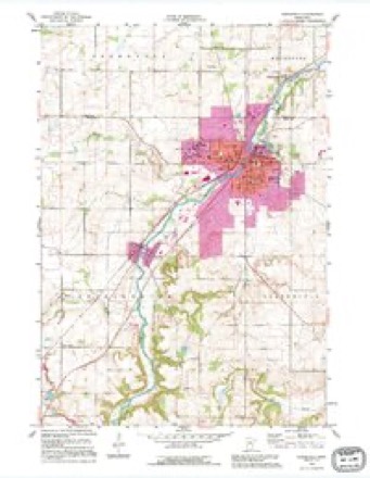
11 topographic sheets cover this place, the earliest surveyed in 1953 and the latest in 1991. It stands in Northfield City. It lies in ZIP code area 55057. It stands on Heath Creek. The Survey maps it on the Northfield quadrangle. 20,790 people lived here at the 2020 count. It stands 912 feet above sea level.
On record in Northfield
Buildings and businesses the archive holds for this place. Each opens its own page, with the source record it came from.
On the National Register 12 of 16 shown
- O. E. Rolvaag HouseNational Historic Landmark · listed 1969
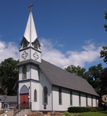 All Saints Church-Episcopallisted 1982
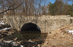 Bridge No. 8096listed 1998
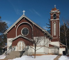 Church of the Annunciation-Catholiclisted 1982
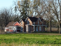 Edwin S. Drake Farmhouselisted 1982
 Goodsell Observatory-Carleton Collegelisted 1975
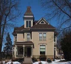 Drew H. Lord Houselisted 1982
 Northfield Commercial Historic Districtlisted 1979
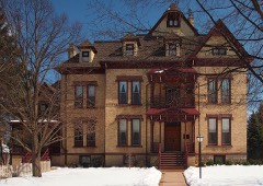 John C. Nutting Houselisted 1970
 Old Main, St. Olaf Collegelisted 1976
 Sciver Block Buildinglisted 1978
 Scoville Memorial Library-Carleton Collegelisted 1982
Topographic sheets covering this place
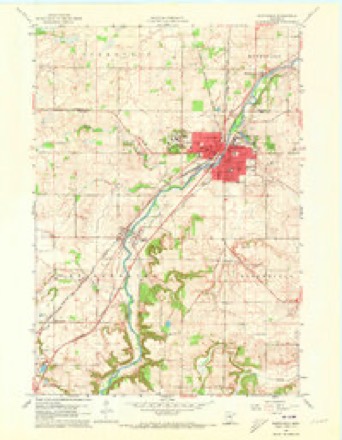
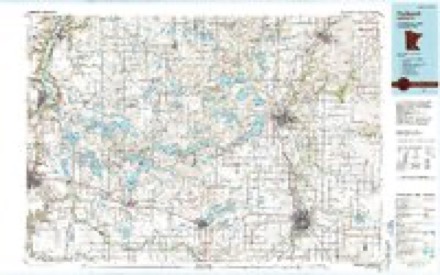
7 surveys from 11 printed sheetsMatched by testing this settlement's coordinate against the published boundary of every sheet in the United States Geological Survey's historical collection. Each opens the scanned sheet at the Survey.
- 1953 USGS Saint Paul quadrangle1:250000, 3 printings
- 1953 USGS St. Paul quadrangle1:250000
- 1959 USGS Saint Paul quadrangle1:250000
- 1959 USGS St. Paul quadrangle1:250000
- 1960 USGS Northfield quadrangle1:24000, 2 printings
- 1985 USGS Faribault quadrangle1:100000, 2 printings
- 1991 USGS Northfield quadrangle1:24000




What happened here
An account from the chapter on Northfield city. The inset identifies its exact source book and publication year.
The Indians
In the autumn of 1862, after the Sioux massacre, the people in and about Northfield were in a chronic state of apprehension. Indians wore constantly passing in small bands, and while the days were passed with feelings of security, the nights were instinct with emotions of dread, every unusual sound was transformed into inJieatious of the approach of the blood-thirsty savage, and very many persons, who had retired for the night had the most gloomy forebodings, and felt that it
In the county-history sources
17,076 words on this townshipHistory of Rice County, published 1882 names this settlement in its chapter on Northfield City. These are the passages that mention it, exactly as the scans read.
KuBY AVedding. - The fortieth anniversary of the marriage of Mr. and Mrs. Joseph Holt, was celebrated on the 20th of November, 1879. The bride's original name was Julia Cushmau. Forty years is more than the life of a full generation, and represents the time spent in the wilderness by the children of Israel, but it is (juite certain that this couple, although they have traveled considerable, have not been all this time in the wilderness. This affair was well attended and was a very jjleasant one.
Passage source: History of Rice County, published 1882.
The party consisted of eight men who arrived in town between 10 and 11 o'clock on the 7th of He])tember, 1876, and making their headquarters at a saloon, waited until 2 o'clock in the afternoon. They then made a concerted attack upon the bank, 2G five of them paying especial attention to the robbery which was couteni] dated, one of them stationed himself on the sidewalk near the corner of Lee & Hitchcock's store, and one at the door of the First National Bank, while the other three went inside to commit the robbery. At the same time the three others came galloping acro.ss the bridge, and with frightful yells and horrible ejaculations, Iiegan firing their revolvers into stores and at all persons who dared to shom themselves at doors or windows, and riding up Division street patroled in front of the bank, keeping up a continuous firing from their revolvers and calling with murderous imprecations upon all who came in sight to "git," displaying the most excellent horsemanship. Meantime the three men who entered the bank jumped over the counter with a single bound and presented revolvers to the heads t)f the three men who were there, .1. L. Heywood, the acting cashier, E. E. Bunker, the teller, and J. F. Wilcox, the bookkeeper, saying that they were going to rob the bank, and asking for the cashier. On being told that he was not in, they ordered Mr. Heywood, who was seated at the cashier's desk, to open the safe; the vault door was standing open, but the safe door was closed. Mr. Heywood positively refused to open the safe for them, when the villain took hold of him and drew a long knife across his throat, threatening with the most horrid oaths to cut bis throat from ear to ear, unless he instantly complied. Mr. Heywood released himself and started for the door crying murder at the top of his voice, but he was knocked down with a navy revolver, and dragged to the door of the vault, and a shot was fired to further intimidate him. Mr. Bunker, meantime had torn himself away and escaped out of the back door, receiving a shot in the shoulder, which, however, did not prevent his shouting an alarm. The leader stepped into the vaidt and tried to open the inside door when Mr. Heywood attemjited to close the door upon him, but was jerked away by one of ruffians. Further etTorts were made to induce the acting cashier to open the safe door, but all without avail. All this time one of the scoundrels had young Wilcox on his knees with a revolver at his temple.
Passage source: History of Rice County, published 1882.
Two of them inimediately jumped over tbe counter and rushed into tbe street, the other one, who is supposed tp have been Jesse James, as he was jumping over the counter, indignant and exasperated at the dismal faihire of the daring scheme, turned and deliberately fired at Mr. Heywood, the second shot killing him instantly, a ball through the left temple literally blowing his brains out.
Passage source: History of Rice County, published 1882.
Machine-read from a century-old scan, so expect the errors a machine makes: misspelled names, dropped words, stray characters.
Read the whole chapter on Northfield City - it names this place 41 more 41 times.
Fires near this place
7 since 2001Regional context, not property-specific evidence. The federal wildfire occurrence database lists 7 fires within 5 miles of Northfield between 2001 and 2012, burning about 4 acres in total. None started naturally. None was recorded as arson. Distance is straight-line from the map coordinates, so a fire counted here may appear on a neighbouring settlement's page as well.
| Reported cause | Fires |
|---|---|
| Recreation and ceremony | 5 |
| Missing data/not specified/undetermined | 1 |
| Equipment and vehicle use | 1 |
The most recent of them, most recent first, with the day each was reported and the service that recorded it.
| Date | Cause | Size | Reported by | Name on the report |
|---|---|---|---|---|
| 13 September 2012 | Recreation and ceremony | under an acre | Minnesota Valley National Wildlife Refuge | CEDAR AVENUE |
| 23 August 2012 | Recreation and ceremony | under an acre | Minnesota Valley National Wildlife Refuge | BASS POND 4 |
| 1 May 2001 | Missing data/not specified/undetermined | 2.0 acres | Minnesota Valley National Wildlife Refuge | STOLAF |
| 20 April 2012 | Recreation and ceremony | under an acre | Minnesota Valley National Wildlife Refuge | BLACK DOG |
| 7 December 2012 | Recreation and ceremony | under an acre | Minnesota Valley National Wildlife Refuge | BLOOMINGOTN FERRY 1 |
| 29 November 2012 | Recreation and ceremony | under an acre | Minnesota Valley National Wildlife Refuge | SORENSON LANDING 1 |
| 22 October 2012 | Equipment and vehicle use | 1.0 acres | Minnesota Valley National Wildlife Refuge | CO RD 18 |
Settlements close enough to share some of these fires:
Mines and quarries near this place
1 within 5 milesRegional context, not property-specific evidence. The federal mineral resources record lists 1 working within 5 miles of Northfield: 1 producer. All of them still produce. What was taken out: Sand and Gravel, Construction. Distance is straight-line from the map coordinates, so a quarry counted here may appear on a neighbouring settlement's page as well.
| Where | Site | Commodity | Status | Recorded |
|---|---|---|---|---|
| Shilling Pit | Sand and Gravel, Construction | Producer |
Storms near this place
55 since 1997Regional context, not property-specific evidence. The National Weather Service names Northfield in 55 storm reports between 1997 and 2024: 19 thunderstorm wind, 18 hail, 9 heavy rain, 4 flash flood. The reports record 1 injury. Each account below is quoted exactly as the forecast office filed it, from the NOAA Storm Events Database, and each date opens the federal record of that event.
| When | Event | Place named | Harm | What the report says |
|---|---|---|---|---|
| May 2001 | Tornado (F2) | Northfield | 1 hurt, $9,000,000 | NWS damage survey rated the tornado an F2. Tornado touched down briefly in downtown Northfield, flipping over a semi trailer truck and lifting the roof off of one business. Three-fourths mile later, it touched down again on the east side of Northfield, and then remained on the ground for 11 miles. After being in Rice County for 5 miles, it crossed Highway 19 into Dakota County and then dissipated in Goodhue County 4 miles west of Cannon Falls, for a total of 12 miles. Numerous rear flank downdraft gusts estimated at 90 mph caused damage alongside the southern periphery of tornado track. One man sustained minor injuries when he was blown from a tractor, but did not require hospitalization. A total of 8 homes received major damage, 22 more had minor damage, and a turkey processing plant was destroyed. |
| August 2006 | Hail | Northfield | $50,000,000 | Hundreds and possibly thousands of vehicles damaged; many had to be totaled. Significant damage to many buildings and houses. Two car dealerships lost their entire inventory. Buildings on the St. Olaf college campus suffered roof and window damage. Approximately 17,000 acres of crops destroyed in Rice County. Unofficial reports of softball size hail. Damage total includes all storm reports from August 24 in Rice County. |
| June 2021 | Hail | Northfield | $2,500,000 | Baseball size hail was reported east of Northfield. The trained spotter emailed the picture of the large hail stone. |
| May 2017 | Lightning | Northfield | $25,000 | Lightning struck a home on the 1500 block of Lindberg Court Monday afternoon in Northfield. Northfield Area Fire and Rescue Service firefighters responded to the home around 1 p.m. Monday to extinguish the fire that started as a result of the strike.||The homeowner was inside the residence at the time of the strike, but no injuries were reported. Lightning struck the chimney liner on the roof, and followed that down to the mechanical room where it ignited storage items.||There was also smoke damage throughout the home. |
| July 2011 | Thunderstorm Wind | Northfield | $25,000 | The City of Northfield received widespread damage with many trees, some several large trees, were snapped off toward the top. Many power lines were also blown down. ||Some of the areas within the city included;|Highway 19 and Highway 3, |Highway 3 and 2nd Street,|Greenvale Avenue west of Highway 3,|Woodley Street east of Highway 3. |
| March 2012 | Thunderstorm Wind | Northfield | $10,000 | Several power poles and a street light were blown down in Northfield, Minnesota, due to severe thunderstorm wind gusts. |
| July 2010 | Thunderstorm Wind | Northfield | $5,000 | Trees and a few power lines were blown down near Northfield, Minnesota. An automated weather station west of Northfield, had a measured wind gust of 56 mph. |
| June 2001 | Thunderstorm Wind | Northfield | $1,000 | Numerous trees felled. Deck of home torn off. |
| June 2005 | Flash Flood | Northfield | $100 | Flooding was reported on the Highway 19 underpass at Interstate 35. |
| June 2024 | Heavy Rain | Northfield | - | Nearly 3 to 4 inches of rain fell in northern Rice county. |
| June 2024 | Heavy Rain | Northfield | - | A total of 3 to 5 inches of rain fell from multiple rounds of thunderstorms. CoCoRaHS observers measured 5.35 inches near Morristown. |
| June 2024 | Heavy Rain | Northfield | - | The storm total was 2.7 inches of rainfall. |
| August 2020 | Hail | Northfield | - | There was a picture of a 1.5-inch hailstone in Northfield. |
| June 2019 | Thunderstorm Wind | Northfield | - | A trained spotter measured a wind gust of 75 mph in the city of Northfield. |
| June 2019 | Thunderstorm Wind | Northfield | - | There were multiple reports of downed trees, up to three feet in diameter, across parts of Northfield. |
| September 2018 | Tornado (EF1) | Northfield | - | A NWS storm survey, plus areal footage of drone and satellite data, concluded that an EF1 tornado tracked 4.7 miles from southeast of Owatonna, east-northeast across mainly corn and soy bean fields before moving into Goodhue County, north of Dennison. However, near the intersection of 110th Street East, and Jacobs Ave, a barn that was a restaurant and event venue was destroyed. It was called the Red Barn and was completely blown off its foundation. The damage was consistent with EF1 damage with maximum wind speeds of 105 mph and a width of 550 yards. |
| July 2017 | Thunderstorm Wind | Northfield | - | Several trees were blown down south of Highway 19, near Northfield. |
| July 2013 | Heavy Rain | Northfield | - | A measured rainfall amount of 5.05 inches fell in less than 3 hours. In addition, Ames Park near the intersecton of Water Street and Highway 19 was flooded. |
| July 2013 | Heavy Rain | Northfield | - | A measured rainfall amount of 4.75 inches fell in less than 3 hours. |
| June 2012 | Thunderstorm Wind | Northfield | - | Several large trees were blown down at 9th and Water Street. |
| June 2012 | Heavy Rain | Northfield | - | A measured rainfall report of 5.51 inches occurred in less than 18 hours. |
| June 2012 | Heavy Rain | Northfield | - | A measured rainfall report of 7.13 inches occurred in less than 18 hours. |
| June 2012 | Flash Flood | Northfield | - | The City of Northfield received 6 to 9 inches of rain and closed parts of Highway 19. In addition, cars were half-submerged in flood waters across town. |
| June 2012 | Flash Flood | Northfield | - | Significant street flooding caused some roads to close around Northfield and Dundas. |
| August 2012 | Thunderstorm Wind | Northfield | - | A large tree limb, approximately 50 feet in length was blown down near Northfield. |
| July 2011 | Heavy Rain | Northfield | - | Minor ponding of water on city street was reported in Northfield, Minnesota, due to heavy rainfall. |
| September 2010 | Heavy Rain | Northfield | - | A cooperative observer measured 5.20 inches of rainfall overnight. |
| July 2008 | Thunderstorm Wind | Northfield | - | One foot diameter tree downed. |
| July 2008 | Thunderstorm Wind | Northfield | - | Trees downed, most one to two feet in diameter. |
| July 2008 | Thunderstorm Wind | Northfield | - | Six inch diameter tree limb severed near Archibald Lane. |
| July 2008 | Thunderstorm Wind | Northfield | - | Two and one half foot diameter tree felled. |
| August 2007 | Thunderstorm Wind | Northfield | - | Light pole and power lines knocked down. |
| May 2005 | Funnel Cloud | Northfield | - | An ambulance driver reported a funnel cloud at the Rice and Dakota County line. |
| June 2005 | Thunderstorm Wind | Northfield | - | Two foot diameter trees were downed on the St. Olaf College campus. Trees were also downed near the intersection of Lincoln Parkway and Second Street, and on Decker Avenue. A tree was downed onto a house on North Linden Street. A tree felled onto a power line started a fire at Ivanhoe Avenue. A utility pole was broken on Cedar Avenue. |
| June 2004 | Thunderstorm Wind | Northfield | - | A number of trees were downed. |
| May 1998 | Thunderstorm Wind | Northfield | - | Large tree uprooted. Estimated windspeed. |
| June 1998 | Thunderstorm Wind | Northfield | - | Measured at the Northfield Safety Center. |
| June 1998 | Flash Flood | Northfield | - | Between 4 and 6 inches of rain resulted in flash flooding in the Northfield area. Portion of county road 78 washed out resulting in train derailment. Highway 19 bridge collapsed under the weight of a semi-truck and trailer. Decker Avenue along Spring Creek washed out between 90th and 100th streets. Extensive flood damage to roadways around Dennison. |
| September 2024 | Hail | Northfield | - | no account filed |
| June 2021 | Thunderstorm Wind | Northfield | - | no account filed |
| August 2012 | Hail | Northfield | - | no account filed |
| June 2012 | Hail | Northfield | - | no account filed |
| July 2010 | Hail | Northfield | - | no account filed |
| August 2007 | Hail | Northfield | - | no account filed |
| July 2007 | Hail | Northfield | - | no account filed |
| August 2006 | Hail | Northfield | - | no account filed |
| August 2006 | Hail | Northfield | - | no account filed |
| June 2005 | Hail | Northfield | - | no account filed |
| April 2004 | Hail | Northfield | - | no account filed |
| July 2002 | Hail | Northfield | - | no account filed |
| May 2002 | Hail | Northfield | - | no account filed |
| May 2002 | Hail | Northfield | - | no account filed |
| June 1998 | Hail | Northfield | - | no account filed |
| June 1997 | Hail | Northfield | - | no account filed |
| July 1997 | Lightning | Northfield | - | no account filed |
Nearest settlements
The eight closest, with where each one stands in the county. Distances are straight-line, computed from the Geographic Names Information System coordinates.
| Map | Place | Distance | Sheets |
|---|---|---|---|
| Dundas | 2.9 miles | 11 | |
| Comus | 7.2 miles | 10 | |
| Hazelwood | 7.9 miles | 11 | |
| Little Chicago | 8.6 miles | 10 | |
| Millersburg | 9.3 miles | 10 | |
| Cannon City | 9.3 miles | 11 | |
| Nerstrand | 9.4 miles | 10 | |
| Webster | 11.3 miles | 11 |
Elsewhere
Matched on this settlement's Geographic Names Information System number rather than its name, so it cannot be a different place of the same name in another state.
| Wikipedia article on Northfield | An encyclopaedic summary. Its text is share-alike, so it is linked here rather than copied. |
| Wikidata item Q996544 | The structured record the population and elevation above come from. Public domain (CC0). |
Provenance
This settlement is recorded in the Geographic Names Information System as feature 648725. The sheet list is computed by point-in-boundary test against the United States Geological Survey's historical topographic inventory. Both are works of the United States government and carry no copyright under 17 U.S.C. 105.
Wildfire. Short, Karen C. 2022. Spatial wildfire occurrence data for the United States, 1992-2020 [FPA_FOD_20221014]. 6th Edition. Fort Collins, CO: Forest Service Research Data Archive. https://doi.org/10.2737/RDS-2013-0009.6 Collected with United States Government funding and usable without additional permissions or fees.
Mines and quarries. USGS Mineral Resources Data System (MRDS) https://mrdata.usgs.gov/mrds/ A work of the United States government, no copyright under 17 U.S.C. 105.
Storms. NOAA National Centers for Environmental Information, Storm Events Database https://www.ncei.noaa.gov/stormevents/ A work of the United States government, no copyright under 17 U.S.C. 105. Narratives are quoted verbatim from the National Weather Service report and are not edited or summarised.