 Block
Reno, Minnesota
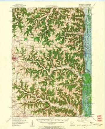
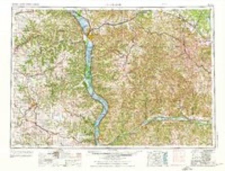
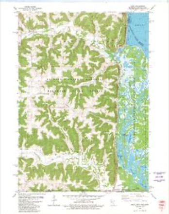
10 topographic sheets cover this place, the earliest surveyed in 1956 and the latest in 1990. It stands in Crooked Creek Township. It lies in ZIP code area 55919. It stands on Clear Creek. The Survey maps it on the Reno quadrangle.
Topographic sheets covering this place
8 surveys from 10 printed sheetsMatched by testing this settlement's coordinate against the published boundary of every sheet in the United States Geological Survey's historical collection. Each opens the scanned sheet at the Survey.
- 1956 USGS Brownsville quadrangle1:62500, 2 printings
- 1958 USGS La Crosse quadrangle1:250000, 2 printings
- 1961 USGS La Crosse quadrangle1:250000
- 1965 USGS La Crosse quadrangle1:250000
- 1976 USGS La Crosse quadrangle1:250000
- 1980 USGS Reno quadrangle1:24000
- 1984 USGS La Crosse quadrangle1:100000
- 1990 USGS La Crosse quadrangle1:100000
In the county-history sources
6,116 words on this townshipHistory of Houston County, Minnesota, published 1919 names this settlement in its chapter on Crooked Creek Township. These are the passages that mention it, exactly as the scans read.
The Chicago, Milwaukee & St. Paul Railway traverses the eastern part of the township, running north and south, and connecting at Renowith the Reno Preston branch of the same road, which runs westward, passing through the Uttle village of Freeburg, thus affording good transportation facilities in various directions.
Passage source: History of Houston County, Minnesota, published 1919.
Reno, the junction point of the two branches, was formerly known as Caledonia Junction, and is situated on Minnesota Slough, in the eastern part of the town, 14 miles southeast of Caledonia and seven miles north of New Albin, Iowa. The western branch, which connects here, was constructed in 1879 as a narrow gauge road. Freight going west from the main line had to be transferred here, with much waste of time and labor. These inconveniences were obviated by the change to standard gauge,, effected in 1901.
Passage source: History of Houston County, Minnesota, published 1919.
Freeburg is situated on the Reno-Preston division of the C, M. & St. P. Railway, in section 30 of the township. As elsewhere shown, some of the land forming its site, or in the immediate vicinity, was claimed by John Oxford, one of the earliest settlers in the township, and soon after Nicholas Roster, another pioneer, also located here.
Passage source: History of Houston County, Minnesota, published 1919.
Machine-read from a century-old scan, so expect the errors a machine makes: misspelled names, dropped words, stray characters.
Fires near this place
34 since 1993Regional context, not property-specific evidence. The federal wildfire occurrence database lists 34 fires within 5 miles of Reno between 1993 and 2020, burning about 165 acres in total. None started naturally. 6 were recorded as arson. Distance is straight-line from the map coordinates, so a fire counted here may appear on a neighbouring settlement's page as well.
| Reported cause | Fires |
|---|---|
| Debris and open burning | 17 |
| Missing data/not specified/undetermined | 6 |
| Arson/incendiarism | 6 |
| Equipment and vehicle use | 3 |
| Power generation/transmission/distribution | 1 |
| Smoking | 1 |
The most recent of them, most recent first, with the day each was reported and the service that recorded it.
| Date | Cause | Size | Reported by | Name on the report |
|---|---|---|---|---|
| 7 September 2003 | Debris and open burning | under an acre | Minnesota Department of Natural Resources | not named |
| 30 August 2013 | Power generation/transmission/distribution | under an acre | Minnesota Department of Natural Resources | not named |
| 16 July 1996 | Equipment and vehicle use | 8.0 acres | Minnesota Department of Natural Resources | not named |
| 4 May 2004 | Debris and open burning | under an acre | Minnesota Department of Natural Resources | not named |
| 11 May 1997 | Missing data/not specified/undetermined | 1.0 acres | Minnesota Department of Natural Resources | not named |
| 1 May 2001 | Smoking | under an acre | Minnesota Department of Natural Resources | not named |
| 8 April 2005 | Missing data/not specified/undetermined | under an acre | Minnesota Department of Natural Resources | not named |
| 6 April 1996 | Debris and open burning | under an acre | Minnesota Department of Natural Resources | not named |
Settlements close enough to share some of these fires:
Storms near this place
6 since 2004Regional context, not property-specific evidence. The National Weather Service names Reno in 6 storm reports between 2004 and 2012: 3 thunderstorm wind, 2 hail, 1 flash flood. No death or injury is recorded in these reports. Each account below is quoted exactly as the forecast office filed it, from the NOAA Storm Events Database, and each date opens the federal record of that event.
| When | Event | Place named | Harm | What the report says |
|---|---|---|---|---|
| June 2010 | Flash Flood | Reno | $4,000 | Thunderstorms with heavy rain caused mud slides to cover parts of Highway 26 in the vicinity of Reno. Also, a small section of County Road 249 near Freeburg was washed out. Rainfall totals included 3.71 inches at Reno, MN, 3.49 inches about 6 miles south of Caledonia, and 2.60 inches in La Crescent. |
| September 2011 | Thunderstorm Wind | Reno | $2,000 | Trees were blown down southwest of Reno including an 18 inch diameter cottonwood. |
| May 2007 | Thunderstorm Wind | Reno | $1,000 | no account filed |
| August 2012 | Thunderstorm Wind | Reno | $500 | Several four to five foot long tree branches were blown down south of Reno. |
| August 2006 | Hail | Reno | - | no account filed |
| June 2004 | Hail | Reno | - | no account filed |
Nearest settlements
The eight closest, with where each one stands in the county. Distances are straight-line, computed from the Geographic Names Information System coordinates.
| Map | Place | Distance | Sheets |
|---|---|---|---|
| Freeburg | 4.8 miles | 10 | |
| Jefferson | 6.0 miles | 10 | |
| Brownsville | 6.4 miles | 10 | |
| Hokah | 11.6 miles | 14 | |
| Village Terrace | 11.7 miles | 14 | |
| Eitzen | 11.8 miles | 10 | |
| Caledonia | 12.0 miles | 10 | |
| Highland Park Estates | 12.0 miles | 10 |
Provenance
This settlement is recorded in the Geographic Names Information System as feature 649929. The sheet list is computed by point-in-boundary test against the United States Geological Survey's historical topographic inventory. Both are works of the United States government and carry no copyright under 17 U.S.C. 105.
Wildfire. Short, Karen C. 2022. Spatial wildfire occurrence data for the United States, 1992-2020 [FPA_FOD_20221014]. 6th Edition. Fort Collins, CO: Forest Service Research Data Archive. https://doi.org/10.2737/RDS-2013-0009.6 Collected with United States Government funding and usable without additional permissions or fees.
Storms. NOAA National Centers for Environmental Information, Storm Events Database https://www.ncei.noaa.gov/stormevents/ A work of the United States government, no copyright under 17 U.S.C. 105. Narratives are quoted verbatim from the National Weather Service report and are not edited or summarised.