 Block
Spring Grove, Minnesota
8 topographic sheets cover this place, the earliest surveyed in 1958 and the latest in 1990. It stands in Spring Grove City. It lies in ZIP code area 55974. The Survey maps it on the Spring Grove quadrangle. 1,256 people lived here at the 2020 count. It stands 1,322 feet above sea level.
On record in Spring Grove
Buildings and businesses the archive holds for this place. Each opens its own page, with the source record it came from.
On the National Register 2 records
- Ballard Hotellisted 2017
- Bridge No. L4013listed 1990
Population over time
2 figuresSpring Grove fell from 1,330 to 1,256 between 2010 and 2020. These are the recorded population figures Wikidata holds for this place, reached through the Geographic Names Information System number this page is keyed on rather than by name, so they belong to this place and not to another of the same name. Most are census counts, but not all are: an early figure may be a founding or settlement estimate, and an estimate published within five years of a census is left out. The change column is computed, and is left blank where more than 20 years separate a figure from the one before it, because a gap that long is not a change between two counts.
| Year | People | Change |
|---|---|---|
| 2010 | 1,330 | |
| 2020 | 1,256 | -74 (-6%) |
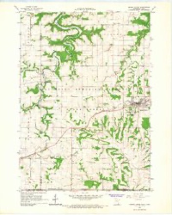
Topographic sheets covering this place
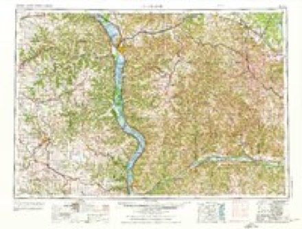
7 surveys from 8 printed sheetsMatched by testing this settlement's coordinate against the published boundary of every sheet in the United States Geological Survey's historical collection. Each opens the scanned sheet at the Survey.
- 1958 USGS La Crosse quadrangle1:250000, 2 printings
- 1961 USGS La Crosse quadrangle1:250000
- 1965 USGS La Crosse quadrangle1:250000
- 1965 USGS Spring Grove quadrangle1:24000
- 1976 USGS La Crosse quadrangle1:250000
- 1984 USGS La Crosse quadrangle1:100000
- 1990 USGS La Crosse quadrangle1:100000
In the county-history sources
4,415 words on this townshipHistory of Houston County, Minnesota, published 1919 names this settlement in its chapter on Spring Grove Township. These are the passages that mention it, exactly as the scans read.
The farmers co-operative movement is represented by the Farmers* Co-operative Creamery Association, and the Spring Grove Stock and Grain Co. This is also the shipping point for the Yucatan Creamery Association, not far away. The Wilmington Township Mutual Life Insurance Co. also has Spring Grove as its address.
Passage source: History of Houston County, Minnesota, published 1919.
The first public well in Spring Grove dates back long before village days. Mons Fladager blasted a seventy-foot well, and lined it with masonry, that being long before the days of the drilled wells. A windmill was placed over this and troughs extended to the street, thus providing water for public use. The first steps toward establishing the village waterworks were taken on Sept. 19, 1894, when land was purchased from Lars Budahl for $350, for the purpose of establishing a water supply. March 12, 1895, by a vote of 56 to 9, the voters authorized the issuing of $3,000 bonds. It was decided to have a plant operated by a windmill, but as the work progressed it was found necessary to have a deeper well and establish a gasoline engine pumping station, with tower and tank. The complete system with mains and hydrants was completed in the early spring of 1896 at a cost of $3,927. The system has since been extended.
Passage source: History of Houston County, Minnesota, published 1919.
One of the beauties of Spring Grove already mentioned is the public park, a triangle of land lying west of the stately church. The eastern part of this park was presented to the village by the church. In 1914 the village erected a bandstand. In the meantime, a number of lots had been sold at the western apex. In 1916, these lots were occupied by several buildings. At the apex was a cellar hole, the store of T. T. Bergh having been torn down. East of this was a long building, extending from street to street, at an angle. It was vacant, the north end having previously been occupied by the Onsgard State Bank and the south end by the Olson & Kieland general store. Next east of this store was the blacksmith shop of H. P. Dahl. In the spring of 1916, Rev. Alfred 0. Johnson and Albert Hallan appeared before the council representing the Church Auxiliary Board, the young peoples' society of the church, and presented a proposition by which that body agreed to present the village with $3,400 toward purchasing these lots, removing the buildings, filling up the holes, and converting the entire triangle into a park. The proposition was accepted, the buildings were removed and the ground levelled, the remainder of the eiq>ense being met by the village. The shrubbery which adorns the park was put in by the Ladies' Improvement Club. This club, officially named the Community Improvement Society, was organized April 4, 1917, with these officers: president, Mrs. C. M. Langland; vice-president, Mrs. Ove Hoegh ; treasurer, Mrs. J. N. Ristey ; secretary, Mrs. C. J. Helland.
Passage source: History of Houston County, Minnesota, published 1919.
Machine-read from a century-old scan, so expect the errors a machine makes: misspelled names, dropped words, stray characters.
Read the whole chapter on Spring Grove Township - it names this place 10 more 10 times.
Fires near this place
19 since 1993Regional context, not property-specific evidence. The federal wildfire occurrence database lists 19 fires within 5 miles of Spring Grove between 1993 and 2018, burning about 67 acres in total. None started naturally. None was recorded as arson. Distance is straight-line from the map coordinates, so a fire counted here may appear on a neighbouring settlement's page as well.
| Reported cause | Fires |
|---|---|
| Debris and open burning | 12 |
| Equipment and vehicle use | 4 |
| Missing data/not specified/undetermined | 3 |
The most recent of them, most recent first, with the day each was reported and the service that recorded it.
| Date | Cause | Size | Reported by | Name on the report |
|---|---|---|---|---|
| 17 September 2018 | Missing data/not specified/undetermined | under an acre | Minnesota Department of Natural Resources | not named |
| 31 August 2005 | Missing data/not specified/undetermined | under an acre | Minnesota Department of Natural Resources | not named |
| 30 June 2012 | Equipment and vehicle use | under an acre | Minnesota Department of Natural Resources | not named |
| 7 May 2004 | Equipment and vehicle use | under an acre | Minnesota Department of Natural Resources | not named |
| 29 May 2003 | Debris and open burning | under an acre | Minnesota Department of Natural Resources | not named |
| 1 May 2005 | Debris and open burning | under an acre | Minnesota Department of Natural Resources | not named |
| 9 April 2009 | Debris and open burning | 8.5 acres | Minnesota Department of Natural Resources | not named |
| 9 April 2004 | Debris and open burning | under an acre | Minnesota Department of Natural Resources | not named |
Settlements close enough to share some of these fires:
Mines and quarries near this place
5 within 5 milesRegional context, not property-specific evidence. The federal mineral resources record lists 5 workings within 5 miles of Spring Grove: 4 producers, 1 past producer. 4 still produce. What was taken out: Stone, Crushed/Broken. Distance is straight-line from the map coordinates, so a quarry counted here may appear on a neighbouring settlement's page as well.
| Where | Site | Commodity | Status | Recorded |
|---|---|---|---|---|
| Guberud Quarry & Mill | Stone, Crushed/Broken | Producer | ||
| Rauk Quarry | Stone, Crushed/Broken | Producer | ||
| Roverud Quarry | Stone, Crushed/Broken | Producer | ||
| Underpass Quarry | Stone, Crushed/Broken | Producer | ||
| Unknown | Stone, Crushed/Broken | Past Producer |
Storms near this place
14 since 1997Regional context, not property-specific evidence. The National Weather Service names Spring Grove in 14 storm reports between 1997 and 2025: 7 hail, 6 thunderstorm wind, 1 heavy rain. No death or injury is recorded in these reports. Each account below is quoted exactly as the forecast office filed it, from the NOAA Storm Events Database, and each date opens the federal record of that event.
| When | Event | Place named | Harm | What the report says |
|---|---|---|---|---|
| May 2024 | Thunderstorm Wind | Spring Grove | $25,000 | Law enforcement reported power lines down in Spring Grove. |
| June 1998 | Thunderstorm Wind | Spring Grove | $12,000 | no account filed |
| August 2018 | Heavy Rain | Spring Grove | $10,000 | Rainfall totaled 6.50 inches during this time frame. |
| June 1997 | Thunderstorm Wind | Spring Grove | $8,000 | no account filed |
| May 2007 | Thunderstorm Wind | Spring Grove | $2,500 | no account filed |
| July 2003 | Thunderstorm Wind | Spring Grove | $1,250 | no account filed |
| March 2025 | Hail | Spring Grove | - | Quarter sized hail was reported by the public in Spring Grove, Minnesota. |
| July 2014 | Hail | Spring Grove | - | Quarter sized hail fell in Spring Grove. |
| September 2012 | Hail | Spring Grove | - | Up to tennis ball sized hail was reported in Spring Grove. |
| August 2018 | Hail | Spring Grove | - | no account filed |
| September 2012 | Hail | Spring Grove | - | no account filed |
| May 2003 | Hail | Spring Grove | - | no account filed |
| June 2000 | Thunderstorm Wind | Spring Grove | - | no account filed |
| June 1998 | Hail | Spring Grove | - | no account filed |
Nearest settlements
The eight closest, with where each one stands in the county. Distances are straight-line, computed from the Geographic Names Information System coordinates.
| Map | Place | Distance | Sheets |
|---|---|---|---|
| Willington Grove | 3.2 miles | 9 | |
| Black Hammer | 4.0 miles | 8 | |
| Newhouse | 4.2 miles | 8 | |
| Riceford | 4.9 miles | 8 | |
| Wilmington | 5.1 miles | 9 | |
| Bee | 5.4 miles | 9 | |
| Schechs Mill | 7.9 miles | 9 | |
| Sheldon | 8.4 miles | 9 |
Elsewhere
Matched on this settlement's Geographic Names Information System number rather than its name, so it cannot be a different place of the same name in another state.
| Wikipedia article on Spring Grove | An encyclopaedic summary. Its text is share-alike, so it is linked here rather than copied. |
| Wikidata item Q203865 | The structured record the population and elevation above come from. Public domain (CC0). |
Provenance
This settlement is recorded in the Geographic Names Information System as feature 652451. The sheet list is computed by point-in-boundary test against the United States Geological Survey's historical topographic inventory. Both are works of the United States government and carry no copyright under 17 U.S.C. 105.
Wildfire. Short, Karen C. 2022. Spatial wildfire occurrence data for the United States, 1992-2020 [FPA_FOD_20221014]. 6th Edition. Fort Collins, CO: Forest Service Research Data Archive. https://doi.org/10.2737/RDS-2013-0009.6 Collected with United States Government funding and usable without additional permissions or fees.
Mines and quarries. USGS Mineral Resources Data System (MRDS) https://mrdata.usgs.gov/mrds/ A work of the United States government, no copyright under 17 U.S.C. 105.
Storms. NOAA National Centers for Environmental Information, Storm Events Database https://www.ncei.noaa.gov/stormevents/ A work of the United States government, no copyright under 17 U.S.C. 105. Narratives are quoted verbatim from the National Weather Service report and are not edited or summarised.